I first heard about Manaslu from a traveller who described it as Nepal’s best-kept secret. A safeheaven where tourism feels less like an industry and more like an invitation to someone’s warm home.
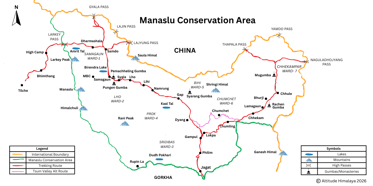
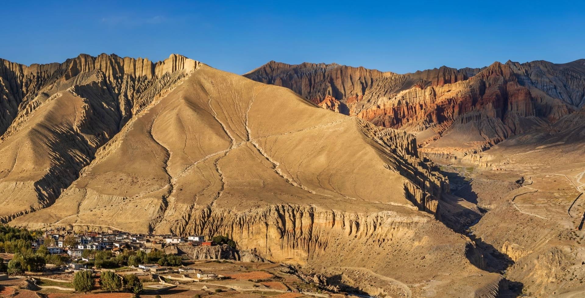
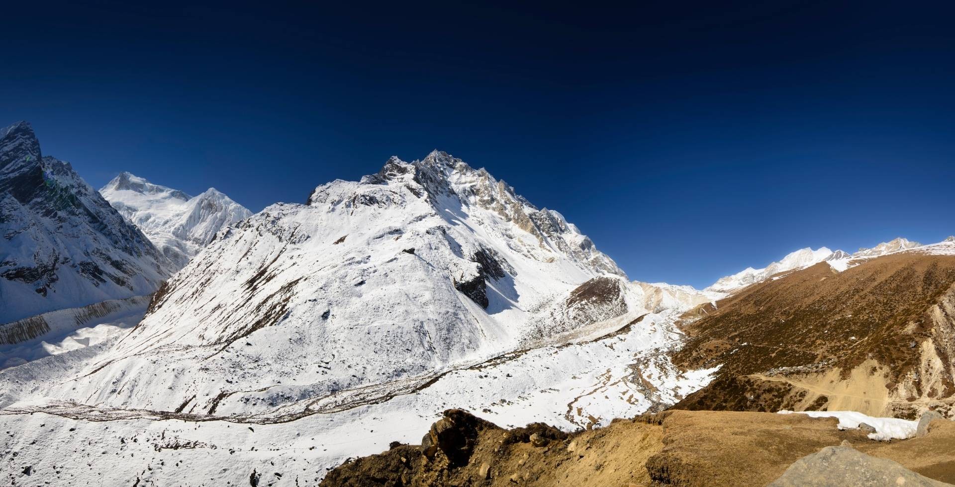
Manaslu Conservation Area is undoubtedly one of Nepal’s most diverse protected regions. Here, you will find six different climatic zones, the Himalayan wilderness, traditional Tibetan Buddhist culture, and remote village life, all in a single trekking corridor.
The Manaslu region was declared a conservation area in 1998 AD. Today, it protects 1,663 square kilometers of mountains, glaciers, forests, and traditional settlements in northern Gorkha.
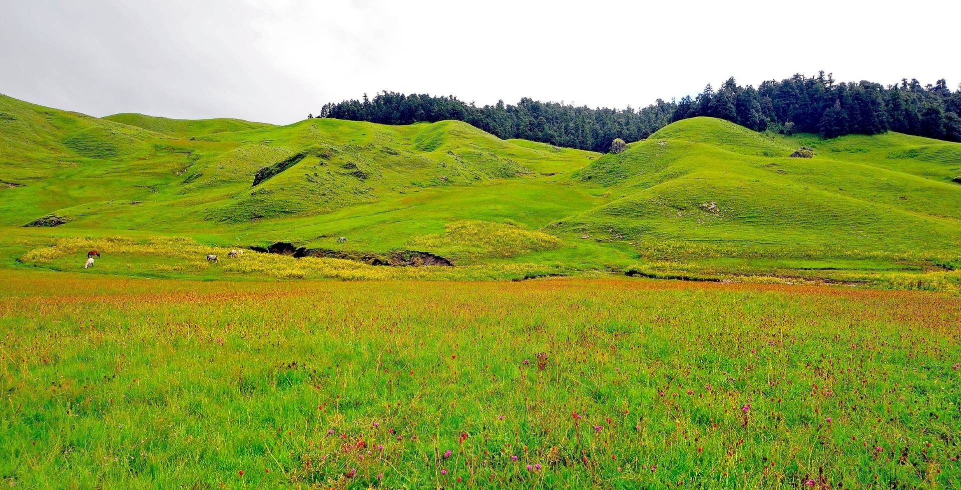
Clearly, Manaslu is a mosaic of ecosystems. You pass from river valleys, hilly forests, and pasturelands and then to high passes and mountains. This gradient in topology creates exceptional biological and cultural diversity.
The Manaslu Conservation Area represents something increasingly rare in the Himalayas: a pristine wilderness where nature, culture, and sustainable tourism coexist in delicate harmony.
In this article, I aim to walk you through the people, villages, trails, terrain, highlights, and so much more about the Manaslu Conservation Area.
Manaslu Conservation Area Facts
|
Location
|
Chumnubri Rural Municipality, Gorkha District, Gandaki Province
|
|
Establishment Date
|
1998 AD
|
|
Area of MCA
|
1,663 sq. km.
|
|
Major Regions
|
Nubri Valley, Tsum Valley, Kutang
|
|
Ethnic Groups
|
Nubripa, Tsumpa, Bhotia, Gurung, and other indigenous Tibetan communities
|
|
Popular Regional Treks
|
Manaslu Circuit, Tsum Valley, Manaslu-Tsum combined, Manaslu-Annapurna Circuit Combined, Manaslu-Annapurna Three Passes
|
|
River Systems
|
Budhi Gandaki and its tributaries mixed into the Gandaki river system
|
|
Major Lakes
|
Birendra Lake, Kalchhuman (Kaal) Lake
|
|
Major Peaks
|
Manaslu, Ngadi Chuli, Himalchuli, Cheo Himal, Shringi Himal, Saula Himal, Larke Peak
|
|
Permits
|
Manaslu Conservation Area Permit, Annapurna Conservation Area Permit, Restricted Area Trekking Permit, Mountaineering Royalty Fee, Chumnubri Rural Municipality Permit
|
Manaslu Conservation Area Location and Demographics
If there’s one thing that keeps pulling the trekkers back to the Manaslu region, it’s the people. There’s something in their way of life that draws you in and makes you fall in love.
The locals have to walk for days, sometimes three, sometimes four, just to reach a big market, and yet they still welcome us with the biggest smiles on their faces.
I’d even go as far as to say that the mountains and the view are secondary; it’s these smiles that truly define Manaslu and stay with you long after you’ve left.
Where is MCA located?
The Manaslu Conservation Area sits in the Gorkha District of Nepal's Bagmati Province, approximately 160 to 180 kilometers northwest of Kathmandu. The road winds through narrow highways, deep river valleys, and remote settlements.
Reaching the trekking starting points usually takes 8 to 10 hours, sometimes more, depending on road conditions. This remoteness is part of what has preserved Manaslu’s pristine self.
Geographically, the region is bordered by Gyirong County in Tibet, China, to the north and east. Nason Rural Municipality of Manang District lies to the west, and Dharche Rural Municipality of lower Gorkha and Lamjung’s Dordi Rural Municipality lie to the south.
The entire landscape is shaped by the Budhigandaki River system, which flows alongside much of the trekking route and acts as a lifeline for the communities living here.
Settlements and Demography of MCA
Administratively, the MCA is centred on Chumnubri (Tsum Nubri) Rural Municipality. The municipality is divided into seven wards: Sirdibas, Chumchet, Chhekampar, Bihi, Prok, Lho, and Samagaun.
These wards are the same village areas you will encounter along the Manaslu Circuit and Tsum Valley trekking routes. Just beyond Larke Pass, towards the end of the circuit, the trail briefly overlaps into a small section of the Annapurna region.
Chumnubri Rural Municipality lies within the Budhigandaki Valley and is divided into three distinct regions:
- Nubri Valley in the northwest (Samagaun, Lho, Prok)
- Kutang in the middle (Bihi)
- Tsum Valley in the northeast (Chumchet, Chhekampar)
Each of these regions has its own identity, defined by high altitude, isolation, and tradition.
According to the latest census data, the rural municipality is home to 5,932 people, with 3,087 females and 2,845 males.
The population is made up of a rich mix of ethnic groups, among which the Chumba and Nubri people form the most prominent communities.
Manaslu Conservation Area Project: What Does It Do?
You need to first understand who manages Manaslu to really appreciate how tourism is being approached in this region.
In 1998, Nepal established the Manaslu Conservation Area specifically to preserve the region's biodiversity while improving the livelihoods of local communities through sustainable tourism.
The National Trust for Nature Conservation (NTNC), a non-governmental organization, has managed the Manaslu Conservation Area Project (MCAP) since its inception. This isn't just bureaucratic management; it's been genuinely transformative.
What makes MCAP different from some other conservation models is its philosophy: conservation and community development aren't opposing forces but partners in creating sustainable change. Revenue from tourism permits is partially channeled back into community infrastructure.
Before MCAP's involvement, communities in Manaslu had virtually no access to electricity, safe drinking water, healthcare, or education. The region was food-deficient and resource-dependent, with locals forced to exploit natural resources unsustainably just to survive.
Of course, MCA protects the natural ecology of the area, but its major contributions to the local community can be summed up by looking at how it has improved their lifestyle.
Empowering Locals Through Tourism
Today, local communities of Manaslu Conservation Area have been trained to operate teahouses and guide services. As a result, now tourism is a viable economic alternative to over-harvesting forests or wildlife.
This shift has changed how locals view their wilderness. Local guides are the most vocal conservationists advocating for sustainable tourism. They understand that protecting the forests and wildlife directly protects their livelihood.
Building Energy and Water Access
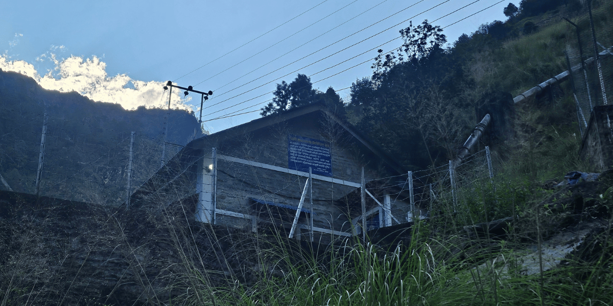
MCAP has supported micro-hydropower projects in major locations of the conservation area with power stations in Jagat, Bihi, Prok, Namrung, Lho, Samagaun, and Samdo. Thanks to these micro-hydro power stations, there is no electricity problem up to Samdo.
Plans for these micro-hydro projects are advancing with prospects of reaching Dharmasala soon. MCAP has also helped develop safe drinking water systems and basic health outreach. It suffices to say, everyday life is more reliable in these remote valleys thanks to the MCAP.
Strengthening Health, Education, and Services
Through tourism revenue and local committees, MCAP has funded improvements to schools, health posts, and community buildings, giving people access to education and medical care that simply didn't exist before.
You will find the health posts and helipads in these locations:
- Lower Manaslu and Kutang: Philim, Gap, Prok
- Nubri Valley: Namrung, Lhi/Hinang, Lho, Samagaun
- Tsum Valley: Chumling, Chumchet, Chhekam, Lamagaun, Bhurji
- Helipad locations: Jagat Bagar, Lhi, Shyala, and Samagaun
The NTNC-MCAP maintains field offices in Philim, with information centers in Jagat and Samagaun. There are police check posts in Jagat, Philim, Namrung, and Samagaun where your permits will be checked.
This presence of an authoritative figure ensures that trails are maintained, waste is managed (as much as possible given the logistics), and cultural practices are respected.
Weather and Climate in Manaslu Conservation Area
You will get to experience six distinct climatic zones in the Manaslu Conservation Area, defined by their altitude and geographic makeup.
Tropical Zone
The tropical zone lies in the lower river basins of the Budhi Gandaki and Marsyangdi rivers. Its elevation is below 1,000 m.
You will find a hot and humid climate here. But since most trekkers don’t spend much time here, the trekking routes start in higher regions.
Subtropical Zone
The subtropical zone is found in regions ranging from 1000 m to 2000 m in elevation. You’ll pass through this zone in your first few days of trekking in areas before the MCA entry point, Jagat, and Deng.
In summer, the temperatures here reach up to 34°C. The vegetation is lush with sal, oak, and bamboo forests. In your Manaslu region exploration, it is only a short pass, but it sets up the rhythm for the rest of your journey.
Temperate Zone
Here you’ll find yourself in areas like Bihi Phedi, Namrung, and Shyo, at an altitude of 2000-3000m. This is also where the rhododendrons completely paint the forest, especially from March to May.
The temperature here is pleasantly cool, ranging from 15-20°C. However, in winter, the temperature can dip to 5-10°C.
Subalpine Zone
This part covers Lho, parts of Samagaun, and the trail towards Samdo. Sitting at an altitude of 3000-4000m, this zone has scattered forests of juniper, birch, and fir.
Temperatures here range from 5-15°C during trekking seasons, with harsh winters dropping below freezing.
Alpine Zone
Lying at around 4000-5000m, this is the zone of open meadows and sparse vegetation. Samagaun, Samdo, and the way to Dharmasala lie in this zone.
Trees are largely absent, replaced by hardy alpine herbs and grasses. Temperatures are consistently below 10°C, often below 5°C at night.
Nival/Glacial Zone
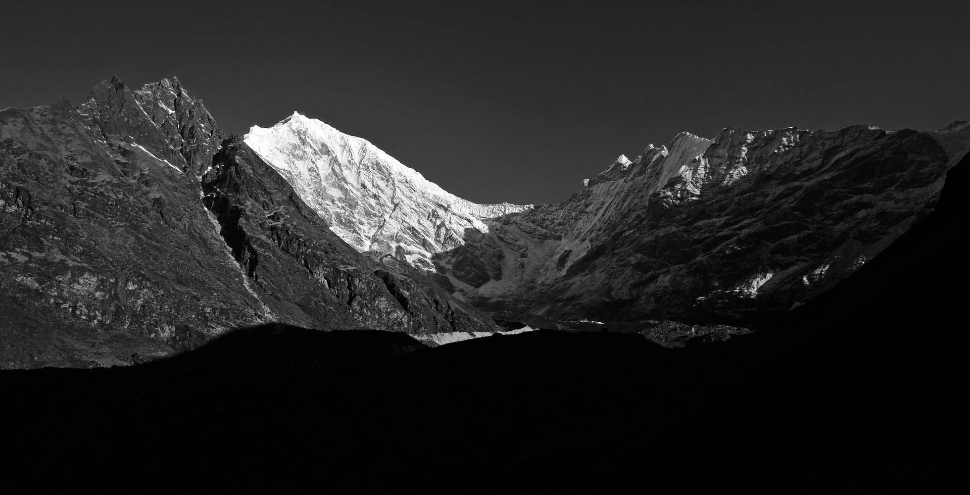
Above 5000m, the glacial zone is the zone of extreme conditions. The Larkya La Pass lies in this zone at 5,106 m. At these elevations, only mosses, lichens, and the toughest of alpine plants survive. Basically, signs of natural life become very rare in this region.
Simply travelling through this zone requires high fitness, thorough preparations, and, sometimes, additional permits. Mount Manaslu itself sits here, reachable only by mountaineers.
What is the Best Time to Visit Manaslu Conservation Area?
Every season has its own pros and cons. Depending on what your trekking preferences are, you must make an informed decision on when to visit Manaslu.

Spring (March-May)
It is arguably the best time to trek in Manaslu. The region receives minimal precipitation during this time. What actually makes spring special is the blooming rhododendron forests.
Imagine walking through a trail paved by rhododendrons all around. The clear skies also mean unobstructed mountain views, which are prominently visible throughout the trail, but even more so after you reach the Larkya La Pass.
Autumn (October to November)
After the summer monsoon ends, only clear skies and fresh air remain. In October, the weather becomes remarkably stable with exceptionally clear visibility.
By November, light snowfall at higher elevations can make passes slightly more challenging. This season sees a huge number of trekkers in the region. Autumn means:
- Clear skies and a vibrantly green landscape
- Higher trekker numbers, which might make finding accommodation difficult
In previous years, September was considered part of autumn, but due to irregular rainfall patterns caused by climate change, the month now fits better within the monsoon season.
Summer/Monsoon (June-September)
Summer, as expected, is monsoonal. The region receives approximately 300 mm of rainfall in June alone, with heavy precipitation throughout.
During this time, the trails are mostly slippery, landslides are quite common, and views are frequently obscured by clouds.
Not the best of a time to visit, but some experienced trekkers often prefer visiting during the monsoon for the lush, green landscape and significantly reduced crowds.
Winter (December-February)
Winter in the Manaslu region is harsh. The high passes are all covered with heavy snowfall, the trails are buried under snow, and the temperature easily drops below -6°C.
During winter, only experienced mountaineers equipped with proper gear are capable of attempting the high trails. The benefit is absolute solitude, but the risks are substantial. Emergency evacuation is complicated, expensive, and rescue resources are limited.
Manaslu Conservation Area Biodiversity Overview
Walking through Manaslu feels as if you have stepped into one of the Himalaya’s most alive places. The vertical range here, from a few hundred meters to over 8,000, creates layers of wildlife stacked on top of each other.
The Diversity in Flora
The plant species in the Manaslu Conservation Area are diverse, with over 1500 recorded species of flowering plants.
- In the lower, subtropical zones, you’ll see sal, oak, and pine forests stretching as far as the eye can see.
- As you move up a bit, the forests open into rhododendrons (lali gurans). If you happen to come in the spring, these forests are dyed in red and pink from the blooming Gurans.
- When you start going higher, Himalayan fir, larch, and juniper take over. The trees thin out, and meadows open up.
- Above 4,000 meters, woody plants give way to hardy herbs, cushion plants, and alpine grasses.
- At the very top, i.e the Nival region, you’ll only find a cold, snowy desert, mosses, lichens, and a handful of flowers tough enough to survive it all.
Some plants here aren’t just beautiful, they’re invaluable due to their medicinal properties. Yarshagumba, the “Himalayan gold”, grows at high altitudes and is worth a fortune in traditional medicine.
At the same altitude of 3000 m - 5000 m, Kutki, Padamchal/Himalayan Rhubarb, and Sugandhawal/Spikenard are found, which are also widely used for their medicinal properties.
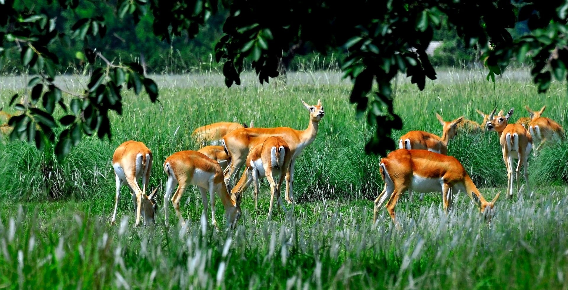
The Diversity in Animal Population
Manaslu is home to 33 recorded species of mammals, and several reptiles and amphibians. These are genuinely some of the rarest creatures you’ll ever see.
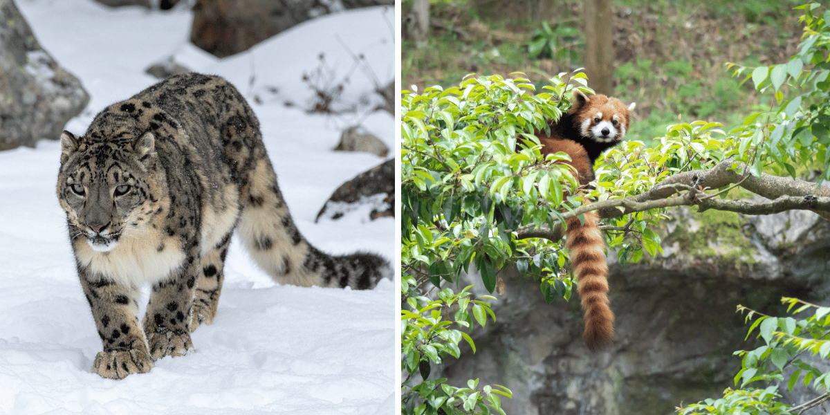
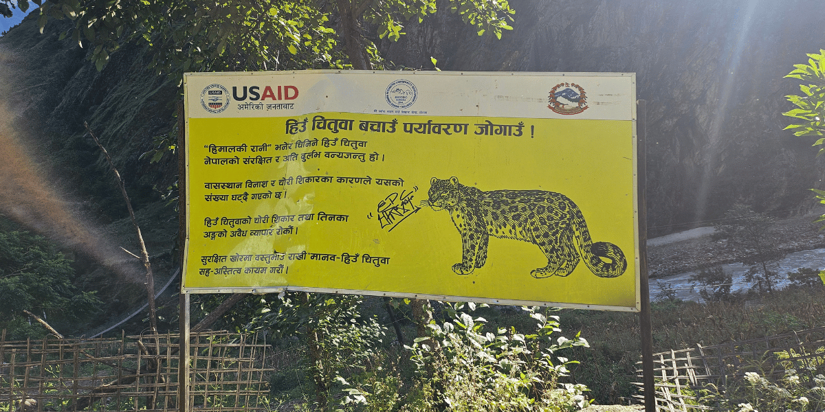
- The Snow leopard (Panthera uncia) is perhaps the most sought-after one. These predators roam the highest slopes, hunting blue sheep and musk deer. It is extremely rare for trekkers to sight them.
- Red pandas (Ailurus fulgens) inhabit the temperate and subalpine forests. They are smaller than domestic cats, with distinctive red coats. Since they are nocturnal by nature, you are unlikely to see these adorable mammals.
- The Himalayan tahr (Hemitragus jemlahicus) is more common and more visible, often seen grazing on steep slopes. These wild goats roam the impossible vertical cliffs simply in search of some tasty grass.
- Musk deer (Moschus leucogaster) represents one of Manaslu’s conservation success stories. These poor animals were once heavily hunted for their musk, which was used in perfumes. The scent still sells for up to $45,000/kg on the black market, making it more valuable than gold. But protection within the conservation area has allowed their population to recover.
Other mammal species of MCA are blue sheep, Himalayan black bears, red foxes, jackals, woolly hares, and Himalayan marmots. These and all I missed mentioning, all play a vital role in balancing Manaslu’s diverse ecology.
The Birds of Manaslu
The Manaslu Conservation Area has over 110 documented species of birds. Hence, it has been recognized as an Important Bird Area (IBA) by BirdLife International. This makes the Manaslu region significant not just nationally but globally for bird conservation.
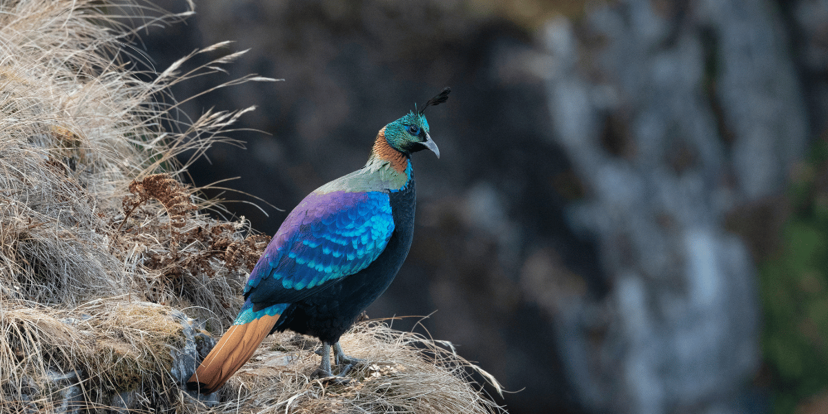
Nepal’s National Bird (Lophophorus impejanus), aka “Danphe”, adds so much to the beauty of Manaslu. If you are lucky, you will also get to see the Tibetan snowcocks, golden eagles, Himalayan griffons, and snow pigeons.
The Budhi Gandaki Valley's forest is a habitat for resident species all year, while higher elevations host migratory species during specific seasons.
What makes Manaslu special is actually the way people here coexist with these majestic creatures. Buddhist traditions forbid hunting, protect the land, and respect the balance of life.
The monasteries had done this long before any conservation law existed. So when you walk here, you’re walking through a place where culture and nature protect each other.
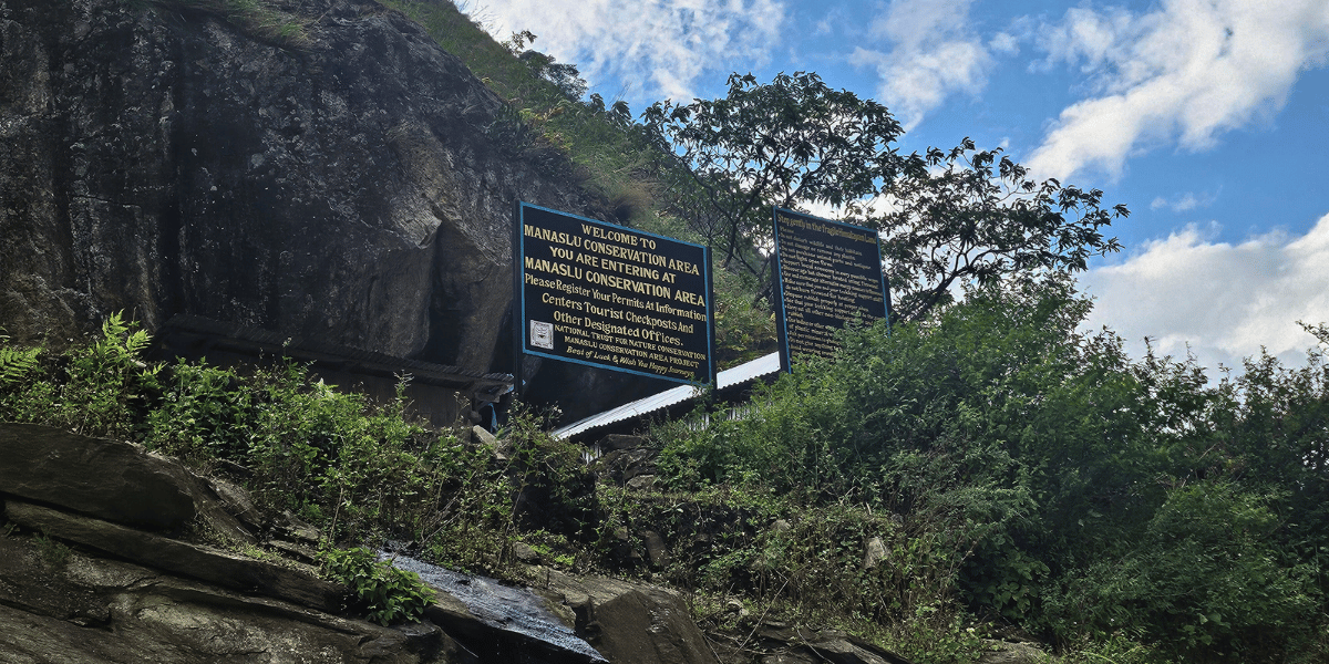
What are the Permits Needed for Manaslu Conservation Area?
Large sections of the Manaslu region are designated as restricted areas under Nepalese regulations. This applies especially to parts of the Tsum and Nubri valleys near the border.
The restrictions aim to protect sensitive border zones and preserve the cultural and environmental integrity of local communities. Trekking in these sections requires a Restricted Area Permit and the presence of a licensed guide and registered agency.
You should get the following permits if you are planning an adventure in the Manaslu Conservation Area:
Manaslu Restricted Area Permit (MRAP):
The Manaslu Restricted Area Permit is the primary permit you will need for the Manaslu Circuit Trek. The permit covers access from Sirdibas to Samagaun wards. It is issued by the government of Nepal only through registered trekking agencies.
The minimum group size to get the MRAP is 2 trekkers with a licensed guide (the guide does not count as a trekker). If you are a solo traveler, you can book a Manaslu circuit group join trek and register with other groups/solo travelers to meet the minimum group size requirement.
Manaslu Conservation Area Permit (MCAP):
The Manaslu Conservation Area is issued by the NTNC (The National Trust for Nature Conservation). It covers your entry into the Manaslu Conservation Area itself.
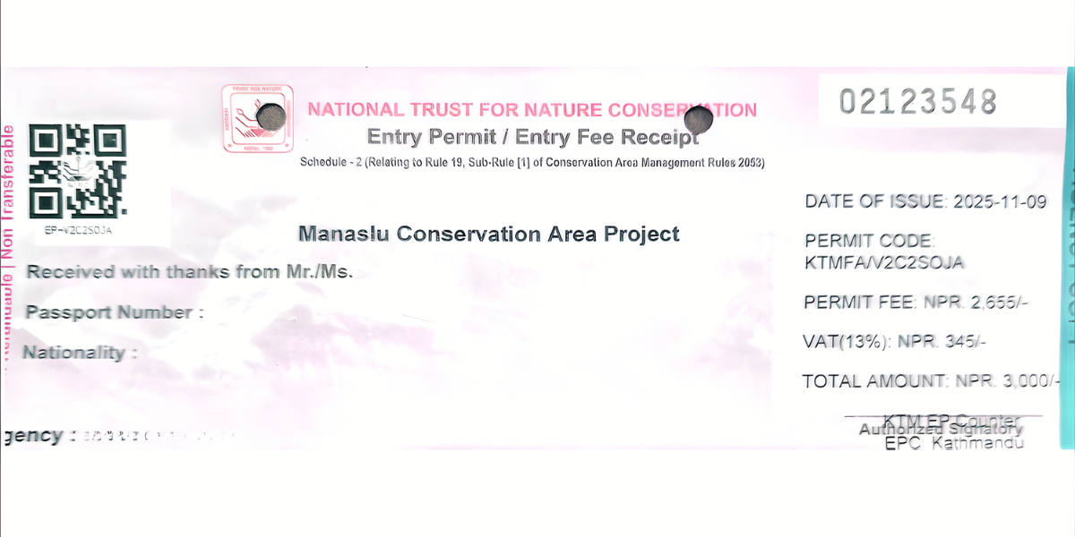
You'll need this from the moment you enter the protected area (around Jagat) boundary. This permit funds local community projects, trail maintenance, waste management, and wildlife monitoring. The fee is standardized year-round.
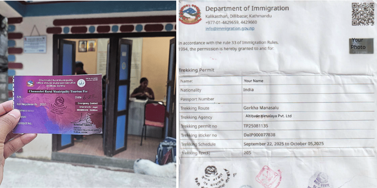
Chumnubri Rural Municipality Permit
The Chumnubri Rural Municipality Permit is a mandatory local entry fee for all trekkers in the Manaslu Circuit and Tsum Valley. It is typically collected in Jagat. The sole purpose of this initiative is to generate direct revenue for the development of local communities.
Annapurna Conservation Area Permit (ACAP)
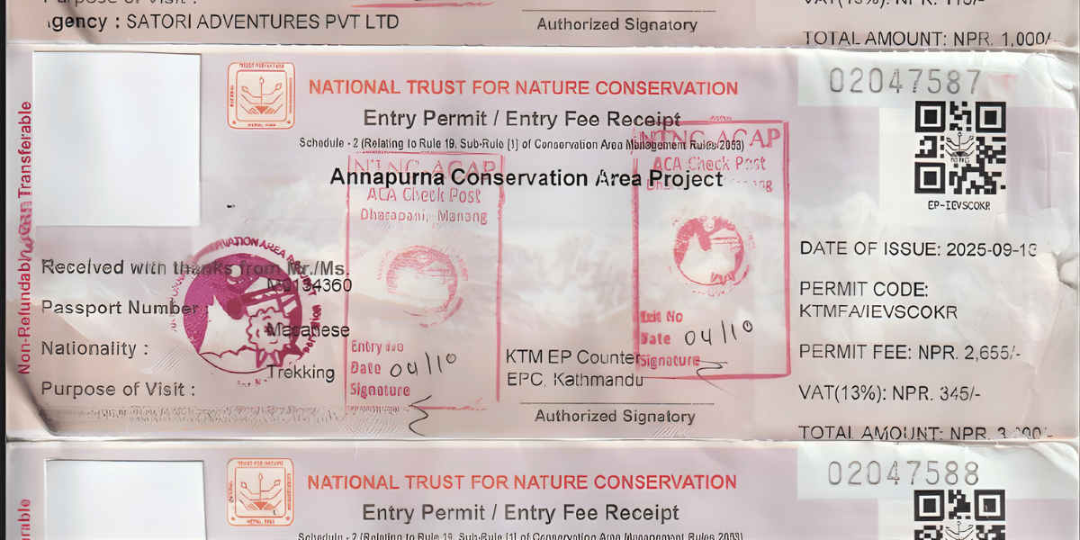
You enter the Annapurna Conservation Area after crossing the Larkya La Pass. This requires a separate ACAP permit. Some trekkers arrange this in advance; others obtain it in the field. It's available online, at the NTNC office, or at the Nepal Tourism Board office.
Tsum Valley Restricted Area Permit:
A Tsum Valley Restricted Area Permit is required only if you are adding the Tsum Valley to your trekking itinerary. Tsum Valley is a restricted region due to its sensitive cultural status and proximity to the Tibetan border; hence, it requires an additional permit.
Trekkers Information Management System (TIMS)
You can get the TIMS card, which is used for managing trekkers' information. To make it clear, the TIMS card isn’t mandatory anymore. Still, for your own safety, you can get it through trekking agencies like the Altitude Himalaya.
Cost Breakdown and Rules
The cost breakdown for all permits needed for the Manaslu region is in the table below:
|
Permits
|
Season
|
Nepali Citizens
|
SAARC National
|
International Trekkers
|
|
Manaslu Conservation Area Project (MCAP) Permit
|
All
|
-
|
NPR 1000
|
NPR 3000
|
|
Manaslu Restricted Area Permit
(covers Chumnubri Rural Municipality 1, 2, 3, and 4)
|
September to November
|
-
|
For a week: USD 100
|
|
Beyond 1 week: USD 15/day
|
|
December to August
|
-
|
For a week: USD 75
|
|
Beyond 1 week: USD 10/day
|
|
Chumnubri Rural Municipality Permit
|
All
|
NPR 200
|
NPR 1000
|
|
Tsum Valley Restricted Area Permit
(covers Chumnubri Rural Municipality 3, 6, 7)
|
September to November
|
-
|
For a week: USD 40
|
|
Beyond 1 week: USD 7/day
|
|
December to August
|
-
|
For a week: USD 30
|
|
Beyond 1 week: USD 7/day
|
|
Annapurna Conservation Area Project (ACAP) Permit
|
All
|
-
|
NPR 1000
|
NPR 3000
|
Note: All permits are free for children below 10 years. You’ll, however, need proof of their age to claim this perk.
Important rules to understand:
- You cannot deviate from your approved route, i.e no impromptu side trips to the Tibet border.
- Camping is restricted to some designated areas.
- There is a strict no-littering policy with fines up to NPR 10,000 for violations.
- If you're found trekking without proper permits, it might result in heavy fines, trek termination, and even possible deportation.
The People and Culture of the Manaslu Region
When you walk through Manaslu, you are not there only for the mountains. You enter a living cultural landscape shaped by centuries of trade, religion, and adaptation to harsh conditions.
Ethnic Groups and Their Settlements
In the Manaslu region, from the start of your trail to the end of it, you'll meet a mixture of ethnic communities. These communities can be grouped by regions, as I have listed below:
- Lower Valley (Soti Khola to Jagat): Mainly Gurung and Magar communities live here, with Brahmin, Chhetri, and Newar families in some villages. People often follow a mix of Hinduism and Buddhism.
- Kutang/Lower Nubri (Deng-Bihi): This region is home to ethnically Tibetan residents, sometimes called Kutungba or people of Kutang. They speak a dialect mixing Tibetan and Gurung elements.
- Upper Nubri (Namrung-Lho-Shyala-Samagaun-Samdo): Nubripa people of Tibetan origin live here, strongly following Buddhist traditions. Their history has deep ties to old monasteries and ancient trade routes to Tibet.
- Tsum Valley (Chumling-Chhekampar-Nile-Mu): The Tsumba people speak their own Tsumke dialect. The valley is a non-violent area called "Shyagya," forbidding hunting and animal slaughter and strictly limiting tree felling.
Languages throughout the MCA include Nepali, Gurung, Tamang, Tibetan dialects (Nubri and Tsum), and other Sino-Tibetan languages. Nubri and Tsum languages are considered endangered, and efforts are underway to preserve them.
Religion, Monasteries, and Spiritual Landscape
From around Philim upward, the landscape becomes very clearly Buddhist. You'll see and experience:
Monasteries (Gompas)
These are important spiritual centres scattered throughout the region:
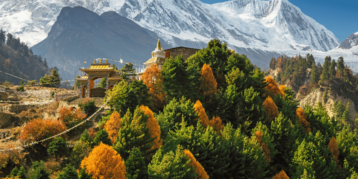
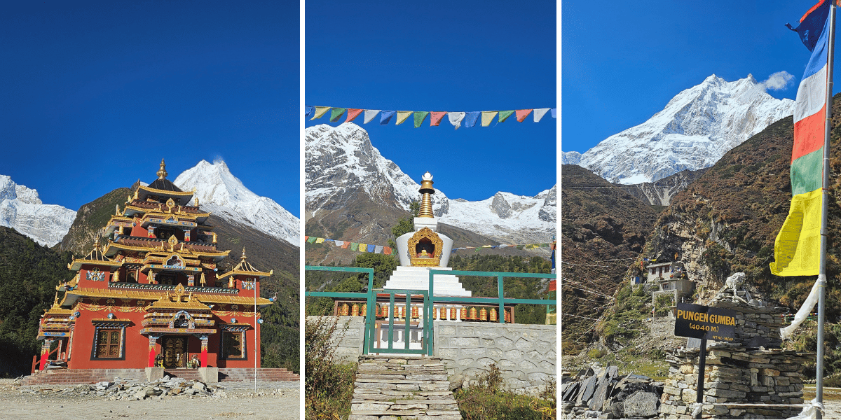
- Ribung Monastery (Lho): A large monastery above Lho village. It is famous for sunrise views of Manaslu and festivals like Lhosar and Dumje.
- Shyala Monastery and Pungen Gumba: Near Shyala and Samagaun. Shyala Monastery lies on the way to Pungen Gumba. Pungen Gumba is perhaps the single most iconic monastery of the region, with a grand view of Manaslu and the surrounding peaks like Himchuli and Ngadi Chuli.
- Pema Chholing Gompa (Samagaun): A historic monastery above Samagaun. Accounts describe it as several hundred years old and an important regional center.
- Serang/Shyar Gompa: A high monastery above Bihi in the Kyimolung Beyul with more than 100 monks and nuns. It has strong ties to the Guru Padmasambhava and Milarepa legends.
- Rachen Nunnery and Mu Gompa (Tsum Valley): Key spiritual centres hosting nuns and monks. Mu Gompa sits at the upper end of the Tsum Valley.
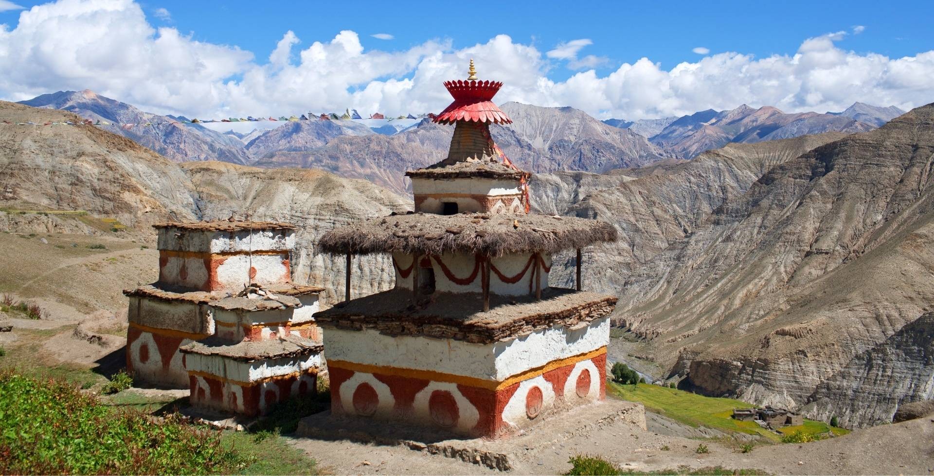
Chortens, Mani Walls, and Prayer Flags
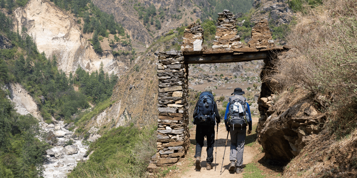
Long mani walls throughout the trail are inscribed with "Om Mani Padme Hum." Gateway chortens, also known as kagnis, mark the village entrances. Prayer flags are always fluttering on ridges and rooftops.
You should always walk left-hand around mani walls and chortens, in the direction of prayer wheels, out of respect. But if you find people doing counter-clockwise, know that they follow bon religion, which another minority of the Manaslu population follows.
Festivals and Ritual Life
If you visit in winter or early spring, you will encounter the following Himalayan festivals:
- Lhosar (Tibetan New Year): A major festival in Nubri and Tsum villages and at monasteries such as Ribung and Pungyen.
- Dumji (Dumje) and Local Protector Deity Festivals: These involve masked Cham dances, offerings, and communal feasts.
- Saga Dawa aka Buddha Purnima: Key Buddhist holy days marked by prayer, butter-lamp offerings, and circumambulation of sacred sites.
- In Tsum, local rituals such as Ne-Tone (harvest festival) and Obyork (crop-ripening ritual) are maintained by village assemblies and clan leaders. Make sure you try their local delicacies while you have the chance!
Lower down, you can also see:
- Gurung dances like Ghatu and Sorathi
- Nepalese Hindu festivals like Janai Purnima are celebrated in both Buddhist and Hindu ways in some valleys
Everyday Life and Economy
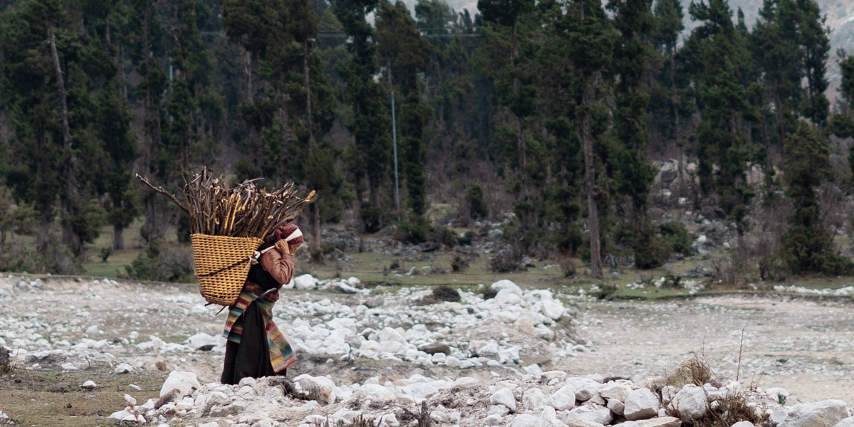
Most households still depend on subsistence agriculture and animal husbandry. Lower villages grow rice, maize, and millet. Higher villages grow barley, buckwheat, and potatoes and keep yaks, sheep, and goats.
Seasonal migration is common. Many families move to lower winter homes or send members to cities or abroad for work.
Cross-border trade with Tibet continues from villages like Samdo via high passes, trading salt, wool, manufactured goods, and livestock.
Tourism has become a major cash source, but you should remember that it's still seasonal and uneven. Lodge owners and guides benefit more than some poorer households. Community-based projects try to spread benefits, but income gaps are still there.
Major Attractions Inside Manaslu Conservation Are
The Manaslu Conservation Area is a journey through extreme geography and living Himalayan culture that is remote, unvarnished, and profoundly spiritual.
These locations, which range from sacred valleys and high mountain passes to cliff-hugging bridges, are what characterise the Manaslu experience.
Cantilever Bridge at Yaru Bagar (Gateway to MCA Trail)
Before you even reach Jagat, near Yaru Bagar, you cross a cantilever bridge anchored into a cliff face above the Budhi Gandaki. It was built with support from the UK's development agency, with materials flown in by helicopter due to the extreme terrain.
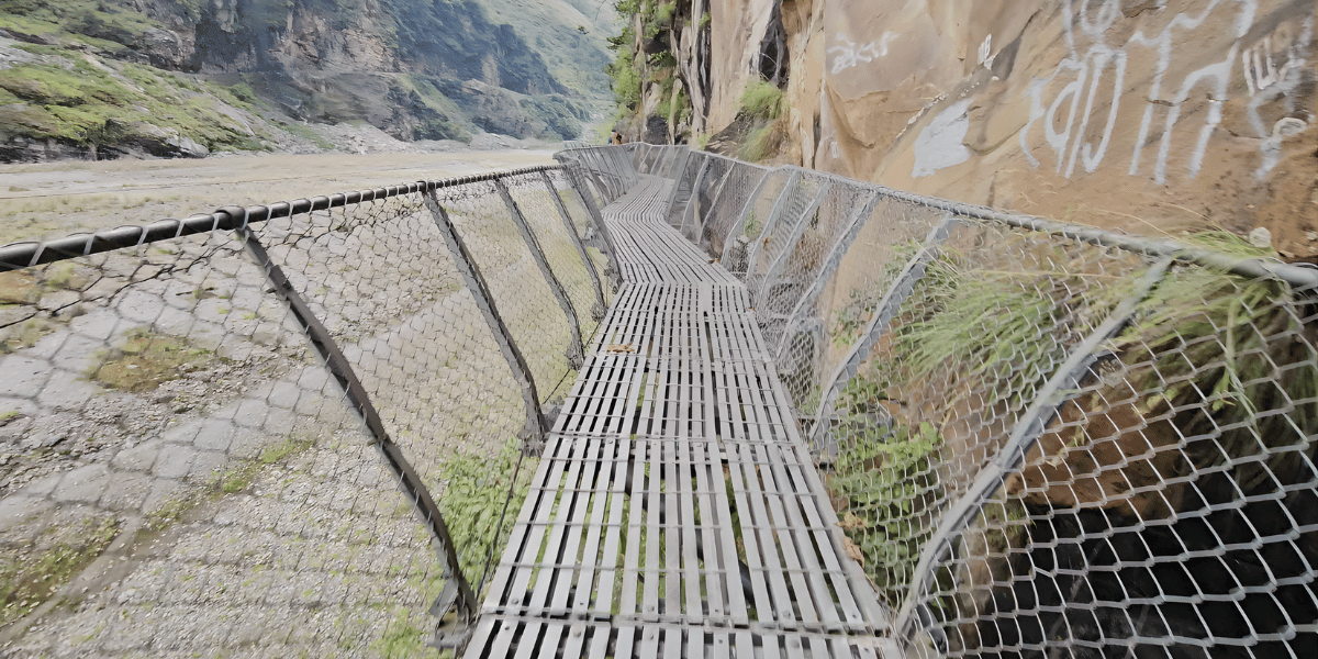
This bridge connects Sirdibas and Kerauja villages and keeps the Manaslu trekking route open. Without it, many communities would be cut off during monsoon floods.
Pungen Gompa
Pungen Gompa is just above Shyala Village at 4,040 meters. It is a meditation retreat center and one of the finest viewpoints for Mount Manaslu.
The monastery sits on a hillside with the mountain dominating the horizon. Of course, the outside views here are most magical at sunset, but to experience the monastery itself, go in early morning, just as the monks begin their chanting sessions.
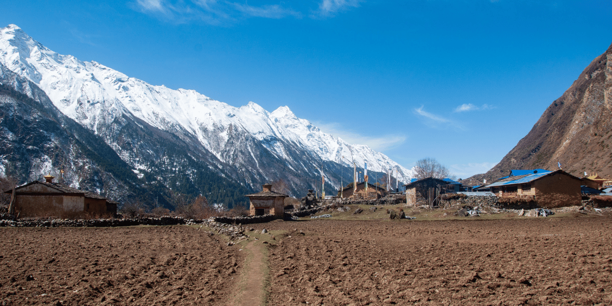
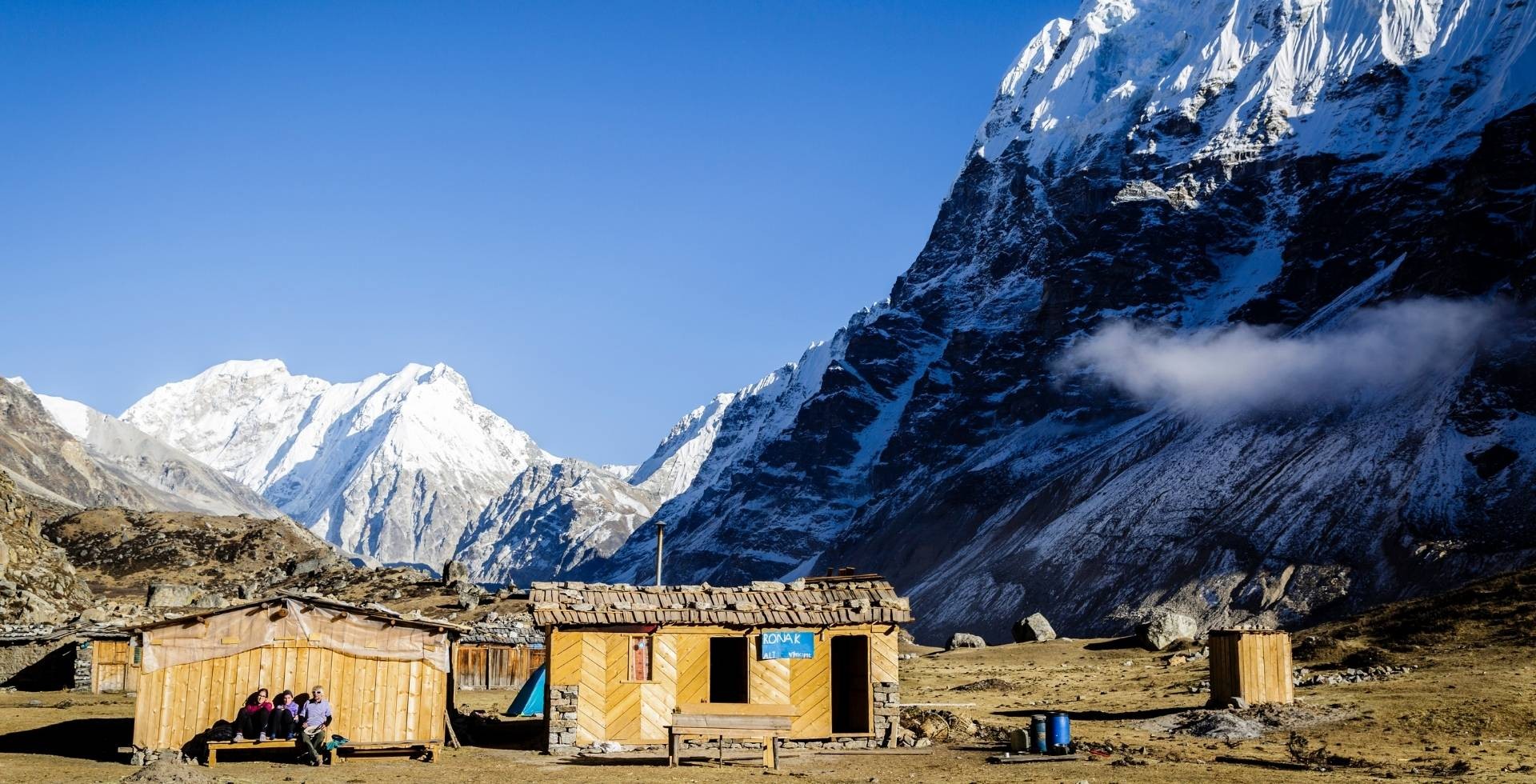
Samagaun: The Heart of Nubri
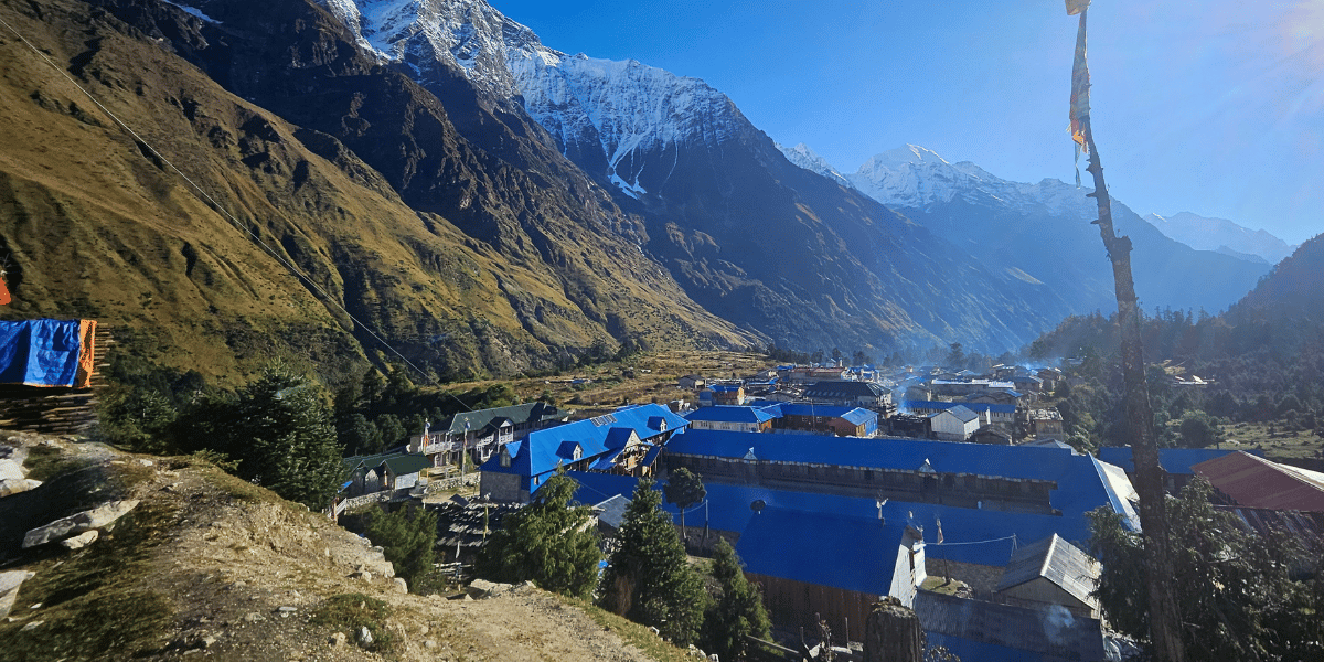
Samagaun sits at 3,530 meters and is the most developed settlement for trekkers on this trail. The village is known locally as the "lotus feet of Manaslu", a poetic reference to its position as the spiritual heart of the region.
Pema Choling Monastery is located on a hillside above Samagaun, housing resident monks and offering peaceful meditation to travellers. From the monastery's location, you can see a beautiful view of Mount Manaslu. You can stay in Samagaun to acclimate for the trek ahead.
Lakes: Where Mountain and Spirit Meet
Mountains and monasteries aside, Manaslu Conservation Area is home to many awe-inspiring lakes.
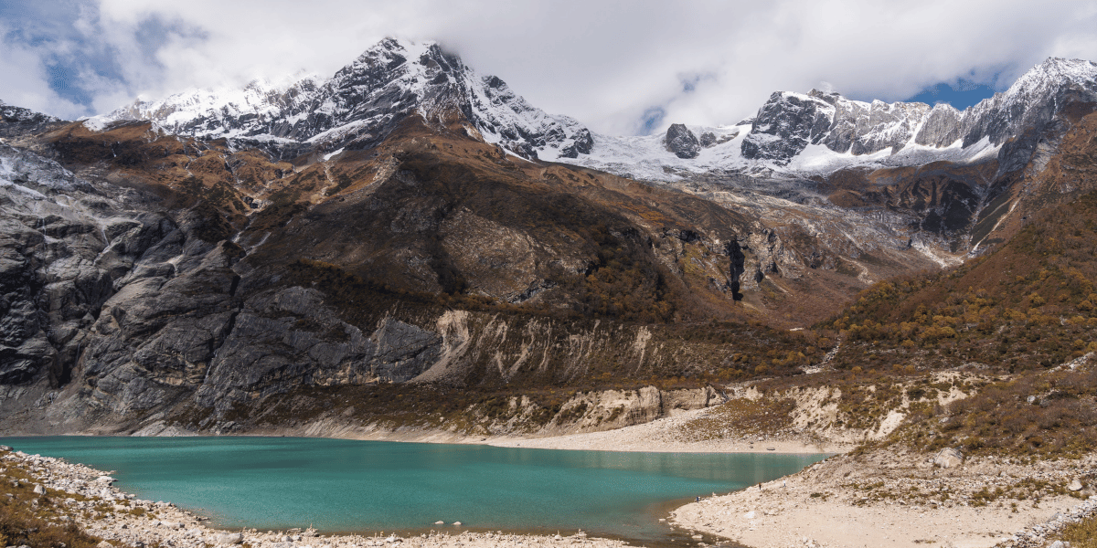
Birendra Lake
It is a glacial lake at an altitude of 3,690 m originating from the Manaslu Glacier basin. It was named after the late King Birendra. The lake's turquoise waters reflect the surrounding peaks, creating an ethereal landscape. It is about 2 hours away from Samagaun.
Kal Tal
Also called Kalchuman Tal or Kalpa Chho, Kal Taal is situated at 3,600 m near Prok. Its name literally translates to "Death Lake".
Although it has an eerie name, it hosts serene beauty. Locals believe visiting during the dark moon and performing circumambulation brings blessings. The lake reflects mirror like image of Mount Manaslu on clear days.
From Kal Tal, the Queen Waterfall originates, which flows downward through alpine meadows, visible from certain vantage points during your trek.
Dudh Pokhari
Dudh Pokhari, aka “Milky Lake”, is a more remote pilgrimage trekking destination outside the Manaslu Circuit trail. This lake lies at around 5,000 m in Sirdibas.
Hindu and local pilgrims visit this lake to dip in its icy water to wash away their sins. I am sure the views of Manaslu, Himalchuli, and the Annapurna range only add more to the spirituality of the whole experience.
Amrit Lake
Amrit Lake is a small glacial lake near Larke Pass. It sits in the high, barren region where its turquoise water creates a sharp contrast with its surroundings. Many simply refer to this lake as the Larkya glacial lake due to its proximity to the high pass.
Manaslu Base Camp
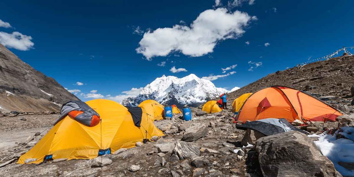
At 4,800 meters, Manaslu Base Camp sits at the foot of majestic Mount Manaslu. The Base Camp area consists of simple structures that are made of stone.
Standing there, watching clouds move through valleys thousands of meters below, is a feeling one can not put into words.
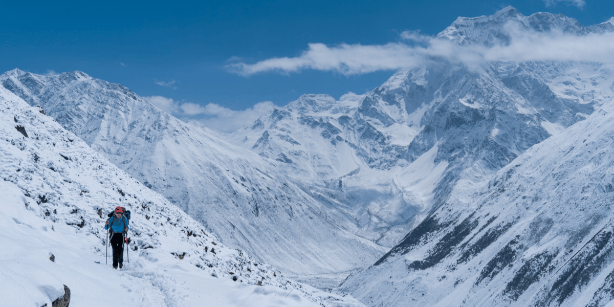
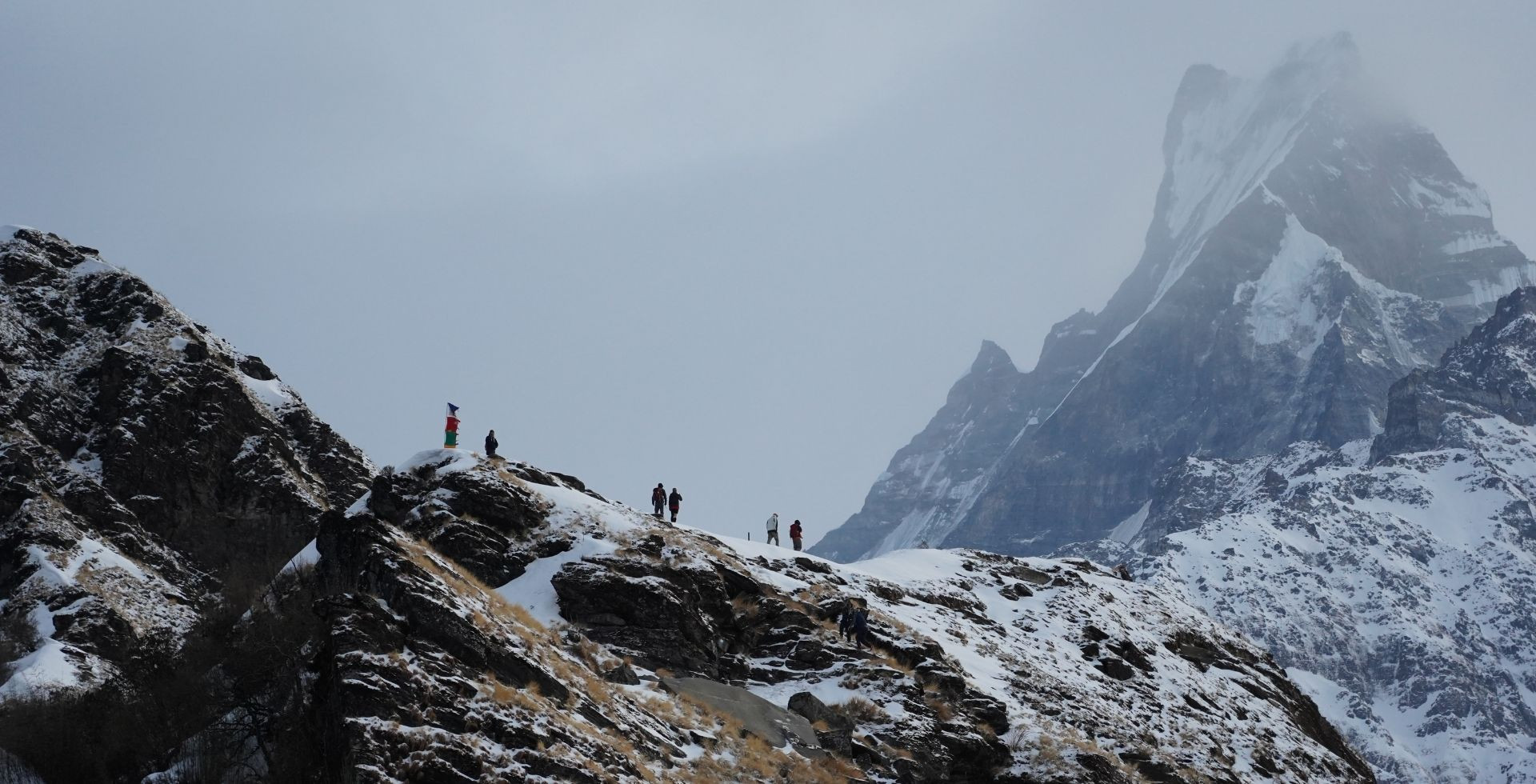
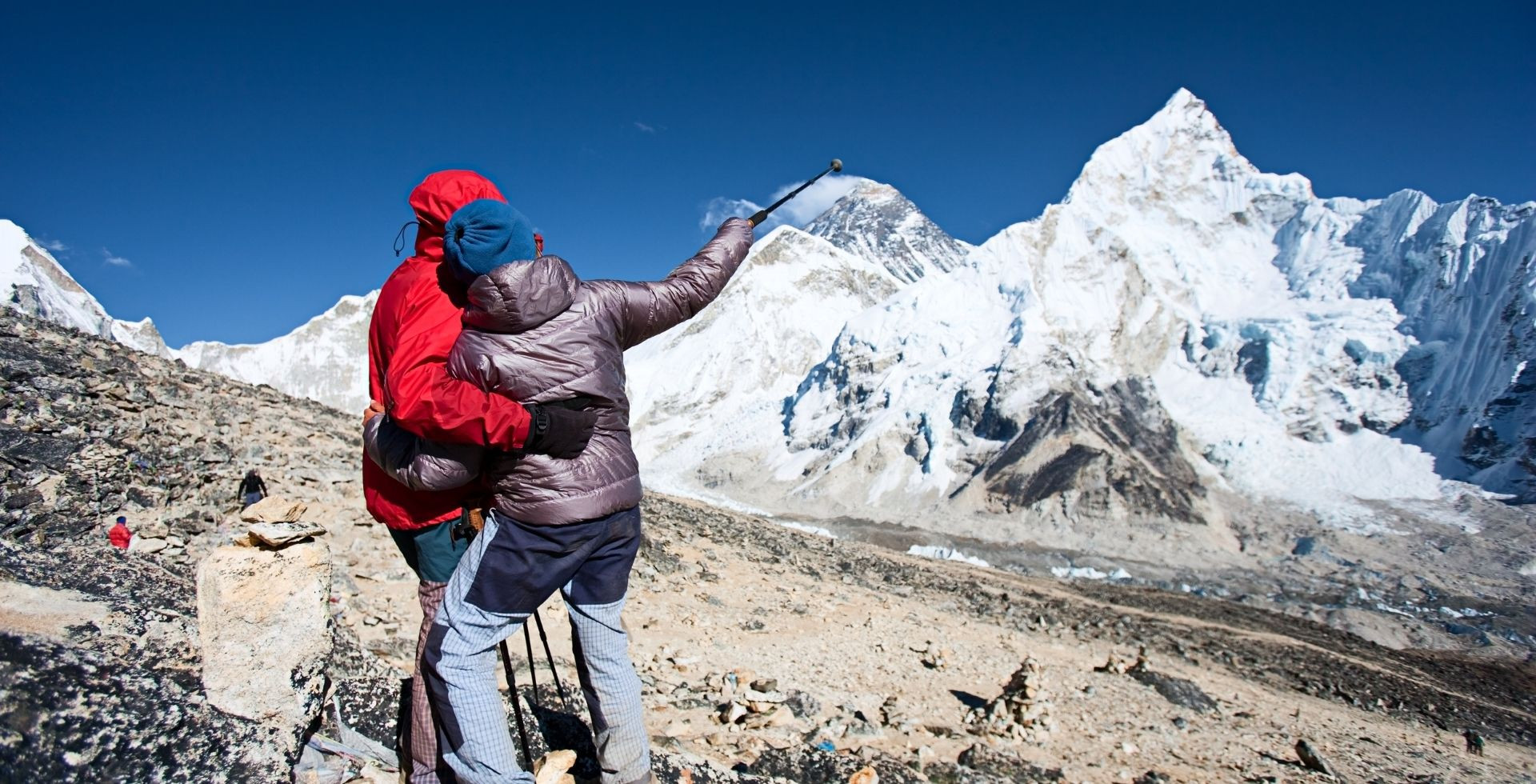
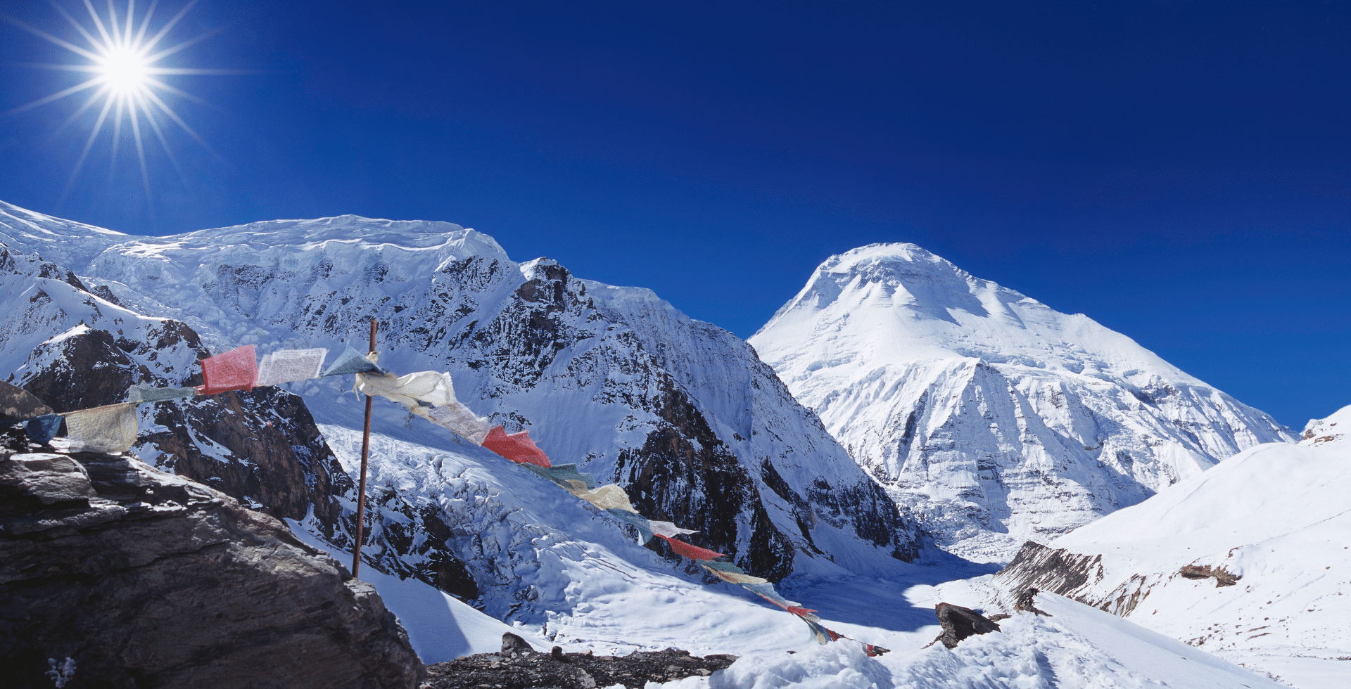
Larkya La Pass
At 5,106 meters, the Larkya La Pass is the highest point on the Manaslu Circuit Trek and arguably its defining moment. This is a geographical and physical separation between the Manaslu region and the Annapurna region.
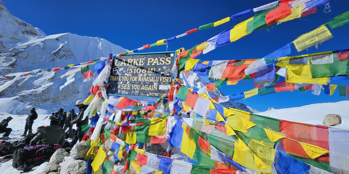
The pass connects the Budhi Gandaki Valley with the Marsyangdi Valley. On clear days, the views from the summit are extraordinary-Mount Manaslu to the east, Annapurna II, Himlung Himal, Cheo Himal, and Kang Guru cluster to the west.
Crossing the pass requires early starts (often 3-4 AM) to maximize daylight. The ascent from Dharmasala involves steep and rocky terrain with thin air, making every step difficult.
The descent into Bhimtang is also equally challenging, with loose rock and altitude fatigue making it physically demanding.
Tsum Valley: Cultural Purity and Sacred Sites
If Nubri represents traditional Tibetan Buddhist culture, Tsum Valley pushes that authenticity further. This isolated valley has been protected as a sacred pilgrimage site (beyul kyimalung).
- Within Tsum Valley, Mu Gompa sits at 3,700 meters and is one of the major attractions for trekkers and pilgrims. The monastery is built into natural caves associated with Milarepa, who is a revered 11th-century Tibetan yogi. These meditation caves are still used by practitioners today to meditate and feel closer to the legend.
- Similarly, Rachen Gompa is one of the few major nunneries in the Himalayas. It houses 200-300 nuns. The monastery was built in 1905 and is filled with colorful murals and prayer flags.
- Serang Gompa (also called Shringi Gompa) sits at 3,800 meters above Bihi village. It represents the Nyingma lineage of Tibetan Buddhism.
Other Notable Passes and Hidden Gems
Beyond the Larkya La Pass, the conservation area consists of several other challenging passes. These are less visited by standard trekkers.
Rupina La Pass (4,720m) offers an alternative route connecting Tsum Valley to the main circuit. Similarly, Yamdo Pass, Lajuyng Pass, and Gyala Pass serve specialized trekking routes for adventurous travellers seeking deeper wilderness.
Things to Do in Manaslu Conservation Area
When you think of visiting the Manaslu Conservation Area, you probably mainly think of trekking. Of course, that is one of the major activities here, but there is also bird-watching, mountaineering, photography, cultural tours, etc.
Let's have a look at all of them to get the perfect match for you.
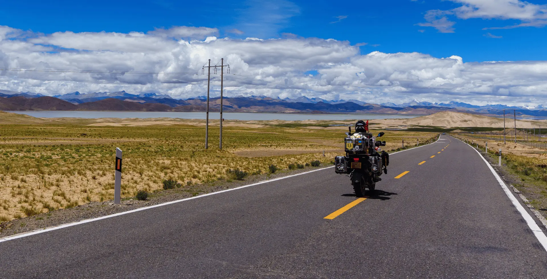
Trekking in the Manaslu Region
Most visitors experience Manaslu through trekking. To reach the main attractions, you usually choose one of these core routes (or a combination):
This is the classic route circling Manaslu and crossing Larkya La. The route is:
Road approach from Kathmandu to Machha Khola or Soti Khola. Trek north along Budhi Gandaki through Jagat, Philim, Deng, Namrung, Lhi, Lho, Shyala, and Samagaun. Continue to Samdo, Dharmashala, and Larkya La Pass, then descend to Bhimthang, Goa, Tilije, and Dharapani. Finally, drive out via Dharapani to Besisahar and then Kathmandu.
The trekking portion often covers 150-180 kilometers, usually over 13-16 days of walking. The combined driving plus trekking distance reaches around 280-445 kilometers, depending on start and exit points.
This route passes almost all the main cultural and natural highlights of Manaslu.
For Aussies: Check our 15-day Manaslu Circuit Trek package here!
Manaslu Circuit with Tsum Valley
If you want both the high pass and the sacred side valley, you can add Tsum Valley to the main Manaslu Circuit Trek.
From Philim/Ekle Bhatti, you branch east into Tsum, visit Chumling, Chhekampar, Nile, Mu Gompa, and Rachen Gompa, then return to the main Budhi Gandaki valley and continue up to Deng and Namrung.
This adds several days, more permits, and strong cultural immersion in Tsumpa communities and Buddhist monastic life.
Upper Route via Prok and Kal Tal
Instead of the direct Ghap-Namrung route, you can take an upper trail through Prok. You climb from Deng to Prok, stay in homestays, and then spend a full day visiting Kal Tal.
You then descend back to Prok and continue to Namrung and Lho. This route brings you closer to local life and away from the busier main trail.
Rupina La and Other Routes
If you want more remote trekking, you might consider:
- Rupina La Pass Trek: Starting in Barpak and Laprak, crossing the 4,720 m Rupina La, and then connecting to the Manaslu Circuit or even Annapurna.
- Serang Gompa Trek: A dedicated side trek from Bihi to Serang/Syarang Gompa and Kyimolung Beyul.
These require camping or very basic lodges and solid high-altitude experience.
Mountaineering on Mount Manaslu
For climbers, summiting Mount Manaslu represents a serious feat. Climbers and trekkers both prefer the same seasons, autumn (September-October) and spring (March-May).
The Manaslu Expedition (35-45 days) requires previous high-altitude climbing experience (ideally 7,000 m+ peaks). It requires excellent fitness, mountaineering skills, and $15,000-30,000+ in expedition costs.
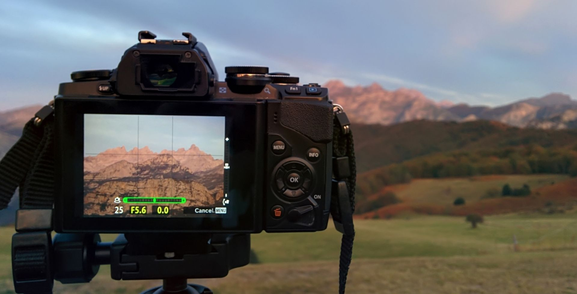
Photography and Bird Watching
The Manaslu region offers great photography and bird-watching opportunities for respective enthusiasts. The region's 110+ species make Manaslu an Important Bird Area.
Spring migration season (April-May) is ideal for bird sightings. Species like the Himalayan monal, snow partridge, and Tibetan snowcock can be regularly observed.
Manaslu Conservation Area Rules and Regulations
You must follow both national restricted area rules and conservation rules when you travel here. Understanding them helps you stay out of trouble and shows respect for the communities and ecosystems you're visiting.
Environmental Respect
Within Manaslu, you must obviously follow the restricted zone rules and regulations. Besides those, you must also respect environmental guidelines, enforced by NTNC and local committees:
- Do not hunt or harm any wildlife
- Do not collect plants without permission
- Do not engage in open campfires
- Do not camp outside designated areas
- Pack out all non-biodegradable waste, and dispose of it in public bins that are present on the trail
If you plan to use drones for photography or research, you must obtain permits from CAAN (Civil Aviation Authority of Nepal), the Department of National Parks and Wildlife Conservation, and relevant ministries.
Cultural Respect
Local communities, monasteries, and village councils also expect you to:
- Dress modestly around monasteries
- Ask before clicking pictures or videos of people, rituals, and inside temples
- Walk left-hand around the mani walls and chortens
- Avoid loud music and any form of public intoxication
- These practices match both NTNC's visitor guidelines and local cultural expectations.
Major Considerations for Visiting the MCA Responsibly
Manaslu is a landscape you are temporarily borrowing. You should be aware of its difficulties, honour local systems, and reduce the strain your presence places on ecosystems and communities.
Here are things you should keep in mind for your visit to the MCA:
Altitude Sickness
The route climbs above 5,000 meters. Altitude sickness risk becomes significant above 2,500 meters above Namrung village. You should build in acclimatization days at Samagaun and Samdo. Even before you start your trek, you should make adequate preparations for an easier time on the trail.
While trekking, always be on watch for symptoms like headache, nausea, dizziness, and breathlessness. If symptoms worsen, descend immediately. No summit or pass is worth your life.
Cold and Snow
Even in spring and autumn, you should expect sub-zero nights above 3,500 meters and possible snow on Larkya La.
Make sure you have proper layered clothing, windproof shells, gloves, hats, and warm sleeping bags in your packing list for Manaslu.
Guides and Rescue
Because guides and groups are mandatory in the restricted area, you benefit from local knowledge. You should also carry adequate travel insurance that covers high-altitude trekking and helicopter evacuation.
Environmental Challenges
This is more of a challenge to the environment of Manaslu than for you. But you need to be aware of the pressure exerted nonetheless. Climate change is causing glacial retreat, and the changes in snow patterns are affecting alpine species.
Road construction projects are underway in previously remote valleys. Yes, the new roads make local life easier, but they also fragment wildlife habitat, increase landslides, and reduce trekking quality.
Hydropower projects elsewhere divert water into tunnels, drying the riverbeds in winter. Tourism pressure from an increasing number of tourists is creating a higher, unsustainable demand for “convenience”.
Future of Manaslu and Final Thoughts
More than 7,000 trekkers visit the Manaslu region annually. This number continues to grow, and while this revenue creates livelihood opportunities, it also creates immense environmental pressure.
Climate change is a greater concern. The region's ecological balance could shift significantly if warming accelerates further. Manaslu's future depends on NTNC's dedication to eco-friendly tourism.
You are also expected to visit with humility, patience, and curiosity. You'll be helping to ensure that snow leopards still roam, prayer flags still flutter, and Tsumpa and Nubripa children can look up at Manaslu with pride for generations to come.
We at Altitude Himalaya believe Manaslu represents the future of responsible Himalayan tourism. It's why we prioritize community-based trekking with stays in local guesthouses, local guides, and by respecting cultural boundaries. When you trek with us in Manaslu, you're also participating in a conservation model.


 Karuna Bhattarai