The Manaslu Circuit Trek is rated as a difficult level trek, and that rating is absolutely honest! But difficult does not actually mean it’s impossible, because with experienced guides and the right preparation, even beginners can complete this journey!
What makes it truly worth every challenging step is the sheer beauty of the route itself.
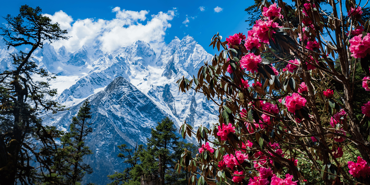
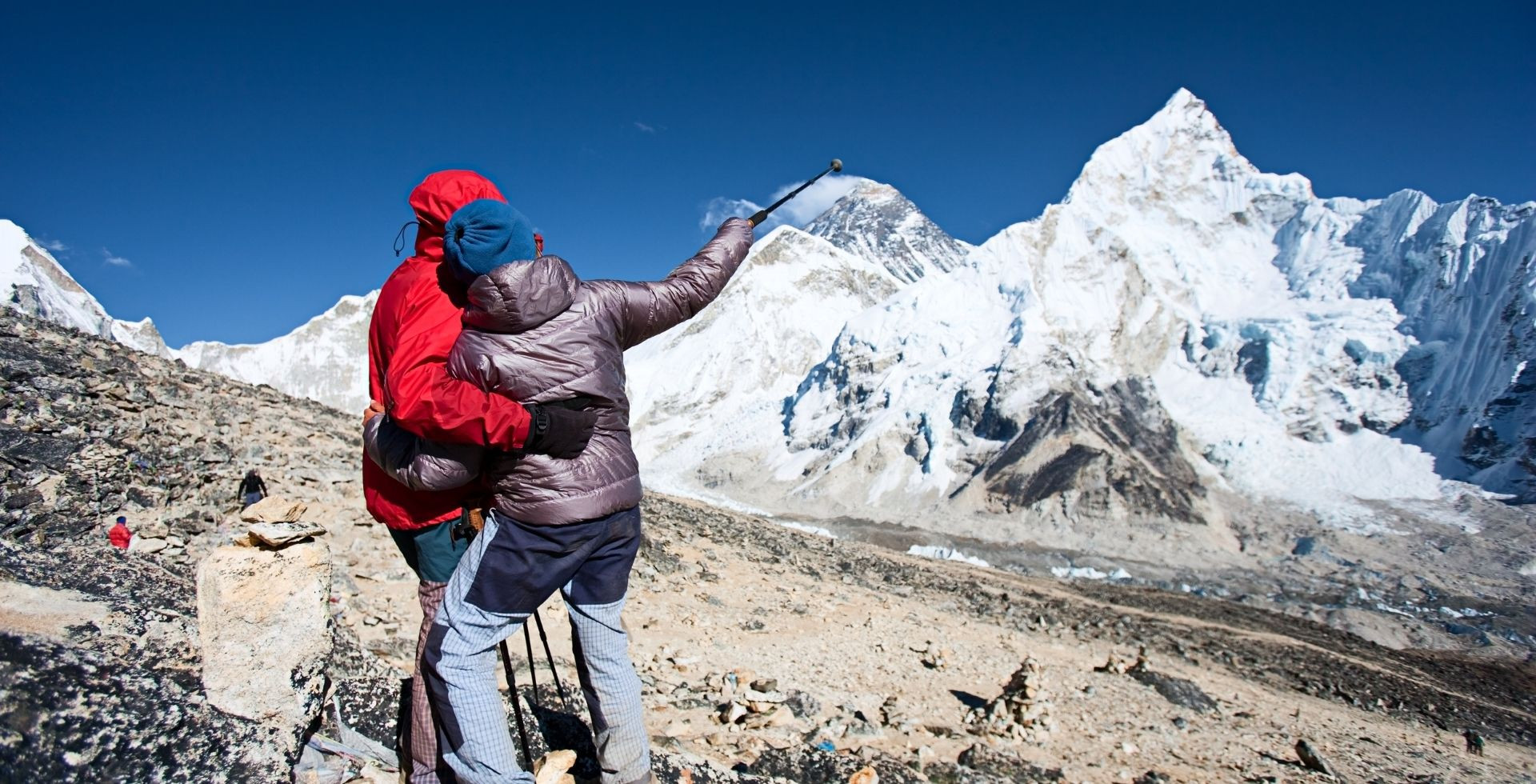
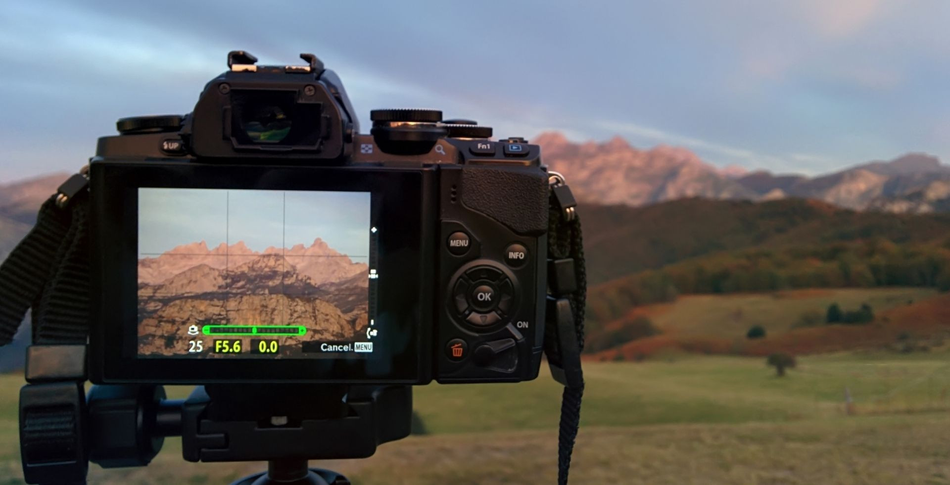
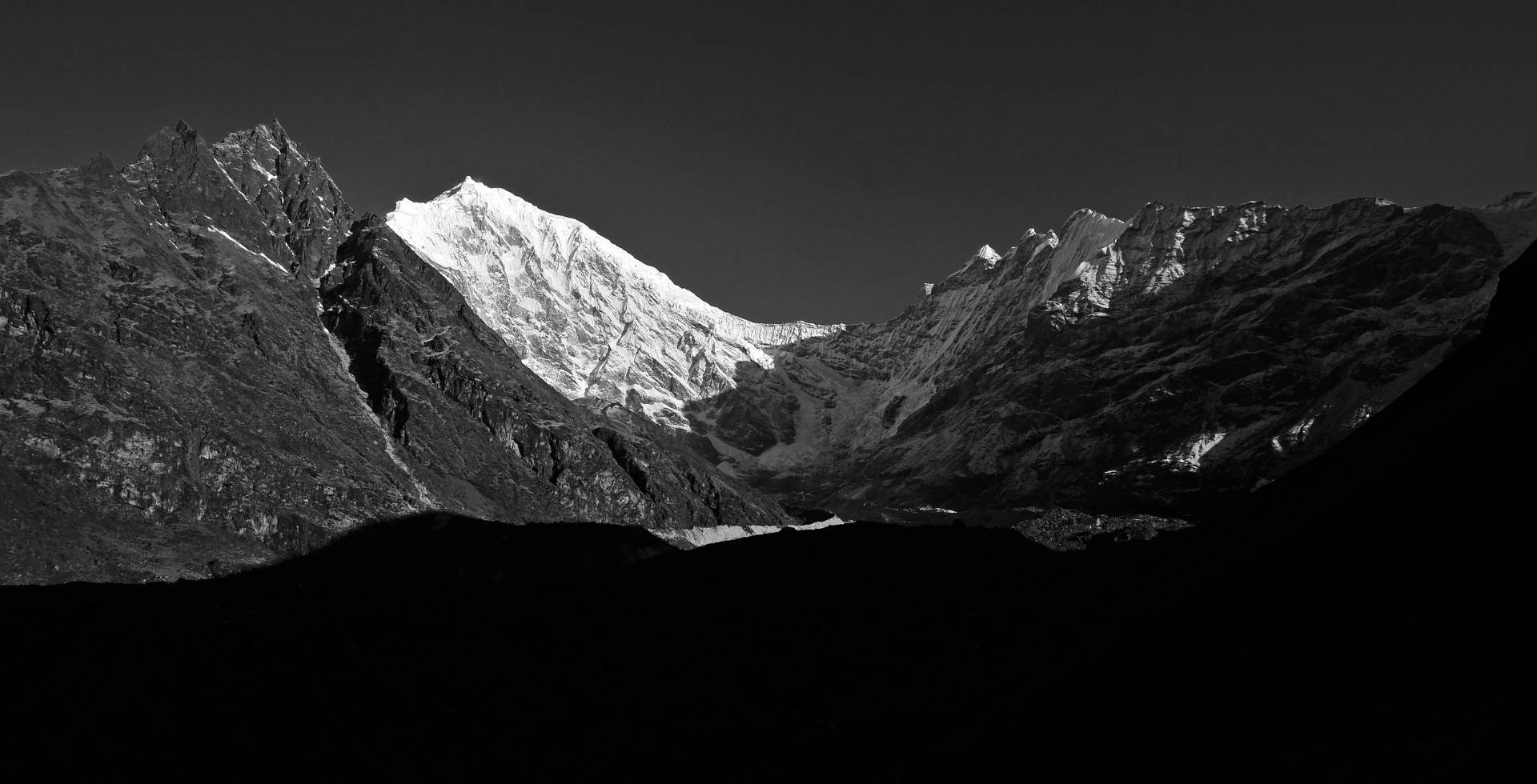
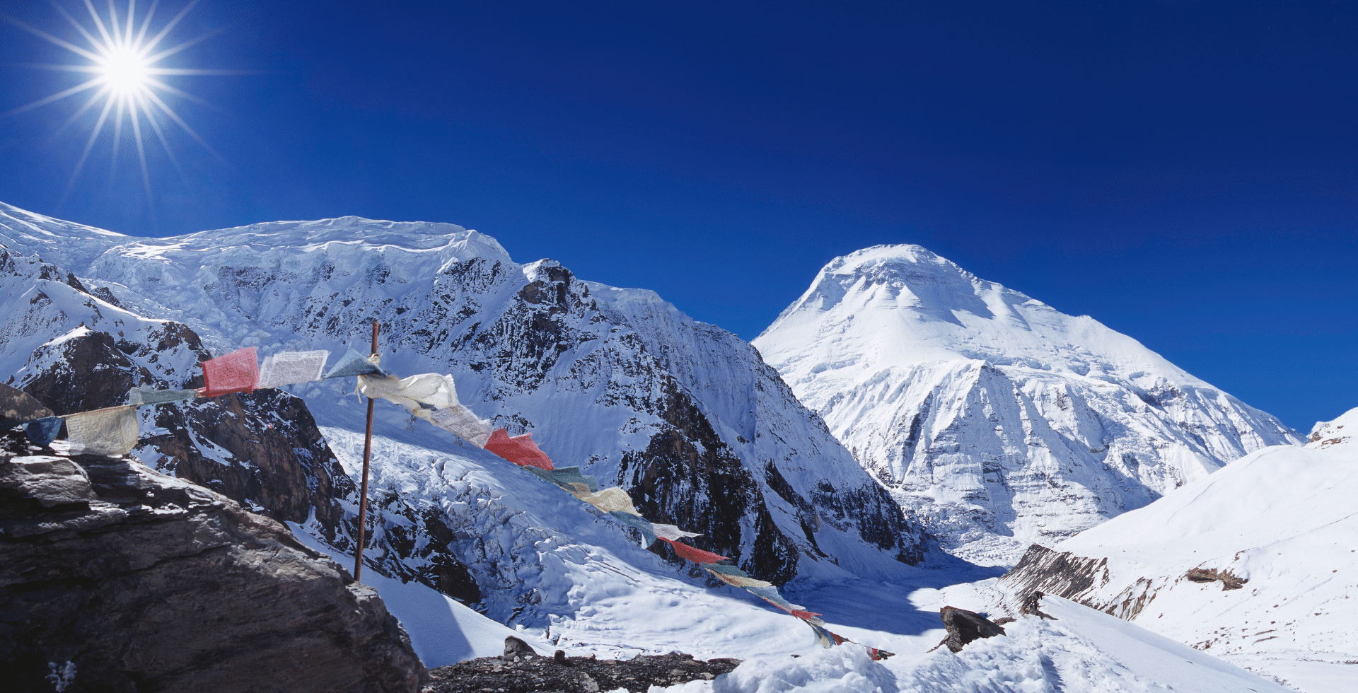
You'll walk through lush subtropical forests and wide green valleys dotted with waterfalls, along with the surreal views of Mt. Manaslu and the Mansiri range that keeps getting better the higher you climb. And after 9 to 10 days of building up to it, you'll finally stand at the top of Larke La Pass (5,106 m), the crowning moment of the entire circuit, connecting the Budhi Gandaki Valley in the Manaslu region to the Annapurna region.
Our Altitude Himalaya team completed this trek in mid-October, and we were genuinely lucky with breathtaking mountain views, roaring waterfalls still carrying the weight of the monsoon, and largely favourable weather throughout. But the challenges were very real too, and experiencing them firsthand is exactly why we felt qualified to put this guide together.
Read on to get an honest breakdown of altitude sickness risks, trail conditions, and weather-related challenges on the Manaslu Circuit Trek, along with practical tips from our own experience to help you tackle each one!
Is Manaslu Circuit Trek Difficult as They Say?
The Manaslu Circuit Trek is known for being quite challenging. Since you have to pass through remote regions that aren’t easily accessible, this trek is certainly among the toughest routes.

Other major factors that can make this trek difficult include: the rugged terrain, exhausting long hikes, and unpredictable weather conditions.
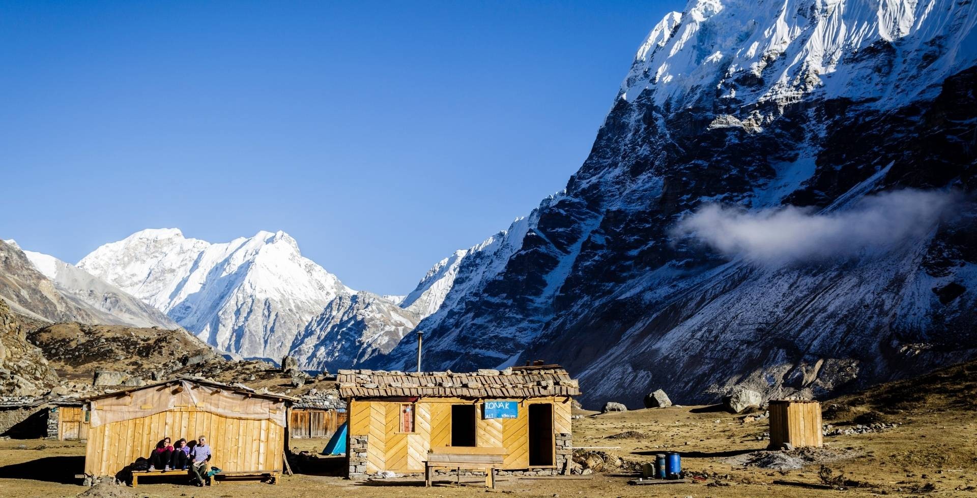
The quality of accommodation on the Manaslu journey is also quite basic, with just limited amenities. Additionally, you have to walk for several hours, often 6 to 8 hours (13 to 15 km), on a daily basis, and that too, on mostly rugged terrain!
So, considering how physically demanding the trek is, it seriously tests your endurance and mental resilience. Nonetheless, determination and careful preparation can make your Manaslu journey possible.
For those who have prior experience with long days of trekking, it isn’t actually that tough. There are just a few challenges, particularly during the knee-hurting downhill from Larke Pass to Bhimthang (3,700 m) and the high-altitude trekking early in the morning.
What Makes the Manaslu Circuit Trek Difficult?
After our own Manaslu Circuit Trek, consulting our prior guests (both novices and professionals), and taking advice from our professional trek guides, we have accumulated the main factors that make this journey difficult:
Long, Demanding, and Mentally Tough Journey
Manaslu Circuit Trek is a physically demanding journey, where trekkers need to walk for 6 to 8 hours a day. As you gain altitude, you’ll also feel the changes in your respiration patterns, and the temperature also drops gradually.

Those 14 to 15 days of continuous journey drain your energy, both mentally and physically. It also tests your patience in many ways. Thankfully, the landscape progressively becomes breathtaking, compensating somewhat for the rising difficulty level.
The continuous trek from Jagat (1,370 m) to Tilche (1,560 m) is a bit stressful, and some even opt out early due to how long and demanding it is. Sometimes, the trek may start from Macchakhola (870 m) and end in Dharapani (1,860 m).
One that particularly lingers in my mind is that final stretch to Larke Pass. Waking up early with barely getting a good night's sleep in Dharmashala (4,470 m) and hiking 7 km. And then came that steep downhill section up to High Camp (4,400 m). A total of 11 km without lunch in between was definitely one that will be in my travel books.
In fact, even in the lower section, you’ll have to walk nearly 17 to 18 km per day if you opt for a fast itinerary. That’s the reason we have worked on an avg. 13 to 15 km itinerary for our guests. Definitely check out our Manaslu Circuit Trek package of 15 days.
High Risk of Altitude Sickness
Your trek begins from Macchakhola or, if vehicles are able to reach, Jagat or Philim. Note the altitude of these places, as from these low elevations, you will gradually reach the maximum altitude at Larke Pass.

A common mistake many trekkers make is not including any resting days. Walking every day for 6 to 7 hours, or more, depending on your pace, without giving your body enough time to rest and adapt to the environment, increases the chances of AMS (acute mountain sickness).
Generally, it is best to gain 500 to 600 meters in elevation each day. However, if you try to move too fast, you will gain more elevation in a short time, which is another major reason for high altitude sickness on the Manaslu Circuit Trek.
Moreover, the temperatures drop every season once you approach higher altitude regions, starting from Deng (1,860 m) and Namrung (2,630 m). While in the lower regions you will be blessed with the warmth of fire; this comfort gradually disappears as you reach Dharamshala at 4,470 m.
For many beginners, adapting to this sudden change in altitude is what makes the trek most difficult. Signs of AMS may lead to high-altitude pulmonary edema (HAPE) or high-altitude cerebral edema (HACE), both of which can be fatal. Therefore, it is important to understand and monitor your body right from the early days of the hike.
Restricted Area and Remote Location
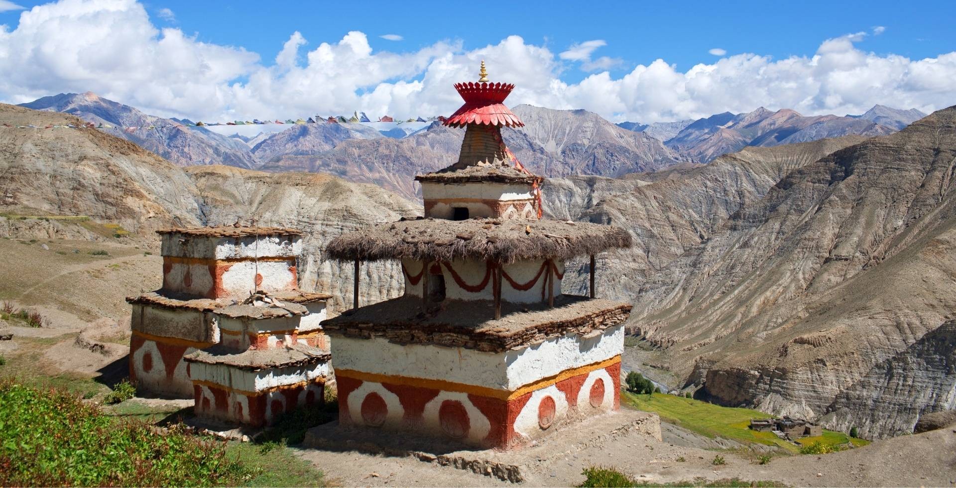
The Manaslu region, covering Chumubri Rural Municipality, is one of the 'restricted areas' and is currently managed by the National Trust for Nature Conservation (NTNC).
That is because of its close proximity to the Tibetan border, unique Tibetan-Buddhist culture inhabited by Nubri and Tsum communities, and fragile ecosystem, which makes it sensitive for security reasons!

For this reason, you will require a special Restricted Area Permit (RAP) along with other necessary Manaslu permits. The RAP covers wards 1, 2, 3, and 4 of Chumnubri Rural Municipality for a specific period. The charges increase after the first week, and you must pay on a per-day basis.
Yes, understanding these permit rules can be a little confusing. However, all of this is handled by your trekking agency. It is important to note that you cannot obtain the Restricted Area Permit individually, as it must be processed through a registered trekking agency.
Moreover, the trails of Manaslu are isolated from road connections, similar to most trekking routes in Nepal. In addition to this, the high-altitude areas are extremely remote, and the only option in case of emergencies is a helicopter rescue.
Having said that, if you fall ill (due to altitude sickness or other health issues) or go through some other difficult situation, you will often have to rely on the local people for immediate help. While there are only limited rescue centres in major villages along the trail, reaching them can still be difficult if an emergency occurs in a more remote section of the trek.
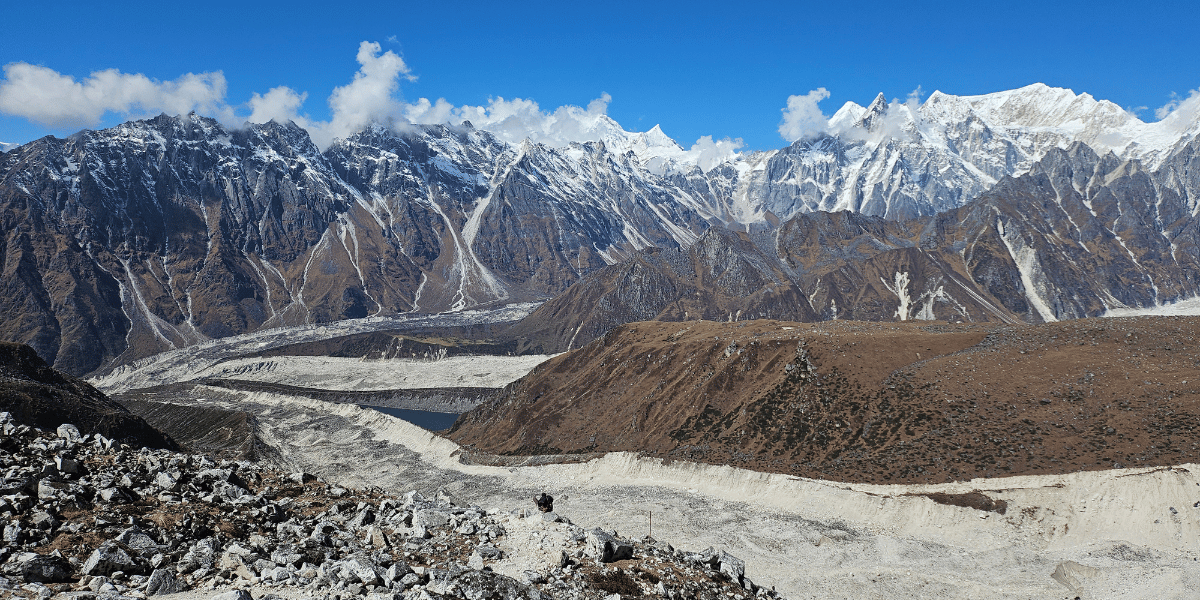
Rugged and Uneven Terrain
From the very start of the Manaslu Circuit Trek, you’ll have to walk on rough and uneven terrain. While you won’t get lost on the trail due to markings, the trail type is what makes it difficult for many.
The lower sections (usually in monsoon and early autumn) are prone to landslides, and the high altitude sections are prone to avalanches (when it’s snowing).
Recalling my own adventure, the final part of the trek from Lake Pass to High Camp (and further up to Bhimthang) was when we had to cross the glacier steeply downhill. This was perhaps one of the most rugged trails I’ve ever hiked. It totally strained my knees, and I even encountered multiple trekkers who got injured here.
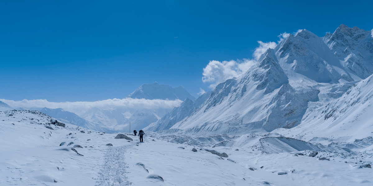
The icy and slippery path beyond Dharmashala (even during autumn and non-snowy periods) is very difficult to cross without crampons. In fact, the narrow trail during the steep downhill will bring your heart to your mouth.
Even the jungle route is muddy, as sun rays can’t reach the ground, and certain sections of the trail are more prone to dry landslide. While maintenance works are always going on, the natural disasters are something we can’t deal with, right?
Unpredictable and Harsh Weather Conditions
The weather is something we can predict but cannot fully rely on. This is especially true on long treks. You never know what may happen over an extended duration. You may start the trek thinking the weather is clear, and within just a few days, the climate can change completely.
We have observed similar cases recently, mainly due to shifting weather patterns. While September and October have long been known as autumn seasons, it has started to rain heavily until late September, with heavy snowfall occurring in October, which is not considered a normal condition.
In the arctic zones of the Manaslu region, the climate changes swiftly. The temperatures also rarely cross the 10°C mark, even during warmer seasons. Therefore, expect snowfall, at least light snowfall, throughout the year near the Larke Pass area.
Even the wind patterns are quite unpredictable. Usually, during the afternoons, wind intensity increases significantly when visiting the main Manaslu region attractions, such as Pungen Gumba, Birendra Lake, and Larke Pass. Particularly at the pass, strong winds can make your journey even more difficult.
Seasonal Challenges
It is true that the weather mainly depends on the season. Also, the beauty of the Manaslu Circuit Trek is distinct at different times of the year.
The most difficult times of the year to travel to this part of Upper Gorkha are when there is heavy rainfall and snowfall. In fact, during peak winter, Larke Pass often becomes impassable due to thick layers of snow and is closed. The side trip to Manaslu Base Camp also becomes challenging during this time.
Seasonal challenges do not only include weather and trail conditions. They also impact the overall trek budget and crowd levels. During the peak seasons of spring and autumn, vehicle costs, teahouse rents, food item costs, and even permit fees are slightly higher.
Moreover, crowding has become another issue. While the Manaslu Circuit Trek was once known as one of the less-visited trekking destinations, this has changed significantly. Considering the remote terrain and adventurous nature of the long journey, it has actually started to become more preferred among trekkers.
Even during our own adventure, we witnessed a surge in crowd numbers, and I can predict that there will be even more trekkers in the coming years. As a result, finding accommodation during the peak season can become difficult if you do not book your package early.
Do not worry. We have departures throughout the year here at Altitude Himalaya. Just contact us on WhatsApp, and we will proceed accordingly.
Recommended Reading: Best Time for Manaslu Circuit Trek
Your Experience and Fitness Level
After assessing the experiences of my own, along with other seasoned as well as first-time trekkers, Manaslu Circuit Trek definitely requires good physical condition and a mentally strong mindset, as you will be on a tiring journey, walking 12 to 13 km per day.
In fact, in some lower regions, you may have to extend your hiking distance to 17 to 18 km. This is particularly the case from Macchakhola to Jagat, Jagat to Deng, and Bhimthang to Tilche.
Even the final day stretch covers almost 16 km from Dharamshala to Bhimthang. First comes the uphill section, followed by the knee-hurting downhill. Even for experienced trekkers, fitness is seriously tested here.
Especially after 4 to 5 days, you may start to feel overwhelmed by choosing this destination. The mountain views will fill your heart, but your legs may ask for more rest due to exhaustion. This is where your mental preparedness comes into play.
And in case you’re planning to add Tsum Valley to the journey, the long distance will further add to the difficulty level for sure!
Most Difficult Sections of Manaslu Circuit Trek
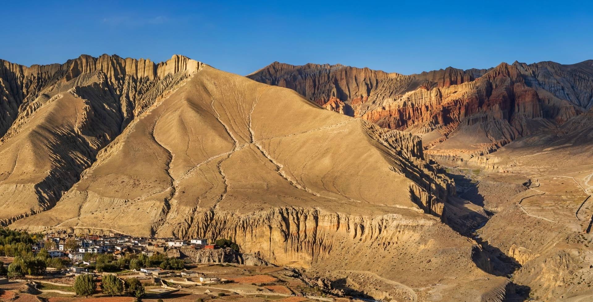
The Manaslu Trek traverses through tropical, subtropical, and temperate zones, as well as subalpine, alpine, and arctic regions. This means you will pass through low hill, middle mountain, and high mountain trails.
Each zone in the Manaslu Conservation Area offers its own climate and trail type. From forested routes to rocky paths, this Manaslu Circuit has everything a mountain route needs to have!
More specifically, there are a few sections within the Manaslu trekking route across different terrains that make it slightly more challenging. These insights come from our own experiences after completing the Manaslu Circuit Trek in multiple seasons:
Reaching the Starting Point: The Road Section
First and foremost, to start your Manaslu Circuit Trek or Tsum Valley Trek, you need to reach Jagat or Philim. However, it is not as easy as the text may suggest. The part of the Gorkha District you are traveling to is not the best in terms of infrastructure.
While the road via Dhading or Abu Khaireni in Tanahun is well paved and black-topped, the latter sections of Dharche Rural Municipality are still mostly off-road. Even just before reaching Soti Khola, there are several sections that are prone to landslides.
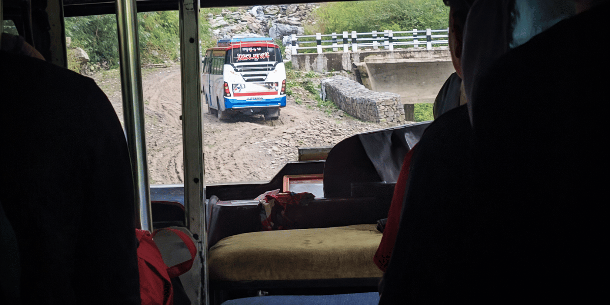
So, if you are traveling by bus, Soti Khola may be your last stop during the monsoon and early autumn seasons. From here, local jeeps take over, and you can hop onto a shared one to reach Maccha Khola or even further up to Tatopani.
The jeep ride, in particular, can be frightening for many, as you will be traveling along slippery and narrow roads. While the drivers are professional, there is always a risk factor that keeps you concerned throughout the ride.
Although during the dry seasons, jeeps can reach up to Pangsing or Philim, the road conditions remain narrow and off-road. The bumpy ride may sound like an adventure to many, but when you actually experience it, your heart will be in your mouth for sure!
Crossing Waterfalls and Rivers: Maccha Khola to Jagat
I am recalling my very own Manaslu Circuit Trek as I'm writing this: the route from Tatopani to Jagat was where our team came across multiple waterfalls (during the early autumn season).
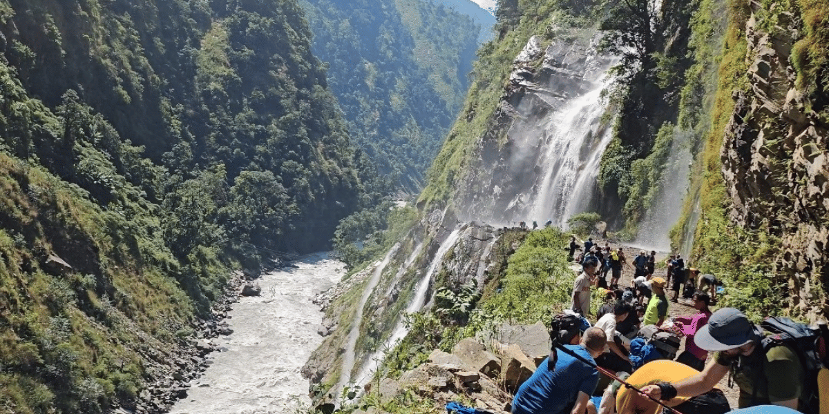
I am talking about large waterfalls that do not just appear in your sight but actually require you to pass through them. You need proper rain gear in these sections because the force of the waterfall is so strong that it might literally take your breath away.
It is fun, but you might get wet early in the trek. If it is sunny, you are lucky and will dry quickly. However, if the weather is gloomy, there is a risk of falling sick in the middle of your journey.
You may also have to cross rivers and streams along the way. One section I particularly remember is from Deng to Bihi Phedi, which is also landslide-prone. It’s not a major challenge, but slipping here would definitely mean getting wet.
There is also no bridge at Birendra Lake. So, you have two options: either cross the lake and join the route to Samdo or return halfway and take a longer approach. My team, along with most other groups, chose to cross the lake, as it added a sense of adventure. However, when the water flow is strong, you need to be cautious in this section.
Landslide Sections in Multiple Routes
Another major risk when trekking the Manaslu Circuit during the monsoon and early autumn seasons is that you encounter landslides, even active ones. Especially after moderate to heavy rainfall, several sections of the Manaslu Circuit trail become highly prone to landslides.
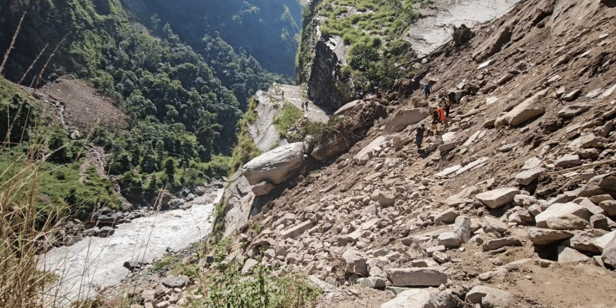
During my own adventure in October, I had to cross multiple landslide-prone zones. Some had damaged the trail, while others were actively being cleared.
Here’s the list:
- Soti Khola to Macchakhola (encountered multiple ones when traveling on a jeep)
- Tatopani to Dobhan (multiple sections)
- Keraunja to Yaruphat (rockfalls)
- Philim to Ekle Bhatti (rockfalls)
- Nyak to Pewa (multiple sections)
- Pewa to Deng (very frequent; I encountered one live)
- Deng to Bihi (river crossing + rockfalls)
- Bur to Gap (frequent erosions with a small stream passing along steep slopes)
- On the way to Samdo (a few sections)
- Samagaun to Manaslu Base Camp (prone to landslides)
- Larke Pass to High Camp (glacier section, prone to avalanches and dry landslides)
- Side hike to Milarepa Cave (landslides + avalanches)
- Chauli Kharka to Surki Khola (in the riverbanks of Dudh Khola)
The Major Uphills and Downhills
The Manaslu Circuit Trek is more about long hikes, usually covering 13 to 15 km per day (even 18 to 20 km in lower regions!). There are no major steep uphills or downhills, but rather a more gradual pattern of ascending and descending.
What makes the trek difficult is the lack of stamina, mental endurance, and the long hiking days. Still, there are a few sections along the trail that can be a little tough for those who do not enjoy uphill and downhill walks. Let me list them below:
- Narrow, landslide-prone, rocky, and a few steep sections from Bupchet to Yaruphat (on the way to Jagat)
- Final stretch from Pewa to Deng
- Forested route from Gapshya to Namrung (more steep section if you choose the Prok route)
- Acclimatization hikes to Pungen Gumba, Manaslu Base Camp, and Birendra Lake
- Final stretch to Samdo (stairways to the entry gate)
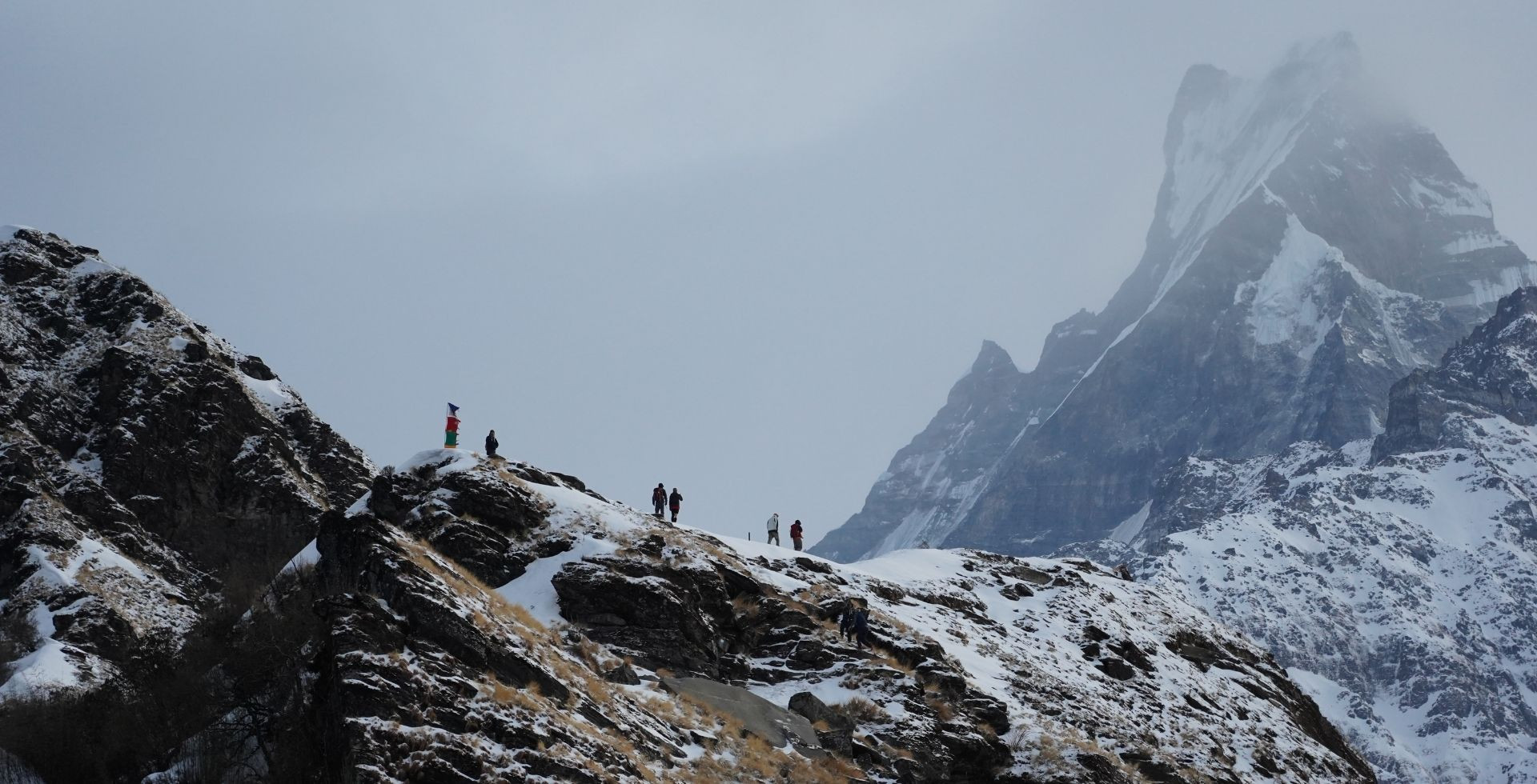
- 7 km long Larke Pass (from Dharmashala to Larkya La) with no teahouse in between
- Steep 4 km downhill from Larkya La to High Camp
- Further 4.5 km downhill from High Camp to Bhimthang
Manaslu Circuit Trek Preparation: How to Overcome Difficulties
By now, you're probably aware of why the Manaslu Circuit is rated difficult and also which sections demand the most from trekkers.
Now, let's come to the real question, which is: should beginners skip it altogether and choose an easier destination? Well, not necessarily!
With a reliable trekking agency by your side (like Altitude Himalaya ourselves), the professional guides handle most of the difficult parts of the Manaslu journey for you.
I'm referring to handling permits and logistics, keeping you motivated on the hardest days, and making sure your overall experience in the Manaslu region remains safe, enriching, and genuinely unforgettable!
Yes, the difficulties are real. But difficulties are manageable when you're prepared for them.

After consulting our professional guides, gathering experiences from our previous guests, and drawing from our own team's treks across different seasons, here are the preparation tips that actually make a difference on the Manaslu Circuit:
- First and foremost, choose an altitude-friendly itinerary that doesn't rush the acclimatization process.
- Set your daily hike at 12 to 13 km, even on days when you feel strong enough to push further. Save that energy for the days when the trail genuinely demands more than 15 km from you.
- Get mentally prepared before you even arrive. Personally, I use reverse psychology on tough days: I remind myself that this trek is strenuous and that I made a commitment to complete it. It sounds simple, but it works!
- If you're not hiring a porter, do not overpack. Go through our complete trekking gear checklist and carry only what you truly need.
- That said, I'd strongly recommend hiring a porter. You'll carry just a daypack, move more comfortably, and directly support the livelihoods of the local communities along the trail.
- Inform your guide immediately if you feel any AMS symptoms. Don't wait and see. Don't tough it out. Just tell them, and they'll take it from there.
- Don't forget to drink plenty of warm water (at least 4 litres per day), electrolytes (ORS), and soups throughout the day. Garlic soup, in particular, is widely recommended along the Manaslu trail and is worth trying at every teahouse that serves it!
- Carry light personal snacks like protein bars and chocolates for the longer stretches between stops.
- Once you're above Namrung (2,630 m) and into higher terrain, follow the "climb high, sleep low" principle by going on acclimatization hikes during rest days. These hikes also give you a chance to explore the region more closely!
- Also, I suggest doing some light stretching and warm-up exercises every morning before you start the hike. Your knees and ankles will genuinely thank you by the time you're descending from Larke Pass.
- Keep buffer days built into your itinerary and arrange your permits and visa accordingly. When extreme weather hits or an unexpected situation arises, that flexibility becomes invaluable.
- Travel insurance is not mandatory, but it's something we recommend to every single guest. If a helicopter rescue is required, you'll want that coverage without any doubt.
- Don't leave crampons, gaiters, and trekking poles behind. These three items are non-negotiable in your packing list for the final stretch to Larke Pass and the descent to High Camp.
- Walk at your own pace and resist the urge to keep up with faster trekkers in your group. Knowing your pace and respecting it is one of the smartest things you can do on this trek.
- For the optional hikes to Manaslu Base Camp, Pungen Gumba, and Birendra Lake, always start in the morning. Afternoon winds in the upper Manaslu region build quickly and can make both the hike and the visibility significantly harder.
- Lean on the local community whenever you need guidance, and look out for fellow trekkers on the trail too. That spirit of mutual support is something the Manaslu region has always been known for!
- Keep an eye on weather updates and don't hike in extreme conditions. No view from any pass is worth the risk of being caught in a serious storm above 4,000 m.
Final Thoughts
Surely, the Manaslu Circuit Trek is a high-altitude challenge that requires good fitness and strong mental endurance. The exhausting, long hikes and remoteness with rugged adventures are some of the difficulties you will need to tackle.
If you are going on this journey, be aware that you will face altitude risks, cold weather, and landslide/avalanche-prone zones. However, since the trek is not technical (it doesn’t require ropes or climbing skills), it is definitely doable even by beginners who have prepared well.
The good news is that we offer customized packages (even group joining Manaslu trek), and on top of that, our Altitude Himalaya experts join you on the journey to simplify your Manaslu Circuit Trek. All you have to do is contact us directly, and we will make everything ready for you.
For more Manaslu-related information, be sure to read our related blogs. Happy trekking!


 Bhishu Acharya