

 Anjala Bhatta
Nepal has preserved some of its areas as restricted zone where one can't enter randomly. A foreigner requires a special permit issued from the department of immigration to enter such a place. Apparently, that's why the term ‘restricted area’ and the permit as restricted area permits (RAPs). Being called the restricted, it's obvious having your enthusiastic mind overflown with the queries like what are these restricted areas, why are they even restricted, what are the attributes of these areas, how to access these areas, what are the permits and the documentation required for the entry, and so on. But, no worries, through this article we will precisely guide you providing all the information regarding the restricted areas in Nepal. Stay tuned to resolve all your confusion!
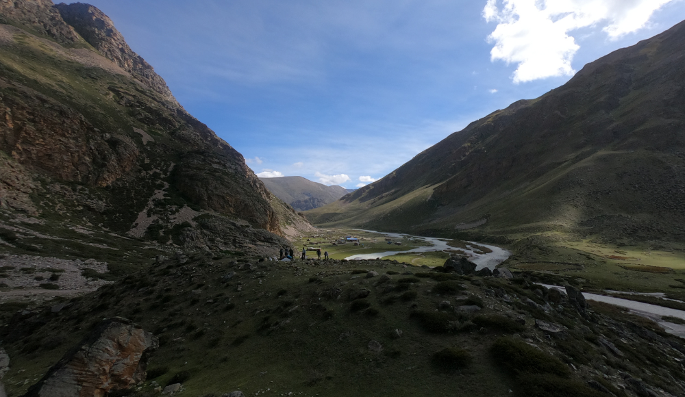
Nepal being a country with rich nature and culture, is at the brink of exploitation because of the ingrowing modernization. So, to avert it, the Nepal government has enlisted some regions of the country in the restricted list. Among these, some bear the cultural significance while others go for its complex yet exalted geography. The restricted areas in Nepal are Upper Mustang, Upper Dolpo, Lower Dolpo, Manaslu Nubri valley - Gorkha, Humla, Taplejung, Tsum valley - Gorkha, Doakha, Mugu, Bajhang, Darchula, Dolakha, Sakhuwasabha, Soulkhumbu, and Rasuwa.
Restricted Areas in Nepal
Restricted areas are designed to protect the culture, tradition, lifestyles, geographic features, and originality of a certain region. These areas are unspoiled by the cruel outside world till now and this is what makes it special! And this is the sole reason why these regions need a shield and here is when the Nepal government comes into action as it preserves them under the list of restrictions.
Restricted areas need dual protection as not only the physical features are its key as the ethnic community residing in those areas also plays a vital role in its existence. So, there are certain rules and regulations formed by the ethnic community residing in that particular region in an attempt to conserve.
In Addition to cultural perseverance, some of them were confined as demilitarised areas, hence they result being restricted. One of which is the Upper Mustang. Also, other restricted areas hold some history and are buried in its shadow as the restricted zone.
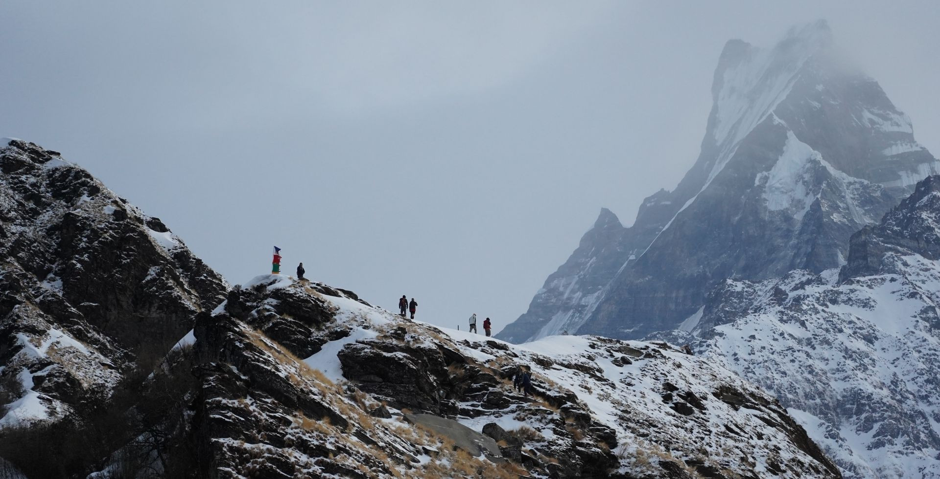
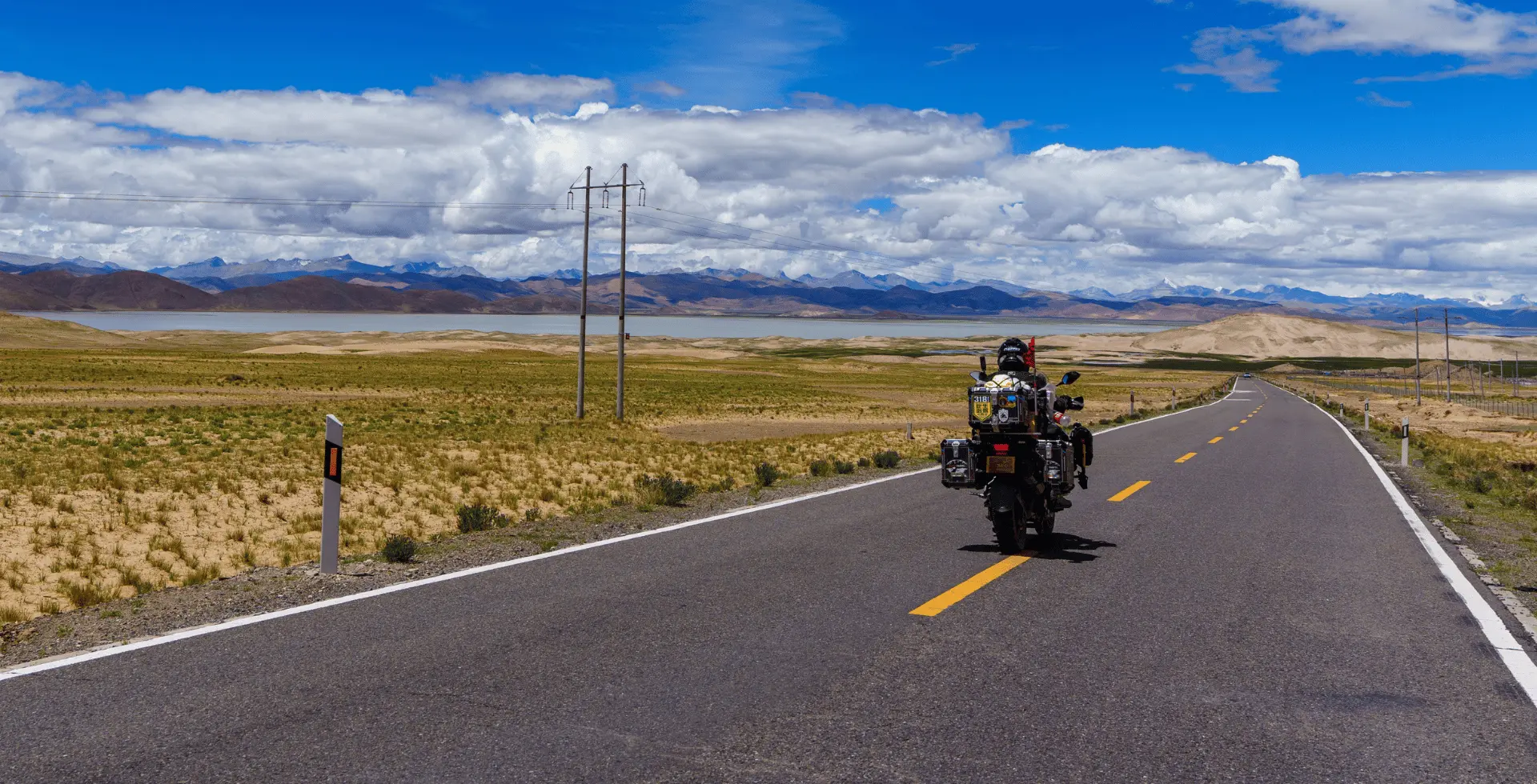
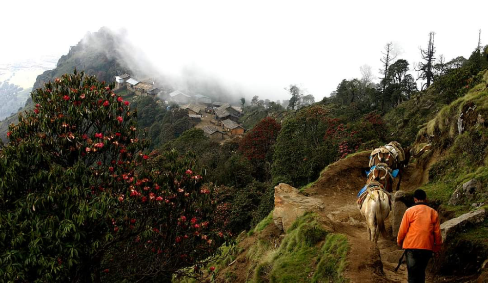
In the late 90’s these areas were highly protected and entry to these regions was strongly prohibited. But nowadays focusing on tourism and its influence on the country's ingrowing economy, trekking to these regions is made possible through a permit. Not only can the permits get you there, you need to have at least two people in your group and a licensed local guide to assist you.
The required permits for these regions are the well-known “restricted area permits” and are only issued by the Department of immigration, Nepal. There is certain paperwork and formalities to get these permits, and you can achieve it only through some legitimate trekking agency of Nepal. So if you want to pay a visit to these regions, get yourself in contact with a trustworthy trekking agency first.
To get a RAP’s, you need to have below mentioned documents submitted to your trekking agency. They are:
- Passport with a minimum of six months of valid date.
- Two recently clicked passport size photographs.
The entry fee (permit charge) to these areas vary by region. It starts with 20$ as minimum and elevates up to 100$ as maximum per day.
Being 15 in number, these restricted areas spread throughout the country. One at the east while the other at the west. Likewise north and south. So, if you want to visit any particular restricted area you need to get the pass and permits of that certain region, not of the entire restricted areas of Nepal.
Facts about Restricted Areas in Nepal
|
Name |
Restricted areas of Nepal |
|
Total Restricted Areas in Nepal |
15 |
|
Location |
Distributed throughout the country. |
|
Trekking to these regions |
Allowed through a permit. |
|
Permit required |
Restricted area permit(RAPs) |
|
Minimum no of trekkers |
2 |
|
Additional assistance |
Compulsory Required (Licensed Trekking Guide) |
|
Permit charge |
Min. USD 20 (per day) and above. (Varies by the restricted area) |
|
Idle time to visit |
Varies by the region, Usually Autumn and Spring (March to May and October to November) |
|
Major attractions |
|
List of the Restricted Areas of Nepal
Restricted areas enlisted by the Nepal Government are tabulated below:
|
S/N |
Restricted Area |
|
|
Upper Mustang |
|
|
Upper Dolpo |
|
|
Manaslu Nubri Valley - Gorkha |
|
|
Humla |
|
|
Taplejung |
|
|
Lower Dolpo |
|
|
Dolakha |
|
|
Tsum Valley - Gorkha |
|
|
Sankhuwasabha |
|
|
Solukhumbu |
|
|
Rasuwa |
|
|
Manang |
|
|
Bajhang |
|
|
Mugu |
|
|
Darchula |
As suggested by the name, restricted areas are the forbidden areas, and later on, modified for some visits. Since there are 15 areas as restricted areas in Nepal, here we are going into detail about each restricted area. Go through the below article to know more about it.
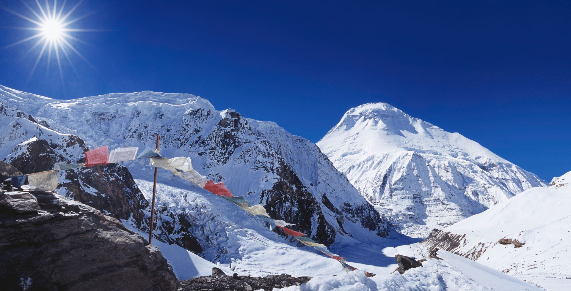
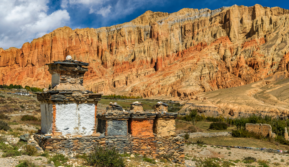
Upper Mustang
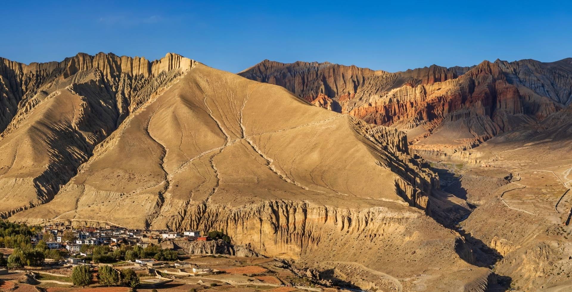
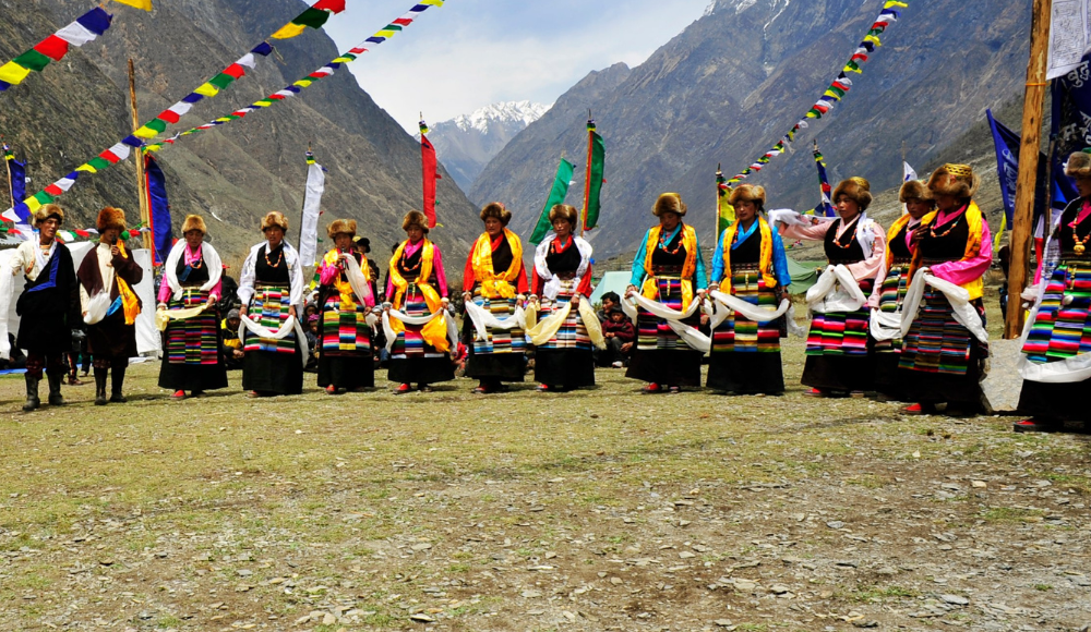
Called ‘’The Forbidden land”, Upper Mustang adds a whole different dimension to Nepal's Tourism. It is believed to be the world's third most beautiful place. It is a Trans-Himalayas area which seems like a desert but is not a desert. The only difference with the desert is, it has water resources and some greenery. It was prohibited in the late 90s as it was an independent kingdom ruled by the royal bloodline bordered by the massive wall.
Later on, after 1992 it was opened to foreigners for the visit through the provision of a RAP. Kagbeni being the gateway to the Upper Mustang, you would encounter spectacular landscapes on your way up there. One fascinating fact in the trail to Upper Mustang is whenever you spot some greenery, there will be a water resource nearby and a small settled village within that perimeter. With the amazing landscapes and the geographical features present there one can have a feeling of being on the moon.
Commonly called Lo Manthang, this region is settled within the huge wall. This wall was constructed by the late King Amadpal Bista surrounding all 9 wards present during that time to protect his people. Now all these wards are merged into one single village after democracy was declared in Nepal in the year 2007. The name Lo Manthang is placed after the name of the people as the people living there were called Loba.
Upper Mustang is divided into three rural municipalities which are Lo Manthang, Dalome, and Baragung Muktichetra. Among which some wards of these municipalities are restricted.
Upper Mustang Facts
|
Region |
Upper Mustang |
|
Allowed to visit from |
1992 |
|
Parts that are restricted |
|
|
Permit cost |
USD 500 per person (for the first 10 days) USd 50 per person /Day ( beyond 10 days) |
|
Activities that require RAP |
Upper Mustang trek, drive to the upper Mustang. |
|
Major residents |
Gurung and Thakali |
|
Best time to visit Mustang |
All year around (During September to October and March to May the weather is clear making the visit worthy) |
Upper Mustang Attractions
- Royal palace
- Caves
- Monasteries
- Landscapes
- Culture and Tradition of Lobas.
- Narrow alleys.
The residue structures of royal castles are the prime attraction of Lo Manthang. It demonstrates the primitive lifestyles of the Royal bloodline. Even after the end of Monarchy, access to this palace and the surrounding was confined only to the royal family and their connectives for some time. But, for now, this whole area is normalised as multiple built houses can be seen within the palace perimeter.
Lo Manthang is originally the western region of Tibet but after the geographical division it has been categorised as Nepal's territory. So, you could get to observe the “little Tibet” here in Lo Manthang. This region is well known for its clustered traditional Buddhist villages. The houses over here are constructed with the local materials like mud, timbers and rocks with a traditional design which resembles medieval architecture.
The small alleys between the houses add another dimension to the bewitching Upper Mustang. The hustle bustle of the residents during the evening time in that chilly cold weather makes the environment “the perfect one” to get moulded into the history and heritage. The small cultural village in the lap of the mountain, providing exquisite sunset and sunrise views along with the enriched ancient arts, crafts and monuments, it is indeed a splendid glory least explored and unspoilt.
Except for the royal palace and villages, there are other attractions over here which are the ancient monasteries, gumbas, caves, Mani stones and the culture of the inhabitants. Likewise the gorge of Ghyakar is another one. It looks fabulous as you may feel like you are on another planet after encountering such a geography. Similarly Ghyakar village is another one you must not miss. The peculiar habitation and lifestyles around here will grant you a relief and refreshness from your usual busy life.
If you want to observe the enthralling vista and get immersed in the scenic beauty, the ideal time for the Mustang visit is the blissful season of Autumn and Spring.
Where is Upper Mustang?
Adored by the phenomenal beauty, Upper Mustang lies in the western region of Nepal at Gandaki province, Mustang district. It is the upper part of the Mustang. It settles behind the massif of Annapurna and Dhaulagiri mountain range. Hence results as an arid rain shadow region without the influence of Bay of Bengal.
How to reach Upper Mustang?
There is no direct link to Upper mustang from Kathmandu. One of the easiest is through flight.
You can go by the flight to Pokhara from TIA (Tribhuvan International Airport) Kathmandu, and from there take the next flight to Jomsom, Mustang. You have to prebook the four wheel jeep to go up above from the Jomsom. Going up above, you will reach a junction at Kagbeni from where two roads depart, one leading to Muktinath and the other to Upper Mustang. Since Upper Mustang is your destination, you will follow the trail leading to the Upper Mustang onwards.
Alternative to this if you want to go through a drive, you can drive to Pokhara from Kathmandu and rest there for the day. Next day, in the early morning, you will hope for the adventurous journey of Mustang which will take you up to Kagbeni. There you will rest for the night which will also help you for the acclimatisation. And the next day you will head for the glorious Upper Mustang. So, it's totally on your preference on which to choose. If you want to experience some thrill, go with the drive otherwise afford the luxury through flight.
Why is Upper Mustang restricted?
The restriction is made to preserve the culture and tradition of the local ‘Lobas’ as it is the inheritance of Tibetan Buddhism. Also the unique lifestyles of the inhabitants is a part of the concern here, so to safeguard it all, some parts of this region are marked as restricted.
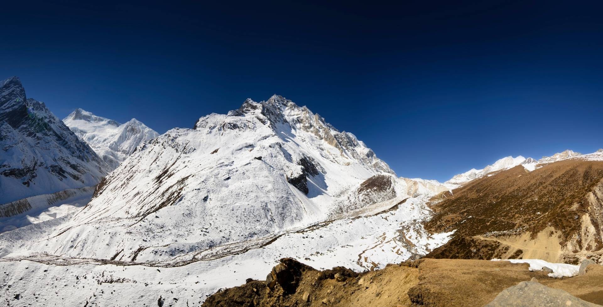
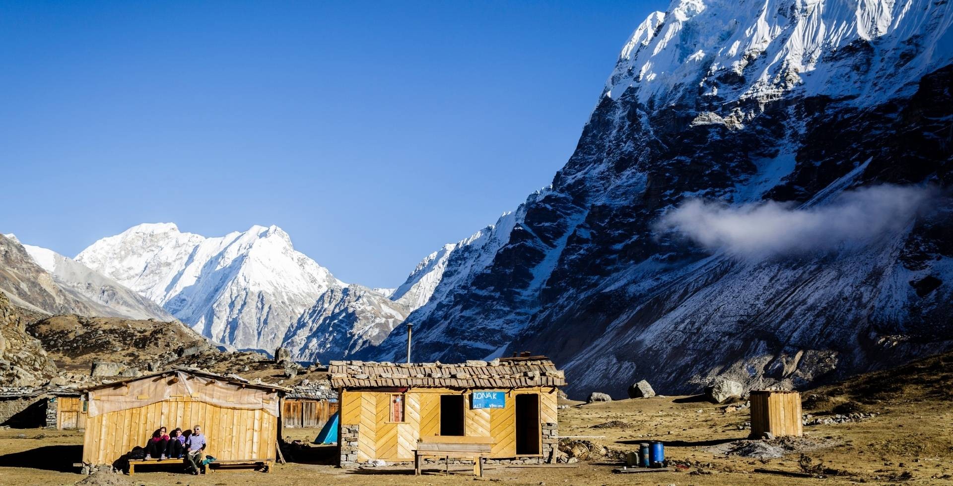
Upper Dolpo
Dolpa is the biggest district of Nepal yet the most remote one. It lies in the Mid western region of Nepal and is categorised into two units: Upper Dolpo and lower Dolpo. Ringma village is a small village separating the boundary of Upper Dolpo and lower Dolpo.
Rich by the geographical beauty and the unique lifestyles of the Dolpo people, Upper Dolpo is the hidden asset of glamorous Nepal. It is an isolated trekking region decorated by nature. Visit to Upper Dolpo was given permission after the end of 1980s.
The trails to Upper Dolpo is the off beaten trail but unlike other trekking regions, few visitors pay attention to this region because of the complex topography. The trek is considered strenuous as there is a high chance of getting lost. Also the difficulties individuals face in the entire upper Dolpo trek because of lack of accommodation, telephone network, medical services, and vehicles are the other reasons for getting few visitors.
Unlike others, it is mandatory to have at least two people in your group and a licensed local guide with a RAP while hoping for the Upper Dolpo. Roaming anywhere is strongly prohibited in these regions. Respecting locals and their traditions, customs and practices is another major thing you need to consider before marching for the upper Dolpo.
Upper Dolpo Facts
|
Region |
Upper Dolpo |
|
Allowed to visit from |
1990 |
|
Parts that are restricted |
|
|
Permit cost |
USD500 per person (for the first 10 days) USD 50 per person /Day ( beyond 10 days) |
|
Activities that require RAP |
Upper Dolpo trek, Kang la pass trek |
|
Major residents |
Chettri |
|
Best time to visit |
April to May and October to November |
Upper Dolpo Attractions
- Shey Phoksundo lake
- Shey Gompa
- Crystal Mountain
- Dho Tarap
- High Trekking Passes
- Floras and faunas
Upper Dolpo is considered as the paradise veiled to the outside world. Not only the rich culture is its only attraction, there are several such as the ethereal looking meadows with the beautiful flowers, distinct faunas camouflage in nature, terrains on the highest altitude, the large soaring waterfalls, ancient Gompas and so on.
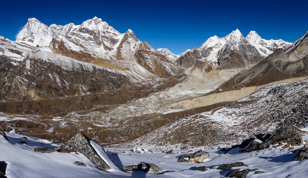
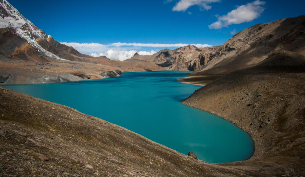
Shey Phoksundo lake is the prime attraction of this region. The name Phoksundo is the Tibetan name which means the lake spreaded in the three corners from the centre. The lake changes its colour according to the time zone, sometimes it's emerald green, sometimes shimmering silver and sometimes deep blue. This is the deepest lake in Nepal and also the Deepest lake lying in this altitude throughout the world.
Likewise Shey Gumba is another charisma of Upper Dolpo. It bears the history and is considered as the biggest Gumba overall as the name Shey itself suggests “The biggest among all”. Every 12 years a grand festival takes place in this Gumba known as Shey Festival and Buddhists from all over the world participate in this festival.
Similarly, Dho Tarap is the one main village of the Upper Dolpo renowned for the Human Settlement at the highest altitude. Here, there is the influence of Northern Tibet, hence the locals adapt the Tibetan culture, tradition, and customs too. You can see them wearing old jewelleries, and costumes during your visit.
Animals like Yaks, Mules, and Horses can be seen marching for transporting the goods as there are no any motorable roads. The houses here are built in ancient architecture as the living space is underground and only a little part of the house is visible at the ground. This is to prevent the extreme coldness they have to face during winter seasons. This extracts Upper Dolpo as the remote zone filled with the vividness.
Where is Upper Dolpo?
Upper Dolpo is in the mid western region of Nepal of Karnali province, Dolpa district. It is bordered by Tibet, China in the northern region and centred in between Dhaulagiri mountain range and the plateau of Tibet.
It is surrounded by Jumla and Mugu on the west, Jajarkot on the south and the Mustang on the east. The mountain range of Dhaulagiri and the Churey are the protectory features guarding the territory of the Upper Dolpo and the Dolpo allover.
Upper Dolpo is the remote zone having access to the Tibetan border, contained within the Shey Phoksundo national park. Mt. Kanjirowa and Dhaulagiri are two main peaks of this region.
How to reach Upper Dolpo?
Through Juphal: Juphal lies in the lower region of Dolpa. You can take a flight to Nepalgunj and then take a flight to Juphal and then trek onwards to upper Dolpo. The trek may take about 10 to 11 days to get to Upper Dolpo.
Also remember that, to get to Upper Dolpo, You have to get through the lower Dolpo. And gradually getting the elevation up to the Upper Dolpo.
Alternative to the flight of Nepalgunj, you can take a drive to Nepalgunj and from there fly to Juphal. The drive to Dolpa is not advised as the geography involves the rocky terrains and the threat of landslides hovers all the way to the headquarter Dunai.
You could choose whatever you like regarding Nepalgunj, can go with the flight or opt to drive.
Beside this all, You can reach Upper Dolpo from Mustang too. For this, you have to get to the Jomsom first, via Pokhara and then trek up to the Kagbeni. From Kagbeni the trekking starts which will eventually take you to the Juphal of Dolpo. This trek is not for the complete beginner so, only the keen adventure seeker with beforehand experience can dive for this amazing trek.
Why is Upper Dolpo restricted?
Just like the others, the main agenda is to protect the tradition, culture, and the wonderful nature of this region. Upper Dolpo has the specific Tibetan religion known as the Bon religion. So preserving it is also a major matter of concern. Also the increasing human traffic, breaching the peace of this region pulls the importance of it being confined under the act of restriction.
Manaslu Nubri Valley - Gorkha
Gorkha district lies in the western region of Nepal with lots of history buried underneath. It is the land of the great Prithivi Narayan Shah (individual responsible for the unification of Nepal) with abundance in natural, cultural, spiritual, and religious aspects. Also, Gorkha emerged as the home of legendary Gurkhas (brave warriors and fighters). Among all its distinctive features and history, Mount Manaslu is the key to this region. Hence, widely popular as the realm of Mt. Manaslu.
Mt Manaslu is the Eight highest peak in the world with an elevation of 8163 metres. The name Manaslu is derived from the Sanskrit word “Manasa” which means intellect or soul. It is considered as the mountain of the spirit hence the name Manaslu and also goes by the Tibetan name “Kutang”.
Manaslu Nubri Valley Facts
|
Region |
Gorkha Manaslu area |
|
Allowed to visit |
After 1991 |
|
Parts that are restricted |
|
|
Permit Cost |
September – November USD 100 per person / week USD 15 per person / day (beyond 1 week)
December – August USD 75 per person / week USD 10 per person / day (beyond 1 week) |
|
Activities that require RAPs |
Manaslu Circuit Trek |
|
Major residents |
Gurung, and Bhotias |
|
Best time to visit |
March to May and October to November |
Manaslu Nubri Valley Attractions
- Mt. Manaslu
- Larkya La Pass
- Rhododendron and blue pine forests.
- Chortens and Monasteries
Mt. Mansalu being the centre of attraction, needs to be preserved. So, the conservation of Manaslu mountain range is handed over to the national park and wildlife conservation department, Nepal. Since 1998, it has been involved in the Manaslu Conservation area project (MCAP) and is preserved under it. It encompasses a total area of 1,663 kilometres. Spreading over the large peripherals, It is the habitat of 110 species of birds, 33 species of mammals, 11 species of butterflies and 3 species of reptiles.
Thousands of people have tried to conquer this mountain before but were unsuccessful because of its tough geography. But, in the year 1956, some of the Japanese with their constant attempts got their victory to this and proved that it can be clambered. These days, many people claim to be getting to the summit. But, it has been found that they have been to a false zone which seems exactly like a summit but not actually the summit. This makes it much more fascinating.
Not just to Mount Manaslu, trekkers prefer trekking to the entire Manaslu Annapurna circuit during their visit to this region. This trail has become quite popular in last five years as every year hundreds of trekkers march for this circuit trek.
Beside this, There are also other supporting features to this region which are the mountain ranges like Ngadi Chuli (7,871m), and Himalchuli (7,893m). Also, Larakya La pass is another highlight. It is quite popular among the trekkers. Along with this, it has multiple other trekking trails such as Tsum valley trek, Barpak village trek and so on and for this purpose you need to have RAPs.
Where is Manaslu Nubri Valley?
Gorkha Manaslu region is located in the western region of Nepal, Gandaki province. It is separated by Budhi Gandaki river in the east and Marsyangdi on the west. Manaslu is the highest peak of Gorkha district lying in the northern part of Gorkha falling under the Mansiri Himalaya range. With an elevation of 8163m, Manaslu sits about 64 km far from the mount Annapurna to the east.
How to reach Manaslu Nubri Valley?
Through Kurintar: You can take a bus to Kurintar from Kathmandu. From there you can choose the trails according to your trek as Gorkha Manaslu region has multiple trekking trails. Mostly, the trekking starts from Arughaat. From Arughat you can follow the trail up to the Soti Khola, and go with the lead toward the Larkya La pass. From there you could get to the Manaslu range.
Why is Manaslu Nubri valley restricted?
Just like others, preserving the Manaslu mountain range is the main motto. Along with this, comes the protection of the flora, fauna, culture and tradition scattered in this region.
Humla
Just like a coin has two faces, Nepal has two sides too: one the developed modernised zone and the other remote isolated one. In the remote category, falls the most underdeveloped district of Nepal, Humla. It is the second biggest district of Nepal by area but by the developmental works, it lies far behind, even from the basic facilities.
Also, The Humla region has two sides: One the gifted nature and the other, people’s struggle to survive. It is rich in natural scenery as there are several mesmerising landscapes, mountains, woodlands, rivers, lakes, monasteries, and temples. But, Because of lack of advertisement and the government’s lack of attention towards this region, inhabitants over here are living their life beyond poverty.
Humla Facts
|
Region |
Humla |
|
Allowed to visit |
Since 1993 |
|
Parts that are restricted |
|
|
Permit cost |
USD 50 per person / week USD 10 per person / day (beyond 1 week) |
|
Activities that require RAPs |
|
|
Major residents |
Khas/chettri |
|
Best time to visit |
May to November |
Humla Attractions
- Limi valley
- Nara La Pass
- Mt. Chang La
- Pilgrimage to Mt. Kailash and Mansarovar lake.
The residents over here can be considered as the major pull of attraction. The northern region is covered by the Tibetan inhabitants known as Lamas while the southern region has been bordered by the Khas(chettris and brahmins). The Khas community uses the Humli Khas language and it is believed that the Nepali language is inherited from this. Similarly, the lamas use the Lama Kham(the Tibetan language). This pinpoints their unique identity.
Besides the residents, The Limi valley is the untouched paradise lying in the northeast region of Humla. It is filled with the amazing meadows, beautiful floras, endangered fauna, diverse culture, and unique inhabitants with their respective buddhist and Hindu religion. From this valley you will spot the intriguing peaks Kanjirowa, Kailash, and Saipal. It grants the valley the title “difficult yet worthy”.
Not only this, it is also the trail to the infamous pilgrimage tour of the religious Kailash and lake Manasarovar. Visitors with spiritual and religious beliefs pay attention to this region as it is the gateway to this holy place. There is this possibility of development seen through this prospect for the Humla region. And also, The economic status of the people can elevate if proper care is taken in this aspect.
Where is Humla located?
Humla is the poorest isolated district of Nepal lying in the mid western region of province no 6, named as Karnali province. It is bordered by Mugu and Tibet of China in the east, Bajhang in the west, Mugu and Bajura in the south, and some Tibetan regions in the north. There are a total 28vdc’s in Humla. Simikot is the district headquarter, which is the only access through which it can get connected to other districts.
How to reach Humla?
Being a remote isolated zone, there are no motorable roads linking Humla to other districts. However you can take a flight to Nepalgunj or Surkhet from Kathmandu and then again the next flight to the district headquarter Simikot. This is the only possible way to get to Humla.
Till date there is no motorable road connecting Humla to the other district, so it is considered the second district without direct access.
Why is Humla restricted?
Just like the others, with the intention of preserving lifestyles, culture, arts, creation and tradition of Humli people, some parts of Humla are categorised as restricted.
Taplejung
Taplejung is the third largest district of Nepal situated in the zone of Mechi. It is widely popular as the land of Goddess Pathivara shielded by the Kanchenjunga mountain range.
The word Taplejung is the combination of two words, “Taple” and “Jung”, Taple was the king ruling this kingdom and Jung is the fort built by the king Taple. Hence named, Taplejung, the “fort of King Taple”. During the period of Unification, this district was merged into Dhankuta, but later in 1962 it regained its own identity as the district Taplejung.
It is accessible to other districts through Mechi Highway and bears the spectacular nature-given scenery such as landscapes, rivers, lakes, waterfalls, meadows, rivers, and mountains. The prime attraction of this region is Pathibhara temple and the mount Kanchenjunga. Not only these two are the only ones, it has the mesmerising alpine forests, enthralling meadows, sacred gumbas, colourful Rhododendrons and many more.
Taplejung Facts
|
Region |
Taplejung |
|
Parts that are restricted |
|
|
Permit cost |
USD 20 per person / week (for the first 4 weeks) USD 25 per person /week ( beyond 4 weeks) |
|
Activities that required RAPs |
Visiting some villages of Phantanglung, Mikwakhola, and Sirijunga municipality |
|
Major residents |
Limbus |
|
Best time to visit |
March to June and September to November |
Taplejung Attractions
- Monasteries of Olangchung Gola (Olangchung- Gola Yangma)
- Kanchenjunga circuit
- Ghunsa and Lelep villages
The main attraction among all its attractions is the Kanchenjunga circuit. With the elevation of 8586m, Kanchenjunga stands insolently at the top of Taplejung, highlighting it. One fascinating thing about Mt Kanchenjunga is, its summit is considered holy hence no human foot has been laid there till now.
It has been preserved under the Kanchanjunga conservation area since 1998. This comprises the area of 2035 sq kilometres colored by the 23 species of rhododendrons and 250 species of birds. It is the region with the floral diversity safeguarding the existence of National Bird Danphe and the endangered Snow leopard.
Also, more than 10 magnificent peaks ranging over 7000m are found here and nearly 60 rivers descend from there. One of the main amidst this is the Mechi and Tamor river. Also, there are a lot of waterfalls, glaciers and ponds over here which look just fabulous. The geography involving the alpine forests, meadows and plateau provides the best shelter to the faunas like Asian black beer, Red panda, blue Sheep, Snow cock, Blood Pheasant, and Red-billed Chough.
The Monasteries of Olangchung Gola named as Olangchung-Gola Yangma is another attraction of this region. Also the village of Ghunsa and Lelep is filled with the natural scenery bearing the outstanding panorama. The locals, their customs, folk songs and dances, festivals they celebrate decorate this region very well.
Where is Taplejung located?
It is a district of province 1, settled in the zone of Mechi, bordered by Sikkim, India in the east and Tibet in the north. It is distributed in the eastern region of Nepal occupying an area of 3646 sq km.
How to reach Taplejung?
Directly getting to Taplejung from Kathmandu is not possible for now but may happen in the upcoming days. For now, you could go there through two ways.
Through air
If you go by air, you have two options available: Either you could take a flight to Suketar or to Bhadrapur. If you go with Suketar, you could take a flight up to here and from there you could join an hour drive to Taplejung. And if you choose Bhadrapur, you could take a flight to Bhadrapur and from there a 7 to 8 hour drive to Taplejung.
Through drive
Optional to the flight, there is drive. If you prefer long drives you could go for this. You can get a bus from Kathmandu Bus park to Birtamod, rest overnight there, and from there you can take a local bus or jeep that will take you to Taplejung (in hours, it will take around 7 to 8). If you follow this trail, you will get a golden chance to visit Eastern Nepal which includes amazing places like Ilam, Phidim and so on.
Why is Taplejung restricted?
Preserving the ethnic community along with their originality and the peaceful nature is the one sole reason for listing some parts of these regions as restricted areas.
Lower Dolpo
Lying in the Karnali province in the mid western region of Nepal, Dolpa is the biggest district of Nepal. Covering an area of 7889 sq km, it is widely spread throughout the semi-arid areas of Nepal. Dunai, being the district headquarters, connects it with other districts. Though being the largest it is considered as the most remote and isolated region resting in the high mountain range.
Divided into two halves: Upper Dolpo and lower Dolpo, it is rich in cultural aspects and natural beauty. Lower Dolpo, lying in lower elevation has its own prime features and glory. The main one is the lower Dolpo trek circuit which is the off beaten trail to follow.
The atmosphere around here is dry as it settles in the rain shadow region influenced by mount Dhauliguri. The trail to the circuit is semi-deserted followed by the meadows, woodlands, mountain passes and greenlands. Rocky terrains are most common in this trail.
Lower Dolpo facts
|
Region |
Lower Dolpo |
|
Allowed to visit |
1990 |
|
Parts that are restricted |
|
|
Permit cost |
USD 20 per person / week USD 5 per person /day ( beyond 1 week) |
|
Major residents |
Chettri and Magar |
|
Best time to visit |
September to November, March to May, June to August |
Lower Dolpo Attractions
- Shey Phoksundo national park
- Bon culture and beliefs
- Numa La Pass (5309 m) and Buga La Pass (5169 m)
- Spectacular views of Mt Dhaulagiri
- Ancient Gompas
Lower Dolpo is the region with uncountable beauty and quirky attributes. Trekking to the lower Dolpo region is the main activity preferred by the visitors. Besides this, it has many other appealing features such as Shey Phoksundo national park. Shey Phoksundo national park is named after the lake Phoksundo. It covers an area of 3555 sq km with sharing a buffer zone of 1349 sq km. The park headquarters is at Suligad which is also the entrance to the park. Also keep it a note that some part of this national park is restricted.
This national park is conserving the diverse flora and fauna along with the amazing landscapes. It is the home to six species of reptiles, 29 species of butterfly, and 200 species of birds. Also this is renowned for preserving 286 species of botanical herbs bearing medicinal importance. One of the main attractions is the YarsaGumba. The endangered himalayan blue deer, snow leopard, grey wolf, yellow-throated marten, crimson-eared rosefinch are well preserved in this park.
Besides all the flora and fauna, this national park is mainly visited for the splendid turquoise lake, Shey Phoksundo. It is believed that the lake changes its colour corresponding to the time zone. It lies in the upper region of Shuligad and looks ethereal. The whole environment around this lake is just fabulous as you can witness the mesmerising lakes surrounded by the mountain peaks with lots of glaciers gliding down. There is a history about this lake believed by the locals passed throughout the generations, hence considered sacred.
Also the two high passes, Numa La Pass and Buga La pass, provide the awesome views of the majestic mountain peaks Kanjirowa and Dhaulagiri accompanied by the scenic view of lake Phoksundo. Trek to these high passes is fun and adventurous and the visitors who pay their visit to lower Dolpo have never missed this trek.
Another peaking feature is the religion of the inhabitants around here. Since it resides at the Tibetan border region, the locals follow Tibetan Culture and religion, precisely known as Bon Tibetan Buddhist. It is somehow similar to Buddhism but also differs at the same time. So Bon religion has got its dominance amidst the residents. Magar and Khas, are the major ethnic groups having Tibetan language and accents as the local dialects.
There are plenty of ancient Gumpas scattered in this region, and each of them have some historical beliefs. Locals perform their prayers in these Gumpas and different types of festivals are celebrated in the yard of these Gumpas. Also there are lots of Chortens in the landscapes which can be regarded as the sign of their long followed practice.
Where is Lower Dolpo located?
Lower Dolpo is the lower part of Dolpa District, settled in the mid western region of Nepal. It is one major district of province no 6, Karnali province, bordered by Tibet in the north and circled by Dhaulagiri mountain range connecting to the plateau of Tibet.
How to reach Lower Dolpo?
The only possible way to reach Lower Dolpo is through Nepalgunj. You can either take a flight to Nepalgunj or go by a drive. Then from Nepalgunj, You can take a flight to Juphal and from there the next flight to Dunai. It will take you to lower Dolpo.
Why is Lower Dolpo restricted?
Diverse geography along with the unique lifestyle of the locals is the alluring feature of this region. So guarding it is the purpose of putting this region into a restricted list.
Dolakha
Dolakha is a district abundant with history, culture, religion, and heritage, blessed by mother nature. It lies in the Bagmati province, eastern region of Nepal acquiring an area of 2191 km sq. Charikot is the district headquarter through which it is connected to several districts of Nepal.
The name Dolakha is later given. Initially, it was named as “Abhayapur” which breaks into two parts as “Abhay” and “Pur” where “Abhay” means Without Fear and “Pur” means cities. Hence resulted as the “city without fear” as it is believed to get protection from the deity Bhim.”
Later this name is changed and a new name is given to this place by the Sherpa ethnic groups which is “Dolakha” that bears a specific meaning as it divides into three parts as “Do” means dhunga (stone), “la” means maa (in) and “Kha” means Mukh (face). Collectively known as “face in stone”.
Dolakha facts
|
Region |
Dolakha |
|
Parts that are restricted |
|
|
Permit cost |
USD 20 per person / week |
|
Activities that require RAPs |
Ruby valley trek |
|
Major residents |
Chettri, Newar and Magar |
|
Best time to visit |
August to October, March to May, November to early February. |
Dolakha Attractions
- Tsho Rolpa Glacial Lake
- Sailung Hills
- Tashi Lapcha pass
Falling under the Gaurishankar Conservation area, the glacial lake, Tsho Rolpa is the restricted yet the tempting part of Dolakha District. As anyone can guess what exactly it means when the name glacial is mentioned. It is a frozen lake looking extremely bright surrounded by the peaks.
On the trek to Tsho Rolpa, you will encounter a landslide-like region, this used to be a village called Imare, destroyed by the 2015 earthquake. The inhabitants, during the winter months, used to take their cattles in this place and live for some time over here. But after the earthquake, the village was shifted to another place. This village is small but traditional with the small huts surrounding all around. Also, the last village with the human civilization in this region is the Na village.
The scenic waterfalls, hanging suspension bridges, large roaring rivers, and the trails filled with the multicoloured flowers makes it the most bewildering lake trek. Additionally, The lush green forests on the shore of the river appeals to the visitors as they garnish this region with their aura.
Where is Dolakha located?
Blessed by nature, graced by the religions, Dolakha lies in the eastern region of Nepal, province no 1, Bagmati province. Edged by the Rolwaling Himal in the north east, bisected by the Tamakoshi river, shielded by the peaks Gauri Shankhar and Melungtse to the west, Dolakha is the district of the religious shrines Bhimsensthan and Kalinchowk Bhagwati.
The district headquarter Charikot lies in the municipality of Bhimeshwar. The peaks of Gauri Shankhar, and Melungtse fall under the protection act of the Gaurishankar Conservation area.
How to reach Dolakha?
Getting to Dolakha is the easiest as it is only 182 km far from the capital Kathmandu. You can reach there through a drive via Araniko Highway which takes about 7 to 8 hours at most to get to district headquarter Charikot. The buses depart from Old Bus park or also you could get it from Koteshwor, Kathmandu.
Optional to this, you could take a direct flight to Jiri from TIA, Kathmandu and from there you can get to the district headquarter, Charikot which takes around 3 hours drive from Jiri. The trail follows Jiri, Kavre and likewise. Though this is the option available, most visitors prefer the drive from Old Bus Park as it goes as Bhaktapur, Dhulikhel, Dolalghat to Charikot.
Why is Dolakha restricted?
Glacial lake conservation is the utmost purpose to get this region restricted. Also preserving the distinct lifestyles of the people residing here is aiding to get listed in the restriction.
Tsum Valley - Gorkha
Gorkha Tsum valley is the least explored unspoilt hidden jewel of Nepal. Rich Tibetan culture, and wonderful mountain views, distinct faunas, and lots of Gumpas is what Tsum valley is all about. The villages under the vast influence of Tibetan Buddhism, and the monks and nuns all over these monasteries is another fascinating part of the bewildering Tsum valley.
Trekkers on the quest of adventure never forget this beautiful Tsum valley. Childrens running here and there, people involved in handicrafts, beautiful scenic villages in the lap of mountains and the old antique lifestyles makes it totally different from other trails of Nepal. So, If you are interested in experiencing authentic traditional village lifestyles, better pack your bag as Tsum valley is all that you need.
 The word Tsum means vivid in English, it is the Tibetan word that means full of multiple sights and scenery. The popular guru Rimpoche named this valley the holy hidden valley of happiness as the locals over here firmly follow the traditional Tsumba culture which is based on the Buddhist principle of nonviolence. So, no any violence is allowed here declaring the valley as the “happy valley” as named by Rinpoche.
Tsum Valley Facts
|
Region |
Tsum valley - Gorkha |
|
Allowed to visit from |
2008 |
|
Parts that are restricted |
|
|
Permit cost |
September – November USD 40 per person / week USD 7 per person / day (beyond 1 week)
December – August USD 30 per person / week USD 7 per person / day (beyond 1 week) |
|
Major residents |
Tsumba |
|
Best time to visit |
March to May and September to October |
Tsum Valley Attractions
- Larke la pass
- Nile, Philim, Lokpha villages
- Lots of Ancient Gompas
- Local unique dialect of the inhabitants
- Ganesh Himal
Tsum valley is the ancient salt trading route. Located near Tibet, the residents adapt Tibetan customs. So, ancient arts, crafts and facts are still prominent in this area. Also, you can discover the locals still getting engaged in agriculture and handworks around this region.
The northern part of this valley is totally influenced by Tibetan folklore. The tribes speak Tibetan, follow Tibetan Buddhism, wear Tibetan attire, ornaments and have their own dialects. Dhido is the main staple here. They grow the vegetables on their own and till today this region has been protected from the evil cast of Modernisation but is highly prone towards it.
Budhi Gandaki river flowing sideways, and aromatic flowers radiating its fragrance on the entire trail is what lured the trekkers for the wonderful Manaslu Tsum valley trek. Also, faunas like Himalayan Thar, Yaks and Yellow-throated Martin are spotted on the trail.
Likewise, different villages such as the Nile, Chumling, and Phillim are also the other attractions of this region. Chumling village separates the lower and upper part of Tsum valley whereas Chhe Kumpar is the starting part of Upper Tsum. Mount Ganesh and Khuchung can be noticed from these villages. Also, there are multiple gompas in these villages. Among which Mu Gumpa is the one last Gumpa lying in the highest elevation of this region. Some of the trekkers may stay here during their trek while most of them choose to stay on the Nile.
Beautiful Tibetan villages and the lifestyles of the residents is the highlight of Tsum valley. Indigenous way of living is the key along with the blend of culture. So, Tsum valley is always prioritised by those who want to immerse themselves in the village life of western Nepal.
Where is Tsum Valley located?
Gorkha Tsum valley is an obscure pristine area lying in the Manaslu region. It is located in province no 4, Gandaki province in the district of Gorkha. Terrorised by the Tibetan border on the north, this enthralling beauty sits in the lap of majestic Manaslu and is preserved under the Manaslu conservation act.
How to reach Tsum Valley?
Getting to Tsum valley is easy, as the daily bus departs from Kathmandu to Sotikhola via Arughat. From there a one hour ride by Jeep will take you to Machakhola and then the trek to Tsum valley starts. Hiking some distance you will get to Jagat, which is the entrance of Manaslu conservation area. Following the ascending trail of Lokpha (Entry point to Tsum valley), and Chhekumpar, you will get to the valley of Tsum.
Why is Tsum Valley restricted?
Gorkha Tsum valley is nearer to the border of Tibet, China. Because of this, the inhabitants have unique customs, practices, norms and values. So to retain the originality of this region, it is enlisted as restricted.
Sankhuwasabha
Being called the gem of Eastern Nepal, Sankhuwasabha is the home of amazing geographical features. It is the region of Makalu barun National Park, hence multiple flora, fauna, mountain ranges, lakes, glaciers, woodlands, waterfalls, and rivers are most prominent here.
With an area of 3840 km sq, this district is spreaded in the province no 1, Nepal. Khandbari is the district headquarter of this region which is full of natural gifts and wonders. Pach Pokhari, Shivadhara, and Dudhkunda are some religious holy places found in this district.
There are a total of 10 municipalities in this region. Among which two municipalities, Bhotkhola and Makalu municipality are the one which have some of the parts(wards) of them in the restricted list of Nepal. Ward no 1 to 5 of Bhotkhola Rural municipality and ward no 4 of Makalu rural municipality is confined under the restricted zone in Sankhuwasabha district.
Sankhuwasabha facts
|
Region |
Sankhuwasabha |
|
Parts that are restricted |
|
|
Permit cost |
USD 20 per person / week (for the first 4 weeks) USD 25 per person /week ( beyond 4 weeks) |
|
Major residents |
Chettri, Rai and Tamang. |
|
Best time to visit |
February to April, October to December |
Sankhuwasabha Attractions
- Mt. Makalu
- Mt. Merapeak
- Mt. Baruntse
- Ethnic community and there lifestyles
Solukhumbu district emerges as the region of Makalu Barun National Park. The eastern region of this national park is spreaded in the Sankhuwasabha district while the western on the Solukhumbu. It is the habitat of 47 species of orchids, 3000 kinds of flowers, 400 species of birds, 25 species of Rhododendron, and 56 rare plants. Endangered Snow leopard, Himalayan tahr, and Musk deer can be spotted in this national park.
This national park is bordered by Arun river in the east, Sagarmatha national park in the west, Tibet, China in the north, and Barun river in the south. The 5th highest peak of the world, Mt Makalu (8463 m) resides in this national park. It is the component of Mahalangur Himalaya range. Similarly other mountains such as Mera Peak, and Baruntse also fall under the same.
The trek for Makalu Base Camp and Barun valley is restricted and only by the means of Makalu restricted area permit you can visit this region. Both of these lie within the territory of Makalu Barun national park.
There are multiple small streams, lakes, lush green forests, glaciers, green hills, and grazing land in this region. In The early morning fog covers the entire area, which looks ethereal just after the sunrise. The vegetation in this area embellish the overall look of this region. The large number of chortens, monuments, and Gumpas demonstrate religious beliefs of people.
The traditional folk songs, and the dance performed by the locals called Deuda is another attractive segment of this region. So, If you ever get to Sankhuwasabha, get yourself acquainted with the locals first and enjoy the perplexing Deuda dance.
Where is Sankhuwasabha located?
Sankhuwasabha lies in the eastern region of Nepal, province no 1. It is bordered by Taplejung in the east, Solukhumbu in the west, Bhojpur, Dhankuta and Terhathum in the south and the Tibet of China in the north. It is in the Koshi zone.
How to reach Sankhuwasabha?
The simplest way is to choose a flight to Tumlingtar, Khandbari(district headquarter). It will only take about 35 min to reach Tumlingtar from TIA, Kathmandu.
Alternative to this, you can go with the drive. The bus departs from New Bus Park, Gongabu which will take you via Dharan to Sankhuwasabha. It will take about 6 hours to get to Dharan and from there, there is a journey ahead of one and half hours to get to Sankhuwasabha.
Why is Sankhuwasabha restricted?
Makalu Barun national park is the national park adequate in flora, fauna and other stunning natural resources. So, to protect this, some portion of this district is labelled Restricted.
Solukhumbu
Solukhumbu is the land of mighty Everest. The majestic peak Mount Everest being the centre of attraction, lures thousands of visitors to this region every year. It is the centre for Tourist attraction as it is blessed with the amazing combination of nature and culture together.
Mt Everest falls under conservation of Sagarmatha national park. The national park comprises several floral, fauna and the mountain ranges as Lhotse, Thamserku, Nuptse, Cho Oyu, Lobuche and many more.
Sherpa being the major resident, there are alot of monasteries around here. Dumji and Mane Rumdu are the two great festivals wildly celebrated by the residents. Their customs and the traditions are something to appreciate as they celebrate it in their own original way.
Pasang Lhamu Sherpa being the first nepali woman to climb Mt Everest, one rural municipality is named in the honour of her, known as Khumbu Pasang Lhamu rural municipality. It is on the trail to the Everest Base Camp and other trekking routes.
Solukhumbu facts
|
Region |
Solukhumbu |
|
Parts that are restricted |
|
|
Permit cost |
USD 20 per person / week (for the first 4 weeks) USD 25 per person /week (beyond 4 weeks) |
|
Major residents |
Sherpa |
|
Best time to visit |
October to November, March to May |
Solukhumbu Attractions
- Mt Everest
- Sherpa culture
- Monasteries
- Suspension bridges
- Namche Bazaar
The restricted part in Solukhumbu is ward no 5 of Khumbu Pasang Lhamu rural municipality. It is none other than Namche Bazaar.
Namche Bazaar is the gateway to the Everest region. It is one village with adequate facilities such as Good telephone services, Atm services, health services, accommodation, and shops along with the good food. Sherpa people along with their greetings and warm hospitality welcome the visitors to this region.
The trekkers usually rest here for the acclimatisation. Also, There are multiple pubs around here, so to get some refreshments after the trek visitors pay a visit towards this too. Apart from this, there is a monastery here, known as Namche monastery. You can observe the monks performing the rituals, practices, and learn the new culture during your stay at Namche.
Where is Solukhumbu located?
It is in the eastern region of Nepal, province no 1, on the lap of majestic Everest. To the east, there is Sankhuwasabha, to the west lies Dolakha and Ramechhap, to the north there resides the Tibetan border and to the South settles Khotang and Okhaldhunga.
How to reach Solukhumbu?
You can get to Solukhumbu through two ways: air and drive. For air, you can go with the flight from Kathmandu to Lukla airport. This is the most used trail to reach Solukhumbu.
Alternatively to this, you can go with the drive-through Salleri. It is less time-consuming and an easy trail to get to Solukhumbu. Other than this, there is also the drive by Jiri. So you can choose any trail to your own preference.
Why is Solukhumbu restricted?
Restrictions are made to preserve the diversity lying beneath a region. Here also, the reason is the same. Preserving the diverse culture and nature is the one sole reason for listing some parts of this region as restricted.
Rasuwa
Rasuwa is the closest midwestern Himalayan district from the capital Kathmandu. Northern part of this district is connected to the Tibetan border of China. It is in the province no 3, Bagmati province encompassing the area of 1544 sq km. Dhunche being the district headquarter, it is the ground for people of multiple ethnic groups, religion, culture and traditions.
Multiple mountains ranging over 5000m such as Ganesh Himal, Langtang Himal and the high hilly regions provide the rooftop for this district. During morning and evening, this region is usually cold but after the sunrise, you can feel the warmth alongside the beautiful nature.
The third most visited Tourist destination, Langtang national park resides in this district. It covers the area of 1710 sq km and is the home for floras like Rhododendrons, Junipers, Birchs, Pine, Oaks, and faunas like Red Panda, Himalayan tahr, Black Beer, Snow leopard, Ghoral and 250 species of birds.
Also, the large part of this district is covered by the high hills, barren landscapes, dense forests, alpine meadows and likewise. So, there are a large number of bewitching features such as Langtang valley, Helambu, Gosaikunda, Panchpokharri, and Ganja la pass. These lures the tourists towards Rasuwa.
Rasuwa facts
|
Region |
Rasuwa |
|
Parts that are restricted |
|
|
Permit cost |
USD 20 per person /week |
|
Major residents |
Tamang |
|
Best time to visit |
October to December, April to February |
Rasuwa Attractions
- Gosaikunda lake
- Helambu region
Gosaikunda lake is the sacred lake in the hindu mythology lying in the altitude of 4380m in the Rasuwa district. This lake is the source of river Trishuli on the trekking trail of Langtang valley. Every year during the time of Janai Purnima, thousands of visitors come to this lake as it is believed that taking the holy bath in this lake will wash away all of your sins.
Legend says that during Samundra Manthan, poison fills the overall environment and kills life on earth, so lord Shiva takes the poison in his throat which in result causes the burning pain to him. Getting the unbearable pain, he went to the chilly mountainous region of Nepal, and poked the mountain with his trident, which caused the flow of 3 waterfalls. Thes waterfalls later mixed together to form a lake, which is the holy infamous lake “Gosaikunda”. The mighty then take a dump into the lake and get the relief from the pain.
Hence this lake is still worshipped with lots of religious beliefs. Apart from religious beliefs, this lake is epitome of the mesmerising beauty. With dark green to emerald blue shade surrounded by the snowy peaks with some rough terrains, this lake seems a piece of heaven to the human eyes. After your encounter with this scenic beauty, you will indeed feel like you are in some kind of fantasy. The surrounding, the lake and the biting cold makes it even more enthralling and proves the proverb right “heaven is myth Nepal is real”.
Where is Rasuwa located?
Rasuwa is the district of Bagmati province situated in the central development region of Nepal. It has its northern border with Tibet China, and is surrounded by the district Sindhupalchowk at east, Dhading at west, and Nuwakot at south.
How to reach Rasuwa?
Rasuwa can be reached from Kathmandu as the daily bus departs from New Bus park, Gongabu to Dhunche via Galchi. Alternatively to this, you can go through Kalikasthan, Lalitpur. From there the bus departs which will take you to Rasuwa via Syabrubesi. It is the easiest trail to get to Rasuwa. Also there is this service of vehicle renting, so you can choose that and afford a comfortable ride.
Why is Rasuwa restricted?
Protecting the infamous pilgrimage site, Gosaikunda and the upper mountainous area of this district is the focal point of getting some parts of Rasuwa restricted.
Manang
Land covered under the shadow of mystic Himalayas, Manang is the unrevealed paradise of beautiful Nepal. Blessed by nature, Manang is the smallest district of Nepal called “Himal Pari ko Jilla”.
Despite the difficult geography, this district embarks as the sovereign district with the enriched diversity in context of nature, resources, and culture. Gurung being the major residents, this district is covered by a large number of Gumpas allover. The multicoloured prayer flags surrounding the arena grants an exquisite view to this place.
Yaks reflecting the Himali lifestyles, is the main means of transportation for the upper part of Manang. Being a mountainous region, there are not many crops farming around here. Some of the harvest are potato, millet, barley and wheat.
Preserved under the Annapurna conservation area, there are a lot of strange things you can observe in this area. One of which can be taken as the airport of Humde. Because of the rocky hills, and the landscapes approximately closer to the airport the landing of the flight is purely thrilling. You can experience this, here in Manang, if you are in the quest of real adventure.
Manang Facts
|
Region |
Manang |
|
Parts that are restricted |
|
|
Permit cost |
September – November USD 100 per person /week USD 15 per person / day (beyond 1 week)
December – August USD 75 per person / week USD 15 per person / day (beyond 1 week) |
|
Major residents |
Gurung |
|
Best time to visit |
September to November, March to May |
Manang Attractions
- Nar Phu valley
- Tilicho lake
- Kang la pass
Manang is the region with plenty of untouched and unspoiled beauty scattered in western Nepal. One of them is Narphu valley. Nar and Phu are the two villages combined to form a large valley called Nar Phu valley. The Nar Phu valley with its breathtaking views is able to protect its ancient trend and customs till now from the outside world.
The dimension of this valley changes rapidly as the large meadows where the horse graze by lies in the middle, above which lies the barren landscapes with some mosses, and up above to this lies the rocky hills and and at the top sets the snowy peaks. And you can observe this entire panorama in one single frame from the valley of Nar Phu.
Also there are lots of monasteries over here. Buddhist pioneers from all over the world visit this place for the religious Tashi Lha Khang community formed by the guru Rinpoche. The houses, monasteries, peoples and tranquil environment makes this valley the most isolated, yet the breathtaking valley of Nepal.
Likewise, Tilicho lake, the highest lake on earth, is another picturesque part of this region. Lying at an elevation of 4919m, enclosed by the snowy peaks, the lake looks impressive. All the trails filled with snow, the lake in between in the shade of green and blue and the frosting cold with AMS (acute mountain sickness) kicking sideways makes this place irresistible if you really want to experience some adventure that is worthy. Also, the best time to visit Tilicho lake is in autumn and spring season to get the perfect views.
Where is Manang?
Manang is the wonder of Gandaki province, lying in the valley of Marshyangdi settled in between the massif of Annapurna and the Tibetan border. Geographically, it is in the western region of Nepal, in the zone of Gandaki. To its east there is Gorkha, to its west there is Mustang, to the north there is Tibet, China and to the south lies Lamjung and Kaski.
How to reach Manang?
There is no direct route to get to Manang from Kathmandu. You have to go via Pokhara. Either you can go through air or by drive.
Through Air
There is only one option available by air to get to Manang which is heli ride. You can get a chartered flight which will directly take you to Manang from Kathmandu. It is the easiest way to reach Manang in a short time.
Through Drive
For driving, you have to take a daily bus for Pokhara that departs from Sorakhutte, Kathmandu. And from Pokhara you can reach Manang through a ride of four wheeler rented jeep. Because of the tough topography, riding private vehicles in this area is not that advised.
Why is Manang restricted?
Sharing the open border with another country is not that safe. Beside this, many blissful natural gifts subsides in this area. So to preserve this all, some part of this region is restricted.
Bajhang
Bajhang is the district shading in the far western region of Nepal, covering an area of 3422 km square. Chainpur is the district headquarter, which is a little more developed than other regions of the district. Seti river and the Baudi Kholaa are the two rivers edging this headquarter.
Khaptad Baba Mandir, Devisthan Mandir, Chuli Tika, Ram mandir, Surma Sarowar, Khulmour Kedar Mandir, Thali, Durga Baddi jyaban, are some of the popular religious shrines and temples located in this region. And because of these, it has been the centre hub for the devotees.
Khas or Chhetri are the major residents of this region followed by the Brahmins. Animal husbandry and agriculture is the main source of the economy through which the standard of the people is gradually increasing. And milk and yoghurt are the main trade of these regions.
Bajhang facts
|
Region |
Bajhang |
|
Parts that are restricted |
|
|
Permit cost |
USD 90 per person / week for the first week USD 15 per person / day (beyond 1 week) |
|
Major residents |
Khas/Chettri |
|
Best time to visit |
Anytime (Best under January to May, and September to December |
Bajhang Attractions
- Saipal Himal
- Local culture and tradition
Lying in the far western, this area is far behind from the other developed cities of Nepal. Lacking in developmental prospects doesn't mean it is behind from the sight of nature too. There are lots of attractions including Saipal Himal range, flora and fauna, and culture and tradition.
Mt Saipal is the one distinguishing feature which is also the second highest peak of this region with an elevation of 7031m. Along with Mount Saipal there are other 10 snowy peaks in this region. The victory to the peak of Saipal was first achieved about 60 years ago in 1963. In the last 20 years no climbers have been able to summit this peak.
Granted with the amazing beauty, this mountain range is considered a little bit difficult to climb in comparison to other peaks. Very deep gorges are the one main reason hurdling the climb to the summit.
Not only the mountain range is the only thing to talk about, but The culture prominent here is also another fascinating part. You can experience the original far western folk songs and dance which really deserves appreciation because of its uniqueness. Also, if you want to get into the wilderness of nature with the least impact of humankind, you should pay a visit to this region.
Where is Bajhang?
Bajhang is a beautiful district in the sudurpaschim province in the zone of Seti. To the east of this district lies the Bajura and Humla, to the west lies the Baitadi and Darchula, to the north resides Humla district and to the south there is the district of Doti and Achham.
How to reach Bajhang?
You can reach Bajhang through 4 alternatives.
Through Dhangadhi: You can take a flight to Dhangadhi from Kathmandu and take a vehicle from there which will take you to Bajhang.
Through Nepalgunj: You can take a flight to Nepalgunj and from there you can take a vehicle to Bajhang.
Through Surkhet: You can take a flight to Surkhet and from there you will go through a drive to Bajhang.
Directly from Kathmandu to Chainpur: There is this bus facility directly from Kathmandu to Chainpur (district headquarter). Also, online booking of tickets for the bus is available. So, You can go with this if you are fond of road travel.
Why is Bajhang restricted?
Preserving the Saipal mountain range and the culture and tradition of the locals is the main reason for getting some part of this region restricted.
Mugu
Mugu is the most remote area of Nepal. Sounds surprising but this district is still far behind in every prospect. The education, primary health services, transportation, network services, there is no such development in these areas. The agriculture is also not that good in this area because of the rugged terrains, So for the inhabitants it is still difficult to have one nice meal a day.
Though it lacks developmental works, it is in the frontline in the aspect of nature. Rara lake being the hub of attraction, this region is enriched by the phenomenal blend of nature and tradition.
Mugu Facts
|
Region |
Mugu |
|
Parts that are restricted |
|
|
Permit cost |
USD 100 per person / week USD 15 per person / day (beyond 1 week) |
|
Major residents |
Chettri |
|
Best time to visit |
March to April, and October to November |
Mugu Attractions
- Rara lake
- Unique culture of the locals
- Handicrafts
Mugu is the region of Khas chettri, known as the brave ethnic groups in the context of Nepal. The amazing culture of this ethnic group is what Mugu can proudly boast about. The festivals celebrated by the locals, the way they celebrate it, the attire they wear, the ornaments they pose, and the dialect they perform are all the alluring parts of this region.
There is no effect of modernisation in this area, so the people totally follow the old customs and practices. So, if you visit Mugu, you can get the authentic taste of Nepali rituals and folklores. Especially the songs and the dance they perform are quite bizarre, you can't observe this in any other region of the world except here.
There are still these Jhakris, known as Shamans, found in this region who are used for treating the diseases. So, you can just imagine how behind the region is, and how poor the condition of the people over here. Despite this all facts, multiple flora and fauna, landscapes and the terrains along with its charisma pulls the visitors to get immersed in its rich nature.
Where is Mugu located?
Mugu is a remote district lying in the Karnali province of mid western region of Nepal. The surrounding districts of this region are Dolpa on the east, Bajura on the west, Humla and Tibet on the north and Kalikot and Jumla to the south.
How to reach Mugu?
Getting to Mugu through the drive is not that applicable, so most of the travellers go with the flight.
There are two options to get to Mugu from Kathmandu, which is:
-
You can take a flight to Nepalgunj and then take a next flight to Talcha, Mugu.
-
You can take a flight to Surkhet and then from there the next flight of Talcha, Mugu.
Also, you can go as, take a flight to Nepalgunj or Surkhet and from there take a drive by Jeep to Mugu. Remember the road conditions are not that good and may be far behind from your imaginations. So, think carefully before signing in.
Why is Mugu restricted?
Rara lake being the centre of attraction, allures the visitors towards it, this is aiding in the economy of the locals. But, as an old proverb goes, Along with the development comes destruction likewise. So, to prevent the natural gifts, wonders and the local culture and tradition, some part of Mugu is enlisted for restriction.
Darchula
Darchula is the historically richest district of the far western region of Nepal. The word Darchula is the combination of two words “Dar and Chula''. According to ancient folklore, “Dar” means edge, here dignified as peak and “chula” means fire stove, hence named after it, as the geography includes three main peaks that look like a three-stoned fire stove. These peaks are worshipped as the sacred peaks as it is believed to bear the history of guru vyasa cooking his food on the fire stove of these three peaks.
Khalanga being the district headquarter, it is sprawled encompassing the total area of 2322 km sq. Api Himal, and Jethi Bahurani, are some mountain peaks of this district whereas Om Parvat, Kali river, and Narayanashram are the most visited destinations of this district.
Darchula facts
|
Region |
Darchula |
|
Parts that are restricted |
|
|
Permit cost |
USD 90 per person / week USD 15 per person / day (beyond 1 week) |
|
Activities that requires RAPs |
Visit to some villages of Vyas Rural municipality |
|
Major residents |
Chhetri |
|
Best time to visit |
May to June, September to December |
Darchula Attractions
- Local culture, traditions
- Bobaye and Jethi Bahurani peak.
Darchula is the isolated and unexplored part of the Far western. It can be the centre of Tourism if taken care properly but till now it is not that prioritised and edged.
Hinduism is the major religion followed by the inhabitants, so there are multiple temples and shrines in this area. Doteli is the major language spoken by them which is different from any other nepali language. It is indeed nepali but sounds different. The people over here have this unique getup as they wear the traditional Jhumkas, Bulakis, Natthi, Silver Bangles and many more.
Children chattering and playing, Women's gathering to take the water from the tap, man crafting the handicrafts, villages lying in between the hills, dense green forests in the surrounding reflects the old traditional nepali village and lifestyles which is quite a sight to see to know ancient Nepal. So, this is the prime attraction of Darchula, Nepal.
Where is Darchula located?
Darchula is a small district lying in the Sudurpaschim province of the far western region of Nepal. The bordering districts and country of this region are: Bajhang in the east, India in the west, China in the north and Baitadi in the south.
How to reach Darchula?
There are three easier ways to reach Darchula. They are:
-
Take a flight to Dhangadhi from Kathmandu, and go with the drive from there.
-
Take a flight to Surkhet and from there take a drive up to the Darchula.
-
Directly go from Kathmandu to Darchula by bus which may take about 15 hours.
Why is Darchula restricted?
Preserving the ethnic community and strengthening the border area is the only reason for getting some parts restricted.
Restricted Area Entry Permits Cost
All these restricted areas require the Restricted areas permit. The fee structure to these areas vary by the regions. Below mentioned table covers all the permit costs of each restricted area of Nepal.
|
Restricted Area |
Permit Cost |
|
Upper Mustang |
USD 500 per person (for the first 10 days) USd 50 per person / Day (beyond 10 days) |
|
Upper Dolpo |
USD 500 per person (for the first 10 days) USD 50 per person / Day (beyond 10 days) |
|
Manaslu - Gorkha |
September – November USD 100 per person / week USD 15 per person / day (beyond 1 week)
December – August USD 75 per person / week USD 10 per person / day (beyond 1 week) |
|
Humla |
USD 50 per person / week USD 10 per person / day (beyond 1 week) |
|
Taplejung |
USD 20 per person / week (for the first 4 weeks) USD 25 per person / week ( beyond 4 weeks) |
|
Lower Dolpo |
USD 20 per person/ week USD 5 per person /day ( beyond 1 week) |
|
Dolakha |
USD 20 per person / week |
|
Tsum Valley - Gorkha |
September – November USD 40 per person / week USD 7 per person / day (beyond 1 week)
December – August USD 30 per person / week USD 7 per person / day (beyond 1 week) |
|
Sankhuwasabha |
USD 20 per person / week (for the first 4 weeks) USD 25 per person / week (beyond 4 weeks) |
|
Solukhumbu |
USD 20 per person / week (for the first 4 weeks) USD 25 per person /week ( beyond 4 weeks) |
|
Rasuwa |
USD 20 per person /week |
|
Manang |
September – November USD 100 per person / week USD 15 per person / day (beyond 1 week)
December – August USD 75 per person / week USD 15 per person / day (beyond 1 week) |
|
Bajhang |
USD 90 per person / week for the first week USD 15 per person / day (beyond 1 week) |
|
Mugu |
USD 100 per person / week USD 15 per person / day (beyond 1 week) |
|
Darchula |
USD 90 per person / week USD 15 per person / day (beyond 1 week) |
Note: In case of Upper Dolpo and Upper Mustang if the royalty fee(mountain expedition) is paid there is no need to pay extra for the RAP but if the expedition fee is low then you have to pay a different amount for the restricted area visit.
Reference: Department of Immigration, Nepal.
Activities or Things to Do
These restricted areas are restricted for a reason, so the activity you perform in those areas directly affects its rule criteria. The activity you can do also varies as the restricted area, as some are open for some more adventure while the other may be strongly prohibited.
Normally trekking is allowed throughout the entire restricted areas of Nepal but apart from that, tenting, swimming, and driving through these reasons may need to acquire a special permission from the local administration and bodies.
And some of the regions don't even have the facility of accommodation, so for that kind of region camping is allowed easily.
In the region like Dolpo, and Mustang, it is prohibited to wander aimlessly and you need to travel in a group with a local guide. So take good care of these rules and protocols before visiting the restricted zone.
Related article: Things to do in Nepal
Accommodation
In most of the regions, normal hotels and lodges are available providing the basic accommodation facilities, whereas on the contrary, you have to go camping for the most remote zone as there is no such facility.
Overlooking all the areas, lodges are the major means of accommodation in many restricted zones of Nepal. Also, in some places there is this facility of homestay managed by the local committee used for the accommodation purpose which in return is expected to improve lifestyles of locals and also provide homelike feel and comfort to the visitors.
Packing List Suggestions
Packing the backpack varies according to your destination of visit. More commonly, you have to pack warm or summer clothes as per your time of visit, maps, some normal medicines, electrical gadgets, permits, handlamps, water bottles and some purifiers.
If you are planning camping at the time of your visit, you should pack accordingly as you will need tents, stands, lights, foods, maps, fire starters, sleeping bags, some lightweight mats, insect repellants, sticks, and so on.
Related article: Nepal trekking gear checklist
Travel Tips and Suggestions.
There are certain rules assigned to every preserved area, so before getting to these areas, make sure to learn and know it briefly. Also, before travelling to any region, you need to know the region nicely. Regarding this all, some of the travel tips for these restricted areas are discussed below:
-
Travelling alone to this restricted zone is not allowed, so be sure to travel in a group along with a guide.
-
Before entering any temples, monasteries and shrines ask the permission from the villagers and then only get inside of it.
-
Don't wander aimlessly .
-
Carrying any materials (sovereign) from these regions are prohibited.
-
Respect the locals and be friendlier with them, and don't get into any trouble.
-
Pack the comfortable footwears and clothes as some of the trails on your journey can be challenging and risky.
-
Also pack some fast foods as some regions can be extremely remote and you may not get anything to have.
Related article: Nepal Travel Information