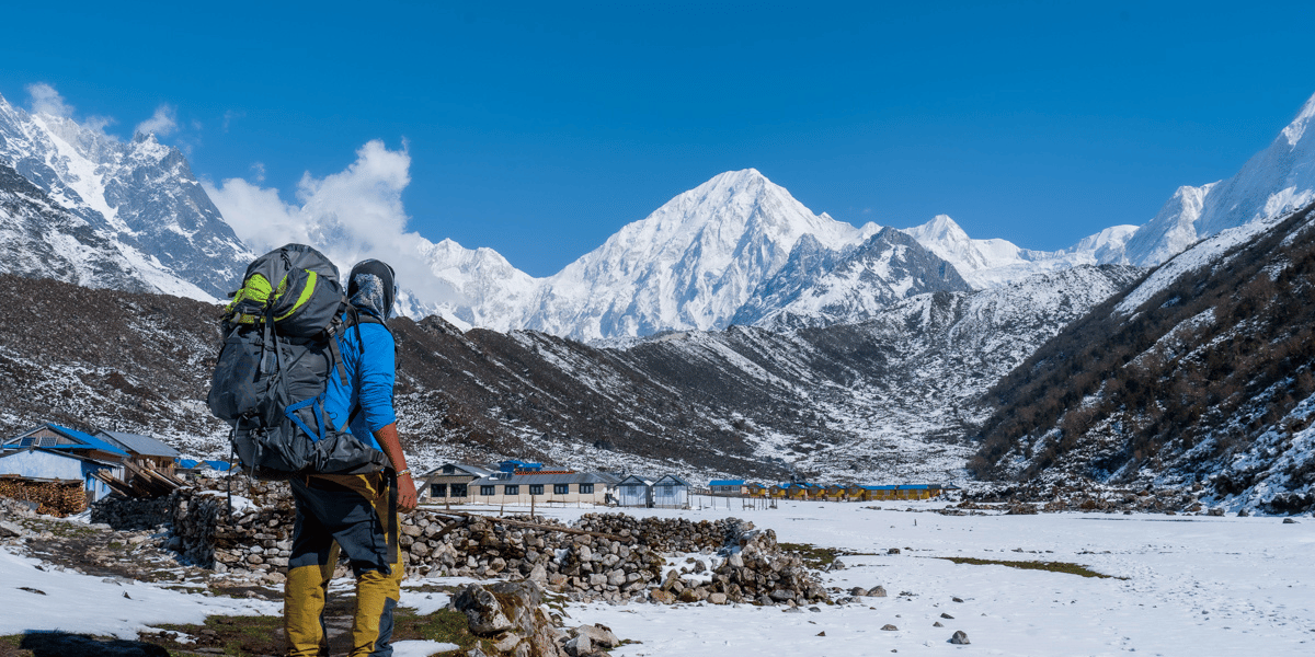
If you’ve chosen the Manaslu Circuit Trek for a secluded experience in the Himalayas, pat yourself on the back. You’re already on the right track!
But before proceeding to visit Nepal, it’s essential that you learn about the Manaslu Circuit Trek’s route and itinerary, along with the region’s trail/terrain type.
Your trek starts from the subtropical region of the Manaslu Conservation Area, followed by temperate, subalpine, and alpine zones. As you ascend into the high-altitude region, the terrain becomes rockier, and the difficulty increases along with it.
Doing the Manaslu Circuit takes roughly 10 to 14 days on paper. However, with arrival and departure dates (and possibly spending time in Kathmandu), it can take 15 to 17 days. Pre-planning is therefore absolutely essential for the smooth completion of this trip.
After reading this guide, I’m sure you’ll have a clear mental map ready before heading to the Manaslu trail.
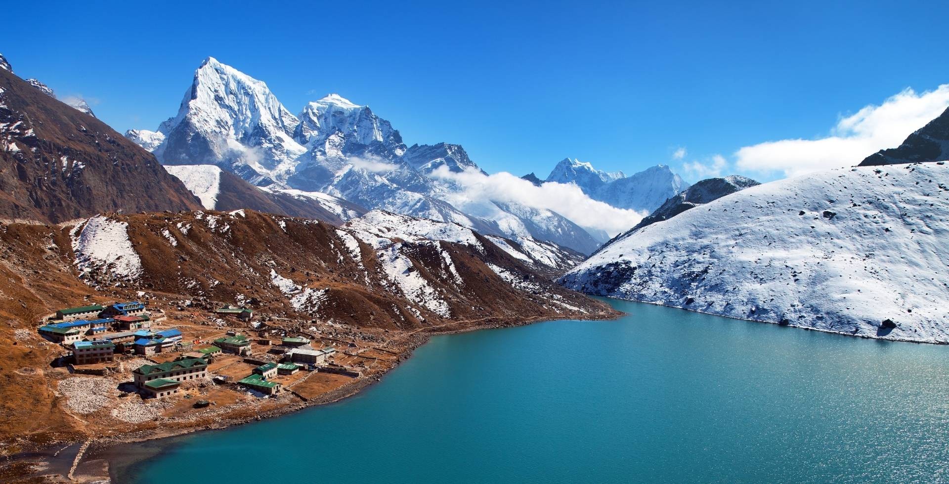
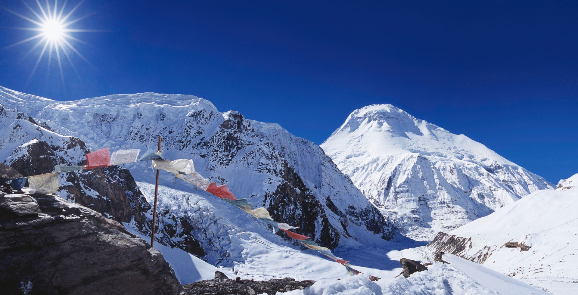
Glimpse of Manaslu Circuit Trek Route Map
Before getting into the details of the villages and rest points of the Manaslu Circuit Trek, let’s get to know more about the Manaslu Conservation Area.
Here’s everything you should know about the location, altitude details, and total distance from one location to the other within one of Nepal’s restricted areas.
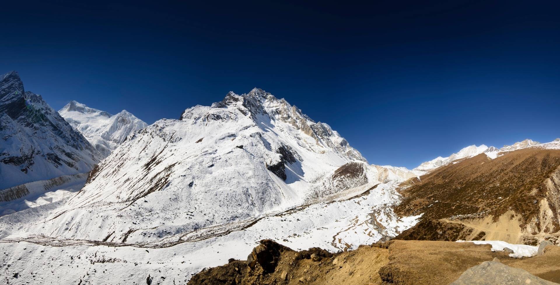
Manaslu Conservation Area Map
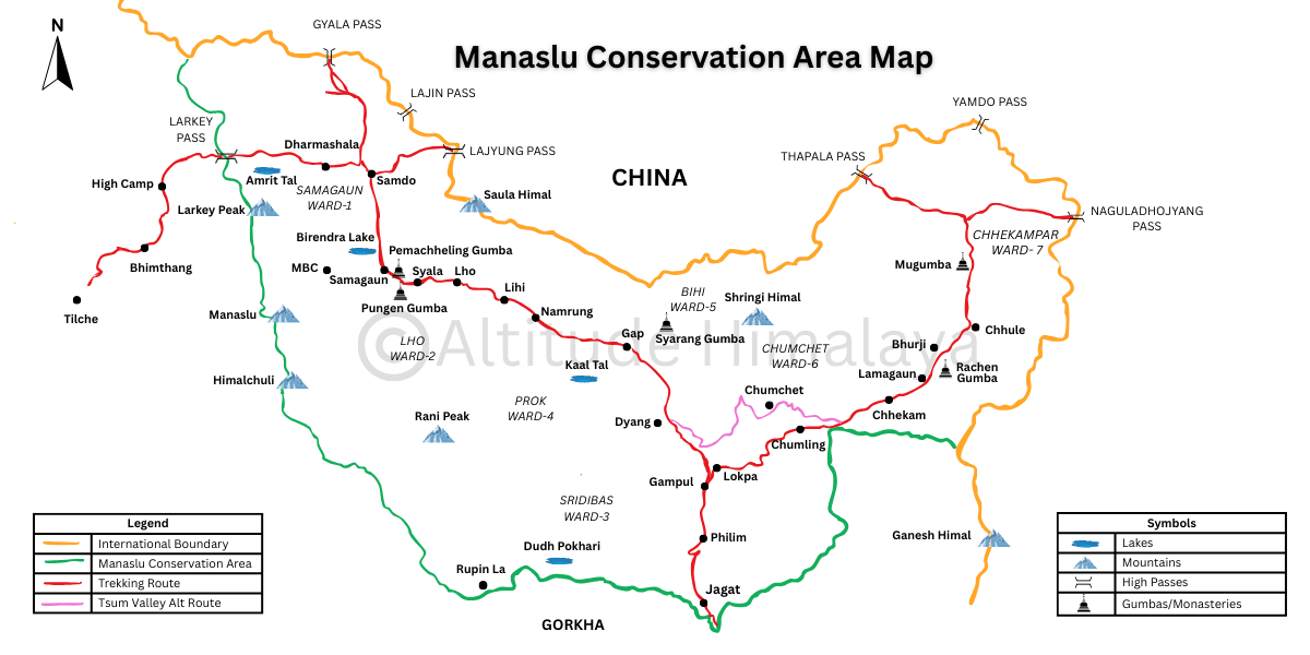
Let’s take a closer look at the map together. Here’s what we understand:
- The conservation area, managed by the National Trust for Nature Conservation (NTNC), lies in the northern Gorkha district.
- It borders Gyirong County in Tibet, China, Gorkha’s Dharche Rural Municipality, Manang’s Nason Rural Municipality, and Lamjung’s Dordi Rural Municipality.
- The starting point of the Manaslu Conservation Area is Jagat Bagar, after crossing the cantilever bridge of Yaru Bagar.
- Seven wards of Chumnubri Rural Municipality, in order, are Samagaun, Lho, Sirdibas, Pork, Bihi, Chumchet, and Chhekampar.
- The most prominent mountains and peaks inside the Manaslu Conservation Area are Mt. Manaslu (8,163 m), Himalchuli (7,893 m), Saula Himal (6,235 m), Shringi Himal (7,187 m), and Larke Peak (6,249 m).
- The most prominent high-altitude passes include Larke Pass (5,106 m), Gyala Pass (5,375 m), Lajing Pass (4,998 m), Lajung Pass (5,098 m), Thapla Pass (5,104 m), Yamdo Pass (5,326 m), Nguladhojuang Pass (5,093 m), and Rupina La (4,720 m).
- The main lakes are Birendra Tal, Kaal Tal, Amrit Tal, and Dudh Pokhari.
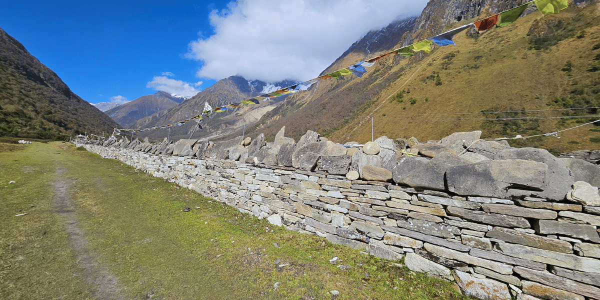
- The main monasteries are Syarang (Serang) Gompa, Shyala Monastery, Pungen (Pungyen) Gumba, Pemachheling Gumba, Rachen Gumba, and Mu Gumba.
- Health posts are available in the following locations:
- Lower Manaslu and Kutang region: Philim, Gap, Prok.
- Nubri Valley: Namrung, Lhi or Hinang, Lho, Samagaun.
- Tsum Valley: Chumling, Chumchet, Chhekam, Lamagaun, Bhurji.
- Helipad locations include Jagat Bagar, Lhi, Shyala, and Samagaun.
- The NTNC-MCAP office is located in Philim.
- Police check posts, where Manaslu permits need to be shown, are in Jagat, Philim, Namrung, and Samagaun.
- Information centres are present in Jagat and Samagaun.
- Micro-hydro power stations operate in Jagat, Bihi, Prok, Namrung, Lho, Samagaun, and Samdo. So there’s no electricity problem up to Samdo!
Manaslu Circuit Trek Elevation Profile
You’ve now got the basic idea of where you’ll be trekking. Now, let’s talk about altitude:
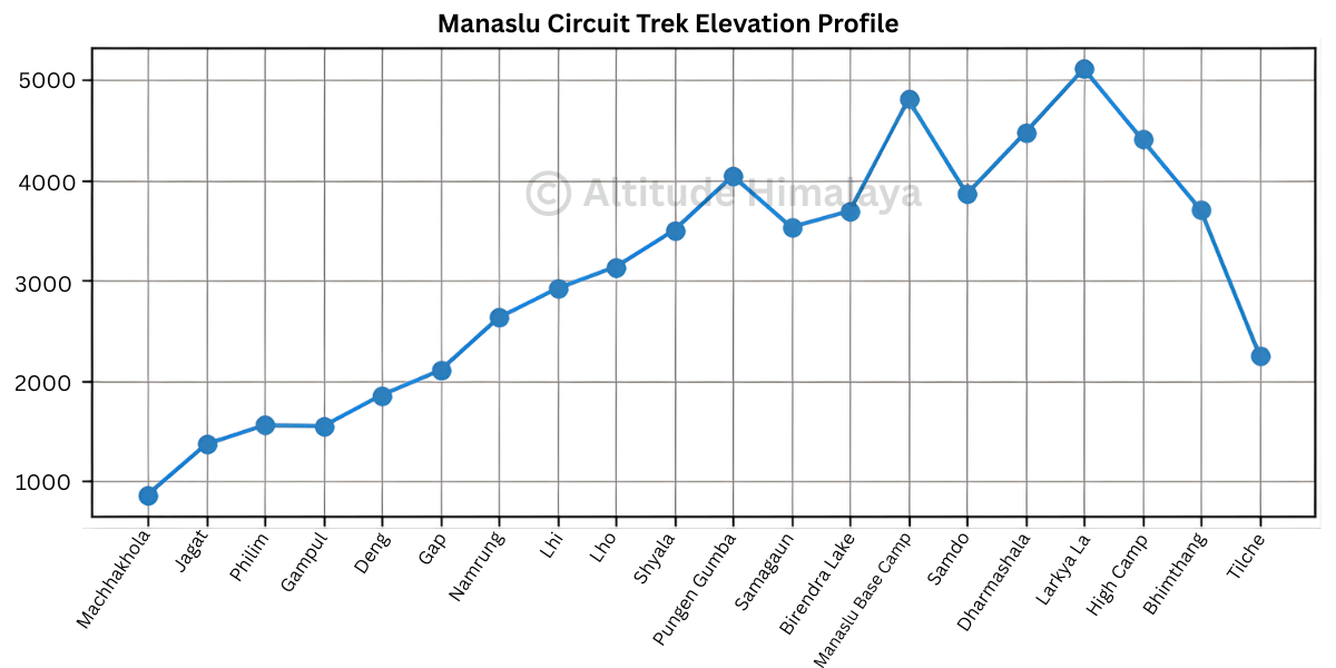
- It is essentially a gradual elevation gain over 7 to 9 days, starting from the lowest altitude of 870 m at Machhakhola to the highest point at Larke Pass (5,106 m).
- Per day, you’ll gain approximately 300 m to 1000 m in elevation, with an average of around 500 m.
- Considering that you’ll be gaining more than 4,300 m in total elevation, make sure your itinerary is well planned. Do not rush, as the risk of altitude sickness is high in this region.
- Here’s how your Manaslu Circuit Trek elevation profile looks based on the classic route:
Machhakhola (870 m) > Jagat (1,370 m) > Philim (1,560 m) > Gampul (1,550 m) > Deng (1,860 m) > Gap (2,105 m) > Namrung (2,630 m) > Lhi (2,920 m) > Lho (3,135 m) > Shyala (3,500 m) > Pungen Gumba (4,040 m) > Samagaun (3,530 m) > Birendra Lake (3,691 m) > Manaslu Base Camp (4,800 m) > Samagaun (3,530 m) > Samdo (3,860 m) > Dharmashala (4,470 m) > Larkya La (5,106 m) > High Camp (4,400 m) > Bhimthang (3,700 m) > Tilche (2,260 m)
- For the Tsum Valley Trek, the route remains the same up to Gampul. From there, the trail diverges, and the elevation profile looks like this:
Machhakhola (870 m) > Jagat (1,370 m) > Gampul (1,550 m) > Lokpa (2,240 m) > Chumling (2,386 m) > Chhokang Paro (3,031 m) > Mu Gumba (3,700 m) > Chhokang Paro (3,031 m) > Lokpa (2,240 m) > Jagat (1,370 m)
- If you’re planning to combine both the Tsum Valley and the Manaslu Circuit Trek, you’ll return to Lokpa, reach Gampul, and continue towards Deng. Or you can go from Rinjam to Chumchet and then reach Deng.
Manaslu Circuit Trek Distance Overview
Here’s a complete summary of the distances you’ll cover during your Manaslu Circuit Trek, along with the approximate time it may take. This should help you better visualise your Manaslu journey and prepare accordingly.
|
Starting Point
|
Destination
|
Distance
|
Time (approximate)
|
|
Soti Khola
|
Macchakhola
|
14 km
|
8 to 9 hours
|
|
Macchakhola
|
Khorlabesi
|
3.5 km
|
1.5 hours
|
|
Khorlabesi
|
Tatopani
|
3 km
|
1 hour
|
|
Tatopani
|
Dobhan
|
3 km
|
1 hour
|
|
Dobhan
|
Yaruphant
|
4 km
|
2 hours
|
|
Yaruphant
|
Jagat
|
3.5 km
|
2 hours
|
|
Jagat
|
Philim
|
6.5 km
|
3 hours
|
|
Philim
|
Gampul (Tsum Valley route diversion)
|
5 km
|
1.5 hours
|
|
Gampul
|
Nyak
|
1 km
|
30 minutes
|
|
Nyak
|
Deng
|
5.5 km
|
2 hours
|
|
Deng
|
Bhijam
|
5 km
|
3 hours
|
|
Bhijam
|
Bur
|
2 km
|
1.5 hours
|
|
Bur
|
Ghap
|
2.5 km
|
1.5 hours
|
|
Ghap
|
Gapshya
|
2 km
|
30 minutes
|
|
Gapshya
|
Lungachyuda
|
1.5 km
|
30 minutes
|
|
Lungachyuda
|
Prok Syaubari (no official name, popular for apple orchard)
|
2 km
|
1 hour
|
|
Prok Syaubari
|
Namrung
|
1.5 km
|
45 minutes
|
|
Namrung
|
Bhanjam
|
2 km
|
1 hour
|
|
Bhanjam
|
Lhi
|
2.5 km
|
1.5 hours
|
|
Lhi
|
Lho
|
5.5 km
|
3 hours
|
|
Lho
|
Shyala
|
4 km
|
2 hours
|
|
Shyala
|
Pungen Gumba
|
6 km
|
3.5 hours
|
|
Shyala
|
Samagaun
|
4 km
|
1.5 hours
|
|
Pungen Gumba
|
Samagaun
|
7 km
|
3 hours
|
|
Samagaun
|
Birendra Lake
|
2 km
|
45 minutes
|
|
Samagaun
|
Manaslu Base Camp
|
7 km
|
7 to 8 hours
|
|
Birendra Lake
|
Manaslu Base Camp
|
5 km
|
6 to 7 hours
|
|
Birendra Lake
|
Samdo
|
8.5 km
|
3 hours
|
|
Samagaun
|
Samdo
|
8 km
|
3 hours
|
|
Samdo
|
Larke Bazaar
|
1.5 km
|
30 minutes
|
|
Larke Bazaar
|
Dharmashala
|
5 km
|
4 to 5 hours
|
|
Dharmashala
|
Larke Pass (5,106 m board)
|
7 km
|
4 to 5 hours
|
|
Larke Pass
|
High Camp
|
4 km
|
2.5 hours
|
|
High Camp
|
Bhimthang
|
4.5 km
|
2 hours
|
|
High Camp
|
Ponkar Lake
|
4 km
|
2 to 2.5 hours
|
|
Bhimthang
|
Ponkar Lake
|
3 km
|
2 hours
|
|
Bhimthang
|
Chauli Kharka (aka Yak Kharka)
|
6 km
|
2.5 hours
|
|
Chauli Kharka
|
Surki Khola
|
3.5 km
|
1 hour
|
|
Sukri Khola
|
Gowa
|
3.5 km
|
1.5 hours
|
|
Gowa
|
Tilche
|
4.5 km
|
1 hour
|
|
Tilche
|
Dharapani
|
6 km
|
1.5 to 2 hours
|
|
Soti Khola to Dharapani
|
165 to 175 km
|
75 to 95 hours
|
|
Macchakhola to Dharapani
|
150 to 160 km
|
65 to 85 hours
|
|
Soti Khola to Tilche
|
160 to 170 km
|
75 to 90 hours
|
|
Machhakhola to Tilche
|
145 to 155 km
|
65 to 85 hours
|
|
Jagat to Tilche
|
130 to 140 km
|
60 to 75 hours
|
|
Jagat to Dharapani
|
135 to 145 km
|
60 to 75 hours
|
|
Philim to Tilche
|
120 to 130 km
|
55 to 70 hours
|
Overview of Manaslu Circuit Trek Route
Your Manaslu Circuit Trek starts from either Machhakhola (Dharche RM) or Jagat and covers five wards of the Chumnubri Rural Municipality in Gorkha. Once you cross Larke Pass, you’ll enter the Nason Rural Municipality of Manang district in the Annapurna region.
So, while completing the circuit of the eighth-highest mountain in the world, you’ll be hiking across two different districts, two or three rural municipalities, and two conservation areas. Allow me to now explain the intrinsic details of the route.
Starting Point: Soti Khola / Machhakhola / Jagat / Philim
The specific starting point of the Manaslu Circuit Trek largely depends on the road conditions in Dharche. I can still recall from my own experience how bumpy the bus ride up to Soti Khola was, followed by another rough journey on jeep to Machha Khola.
Actually, the road is concrete, with minimal potholes and ruts, up to Arughat (as of 2026). After that, what you mostly experience is an earthen road up to Soti Khola.
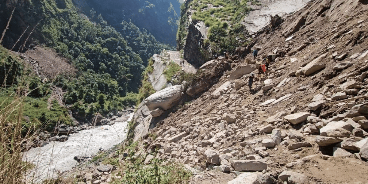
During the monsoon and post-monsoon seasons, this area is prone to landslides. If the condition worsens, buses usually do not go beyond certain points due to the high possibility of mud traps.
In such cases, you’ll have to rely on jeeps to reach Machha Khola and beyond. These off-road vehicles usually reach Tatopani.
Lucky for those who are choosing to do the trek in the dry seasons (especially autumn to winter). During this time, the unpaved roads are comparatively easier to travel. So you can expect to reach Jagat or Pangsing on jeep, which serves as the roadhead as of 2026.
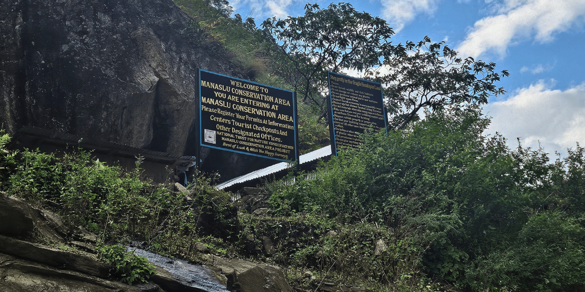
If you’re able to get up to Pangsing, all you need to do is cross a suspension bridge, and that takes you to Philim, which then becomes the starting point of your trek. Even so, a stop at Jagat is absolutely essential to show your MCAP and RAP permits, along with obtaining the Chumnubri Rural Municipality Permit.
Key Stops Along Manaslu Route
There are plenty of local restaurants, bhattis, and lodges along the Manaslu Circuit Trek route for stops. So whether it is for accommodation or short tea breaks, you won’t face many issues.
Here are the main landmarks along the Manaslu Circuit Trek route after Philim:
- Gampul: The exact point that separates the Manaslu Circuit route from the Tsum Valley trail. It is not a large settlement, just a junction.
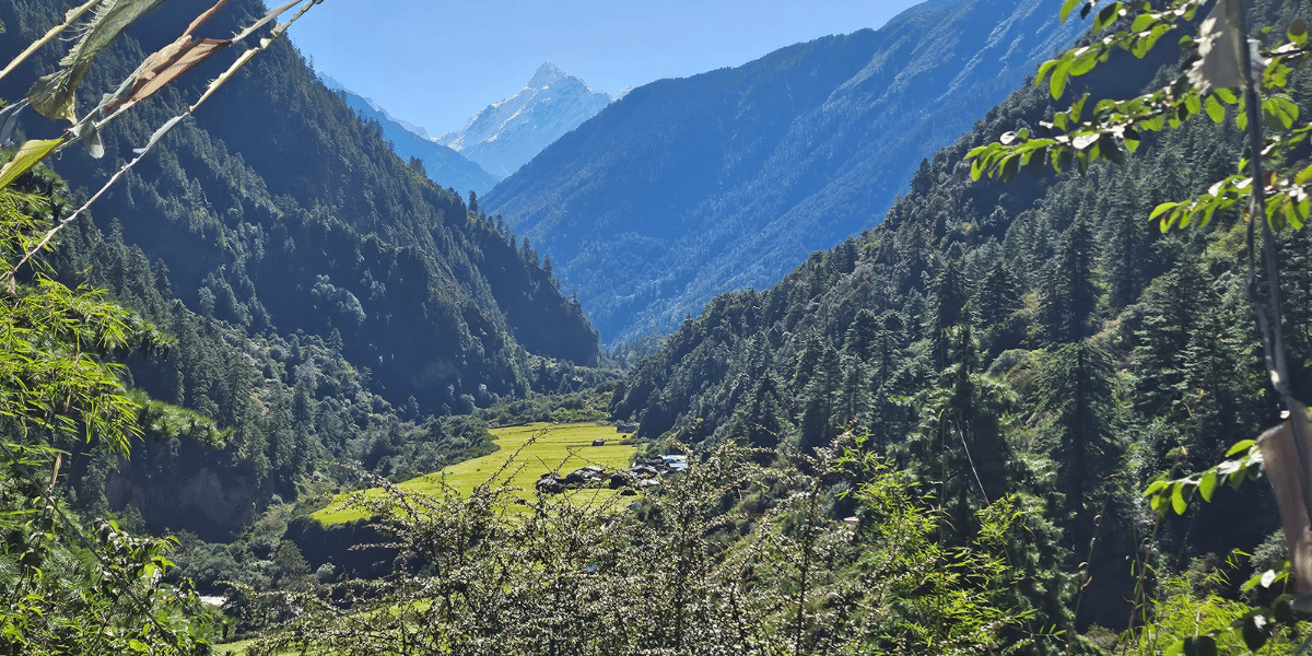
- Nyak: A perfect lunch point for the first or second day of the trek. It is a small settlement where you begin to get glimpses of the mountains, particularly Shringi Himal.
- Dyang (Deng): A great rest point inhabited mostly by Gurung and Tamang communities. From here, you get solid views of the Shringi or Serang Himal range.
- Gap (or Ghap): This is where you cross the 2,000-meter mark and the mountain atmosphere truly kicks in. Surrounded by waterfalls, this place is ideal for both lunch and an overnight stay. Just beyond the main settlement is another spot called Gapshya, from where you can take an alternative route to reach Serang Gompa.
- Namrung: This is yet another prime location on the Manaslu Circuit Trek. It is home to apple orchards and also serves as the gateway to the Nubri Valley. So, when you’re here, definitely try some apple treats and shop for anything that you need before moving forward. Just keep in mind that the prices of goods increase after this, which may impact your overall Manaslu Trek budget.
- Lihi (Lhi): Home to the Buddha Temple, where there are around eight stupas. You will also be close to the 3,000-meter mark. So if time does not permit you to move forward, it is better to plan a stay here. It may not offer the best accommodations, but it provides the best local experience.
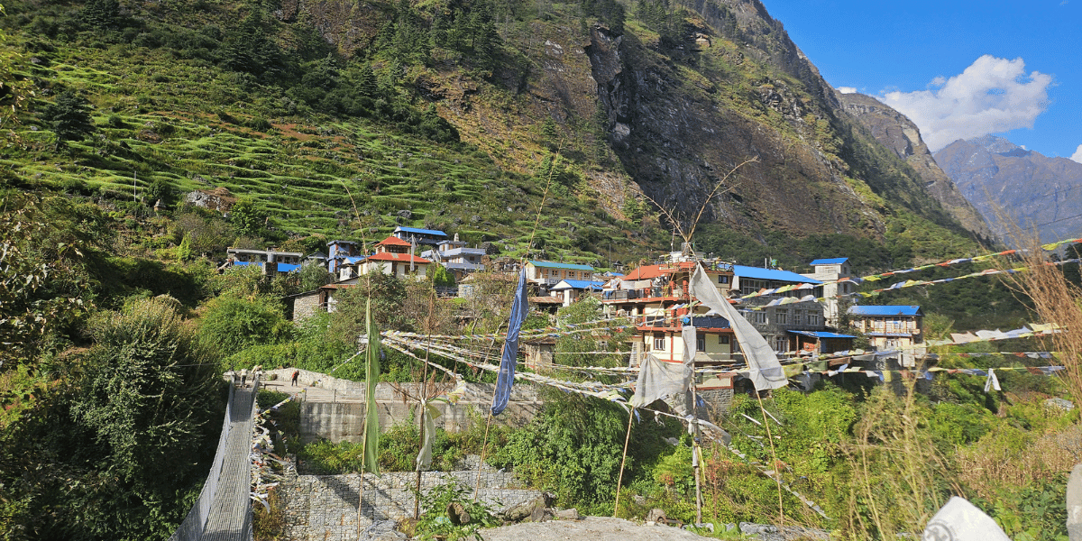
- Lho: A much more popular overnight stop compared to Lhi, especially considering the quality lodges present here. The main highlight of Lho has to be the Ribung Monastery, which serves as a spiritual hub for the entire Nubri community.
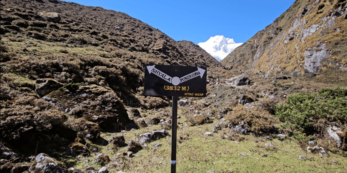
- Shyala: I would say this is the most underrated spot on the trek. The views of Mt. Manaslu become even more spectacular after seeing it for the first time in Lho. The famous Pungen Gumba hike starts from here. On the way, you will also stop to admire the timeless architecture of Shyala Gompa.
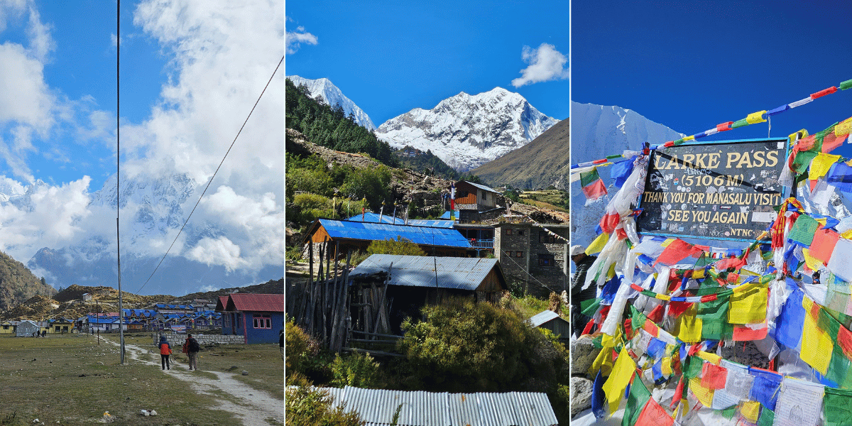
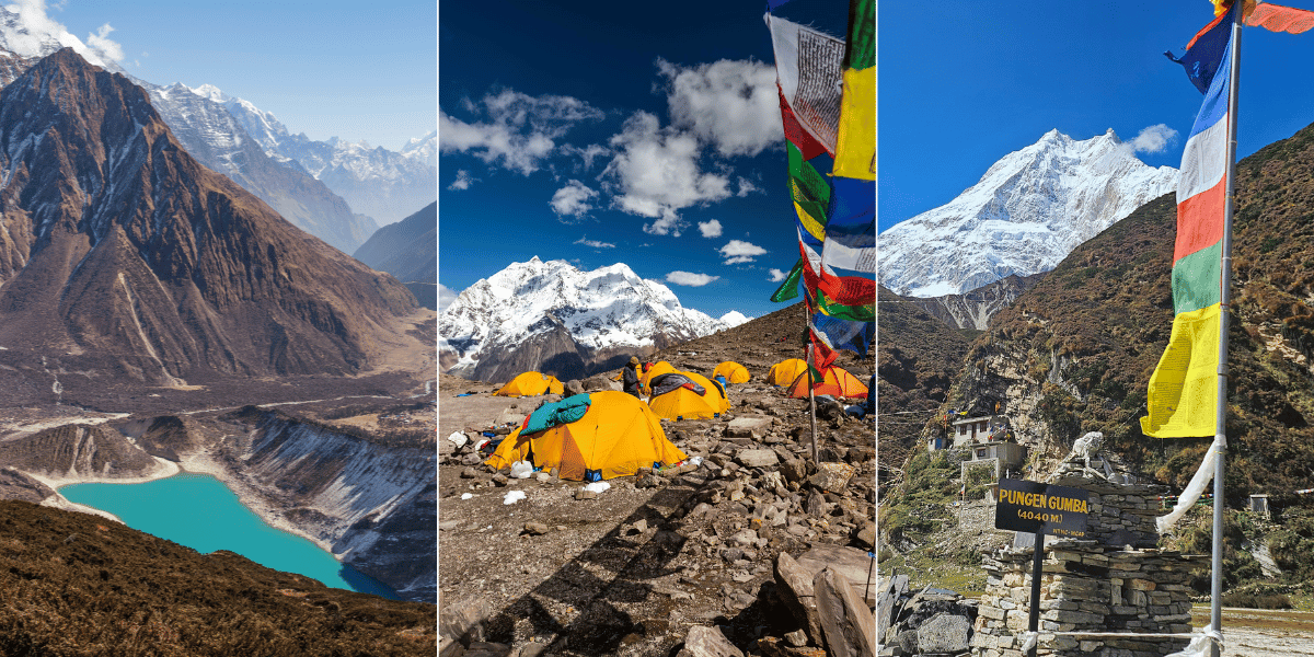
- Samagaun: The largest village/ward in the Chumnubri Rural Municipality, also regarded as the ‘Lotus Feet of Manaslu Heritage’ for its spirituality. And this is where you meet the core Nubri and Bhotia community and learn about their culture and lifestyle, considering you’ll spend an extra day. It is also home to Pemachheling Gumba and Birendra Lake, some of the best attractions in Manaslu CA.
- Samdo: This is the place from where the true remoteness of the Manaslu region becomes evident, and you’ll get a strong Tibetan cultural influence. I personally experienced the hospitality of a local Bhotia family during my own visit, and it was honestly the best stay of my trip!
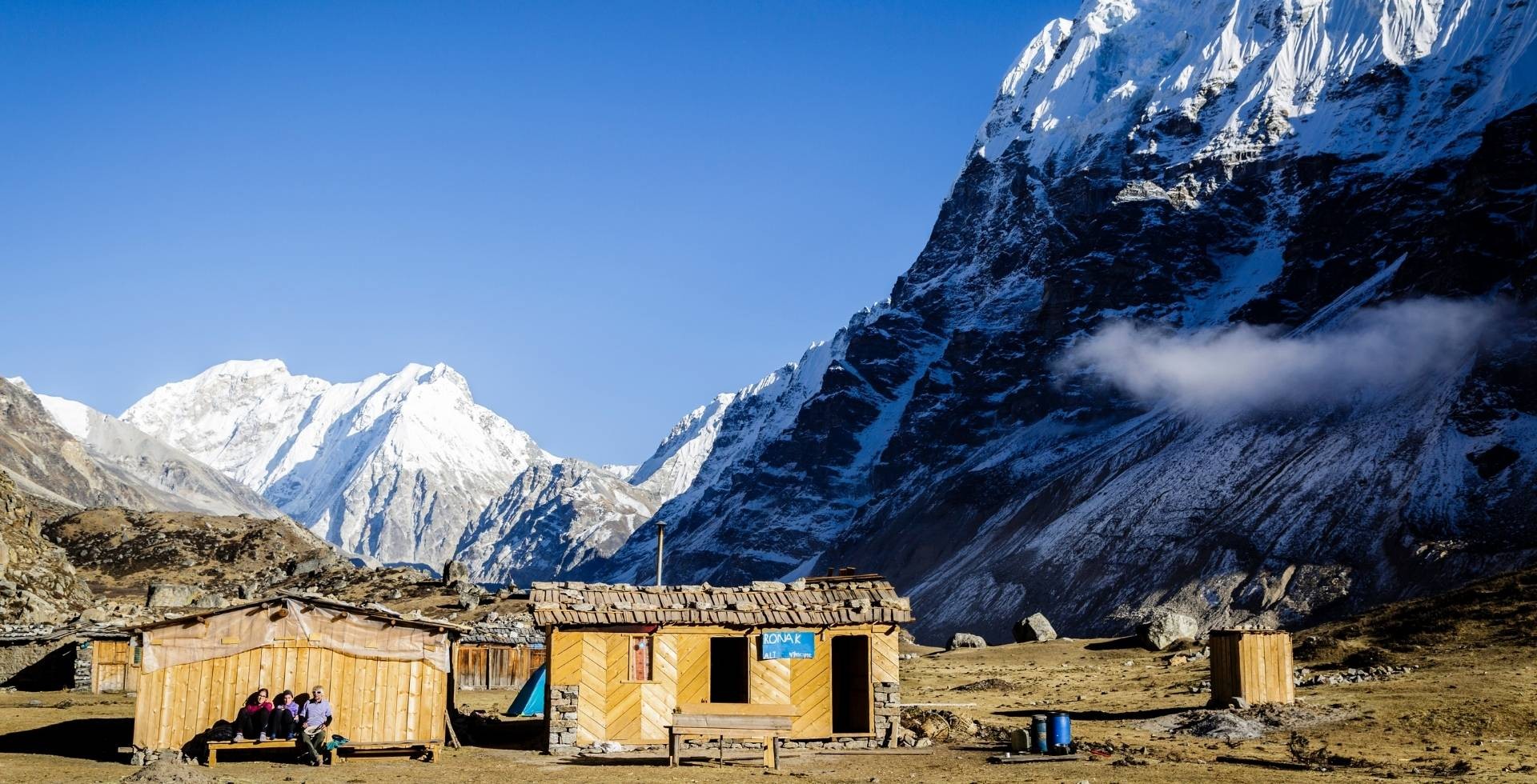
- Dharmashala: The accommodations here may disappoint you, especially during peak seasons when it gets crowded. However, this is only for one overnight stay (that too for a few hours) as we’re going to start the hike from early morning (around 3 AM). So, it’s just one night that you have to manage with. And in case less crowd, you can have similar expectations to other places. Just be cautious of altitude sickness symptoms, as sleeping at 4,470 m can be risky, especially for first-time trekkers.
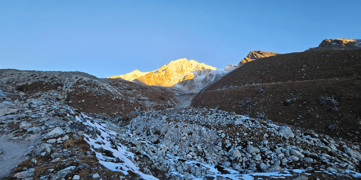
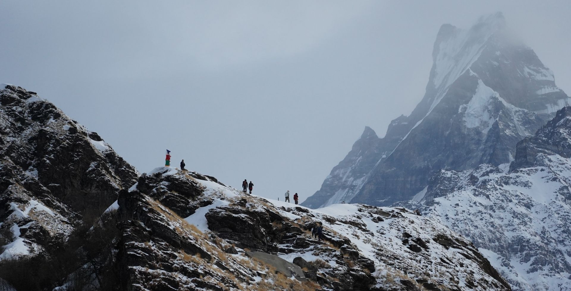
- Larke Pass: The highest point of the Manaslu Circuit Trek. It is not a village or settlement but one of Nepal’s most prominent high trekking passes, decorated with prayer flags and marked by large signboards. Once you cross the pass, Mt. Manaslu slowly fades from view, and you realize that your journey is gradually coming to an end.
- High Camp: The real challenge of the Manaslu Circuit Trek begins when you descend along an icy and rocky trail from Larke Pass towards High Camp. This usually becomes your lunch stop after a long 6 to 7-hour morning hike.
- Bhimthang: A surreal location nestled between the Manaslu and Annapurna mountain ranges. Known for vibrant rhododendrons in spring, this village also serves as the gateway to Milarepa Cave and Ponker Lake.
- Tilche: This is where the modern Manaslu Circuit Trek typically ends. If you wish, you can proceed further to Dharapani. However, the roads are now paved up to Tilche. So I recommend spending a night here before driving back to the capital via Besisahar the next day.
Best Side Hikes During Manaslu Circuit Trek
Your Manaslu journey is not just about completing the marked trail and crossing Larke Pass. It is actually more about the acclimatization side hikes you take along the way.
Honestly, when I think about Manaslu, Pungen Gumba and Birendra Lake immediately come to my mind. These are two places you simply should not miss while circumnavigating Mt. Manaslu.
However, there are more of such gems here. Let me introduce you to some of the major attractions within the Manaslu Conservation Area:
- Prok Village visit with Kaal Taal: An underrated destination within the Manaslu Conservation Area that requires an extra full day to explore. Those who do not take this route will still get a glimpse of the Queen Waterfall upon reaching Bur.
- Syarang Gumba (aka Serang Gompa): You need to hike for 4 to 6 hours through a mix of forests and rugged terrain to reach this peaceful monastery from Gapshya. It sits right beneath Shringi Himal.
- Pungen Gumba: This is the most iconic side hike during the Manaslu Circuit Trek. It is about 6 km from Shyala and can be reached in roughly three hours. Situated at 4,040 m and home to a centuries-old monastery, this place is especially famous for its stunning 360-degree views of Mt. Manaslu and the Mansiri range.
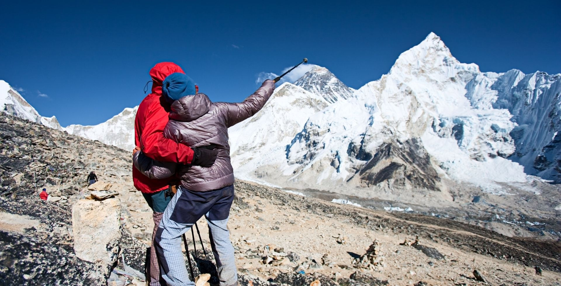
- Birendra Lake: The most prominent glacial lake at an altitude of 3,690 meters, located right beneath the massive Manaslu. The views of the eighth-highest mountain, along with Manaslu North and Naike Peak, look absolutely stunning.
- Manaslu Base Camp: A strenuous 6-hour hike of around 7 km from Samagaun takes you to the base camp of one of the highest mountains in the world. Reaching 4,800 m is excellent for acclimatization. So, once you accomplish this, crossing Larke Pass feels comparatively easier. Not to mention, the close-up view of Manaslu’s east pinnacle is worth every single step.
- Ponkar Lake: The clear blue lake often spotted from the vantage point of Larke Pass becomes your motivation to complete the demanding downhill hike toward Bhimthang across rocky glacial terrain. If you can spare an extra day in Bhimthang, visiting this hidden gem in the Annapurna region is highly recommended.
- Milarepa Cave: The name of this cave comes from the 11th-century Tibetan saint Milarepa, who is believed to have meditated here. You can reach it after about a 1.5-hour hike from Habu on your return journey.
End Point: Tilche or Dharapani
As mentioned earlier, you’ll end your Manaslu Circuit Trek in the Annapurna region. But whether it will be in Tilche or Dharapani depends totally on you.
Dharapani was traditionally the classic endpoint of the Manaslu trek. However, these days, Tilche commonly serves as the final stop.
If you arrive early, it is possible to take a jeep ride the same day to Besisahar for a more comfortable night compared to local accommodation in Tilche. However, you need to be mentally prepared for a roughly 4-hour bumpy ride.
On the way, you will be rewarded with views of the impressive Octopus Waterfall and the beautiful settlement of Tal Village, which was reconstructed after being completely destroyed in the 2021 flood.
I’d suggest spending one more night among the local community in Tilche. This allows you to return to Kathmandu in a more relaxed manner the following day, something we have thoughtfully included in our own Manaslu trek packages.
Manaslu Circuit Trail and Terrain Explained
When undertaking the 12 to 15-day Manaslu adventure, you’ll pass through multiple types of terrain.
Unlike other trekking regions of Nepal, this part of Gorkha offers a more rugged experience, which is exactly why it remains one of the most preferred routes among adventure seekers.
Lower Manaslu Trail [Machhakhola to Gap]
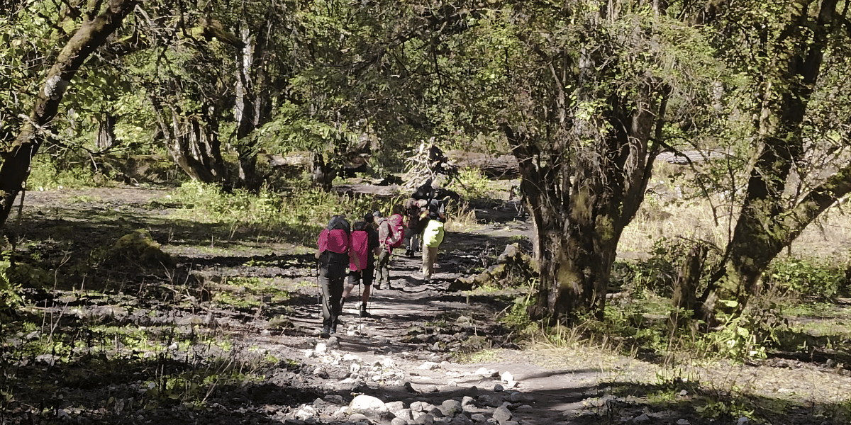
Expect this section of your Manaslu Circuit Trek to be filled with greenery, thanks to farmlands and abundant vegetation.
You’ll pass through villages as well as stretches of paved road, making you think that one day the roads will fully reach here and the journey will be shortened. Good for the locals, really!
You’ll experience more village life here rather than dramatic mountain views. This phase usually lasts for two days and might feel slightly monotonous for those who trek regularly.
There are no major steep climbs, except for the stretch from Pewa to Deng. You’ll walk alongside the Budhigandaki River, and despite being considered an “easy” hike, challenges still exist.
Several sections are prone to landslides, especially during the monsoon and post-monsoon seasons. You may also have to cross waterfalls during this time, particularly when hiking from Tatopani towards Jagat.
Forested Route from Gapshya to Shyala
Pine, rhododendron, bamboo, and oak trees begin appearing right from the start of your trek at Machhakhola. From Gapshya to Shyala, forests of birch, rhododendron, and juniper become more prominent.
This part of the Manaslu Circuit Trek features comparatively denser forests.
In some areas, the trail can become extremely muddy. I clearly remember experiencing this during my own walk from Lungachhyuda to Namrung and from Lho to Shyala, even in autumn (usually considered the best time for Manaslu).
Mountainous Terrain From Shyala to Dharmashala
Upon reaching Shyala and witnessing the jaw-dropping views of Mt. Manaslu and the Mansiri Himal range, the trail starts becoming more rugged.
Once you arrive in Samagaun, the route becomes a little more developed, as it is the largest settlement in the Chumnubri Rural Municipality. However, after crossing Samagaun and moving towards Samdo, the landscape again becomes more barren and rugged (including the route to Birendra Lake).
There is also a steep uphill climb before reaching the entrance gate of Samdo, so be prepared to fill your lungs there!
The further you proceed, the more mountainous the terrain becomes. After crossing Larke Bazaar, you’ll be welcomed by altitude signboards marking every 100-meter ascent.
Mt. Manaslu will now be on your left side. And seeing it from a different angle still feels surreal!
Eventually, you’ll settle in Dharmashala, which is more of a resting point for trekkers than a permanent settlement, located along a rugged trail besides glacial streams.
Extremely Rugged Route From Dharmashala to Bhimthang
Up to Dharmashala, the route is honestly manageable. However, once you begin the early morning hike towards Larke Pass, the most challenging section of the Manaslu trek begins.
You must be cautious of both rocky and icy conditions and also hope that strong winds do not disrupt your ascent.
And during extreme weather, the route can become impassable.
You see, the difficulty of Manaslu Circuit Trek is not necessarily about steep ascent but more about navigating icy sections with chilling winds that can make the hike demanding.
Especially after crossing Amrit Taal (a small lake on the way to Larke Pass), the trail likely becomes snowy or icy, depending on the season.
Snowfall chances are lower in the early morning, so it is wise to monitor weather conditions and aim to reach the pass as early as possible.
Be careful if the snow has melted, as the trail can become slippery. That is why I always suggest adding crampons to anyone packing for their Manaslu trek!
Once you complete the long 7 km ascent and begin descending, the most difficult part of the entire Manaslu journey begins. I’m talking about the steep descent along a rocky moraine and glacial trail towards High Camp. It seriously puts strain on your knees!
That is also when you realize the importance of sturdy hiking boots and trekking poles. The path is narrow in some sections, so you must be extremely careful. Do not rush. One wrong step can lead to serious consequences!
Trail and Terrain of Side Hikes
Well, the side hikes along the Manaslu Circuit are honestly manageable and won't add significant difficulty to your overall journey. One clear exception is the Manaslu Base Camp! Here's an honest breakdown of each:
- Tsum Valley: Often rated as a moderate to challenging extension, this additional 6 to 8-day detour involves steep climbs and multiple landslide-prone sections that require extra caution. But the sweeping views of the Ganesh Himal range, centuries-old monasteries, and the deeply preserved culture of the Tsumpa community make every extra step completely worth it!
- Serang Gompa: The trail to Serang Gompa is mostly uphill, passing through pine and rhododendron forests, but it's well-marked and doesn't throw any particularly rugged terrain at you. It's a steady, peaceful climb to a spiritual site that carries a quiet atmosphere unlike anywhere else on the circuit.
- Prok Village and Kaal Tal: Getting to Prok involves a somewhat steep trail with suspension bridge crossings and pine forest sections that keep things interesting. The onward hike to Kaal Tal (also known as Death Lake) is a steep ascent, but the pristine, untouched landscape at the top gives the whole effort a genuinely rewarding quality.
- Pungen Gumba: This one is mostly easy, beginning through forested terrain before transitioning into slightly rugged ground as you gain elevation. The trail is well within reach for most trekkers, and as you climb higher, the views of Mt. Manaslu grow more and more dominant. Those open grounds right in front of the eighth-highest mountain in the world are honestly one of the most memorable sights on the entire circuit!
- Birendra Lake: There are multiple routes to reach this glacial lake. You can go via the monastery in Sama village or take a forest trail from slightly farther away (the latter can be a little confusing). First, you reach the viewpoint, where a tea shop is available. Then you hike straight downhill to the lakeside. You may even cross the lake to connect with the Manaslu Base Camp trail.
- Manaslu Base Camp: This is undoubtedly the most difficult side hike of the Manaslu Circuit Trek. I personally had to skip it due to bad weather and extremely icy trail conditions during my visit in October. The route towards the base camp is rocky and moraine-filled. So it is important to seek advice from locals before attempting it. If conditions are favourable, the journey will certainly become rewarding.
- Ponkar Lake: Another destination marked by rocky paths and rugged terrain. You can either stay overnight in Bhimthang and visit the lake the next day or reach it in the late afternoon while descending from High Camp.
The Final Downhill to Tilche
The final day of the Manaslu Circuit is beautiful in its own right, and there's something deeply satisfying about looking back at the Mansiri Himal range one last time while the first glimpses of the Annapurna peaks begin appearing ahead of you.
The terrain shifts noticeably as the descent toward Chauli Kharka begins, with a mix of forested and rocky trail sections keeping the walk interesting right to the end.
The Dudh Khola River stays close alongside you for much of this stretch, and just when you think the trail is done testing you, one final short but steep ascent toward Gowa reminds you that the Manaslu Circuit saves a little something for the very last day!
Once you cross Gho Khola, you return to a paved road. Some locals even bring their motorcycles up to this point, and you may be able to book a ride. How you reach Tilche is up to you.
Your journey ends with one final suspension bridge crossing, often an emotional moment before boarding a jeep for another bumpy ride towards Besisahar.
The Best Manaslu Circuit Trek Itineraries
It takes about 10 to 14 days to complete the actual trek, excluding drives and other sightseeing (covering the route from Machhakhola to Tilche/Dharapani). And when you count the drive days, it’s about 12 to 17 days. Even that depends on the side hikes you choose to cover.
When booking with Altitude Himalaya, you even get the perk of a full-day Kathmandu sightseeing tour along with a cultural dinner on the final day. Also, most parts of the treks are privatized, from transportation to accommodations.
I personally completed my Manaslu Circuit Trek with just Pungen Gumba in 11 days, which included 9 days on the trail and 2 days of driving. But if I had added Manaslu Base Camp, it would have been a total of an 11-day hike.
Not to forget, you need to add buffer days considering emergencies and bad weather. Keeping everything in mind, I have curated three different itineraries for you. Let’s check each one out:
14 to 17 Day Classic Manaslu Circuit Trek
This is the itinerary straight from our 15-day Manaslu Circuit Trek package:
- DAY 01: Kathmandu Arrival.
- You’ll spend your day in the capital city of Kathmandu. It’s better to go for self-exploration if you have time.
- DAY 02: Kathmandu Sightseeing, Trek Preparation.
- DAY 03: Drive to Macchakhola.
- Route: Thamel (Kathmandu) > Malekhu (Dhading) > Salyantar (Dhading) > Aarughat (Gorkha) > Soti Khola > Machha Khola
- Transportation option: Private Jeep (some trekking agencies may opt for public bus followed by shared jeep)
- Total distance: 160 km
- Approximate time: 8 to 10 hours (depends on road conditions)
- DAY 04: Machhakhola to Philim Drive via Jagat, Reach Deng.
- Route: Machhakhola > Khorlabesi > Yaruphant > Jagat > Pangsing > Philim > Ekle Bhatti > Gampul > Nyak > Pewa > Deng
- Transportation option: Private or shared jeep
- Total drive distance: 8 km
- Total drive duration: 2 to 3 hours
- Hike distance: 13 km
- Hike duration: 6 to 7 hours
- Elevation gain: ~300 m
- When vehicles can’t reach Philim or Jagat, you can hike 18 km in one day to reach Jagat from Machhakhola and then reach Deng the next day.
- DAY 05: Deng to Gap.
- Route: Deng > Rana Gaun > Bihi Phedi > Bihi > Bur > Gap
- Hike distance: 13 km
- Hike duration: 6 to 7 hours
- Elevation gain: ~300 m
- DAY 06: Gap to Lhi.
- Route: Gap > Gapshya > Lungachhyuda > Namrung > Bhanjam > Lhi
- Hike distance: 12 km
- Hike duration: 6 to 7 hours
- Elevation gain: ~800 m
- DAY 07: Lhi to Shyala.
- Route: Lhi > Shyo > Lho > Shyala
- Hike distance: 9 km
- Hike duration: 4 to 5 hours
- Elevation gain: ~600 m
- DAY 08: Visit Pungen Gumba, Reach Samagaun.
- Route: Shyala > Pungen Gumba > Samagaun
- Hike distance: 13 km
- Hike duration: 7 to 8 hours
- Elevation gain: ~550 m
- DAY 09: Samagaun Rest Day, Optional Hikes.
- Route: Samagaun > Birendra Lake > Manaslu Base Camp > Samagaun
- Hike distance: 14 km
- Hike duration: 9 to 10 hours
- You can choose to skip Manaslu Base Camp and only visit Birendra Lake on this day. Or completely rest, explore Sama village, and try local Manaslu food.
- DAY 10: Samagaun to Samdo.
- Route: Samagaun > Samdo
- Hike distance: 8 km
- Hike duration: 3 to 4 hours
- Elevation gain: ~350 m
- DAY 11: Samdo to Dharmashala.
- Route: Samdo > Larke Bazaar > Dharmashala (go for acclimatization hikes)
- Hike distance: 6 km
- Hike duration: 5 to 6 hours
- Elevation gain: ~600 m
- DAY 12: Dharmashala to Bhimthang via Larke Pass.
- Route: Dharmashala > Larke Pass > High Camp > Bhimthang (start hike at 3-4 AM)
- Hike distance: 16 km
- Hike duration: 9 to 11 hours
- Elevation gain: ~650 m
- DAY 13: Bhimthang to Tilche.
- Route: Bhimthang > Habu > Chauli Kharka > Surki Khola > Gowa > Gho Khola > Tilche
- Hike distance: 18 km
- Hike duration: 7 to 8 hours
- DAY 14: Tilche to Kathmandu Drive, Farewell Dinner.
- Route: Tilche (Manang) > Dharapani (Manang) > Besisahar (Lamjung) > Dumre (Tanahun) > Mungling (Chitwan) > Malekhu (Dhading) > Thamel (Kathmandu)
- Drive distance: 225 km
- Drive duration: 8 to 9 hours
- Dinner with cultural dance program on us!
- If you’re planning to extend your stay in Nepal, you can even opt for a drive to Pokhara city and spend 2 to 3 days there.
- DAY 15: Farewell, Departure.
- Spend your final morning in Kathmandu and reflect back on your Manaslu journey.
For 14 days: You can choose to hike directly from Gap to Namrung and then to Shyala. This saves you a day.
For 16 or 17 days: This is best recommended for those opting for the Manaslu Base Camp adventure. Within the same itinerary, add 1 to 2 days in Samagaun for rest. The 16-day and 17-day Manaslu Base Camp options can also be customized with the inclusion of other side hikes like Serang Gompa and Kaal Taal.
For Aussies: If you’re planning your trek from Australia, we have curated a special 15-day package for you. Check that out and contact our team there!
10 to 12 Day Short Manaslu Circuit Trek
This is a fast-paced itinerary best suited for trekkers who have less time but still want the best experience in the Manaslu region. No Manaslu Base Camp is added, though.
The focus is on completing the trek on time. This one is based on my own 11-day experience:
- DAY 01: Kathmandu to Machhakhola.
- Drive distance: 160 km
- Drive duration: 8 to 10 hours
- DAY 02: Machhakhola to Jagat.
- Hike distance: 18 km
- Hike duration: 8 to 9 hours
- Elevation gain: ~500 m
- DAY 03: Jagat to Deng.
- Hike distance: 20 km
- Hike duration: 8 to 9 hours
- Elevation gain: ~500 m
- DAY 04: Deng to Namrung.
- Hike distance: 17 km
- Hike duration: 8 to 9 hours
- Elevation gain: ~800 m
- DAY 05: Namrung to Shyala.
- Hike distance: 13 km
- Hike duration: 7 to 8 hours
- Elevation gain: ~900 m
- DAY 06: Pungen Gumba Hike, Reach Samagaun.
- Hike distance: 13 km
- Hike duration: 7 to 8 hours
- Elevation gain: ~550 m
- DAY 07: Birendra Lake Hike, Reach Samdo.
- Hike distance: 11 km
- Hike duration: 5 hours
- Elevation gain: ~350 m
- DAY 08: Samdo to Dharmashala.
- Hike distance: 6 km
- Hike duration: 5 to 6 hours
- Elevation gain: ~600 m (excluding acclimatization hikes)
- DAY 09: Dharmashala to Bhimthang via Larke Pass.
- Hike distance: 16 km
- Hike duration: 9 to 11 hours
- Elevation gain: ~350 m
- Day 10: Bhimthang to Tilche.
- Hike distance: 18 km
- Hike duration: 7 to 8 hours
- Elevation gain: ~650 m
- Day 11: Drive to Kathmandu.
- Drive distance: 225 km
- Drive duration: 8 to 9 hours
Reverse Manaslu Circuit Trek in 12 Days
Less preferred among trekkers, the Manaslu Circuit Trek can also be done from the Manang side. In fact, there is even a route that takes you to the Manaslu Base Camp from Habu.
But do I recommend it? Not really. That steep uphill from Bhimthang to Larke Pass, combined with the high altitude, can be extremely challenging. You also have to cover long distances, around 15 to 20 km per day.
Still, with proper acclimatization, many trekkers take on this challenge. It is shorter compared to other itineraries. And if it feels too difficult, returning to Tilche is relatively short and easy.
Many even go up to Bhimthang, which is popularly commercialized as the “Manaslu View Trek,” completed within a week.
Let me guide you through the reverse Manaslu Circuit Trek:
- DAY 01: Kathmandu to Besisahar Drive.
- Drive distance: 175 km
- Drive duration: 6 to 7 hours
- DAY 02: Besisahar to Tilche Drive.
- Drive distance: 65 km
- Drive duration: 4 to 5 hours
- Elevation gain: ~1500 m
- DAY 03: Tilche to Chauli Kharka.
- Hike distance: 12 km
- Hike duration: 6 to 7 hours
- Elevation gain: ~800 m
- DAY 04: Chauli Kharka to Bhimthang.
- Hike distance: 10 km
- Hike duration: 7 to 8 hours
- Elevation gain: ~700 m
- DAY 05: Acclimatization Hike to Ponkar Lake, Stay at Bhimthang.
- Hike distance: 6 km (round-trip)
- Hike duration: 3 to 4 hours (round-trip)
- Elevation gain: ~400 m
- DAY 06: Bhimthang to High Camp.
- Hike distance: 4.5 km
- Hike duration: 4 to 5 hours
- Elevation gain: ~700 m
- DAY 07: High Camp to Larke Pass, Reach Samdo.
- Hike distance: 17 km
- Hike duration: 11 to 12 hours
- Elevation gain: ~700 m
- Can opt for a stay in Dharmashala or Larke Bazaar too.
- DAY 08: Samdo to Lho via Birendra Lake.
- Hike distance: 18 km
- Hike duration: 8 to 9 hours
- If you prefer staying an extra day, you can choose Samagaun and follow this itinerary more slowly.
- DAY 09: Lho to Gap.
- Hike distance: 17 km
- Hike duration: 7 to 9 hours
- DAY 10: Gap to Nyak.
- Hike distance: 18 km
- Hike duration: 7 to 9 hours
- DAY 11: Nyak to Tatopani.
- Hike distance: 24 km
- Hike duration: 8 to 10 hours
- In case the road conditions are good, you can hike to Pangsing or Jagat and then take a jeep to Tatopani or Machhakhola.
- DAY 12: Enjoy Hot Springs, Drive to Kathmandu.
- Drive distance: 170 km approx.
- Drive duration: 9 to 10 hours
Other Popular Itineraries
The ones I covered above are the most popular Manaslu Circuit-focused itineraries. But if you want a more immersive experience in the Manaslu region or want to extend it towards Annapurna, here are a few options:
- 21-day Manaslu-Tsum Valley Trek:
- Route: Machhakhola > Jagat > Lokpa > Chhokangparo > Nile > Mu Gompa > Lama Gaun > Lokpa > Deng > Namrung > Lho > Samagaun > Samdo > Dharmashala > Larke Pass > Bhimthang > Tilche/Dharapani.
- Total Distance: 200 to 215 km
- Manaslu + Annapurna Circuit Trek:
- Route: Machhakhola > Jagat > Deng > Namrung > Lho > Samagaun > Samdo > Dharmashala > Larke Pass > Bhimthang > Tilche > Chame > Upper Pisang > Manang > Yak Kharka > Thorang Phedi > Muktinath > Jomsom.
- Total Distance: 230 to 250 km
- You can even include the popular Tilicho Lake in this itinerary.
Also check out: 24-day Manaslu Annapurna Three Passes Trek
Final Thoughts: Is Manaslu Trek Right For You?
I’m sure you now have a clear visual map in your head. Now it’s time to decide whether this trek is right for you!
While we can’t call this trek completely beginner-friendly, with the right preparation and constant support from your operator (like Altitude Himalaya ourselves), almost anyone can complete it.
And if you still have confusion regarding the Manaslu Circuit Trek route, duration, or itinerary, don’t hesitate to contact us directly. We even offer Manaslu’s group join trek in case you’re thinking to go solo.
We are also posting regularly on Altitude Chronicles, our web series that provides up-to-date information on Manaslu and other trekking regions. So do check it out!


 Bhishu Acharya