Which mountain is called the Killer Mountain? A G.K question I had to memorise in grade 6. It always left me with so many questions. Especially when I learnt people still climbed, or at least tried to climb, this “Killer” mountain, even with such an infamous nickname.
Yes, this article is about that very infamous, very stunning Manaslu mountain and all the questions grade‑6‑me would like an answer to.
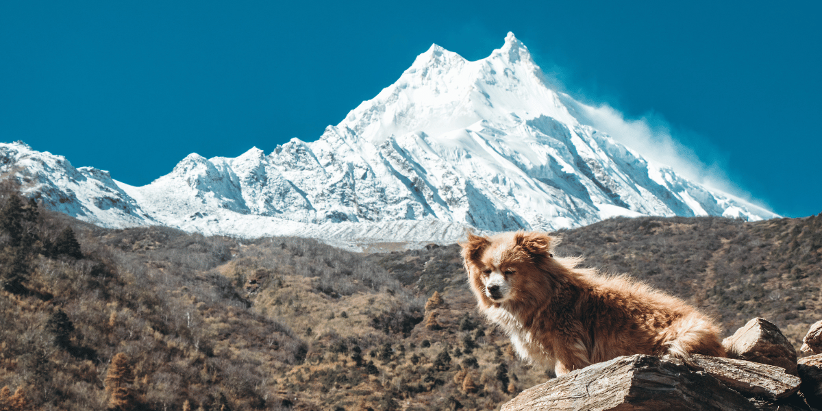
Its glaciated terrain over the Budhi Gandaki valley, its towering presence in the Mansiri Himal Range, its people in Nubri and Tsum valleys, and their beliefs, altogether, are what make Manaslu, Manaslu today.
So this time, instead of just memorising a one-word answer, let's figure out the whole story behind it together.
Manaslu in Brief
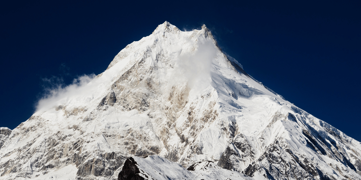
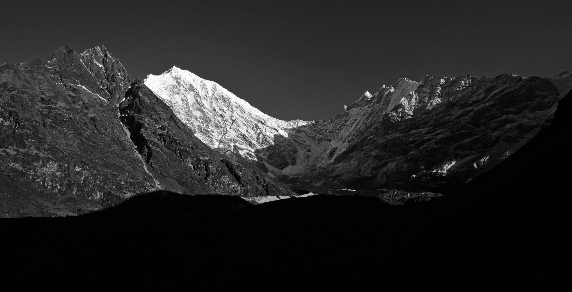
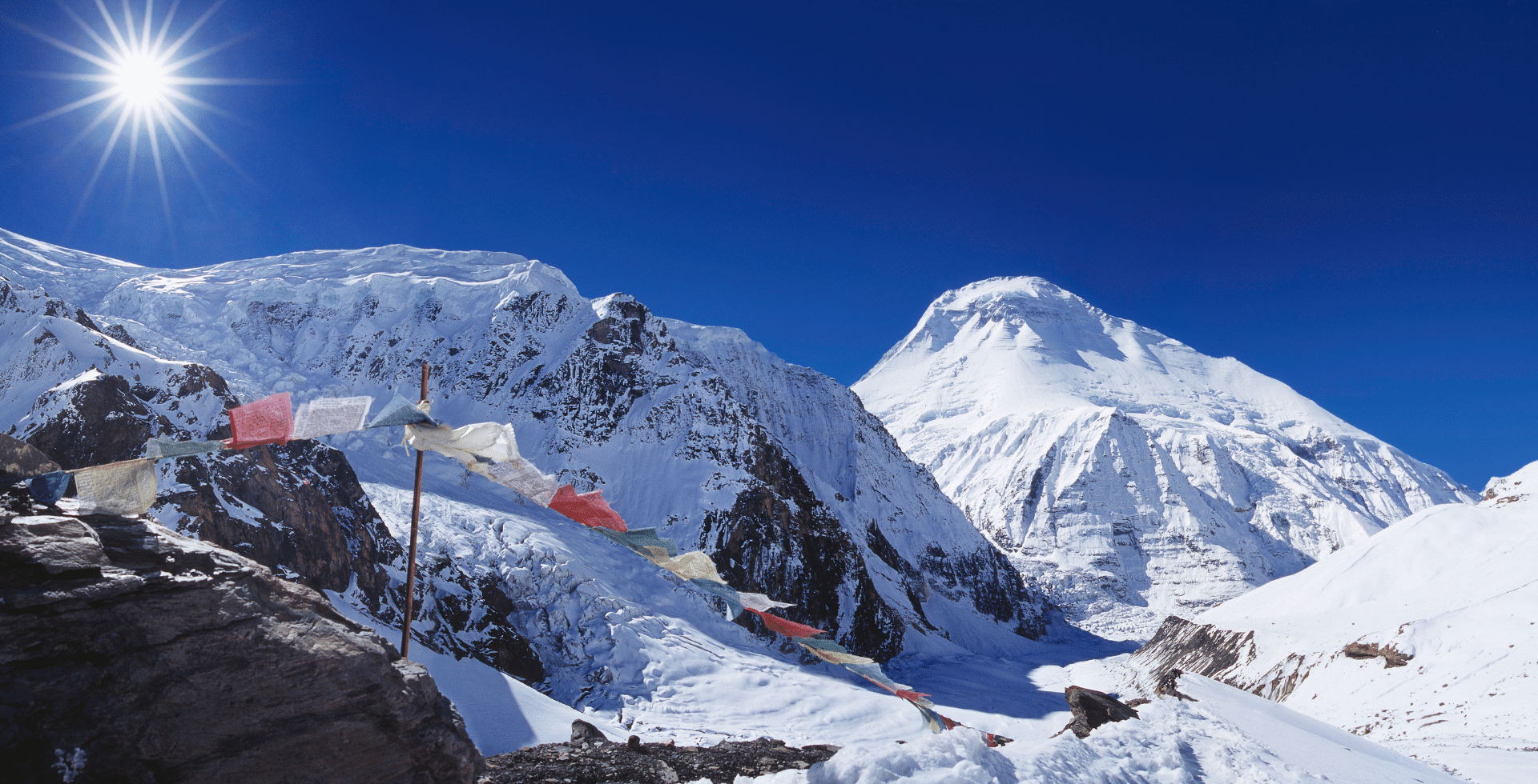
Mount Manaslu is the world’s eighth-highest mountain, standing at 8,163 m. It sits in the Mansiri Himal subrange of the greater Himalaya, roughly 100 km northwest of Kathmandu, Nepal.
Administratively, it lies in the Gorkha and Manang districts, within the Chumnubri and Nason Rural Municipalities, and inside the Manaslu Conservation Area.
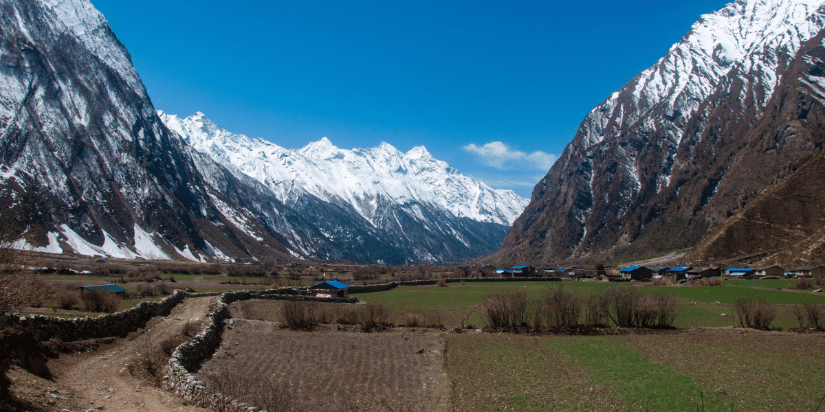
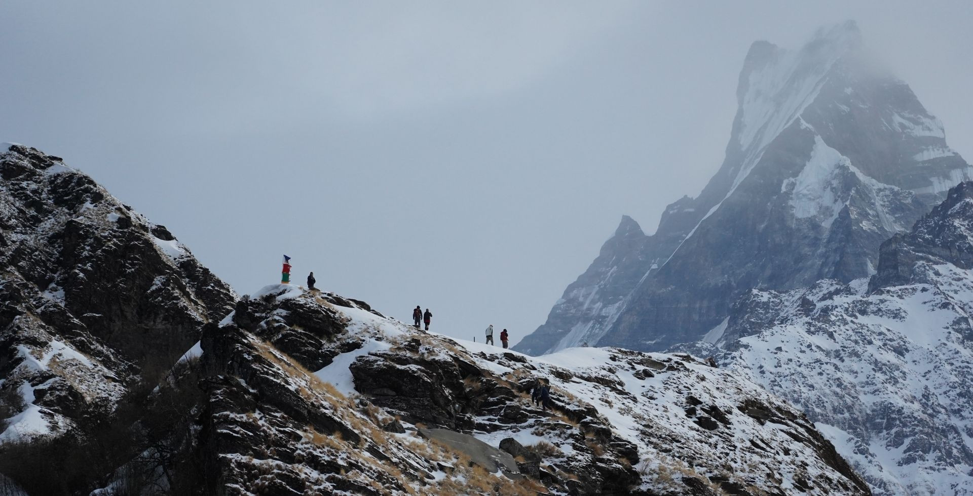
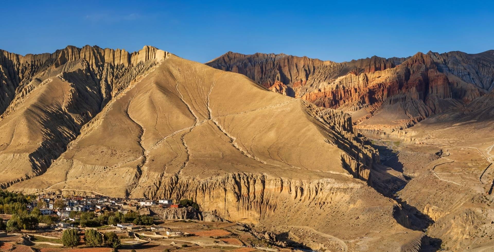
The Budhi Gandaki River carves a dramatic north-south gorge below Manaslu, with side valleys leading to Nubri (towards Samagaun and Samdo) and Tsum (towards Chhekampar and Nile).
Large sections of the Manaslu region are designated as restricted areas under Nepalese regulations. This applies especially to parts of the Tsum and Nubri valleys near the border.
The restrictions aim to protect sensitive border zones and preserve the cultural and environmental integrity of local communities. Trekking in these sections requires a Restricted Area Permit and the presence of a licensed guide and registered agency.
Manaslu’s name is generally linked to the Sanskrit word “Manasa”, often interpreted as “spirit” or “soul”. This is also why it is sometimes referred to as the “Mountain of Spirits”.
Quick Facts About Manaslu Mountain
|
Main Name
|
Manaslu
|
|
Other Names
|
- Killer Mountain
- Mountain of the Spirits
- Kutang
- Kampunge
- Peak 30
|
|
Elevation
|
8163 m
|
|
Mountain Range
|
Mansiri Mountain Range
|
|
Location
|
Border of Chumnubri Rural Municipality, Gorkha District, and Nason Rural Municipality, Manang District (in Gandaki Province)
|
|
Protected Area
|
Manaslu Conservation Area
|
|
Area of MCA
|
1,663 km²
|
|
Major Valleys
|
Nubri Valley, Tsum Valley
|
|
Ethnic Groups
|
Nubri and Tsum Tibetan communities, Gurung communities
|
|
Popular Regional Treks
|
Manaslu Circuit, Tsum Valley, Manaslu-Tsum combined, Manaslu-Annapurna Three Passes
|
|
River Systems
|
Budhi Gandaki and its tributaries mix into the Gandaki river system
|
|
Major Lakes
|
Birendra Lake, Kalchhuman Lake
|
|
Nearby Peaks
|
Ngadi Chuli, Himchuli, Cheo Himal, Shringi Himal
|
|
Permits
|
MCAP, ACAP, Restricted Area Trekking Permit, Mountaineering Royalty Fee, Chumnubri Rural Municipality Permit
|
|
First Ascent
|
Toshio Imanishi (Japan) and Gyaltsen Norbu (Sherpa) in 1956
|
Different Names and Meanings of Manaslu Mountain
“Manaslu” is just one of the many names used to describe this mountain. Each name it’s called by reflects the spirituality Manaslu evokes and the diverse terrain it offers.
The Killer Mountain
As you might guess, Manaslu’s “Killer Mountain” nickname comes from its history. Deadly avalanches, icefall collapses, and a comparatively high fatality rate among 8,000ers were the norm, especially in earlier decades.
The 2012 avalanche alone, triggered by a serac collapse above Camp 3, killed 11 climbers. To date, this remains one of the worst disasters on the mountain.
Elevation and Objective Hazards
Manaslu is a very high, glaciated peak with complex terrain. It contains heavily crevassed glaciers, steep snow slopes, and hanging seracs, especially on the upper sections of the standard climbing route.
Avalanches and serac collapses are the main objective dangers. These hazards are concentrated between Camps 2 and 3 (mainly above Camp 3) in many seasons.
Documented Accidents
Here are the key accidents that have shaped Manaslu mountain’s deadly reputation over the years:
- In April 1972, an avalanche on the northeast face claimed 15 lives, including ten Sherpas and the expedition leader.
- During the 1990 American expedition, a slab avalanche killed climbers and a Sherpa guide.
- A major accident occurred on 23 September 2012, when a large serac fell above Camp 3. This triggered an avalanche that struck Camps 2 and 3, killing 11 climbers!
- The most recent fatal incident occurred in autumn 2022 near Camp 3. This was due to unstable upper seracs and fresh snow, which cost the life of a professional Nepali guide and several other climbers were injured.
Well, these tragedies are simply examples that highlight the persistent risks on Manaslu. Despite its reputation as one of the more “attainable” 8,000‑meter peaks, make sure to keep all your senses awake if you’re attempting this giant.
Fatality and Success Rates
By December 2024, Manaslu had approximately 3,317 successful summits and about 90 deaths. This gives an overall fatality rate of around 2.7%. In 2025 alone, the Nepal Government issued permits to 457 climbers from 47 expedition teams.
Many commercial operators currently report success rates at the summit in the 60-70% range. Rates vary by season, weather pattern, and climber experience.
Compared with other 8,000ers like Annapurna (8,091 m) and Dhaulagiri I (8,167 m), Manaslu is not the most lethal.
But it is clearly more dangerous than peaks like Cho Oyu (8,188 m) and Lhotse (8,516 m). Manaslu’s risk profile is closer to mid-range 8,000ers, largely due to its avalanche and serac fall exposures.
Mountain of the Spirits
The word “Manaslu” is believed to originate from the Sanskrit word “Manasa”, relating to mind, soul, or spirit. This understanding leads to the widely used translation “Mountain of the Spirit”.
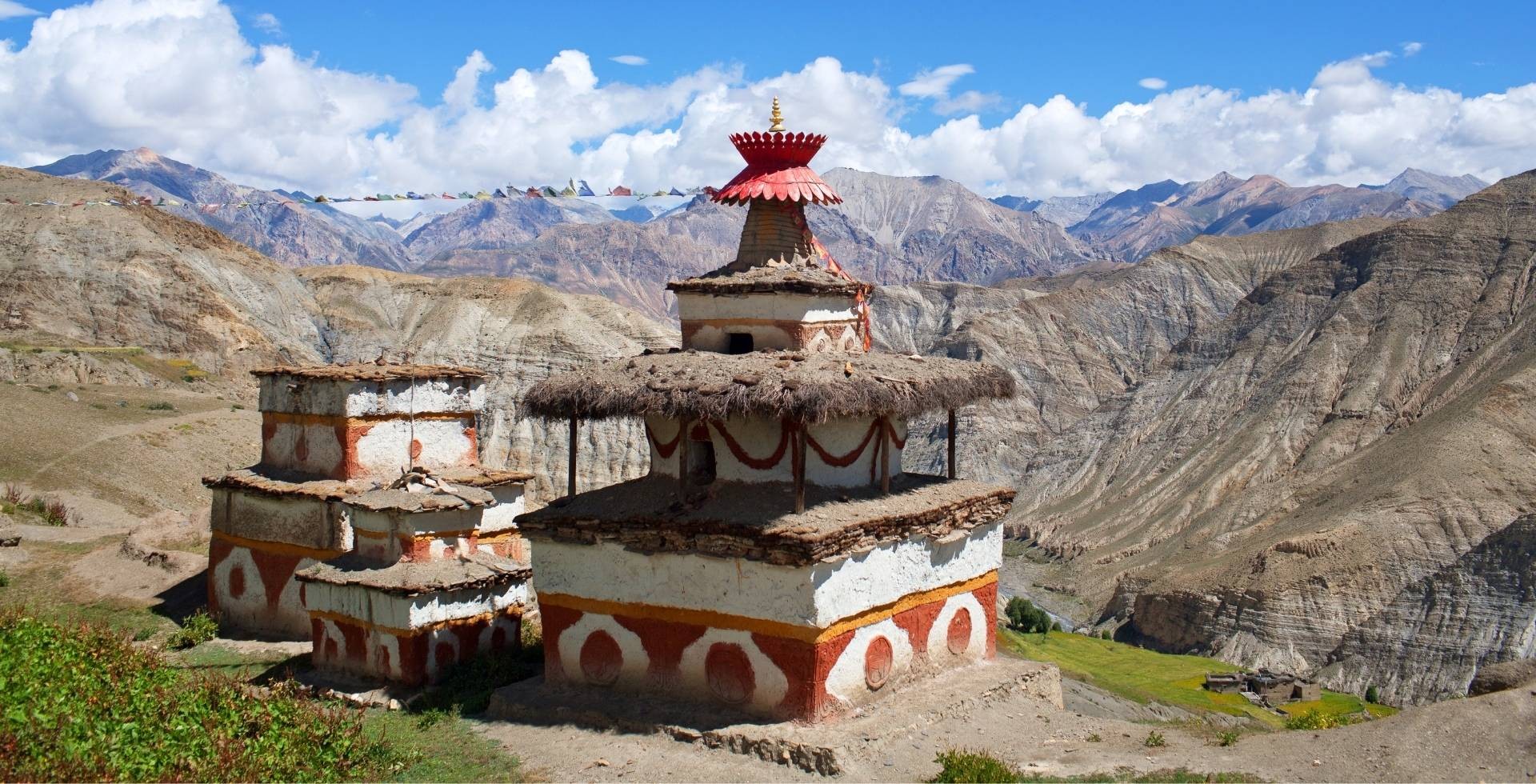
Locals from Nubri and Tsum call it 'lha ri' (god-mountain), home to protective deities that influence weather and fortunes. They have woven these names into their daily rituals, mantras, and the way they talk about weather, illness, and fortune.
Other Known Names
Locals also refer to Mount Manaslu as Kutang (or Kutan I), which means a “flat place” referencing the high plateaus and alpine terrain surrounding the mountain.
Another local name for the peak is Kampunge, which functions more as a regional name than a formal one.
Similarly, in early expeditions and survey records, when Manaslu was not formally recognised, it was simply referred to as Peak 30.
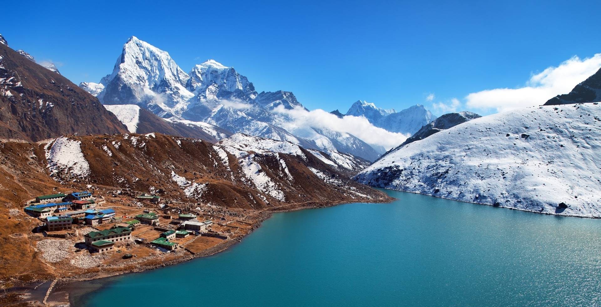
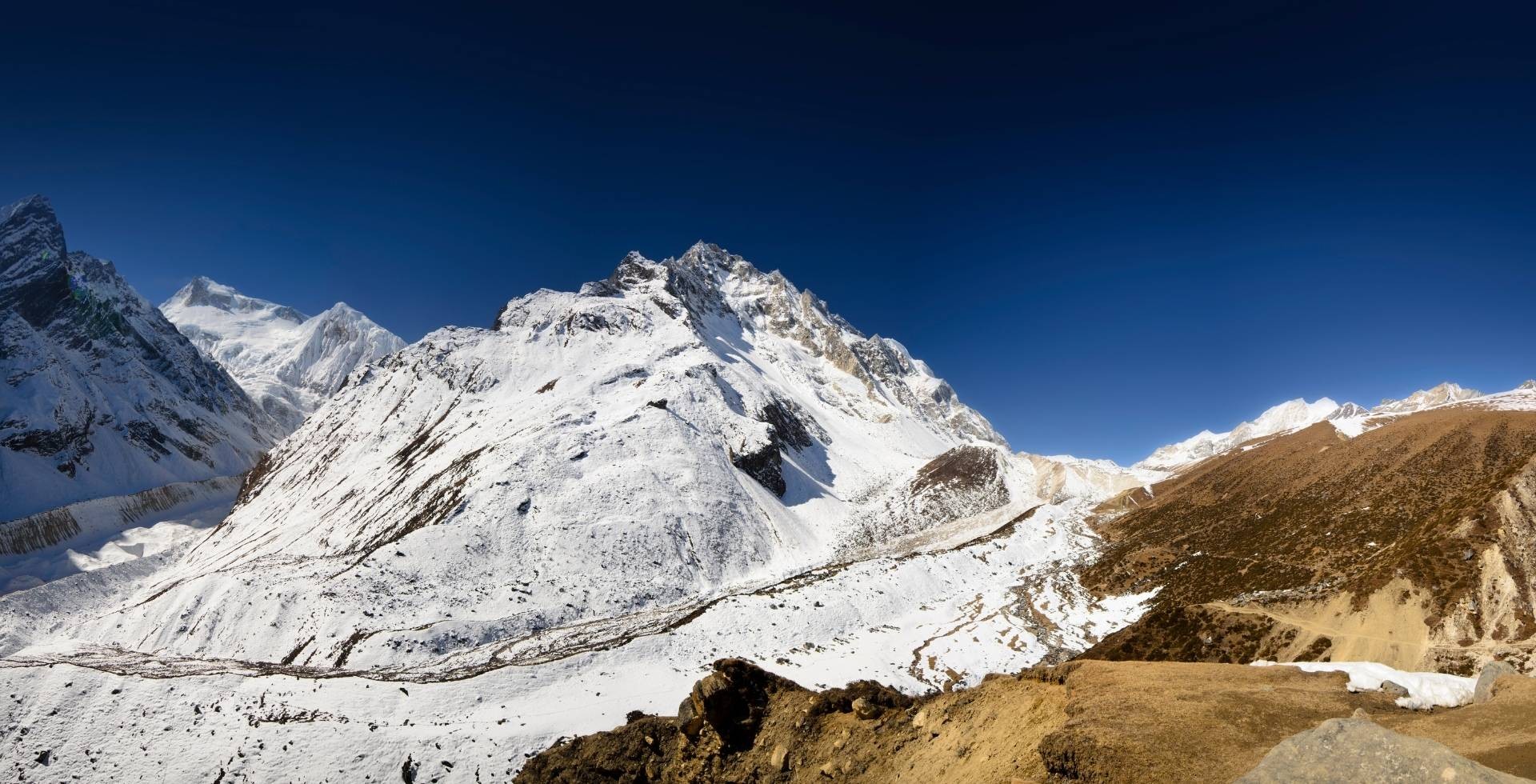
The Mansiri Himal Range: Mountains Around Manaslu
The Mansiri Himal range is a compact but very high subrange of the central Himalaya. It lies between the Marsyangdi River to the west and the Budhi Gandaki to the east.
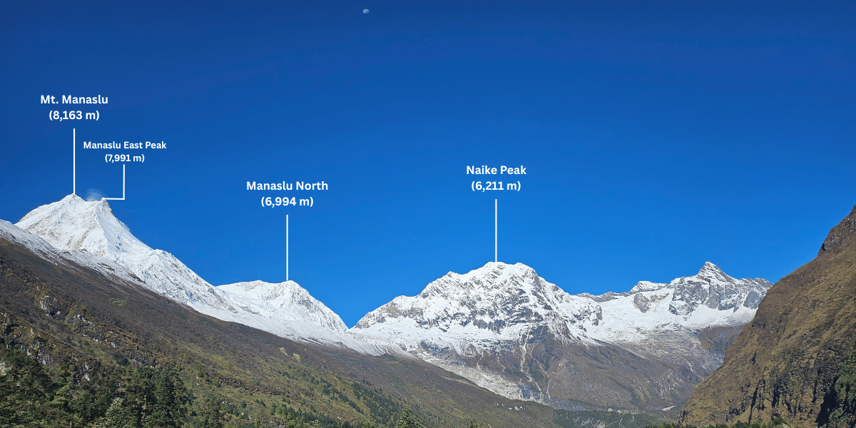
The range contains several major 7,000 m and 8,000 m peaks. Manaslu is the highest of these summits!
Aside from Mount Manaslu standing tall at 8,163 m, the Mansiri Himal Range is decorated by these mountains:
- Himalchuli - 7,893 m. Also called Himchuli, it’s a massive, hard-to-climb peak towering above the lower Gorkha hills.
- Ngadi Chuli (Peak 29) - 7,871 m, a notoriously difficult and rarely climbed peak.
- Shringi Himal - 7,187 m, standing west of the Budhi Gandaki, visible from villages like Deng and Prok.
- Manaslu North - 7,157 m, a secondary summit of the Manaslu massif, seen when doing the Manaslu Circuit trek.
- Baudha Himal - 6,672 m, a part of the enclosing wall of the Nubri Valley, and recent trekking routes like the “Buddha Himal-Himalchuli Circuit Trek”.
- Cheo Himal, Larke Peak, Naike Peak, and others - astonishing 6,000+ m summits guarding the Larke Pass.
These peaks together form a continuous high barrier. When trekking in the area, you move through an amphitheatre of high peaks that shape climate, water flow, and settlement patterns in most of central Nepal.
Local Beliefs and Cultural Significance of Manaslu
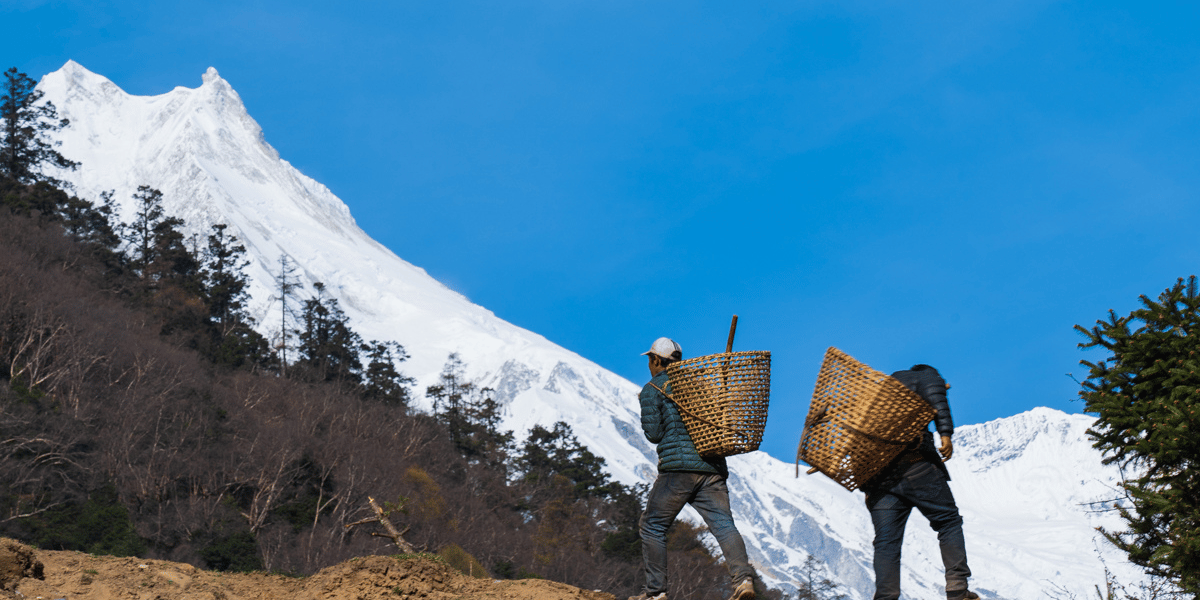
For the Nubri and Tsum valley communities, Manaslu is not just a geographic feature with a height and a rank.
It is a sacred presence for the local population, who are largely of Tibetan origin and follow Tibetan Buddhism. The way these people see the mountains shapes how they live, travel, and even how they respond to outsiders.
Sacred Mountains, Jibta, and Local Spirits
It’s not really a surprise that locals of Nubri, Tsum, and other communities of Manaslu see the high peaks as abodes of their Gods. These Gods are revered by different names, Iha being a collective of them all.
Here are some of the beliefs people abide by in Manaslu:
- Each major village in Chumnubri Rural Municipality has a corresponding Yul-Lha, i.e., the village’s guardian deity. Yul-Lha are believed to protect the people, livestock, crops, and settlements.
- Similarly, there are three nature guardian spirits that the locals believe in: Lha, Lu, and Shipda. Lha means the sky and mountain deities, Lu represents water and earth spirits, and Sa-Dha/Shipda are associated with land and soil.
- Mountains like Manaslu, Chhepchhe, Kipu, Taaya, and others are treated as living beings whose mood can change with behaviour, especially disrespect or pollution.
- Snow leopards, or 'Jibta' in the local tongue, are considered the guardians of high pastures, forests, and remote landscapes.
- When harvests fail, people get sick, and journeys get hazardous, locals believe it's caused by a local deity being disturbed or displeased.
Generally speaking, in Manaslu, misfortune is not random. It is a sign that the balance with the protector needs to be restored.
Conflict with Early Expeditions
These beliefs led to real tensions when foreign expeditions first arrived to scale Manaslu. The local villagers resisted and barred the Japanese climbers in 1954, fearing that ascending the mountain would anger the gods.
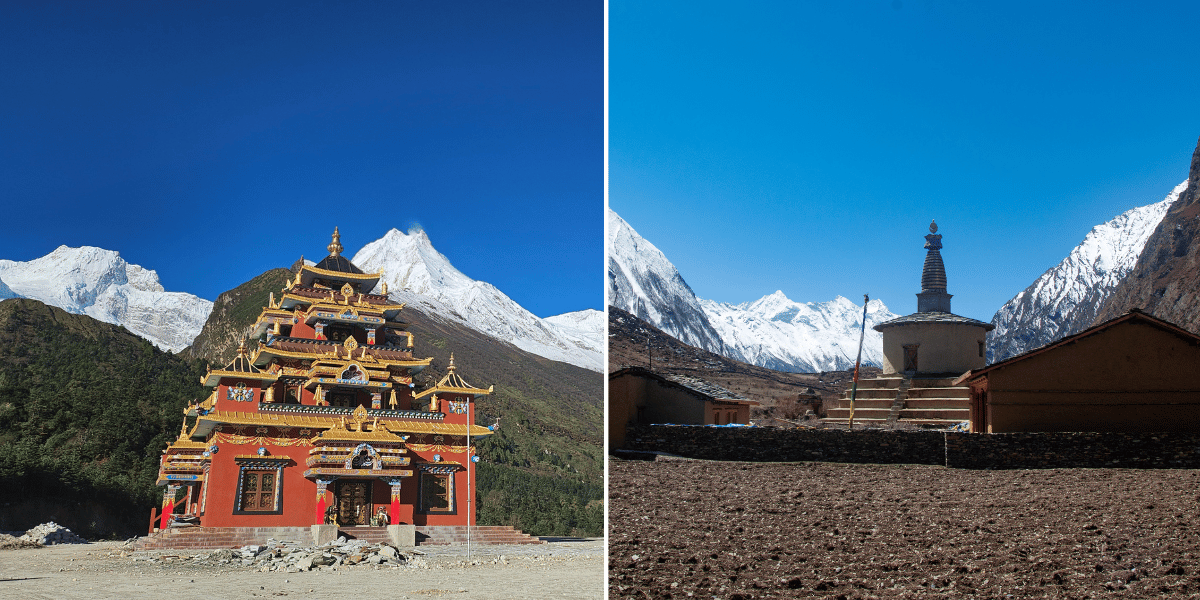
Their fears intensified after an avalanche allegedly triggered by a previous expedition destroyed the sacred Pungen Monastery and killed 18 people.
Villagers were convinced that the gods had been displeased and dishonored. Their hostility forced the expedition to retreat hastily to Ganesh Himal. As a way of “making up”, the team made a large donation to help rebuild the monastery.
However, this gesture was not nearly enough to ease the deep distrust towards Japanese climbers.
Even the successful ascent in 1956 faced similar opposition. As a result, no Japanese expedition returned to the mountain until 1971.
But it is not just about the eighth-highest mountain in the world. Chhepchhe, Khungghyu, Taaya, Kipu, and Fuchyong Himal are actually restricted from climbing because of these beliefs.
So, one thing is for sure: when you’re here, just be sure to respect the local culture and traditions.
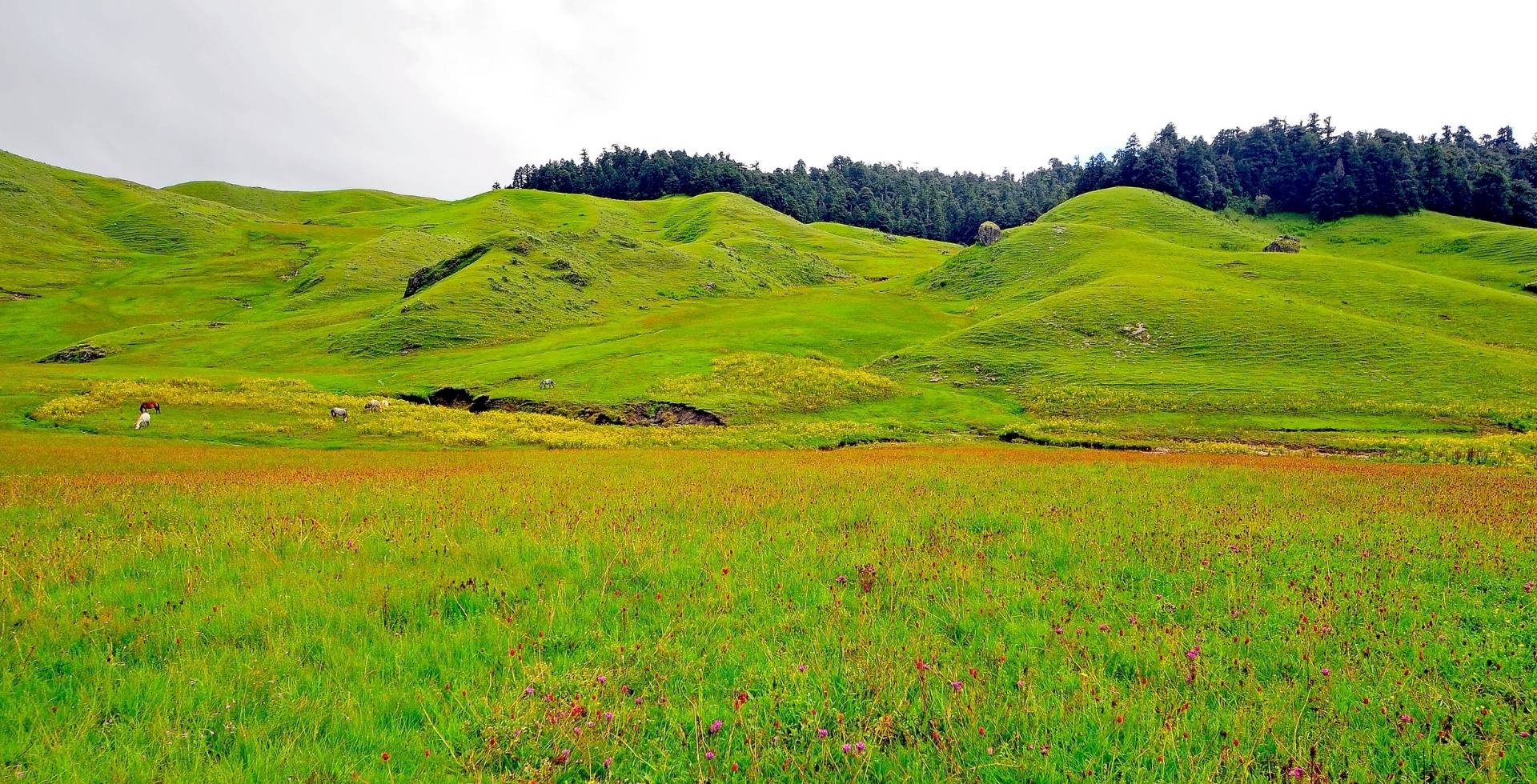
Manaslu’s Unique Ecosystem: Flora, Fauna, and Ecology
The Manaslu region was declared a Conservation Area in 1998 under Nepal’s National Parks and Wildlife Conservation Act. Management was given to the National Trust for Nature Conservation (NTNC) under the Manaslu Conservation Area Project (MCAP).
The Manaslu Conservation Area covers roughly 1,663 km². Elevation ranges from about 600 m to more than 8,000 m. The Manaslu Conservation Area runs from sub‑tropical river gorges to high alpine deserts, offering a huge range of habitats in its 1,663 km².
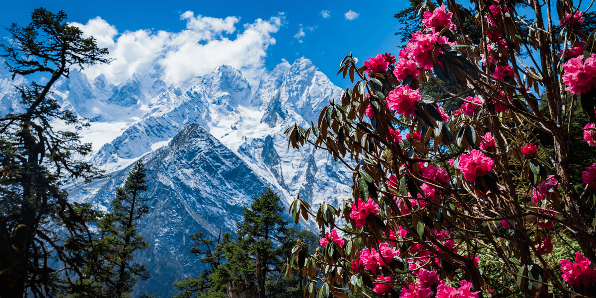
Lower areas around Soti Khola and Jagat hold mixed forests of pine, oak, and rhododendron. As you move up towards Samagaun and Samdo, vegetation gradually gives way to birch, juniper, and high-altitude shrubs.
Spring rhododendron around 2,500-3,500 m turns parts of the trail into a red, pink, and white tunnel. This still surprises trekkers who think of Manaslu only as ice and rock.
Wildlife highlights
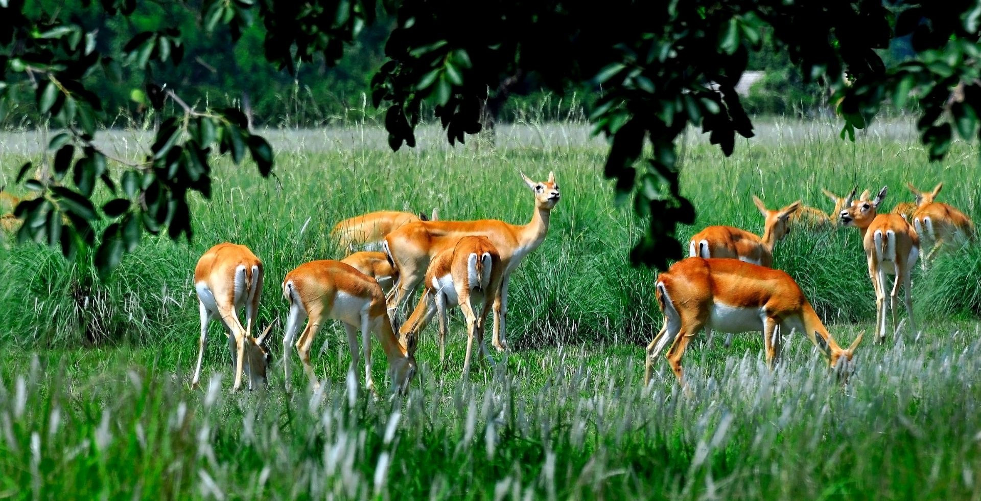
The Manaslu region is home to over 2,000 species of plants, 39 mammals, 201 birds, 3 reptiles, and 11 butterflies in 11 types of forest. Here are some of the wildlife you can expect when visiting here:
- Snow leopard: They are the elusive apex predators of Manaslu Conservation Area. They prowl high alpine zones above 3,500 m near Samagaon and above, leaving faint tracks and scrapes as signs of their nocturnal hunts.
- Red panda: They are rare, but they dwell in temperate forests around Prok and Nupri (2,500-4,000 m), munching bamboo in rhododendron canopies
- Blue sheep and Himalayan tahr: They graze openly on cliffs near Lho and Samagaun. These are the few animals that you’ll actually encounter in your treks.
- Birds: Pheasants, Himalayan monals, and raptors like golden eagles circling high above ridges make Manaslu Conservation Area one of the best spots for bird watching in Nepal.
When you take a deep look, Manaslu becomes less of a single mountain and more of a living, layered ecosystem!
Conservation Efforts and Challenges
The Manaslu Conservation Area is managed by the National Trust for Nature Conservation (NTNC). The NTNC works with local communities on wildlife protection, waste management, and sustainable tourism.
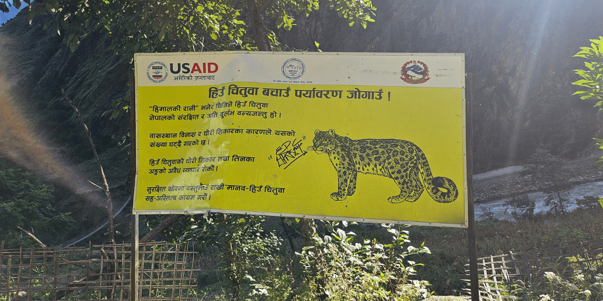
The current anti‑poaching efforts focus on protected species like snow leopards and red pandas. Over the recent years, directly educating the local communities has helped reduce illegal hunting compared to earlier decades. Research is conducted regularly to develop a database on biodiversity and socio-economic conditions in the region
While the community efforts have helped, there is a growing number of trekkers in the area. With more trekkers, plastic waste has increased, and there is pressure on firewood and grazing land.
Choosing agencies that prioritize responsible practices is one of the most direct ways you can help.
Summiting Manaslu: Is it Possible?
The short answer is yes, but only for the truly prepared.
Manaslu is marketed by some operators as a relatively “attainable” 8,000 m peak. This means that, in purely technical terms, the normal route does not require extreme mixed or vertical ice climbing when well fixed.
However, this label can be misleading. Crevasse fields, avalanche-prone slopes, and high‑altitude exposure mean it belongs firmly in the “elite” category.
Routes and Avalanche‑prone Zones
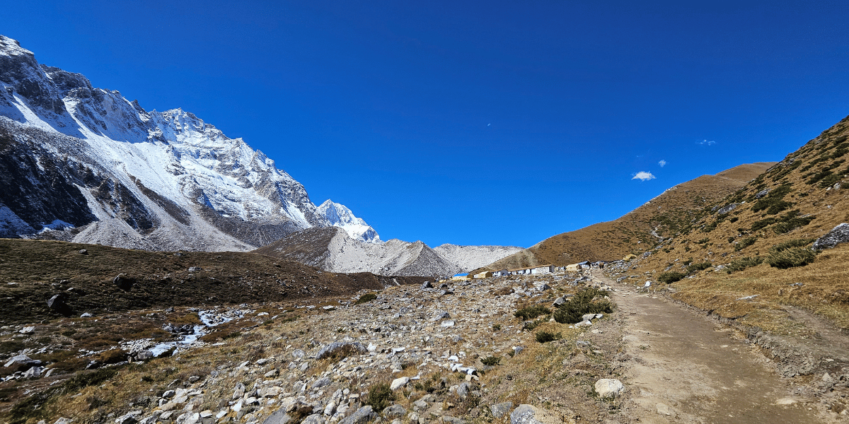
Most commercial expeditions follow the northeast route from Manaslu Base Camp above Samagaun, moving through a series of camps on the glacier and snow slopes.
As mentioned earlier, avalanche and serac‑fall hazard is particularly serious between Camps 2 and 3 (mainly above Camp 3), where steep slopes and hanging ice are common.
Aside from the main Northeast route to the top, several other routes attract more experienced and exploratory teams:
- The North route was the line of the first ascent in 1956, though it is rarely attempted these days.
- The Northwest Spur follows a ridge with more continuous climbing. Among the alternate routes, this route is attempted more often than others.
- The Southwest Face is an even more complex wall of steep snow, ice, and scar bands. It has seen fewer than 10 known ascents, including a new Russian line in 2024.
- West Couloir/South Ridge line is another rarely attempted route, climbing a narrow gully and ridge system on the west side of the mountain. It has seen under 20 recorded summits and very limited traffic.
Climbers spend days assessing snow loading, wind slabs, and temperature trends. Good operators are willing to turn around even after weeks of effort if conditions look unstable.
Camps and elevation of the main route to Manaslu:
- Base Camp: 4,800 m
- Camp 1: 5,700 - 5,800 m
- Camp 2: 6,300 - 6,400 m
- Camp 3: 6,900 m
- Camp 4: 7,300 m
- Summit: 8,163 m
Note: Exact altitudes vary by expedition and season. The upper ridge includes a known “false summit” where some climbers historically stopped below the highest point.
Climbing History and Carlos Soria’s Incredible Ascent
Manaslu was first climbed in 1956 by a Japanese expedition led by Toshio Imanishi and Gyalzen Norbu. Of course, it was after years of tension with local communities who opposed early attempts on the mountain.
Over time, their opposition lightened. Following this success, Manaslu became a regular objective on the 8,000-metre circuit for climbers of all grades.
In September 2025, the mountain returned to global headlines because of the legendary Spanish mountaineer Carlos Soria Fontán. He made headlines by summiting Manaslu at age 86, becoming the oldest person to climb an 8,000‑metre peak.
This was Carlos’s second Manaslu summit. He had already reached the top in 2010 at age 71, without supplemental oxygen. This feat turned Manaslu into his long, personal story of his lifelong climbing journey.
Permits and Requirements for Expeditions
Climbing Manaslu requires a dedicated expedition permit issued by Nepal’s Department of Tourism, in addition to standard conservation and restricted-area permits. These are the requirements you must fulfil before you attempt the peak:
- Expeditions must arrange:
- Liaison officers
- Insurance for Nepali staff
- Sherpa support
- Full logistical coordination
- Should be of the age 16 or above to get a climbing permit.
- Most importantly, many companies require you to have prior experience of 7,000 m or 8,000 m peaks.
Commercially guided Manaslu expeditions typically cost tens of thousands of US dollars per climber. Prices vary widely depending on Sherpa-to-client ratios, oxygen use, logistical support, personal gear inclusion, and the operator’s experience and reputation.
Here’s a basic list of permits you’ll need if you are thinking of climbing Manaslu Mountain:
- A Manaslu expedition climbing permit from Nepal’s Department of Tourism.
- Manaslu Conservation Area Project (MCAP) Permit
- Manaslu Restricted Area Permit
- Chumnubri Rural Municipality Permit
- Annapurna Conservation Area Project (ACAP) Permit
I have mentioned the permit price and coverage breakdown in the upcoming sections.
Popular Trails Around Manaslu: Best Itineraries
In the Manaslu region, you’re not locked into just one route. This region offers several trekking options, from classic circuits to quieter side valleys and longer high-pass journeys.
You get to pick an itinerary based on how much time you have, how comfortable you are at altitude, and how ambitious you want the trek to be. Here are the major treks I believe cover the essence of Manaslu region trekking.
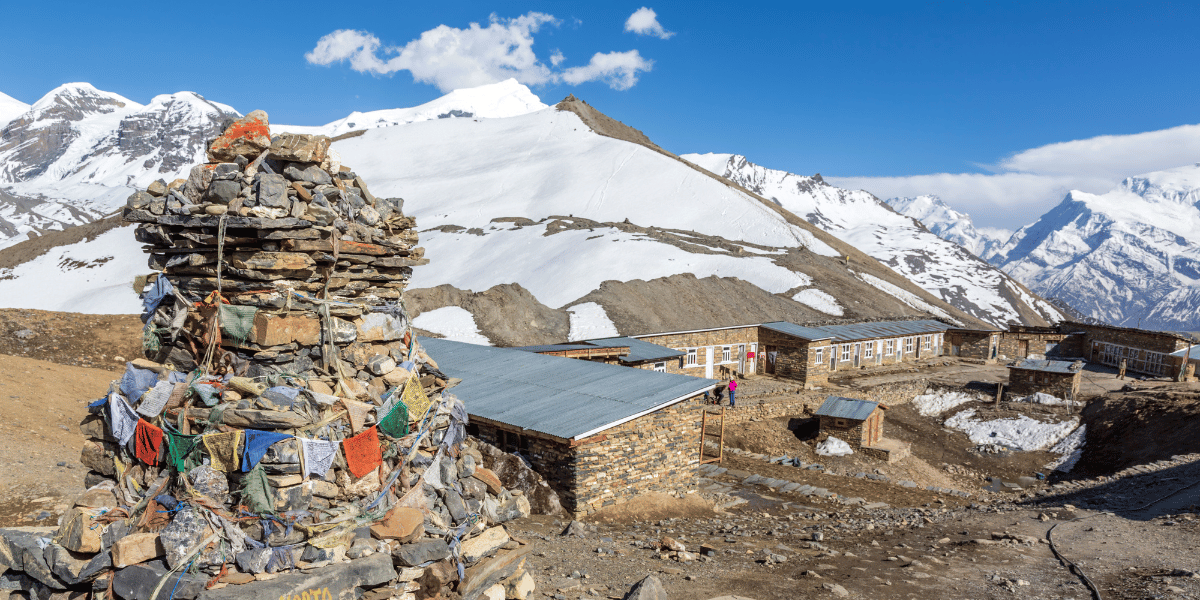
The Manaslu Circuit is a high‑altitude loop around the massif. It usually takes 13-18 days, depending on pace and side trips.
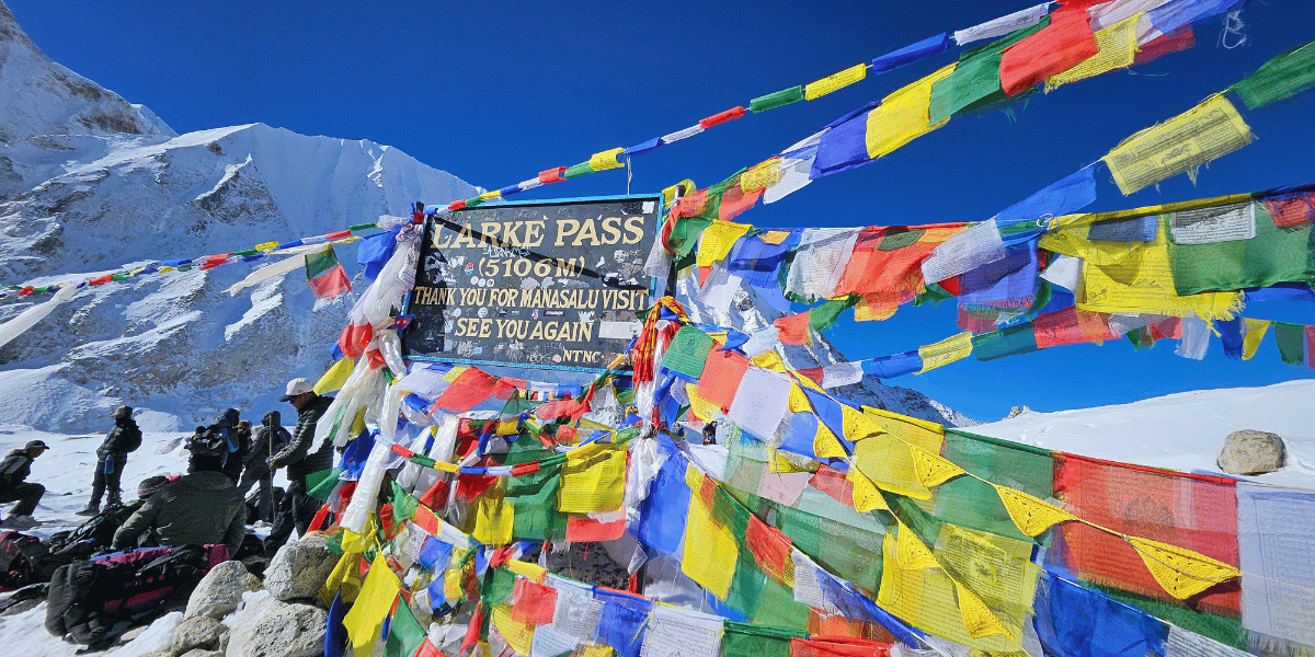
The route typically begins near Machha Khola, Jagat, or Philim. It follows the Budhi Gandaki gorge through villages such as Jagat, Deng, and Namrung, then passes Lho, Shyala, Samagaun, Samdo, and crosses Larkya La (5,106 m) before descending to Tiliche and the Annapurna side.
The classic Manaslu Circuit Trek offered by Altitude Himalaya has the following itinerary:
- DAY 01: Kathmandu Arrival.
- DAY 02: Kathmandu Sightseeing, Trek Preparation.
- DAY 03: Drive to Macchakhola.
- DAY 04: Macchakhola to Philim Drive, Reach Deng.
- DAY 05: Deng to Ghap.
- DAY 06: Gap to Lhi.
- DAY 07: Lhi to Shyala.
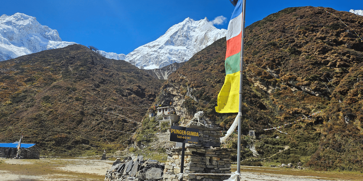
- DAY 08: Visit Pungen Gumba, Reach Samagaun.
- DAY 09: Samagaun Rest Day, Optional Hikes.
- DAY 10: Samagaun to Samdo.
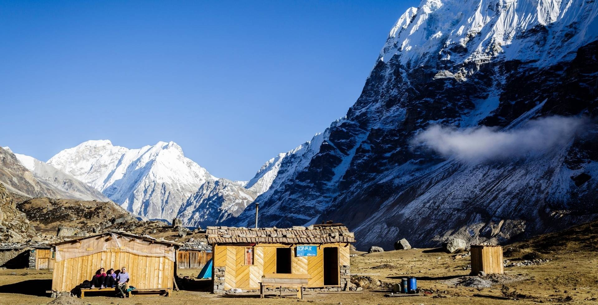
- DAY 11: Samdo to Dharmashala.
- DAY 12: Dharmashala to Bhimthang via Larke Pass.
- DAY 13: Bhimthang to Tilche.
- DAY 14: Tilche to Kathmandu Drive, Farewell Dinner.
- DAY 15: Farewell, Departure.
Note: We also do Manaslu Circuit group-joining adventures. And if you’re from Australia, be sure to check this dedicated 15-day Manaslu package.
The Tsum Valley Trek diverges from the main circuit in Gampul and then goes to Lokpa. It enters a side valley with strong Tibetan cultural influence and several important monasteries.
Settlements such as Chumling, Chhekam, Lamagaun, and Nile provide insight into traditional trans‑Himalayan life. The route includes Mu Gompa and other monastic sites near the head of the valley.
The Tsum Valley Trek can be completed within 13 days with the following itinerary:
- DAY 01: Kathmandu Arrival.
- DAY 02: Kathmandu Sightseeing and Trek Preparation.
- DAY 03: Drive to Machha Khola via Soti Khola.
- DAY 04: Machha Khola to Jagat.
- DAY 05: Jagat to Lokpa.
- DAY 06: Lokpa to Chumling.
- DAY 07: Trek to Chhokang Paro.
- DAY 08: Trek to Mu Gumba.
- DAY 09: Trek to Chhokang Paro.
- DAY 10: Trek to Lokpa.
- DAY 11: Trek to Jagat.
- DAY 12: Drive from Tatopani (Jagat) to Kathmandu.
- DAY 13: Departure, Farewell.
A combined Manaslu Circuit plus Tsum Valley itinerary integrates both the main loop and the side valley. This requires a longer schedule, often more than 20 days.
The combined trek increases cumulative elevation gain and total days at altitude. It is therefore suited to experienced trekkers with good fitness and adequate time.
The reward is that you get to experience almost every highlight of the Manaslu region, making it the most complete option for exploration.
The Manaslu-Tsum Valley Trek itinerary looks like the following:
- DAY 01: Kathmandu Arrival.
- DAY 02: Kathmandu Cultural Sightseeing.
- DAY 03: Drive to Machhakhola.
- DAY 04: Trek to Jagat.
- DAY 05: Trek to Lokpa.
- DAY 06: Trek to Chhokangparo.
- DAY 07: Trek to Nile.
- DAY 08: Trek to Mu-Gompa, Back to Lamagaun.
- DAY 09: Trek to Lokpa.
- DAY 10: Trek to Deng.
- DAY 11: Trek to Namrung.
- DAY 12: Trek to Lho Gau.
- DAY 13: Trek to Samagau.
- DAY 14: Acclimatization Day at Samagau.
- DAY 15: Trek to Samdo.
- DAY 16: Trek to Dharmashala.
- DAY 17: Trek to Bhimtang via Larkya la pass.
- DAY 18: Trek to Tilje.
- DAY 19: Tilje to Dharapani, Drive to Kathmandu.
- DAY 20: Leisure in Kathmandu.
- DAY 21: Departure.
Manaslu-Annapurna Extended Routes
Some itineraries continue from Manaslu into extended Annapurna circuits or multi-pass routes. These turn the trek into a continuous journey of more than three weeks, with repeated crossings above 5,000 metres.
Because of this, they demand careful logistics, solid acclimatization planning, and close attention to weather and seasonal conditions.
The Manaslu–Annapurna Three Passes Trek combines two of Nepal’s most iconic routes into a single, demanding journey. Along the way, you cross three major high passes: Larkya La, Kang La, and Thorong La.
The breakdown of the itinerary is as follows:
- DAY 01: Kathmandu Arrival.
- DAY 02: Kathmandu Sightseeing and Trek Preparation.
- DAY 03: Drive to Dobhan, Trek to Jagat.
- DAY 04: Jagat to Deng.
- DAY 05: Deng to Namrung.
- DAY 06: Namrung to Lho Gaun.
- DAY 07: Lho Gau to Samagaun.
- DAY 08: Acclimatization at Samagaun.
- DAY 09: Samagau to Samdo.
- DAY 10: Samdo to Dharmashala.
- DAY 11: Dharmashala to Bhimtang via Larkya La Pass.
- DAY 12: Bhimtang to Tilje.
- DAY 13: Tilje to Koto.
- DAY 14: Koto to Meta.
- DAY 15: Meta to Nar Village.
- DAY 16: Nar Village to Ngawal via Kang La Pass.
- DAY 17: Ngawal to Manang.
- DAY 18: Manang to Yak Kharka.
- DAY 19: Yak Kharka to Thorong High Camp.
- DAY 20: Trek to Muktinath via Thorong La Pass.
- DAY 21: Muktinath to Jomsom via Lupra Village.
- DAY 22: Fly to Pokhara.
- DAY 23: Fly to Kathmandu, Leisure Day.
- DAY 24: Departure, Farewell!
Difficulty of Manaslu Region Treks: Is Manaslu for You?
The trails of Manaslu are high, remote, and honestly, long and exhausting.
If you are considering the Manaslu region as your next trekking destination and want to make the most out of it, you should know what challenges you might stumble into.
For Regional Treks
- Physical difficulty: The Manaslu Circuit and Tsum Valley are generally graded as difficult. You’ll have to face long walking days, significant elevation gain, and a 5,000 m-class pass like Larkya La. These days will test your endurance but also feel the most satisfying once you’re through.
- Altitude: Altitude is one of the biggest factors in Manaslu and will shape much of your experience. Since you spend many nights above 3,000 m, passes can take you near or above 5,000 m; proper acclimatization is not something you can rush. You need to be prepared to slow down or stop altogether if symptoms of altitude sickness appear.
- Trail conditions: Trail conditions vary a lot across the region. Lower sections can be hot, humid, and rough, especially in the river valleys. Higher up, depending on the season, you may encounter snow, ice, or exposed traverses that require careful footing and focus.
To sum up everything mentioned above, if you’re reasonably fit and willing to go slowly, Manaslu is absolutely doable.
To sum up everything mentioned above, if you’re reasonably fit and willing to go slowly, Manaslu is absolutely doable.
When you book a trek with Altitude Himalaya, we ensure that you’ll be walking with a professional guide who makes a big difference. They keep an eye on your pace, hydration, and acclimatization.
- Packing and seasons: Bring layered clothing, sturdy boots, a sleeping system, and personal gear suited to both warm valleys and cold high passes. You can review our complete Manaslu trekking packing list guide for complete details.
The best seasons are spring (March to May) and autumn (October to November), when the weather is most stable and visibility is at its best.
When trekking with Altitude Himalaya, we guarantee accommodation, proper permits, and support throughout your journey.
For the Summit
The summit of Manaslu sits on a completely different level of difficulty. Its difficulty far exceeds the trek in both technicality and associated risks.
- Technical challenges: You will travel through glaciers, ascend using fixed ropes, and navigate crevasses and seracs, and you must understand the possibility of hazards of avalanches.
- Experience requirement: You should already have prior 7,000 m experience (and ideally 8,000 m) along with ice-climbing skills. And of course, you must know your way around using crampons, jumars, and descenders for long hours.
- Risk tolerance: Even with the best operator, risk cannot be reduced to trekking levels. You must be confident in making serious decisions about weather and conditions. If things start going wrong at any point, you should be prepared to make your way back right away.
If all of this feels overwhelming, it’s okay! The circuit and valleys are spectacular on their own. They give you a full, immersive Manaslu experience without stepping onto its dangerous ground.
What Permits Do You Need for Manaslu Region Trekking?
For the Manaslu Circuit Trek, you require two conservation area permits, as the trek passes through the Manaslu Conservation Area and the Annapurna Conservation Area.

And since Manaslu is a restricted region, a RAP (Restricted Area Permit) is also required. Lately, even the rural municipality has started collecting additional funds for conservation and development purposes, too.
There is another document you can get called the Trekkers Information Management System (TIMS) card. To make it clear, the TIMS card isn’t mandatory anymore. Still, for your own safety, you can get it through trekking agencies like the Altitude Himalaya.
The cost breakdown for all permits needed for the Manaslu region is in the table below:
|
Permits
|
Season
|
Nepali Citizens
|
SAARC National
|
International Trekkers
|
|
Manaslu Conservation Area Project (MCAP) Permit
|
All
|
-
|
NPR 1000
|
NPR 3000
|
|
Manaslu Restricted Area Permit
(covers Chumnubri Rural Municipality 1, 2, 3, and 4)
|
September to November
|
-
|
For a week: USD 100
|
|
Beyond 1 week: USD 15/day
|
|
December to August
|
-
|
For a week: USD 75
|
|
Beyond 1 week: USD 10/day
|
|
Chumnubri Rural Municipality Permit
|
All
|
NPR 200
|
NPR 1000
|
|
Tsum Valley Restricted Area Permit
(covers Chumnubri Rural Municipality 3, 6, 7)
|
September to November
|
-
|
For a week: USD 40
|
|
Beyond 1 week: USD 7/day
|
|
December to August
|
-
|
For a week: USD 30
|
|
Beyond 1 week: USD 7/day
|
|
Annapurna Conservation Area Project (ACAP) Permit
|
All
|
-
|
NPR 1000
|
NPR 3000
|
Note: All permits are free for children below 10 years. You’ll, however, need proof of their age to claim this perk.
Tips to Better Explore Mt. Manaslu
Manaslu reveals itself not just to those who reach the peak but to trekkers who pause at the right ridges and villages.
To explore Manaslu is to experience the mountains, culture, and people fully. Knowing where to go, how to behave, and how to plan your days can turn a trek from “done it” to truly lived.
Major Attractions and Viewpoints
Some of the best vantage points are along the Manaslu Circuit, which we cover in detail in our main guide:
- Lho and Shyala: Lho gives you the first glimpse of Manaslu mountain. Then, from Shyala, you get a stunning view as well, and then you get to hike to Pungen Gumba for close-up views of Manaslu.
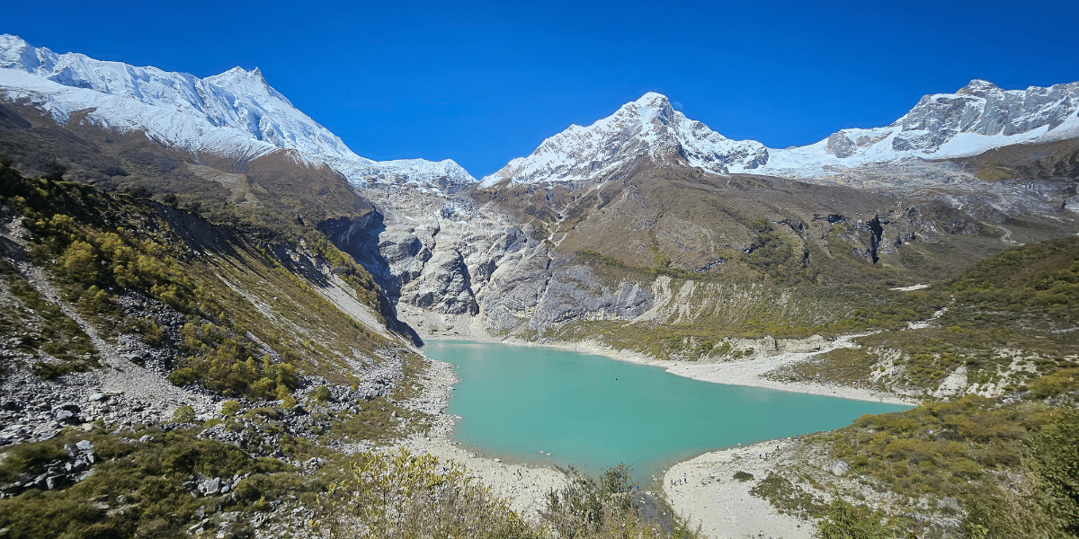
- Samagaun: the classic village base for side trips to Manaslu Base Camp and Birendra Lake, with huge frontal views of the peak.
- Larke Pass (aka Larkya La): a high, wide vantage point looking out over Cheo Himal, Himlung, Kang Guru, and the sweeping glaciated skyline beyond. Larke Pass is the highest point of your Manaslu circuit trek. At the pass, Mt. Manaslu is hidden, but the view of other mountains from the Mansiri range won’t let you feel its absence.
Plan your days so you arrive at these major attractions with enough energy to explore, rather than collapsing into bed. It is one of those small things that make a trekking experience feel full.
Dos and Don’ts
|
Things to Do
|
Things to Avoid
|
|
Carry small trash bags to collect your garbage.
|
Don’t wear your boots or sandals when entering sacred sites.
|
|
Respect local customs and learn basic Nepali greetings like “Namaste”.
|
Don’t bargain aggressively in small villages
|
|
Keep your permits with you to show them to the respective offices on the Manaslu Circuit trail.
|
Don’t leave the group without informing the guide.
|
|
Respect other trekkers’ privacy and walk in a queue (if required when the trail is crowded).
|
Don’t make excessive noise that disturbs others (avoid carrying speakers).
|
|
Ask before photographing locals.
|
Don’t get drunk at high altitudes.
|
|
Give way to trekkers, porters, and animals coming from the opposite side.
|
Don’t panic in case you fall down or show signs of altitude sickness.
|
Preparation Before the Trek
The Manaslu circuit demands mental endurance, physical fitness, proper planning, and trekking experience.
We recommend starting your preparation with long-distance walking, strength training, cardio training, food and diet planning, budget allocation, etc.
If your schedule allows it, it’s better to trek at a higher altitude first, before attempting Manaslu, so that your body can adapt faster.
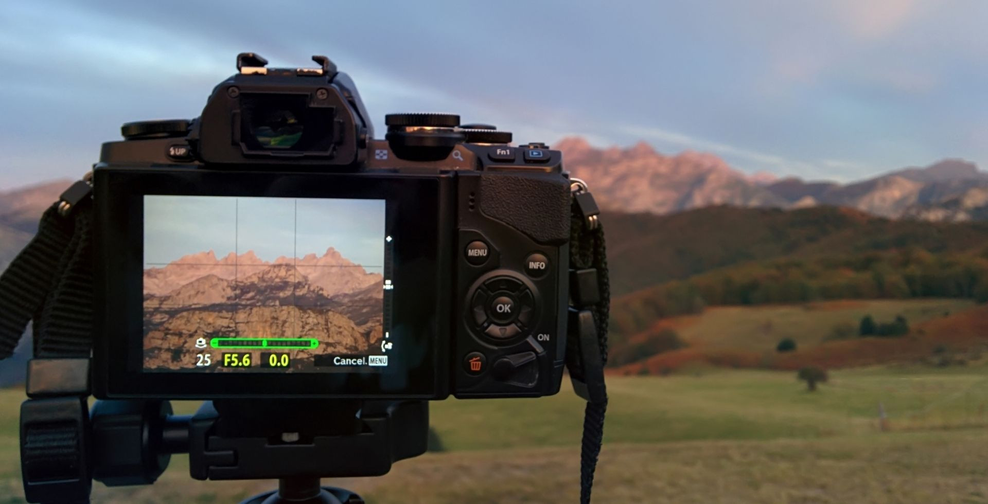
- Pack wisely: You need to carry layered clothing, waterproof jackets, good trekking boots, trekking poles, and first aid items. Carry enough snacks, water purification tablets, a good camera if you have one, and even a journal
- Best seasons: Plan your trek for the right time. We recommend Spring (March–May) for rhododendron blooms and autumn (October to December) for clear skies.
- Weather awareness: It is given that the upper sections can be icy and snowy, while the lower valleys are hot and humid. There is no one-size-fits-all weather condition for the entire trek. So, do your research and check conditions beforehand.
- Mindset: In long treks (like this one in the Manaslu region), your mental strength is surprisingly tested more than your physical fitness! You should understand that delays, rough terrain, and unexpected weather are inevitable. A good mindset will help you make the most out of your trip.
With all this in mind and practice, Manaslu will surely turn into a journey towards the story you will carry home.
Final Thoughts
If I could explain all this to my grade‑6 self, I would probably start by saying: the “Killer Mountain” tag is both accurate and incomplete.
Yes, Manaslu has taken lives. It is high, cold, and dangerous for climbers who step onto its upper slopes. But it is also alive in ways that go beyond height or danger. Villages, forests, animals, and monasteries all exist in its shadow, carrying on their routines no matter the storms above.
People still climb it because risk is part of mountaineering and because certain goals, personal, cultural, or professional, are worth that risk to them. People still trek around it because, even from a safer distance, Manaslu has a presence that is hard to describe and harder to forget.
In the end, Manaslu is more than a statistic, a “Killer Mountain”, or a trekking route. It is a living landscape, one that asks for respect, curiosity, and patience. “Which mountain is called the Killer Mountain?” is a start, not an end. Manaslu is not just a fact to memorise; it is a place to understand.


 Karuna Bhattarai