Langtang National Park is one of those places where the Greater Himalayas feel so close and still just as authentic as in any remote trails.
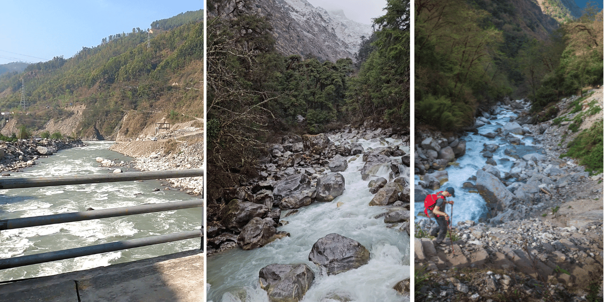
You leave Kathmandu in the morning, ride out of the smog and traffic, and by evening, you are listening to rivers thunder through deep gorges under steep green hills.
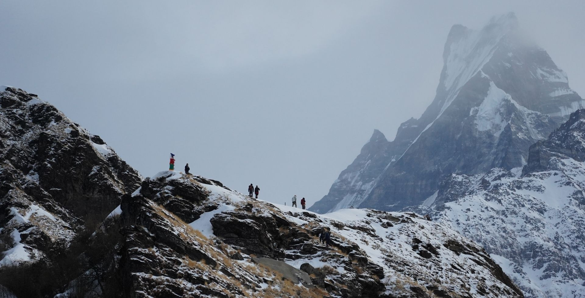
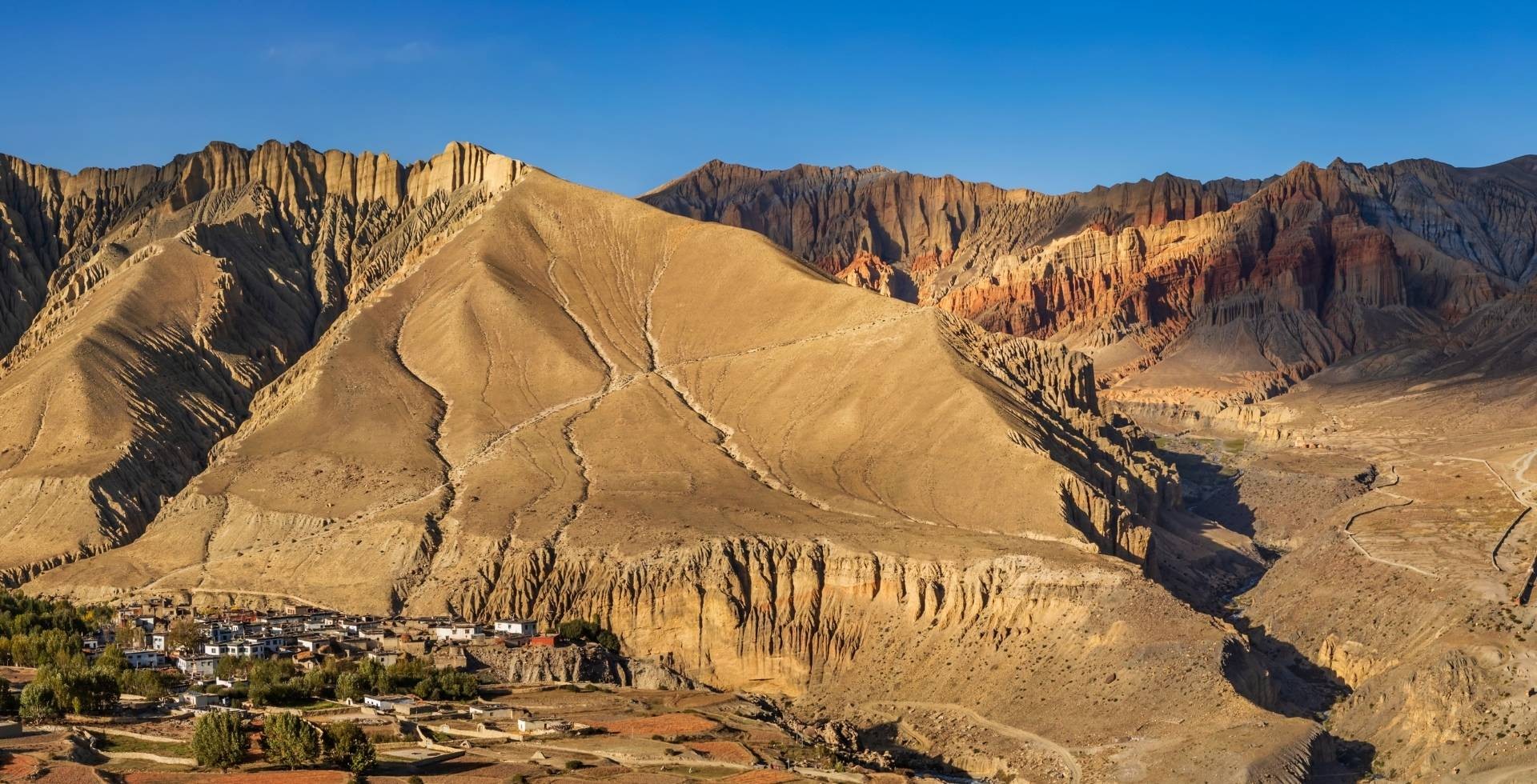
Another day or two on foot, and you are already walking towards the Valley of Glaciers with a wall of stunning sky-touching peaks that sit right on the border with Tibet.
Established in 1976, Langtang National Park is Nepal’s first Himalayan national park. Inside its 1,710 square kilometres, the land rises from warm subtropical river valleys to more than 7,000 m on peaks like Langtang Lirung.
That sharp variation in elevation is what creates Langtang’s famous mix of forests, wildlife, glaciers, and mountain cultures so close to Kathmandu.
Believe it or not, more than 30,000 visitors entered the Langtang-Gosaikunda region between Shrawan and Poush 2082 BS (July to December 2025) alone. Local authorities expect the total for this fiscal year to reach above 50,000.
Yet, when you are actually on the trail, Langtang still feels quiet and comforting. At Altitude Himalaya, we genuinely see it as that sweet spot between accessibility, authentic Tamang and Hyolmo culture, and some of the best Himalayan sceneries.
Quick Facts About Langtang National Park
|
Establishment Date
|
National Park in 1976,
Buffer Zone in 1998
|
|
Province
|
Bagmati
|
|
Districts
|
Rasuwa, Nuwakot, Sindhupalchowk
|
|
Total Area
|
1,710 sq. km
|
|
Permits
|
Langtang National Park Entry Permit, Trekkers’ Information Management System (TIMS) Card
|
|
Entry Points
|
Syabrubesi (Langtang Valley)
Dhunche (Gosaikunda)
Mailung (Langtang Valley)
|
|
Accommodations
|
Mountain lodges, teahouses
|
|
Best Seasons
|
Spring and Autumn
|
|
Number of Plant Species
|
>1000
|
|
Number of Mammals
|
46
|
|
Number of Birds
|
380
|
|
Key Wildlife
|
Red Panda, Himalayan Tahr, Assamese Macaque, Himalayan Monal, Golden Eagle, Musk Deer, etc
|
|
Key Plants
|
Sal, Oak, Maple, Magnolia, multiple Rhododendron species, Juniper, Hemlock, Langtang Larch, etc
|
|
Key Attractions
|
Langtang Valley, Kyanjin Gompa, Kyanjin Ri, Tserko Ri, Langtang Glacier, Yala Glacier, Tamang and Tibetan-influenced villages, Gosaikunda Lake
|
|
Major Caste
|
Tamang (Sherpa and Hyolmo in small numbers)
|
|
Major Religion
|
Tibetan Buddhism
|
|
Major Mountains
|
Langtang Lirung, Ganchenpo, Changbu, Yubra, Yala Peak, Dorje Lhapka, Langtang II, and other peaks/mountains
|
|
Major Rivers
|
Langtang Khola, Trishuli River, Bhote Koshi, Lirung Khola, Tanmarche Khola
|
|
Major Lakes
|
Gosaikunda Lake, Panch Pokhari Lakes
|
|
Major Glaciers
|
Langtang Glacier, Lirung Glacier, Yala Glacier, Langshisha Glacier
|
|
Key Treks
|
Langtang Valley Trek, Gosaikunda Lake Trek, Tamang Heritage Trail, Panch Pokhari Trek, Helambu Circuit
|
Where Exactly is Langtang National Park
Langtang National Park lies almost directly north of Kathmandu Valley in central Nepal, within Bagmati Province. In a straight line, it is only about 50-60 km from the capital. But the road has to follow rivers and winding roads, so the journey takes a full day.
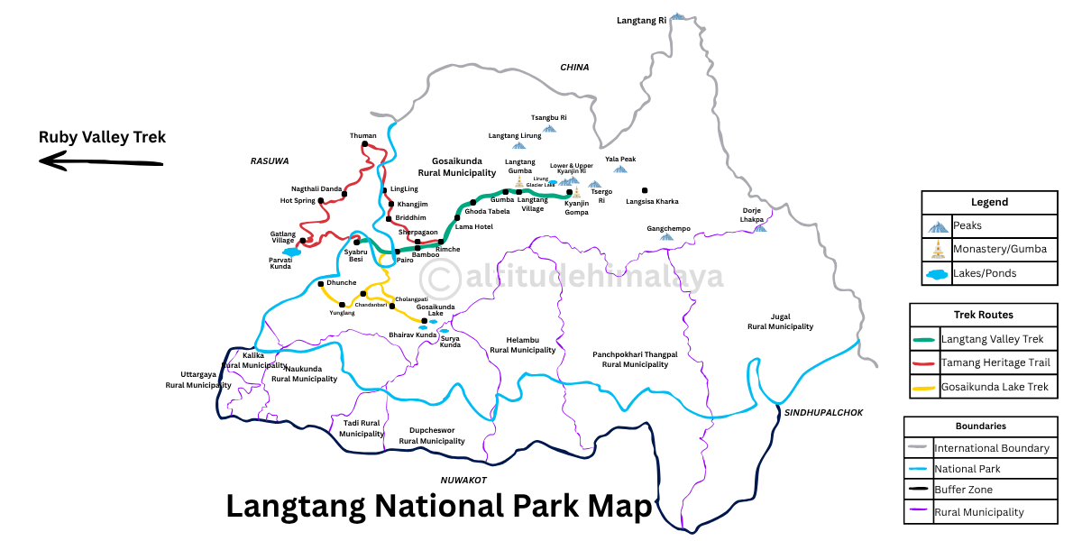
Administratively, the park spreads over three districts:
- Rasuwa: Classic Langtang Valley and much of the Tamang Heritage Trail.
- Nuwakot: Southern and southwestern slopes.
- Sindhupalchok: Eastern and southeastern flanks, including sections of Helambu and Panch Pokhari.
To the north and east, Langtang shares a boundary with Qomolangma National Nature Preserve in Tibet. These two together form a larger transboundary conservation landscape along the Greater Himalaya.
To the west, the Bhote Koshi and Trishuli rivers roughly mark the park boundary. To the south, the park line runs just north of the Kathmandu Valley rim and ties into the headwaters of the Sun Koshi basin.
Terrain and Everyday Life in Langtang
The lower sections of the Langtang National Park are narrow and steep. Rivers carve deep gorges that you can see from Dhunche and Syabrubesi itself.
Trails within the park take you directly through forests, then open into wider flats like Ghoda Tabela and Kyanjin, the meadows around Chandanbari, or the terraced basin around Gatlang.
Above those flat basins, walls of rock and ice block the horizon. For local communities, this terrain determines almost everything, from what they grow to where they graze and how they earn a living.
Around Dhunche and Syabrubesi, with a warmer climate and road access, people grow vegetables, maize, and millet. They also run shops for trekkers and residents alike.
In the higher Tamang villages like Gatlang, Tatopani, Briddim, Langtang, etc, families grow potatoes, barley, and cabbage. They herd yaks and cattle and, in some places, make yak cheese to sell to lodges and down-valley markets.
Across Helambu villages like Melamchighyang and Tarkeghyang, locals are actually reviving commercial apple orchards after almost 3 decades. Alongside tourism and regular farming, they want to bring back Helambu as the apple hub of the region.
On the Jugal Himal side of Langtang, there are smaller settlements of Tamang and Sherpa communities that still depend mainly on animal husbandry and seasonal tourism.
Throughout the park territory, tourism has become just as important as farming and herding, with seasonal work as guides, porters, and drivers supporting household income.
This is part of the reason why we at Altitude Himalaya usually hire local guides and book with local communities for your stay. This provides you with an authentic cultural experience while also directly uplifting the local economy.
The Langtang Ecology: Climate, Flora, and Fauna
Langtang National Park protects over 1000 plant species, with 21 species endemic to the region or nearby. These species are spread over 5 different climatic zones.
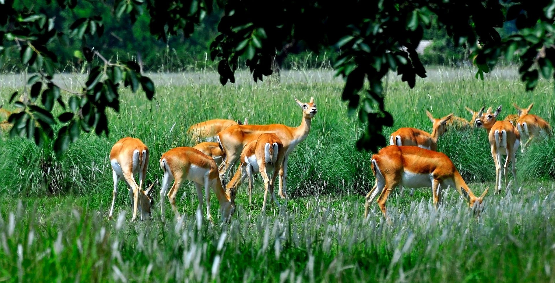
Langtang is also home to 46 mammals, 4 reptiles, 40 species of fish, and over 300 bird species that will accompany you on your visit.
The Five Bio-Climatic Zones and Floras
When you walk from Syabrubesi to Kyanjin, or from Chisapani into Helambu, you pass through several clear ecological bands. Ecologists describe them as five main bioclimatic zones, each with its own forest type and plant species.
Tropical Zone (below 1,000 m)
In Langtang, the tropical zone is found in a very small area in the lower Bhote Koshi Khola and Trishuli in Ramche. The main plant species of this region is Sal, but it's found in limited areas only.
Subtropical Zone (about 1,000-2,000 m)
This zone covers the southern edges of the park and the lower river valleys.
- Dominant forest: sal with Schima, Castanopsis, and other broadleaf trees.
- Where you see it: lower approaches to Langtang, Gosaikunda, and Helambu, i.e., around Syabrubesi, Dhunche.
Temperate Zone (roughly 2,000-3,000 m)
As you climb above Syabrubesi, you quickly enter the mixed temperate forest area.
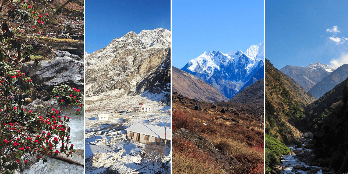
- Trees: oaks, maples, magnolias, multiple rhododendron species.
- Understory: thick bamboo along slopes and gullies.
- How it feels: vibrantly green and humid, especially between Syabrubesi, Lama Hotel, and up towards Ghoda Tabela.
This is prime habitat for red pandas, Himalayan Tahr, Assamese Monkeys, and many forest birds.
Subalpine Zone (around 3,000-4,000 m)
At this elevation, the forest starts to thin and shift.
- Trees: fir, hemlock, juniper, birch, and Nepal’s only native larch species.
- Where you feel it: Above Ghoda Tabela, towards Langtang village, Lauribina, and parts of Helambu.
Tree height drops, and dwarf rhododendron and shrubs begin to dominate.
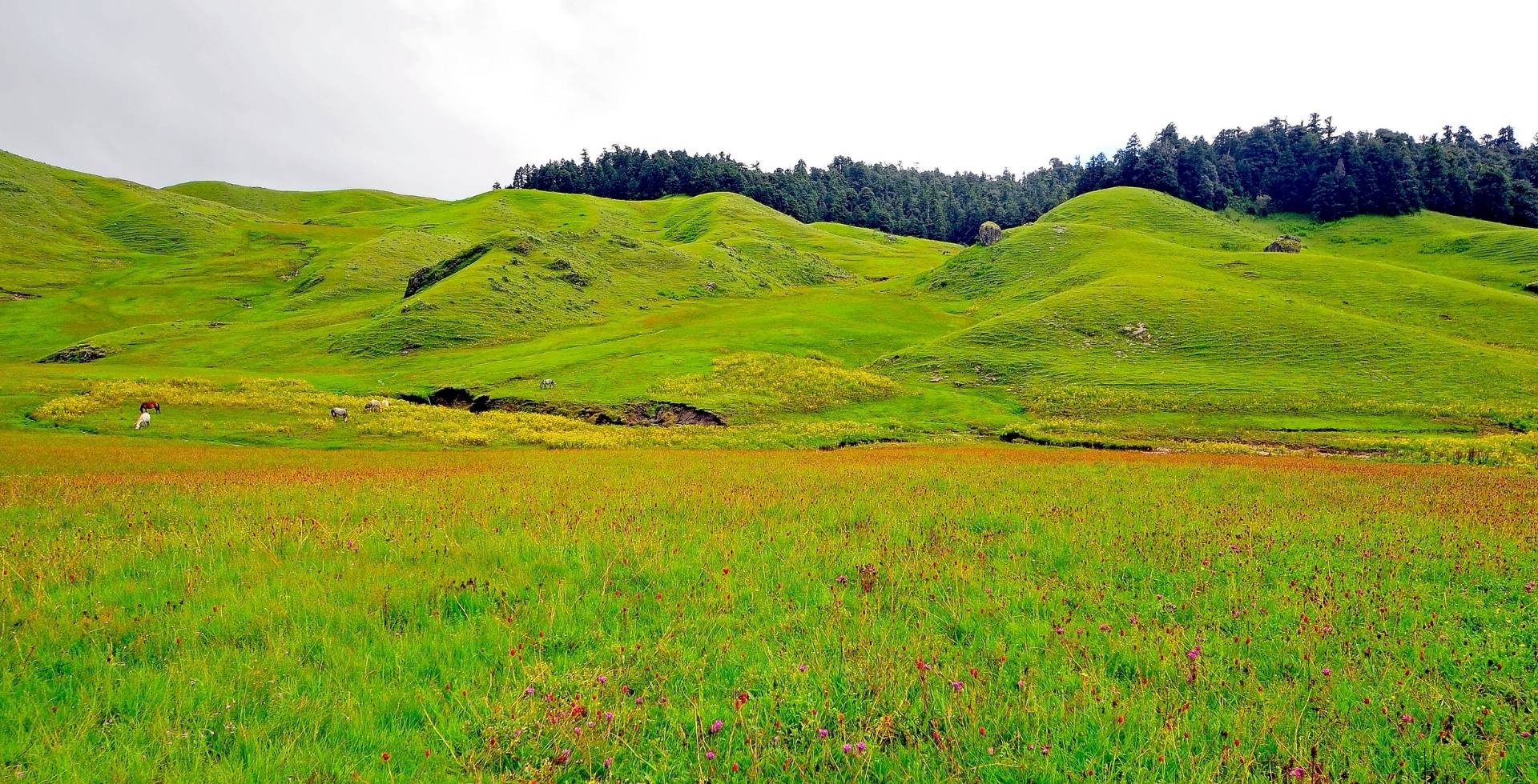
Alpine Zone (about 4,000-5,000 m)
Trees finally fade out into open, high pastures and rock fields.
- Vegetation: alpine meadows, hardy cushion plants, mosses, scattered shrubs.
- Typical areas: Kyanjin Gompa, Langshisa Kharka, Laurebina La, Gosaikunda, and Panch Pokhari.
Many high-value medicinal and aromatic plants grow here, including Spikenard (Nardostachys grandiflora) and Chirayita (Swertia chirayita).
Above 5,000 m, i.e., above the snow line, plants are extremely rare, and only a few herb species exist. You will find only bare rocks, glaciers, and snow. This subsection of the Alpine zone is referred to as the Nival zone, aka the zone of permanent snow.
The Fauna of Langtang
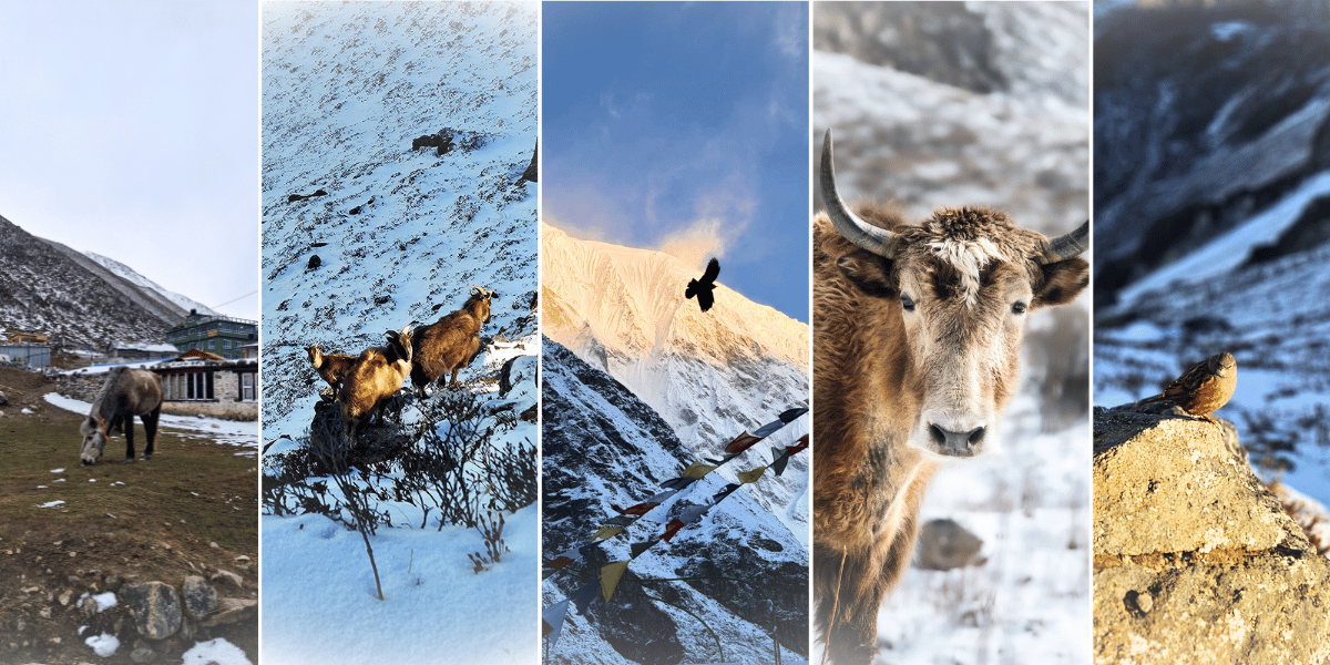
If you love wildlife, Langtang National Park can be very rewarding as long as you are patient. The park is home to more than 46 mammal species and hundreds of bird species, but dense forest and shy behaviour mean sightings are often brief and lucky.
The Iconic Mammals
- Red panda: It prefers cool, bamboo-rich forest between about 2,400 and 4,000 m. You have to look for them in quieter side valleys and thick forest belts with less disturbance i.e less visitors.
Even if you do not see one, you will certainly walk through their habitat between Bamboo and Ghoda Tabela.
- Snow leopard: They roam high rocky areas near the snowline. Your chances of seeing one are very slim, but camera traps have confirmed their presence.
- Other carnivores: Himalayan black bear, clouded leopard, and common leopard in forest belts.
- Hoofed Animals: Musk deer, Himalayan tahr, goral, serow, and blue sheep in subalpine and alpine zones.
- Primates: Langur monkeys, rhesus macaques, and occasionally Assamese monkeys in lower and mid-hill forests.
On my trip to Langtang Valley, I spotted the Langur and Assamese monkeys as well as Musk deer in the stretch between Lama Hotel and Ghoda Tabela.
Birdlife in Langtang
Don’t forget your binoculars if you are an avid birdwatcher! In Langtang, you often hear birds long before you see them.
As of the latest (FY 2081/2082), there are 380 bird species within the Langtang National Park. It is honestly going to be a special treat for you.
Around the trails, you can look for:
- Pheasants: Himalayan monal (Danphe, Nepal’s national bird, iridescent), satyr tragopan, blood pheasant, snow partridge.
- Vultures/raptors: Himalayan griffon, bearded vulture (lammergeier), golden eagle.
- Others: Ibisbill by rivers, rosefinches, warblers, laughingthrushes, thrushes, and a wide variety of forest songbirds.
Permits Needed for the Langtang National Park
To trek in the Langtang region, you must have proper trekking permits.
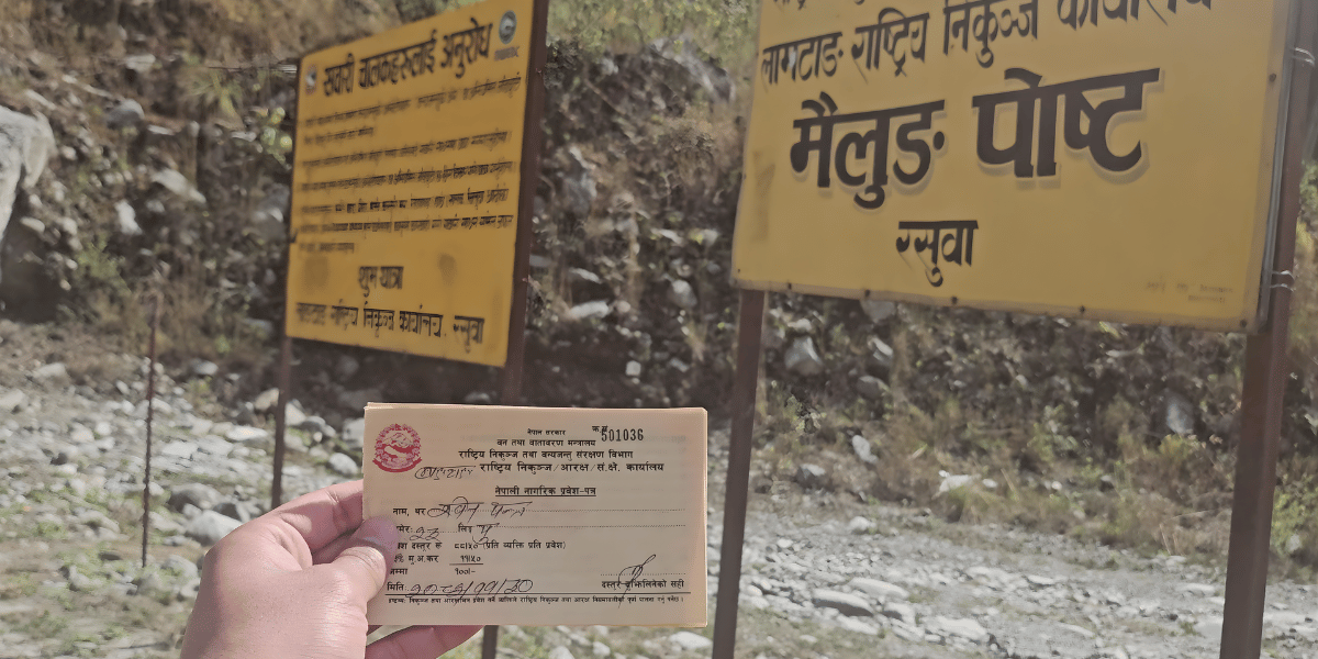
Legally, you only need the Langtang National Park Entry Permit to enter the Langtang National Park. But for your own safety on treks, we recommend you also carry the TIMS card with you.
The cost of these permits varies depending on your nationality, age, and group size. The permits are:
- Langtang National Park Entry Permit
- Trekkers Information Management System (TIMS) Card [Optional]
Here are the complete details of the Langtang trekking permits:
|
Permits
|
Nepali Citizens
|
SAARC National
|
International Trekkers
|
Child Discount
|
Porter Fee
|
|
Langtang National Park Entry Permit
|
NPR 100
|
NPR 1500
|
NPR 3000
|
Free for children below 10 years
|
NPR 25
|
|
TIMS Card
[OPTIONAL, we’ll provide if necessary]
|
-
|
Group: NPR 300
|
Group: NPR 1000
|
-
|
|
Camping Fee (for those wishing to choose camps over teahouses)
|
NPR 100
|
NPR 1000
|
NPR 1500
|
-
|
Note: When booking with Altitude Himalaya, you won’t have to worry about permits at all. Once you confirm your Langtang Valley Trek with us and send over the required documents and photos, our team will sort out every step of the permit process for you.
Peaks, Glaciers, Rivers, and Lakes of Langtang
Langtang National Park lies under a compact section of the Greater Himalaya known as the Langtang Himal, with the Jugal Himal forming the eastern skyline.
Together, these ranges create the high peaks, hanging glaciers, and deep valleys that make Langtang feel so intense on a relatively short trek.
The Great Summits and Peaks of Langtang
You may have already heard of some of these names while looking at the major attractions of the Langtang region. These mountains either sit inside the park or form its eastern and northern boundaries.
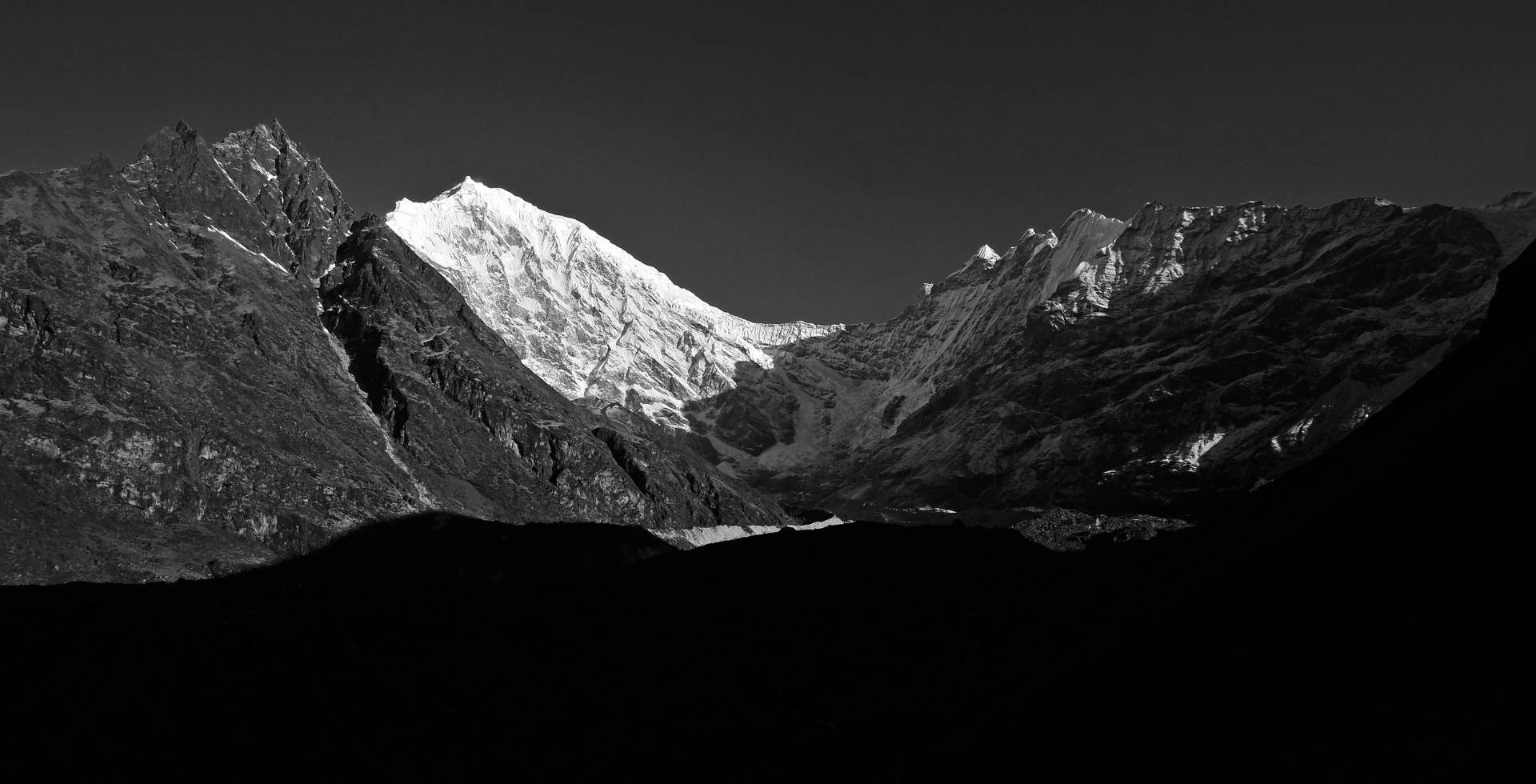
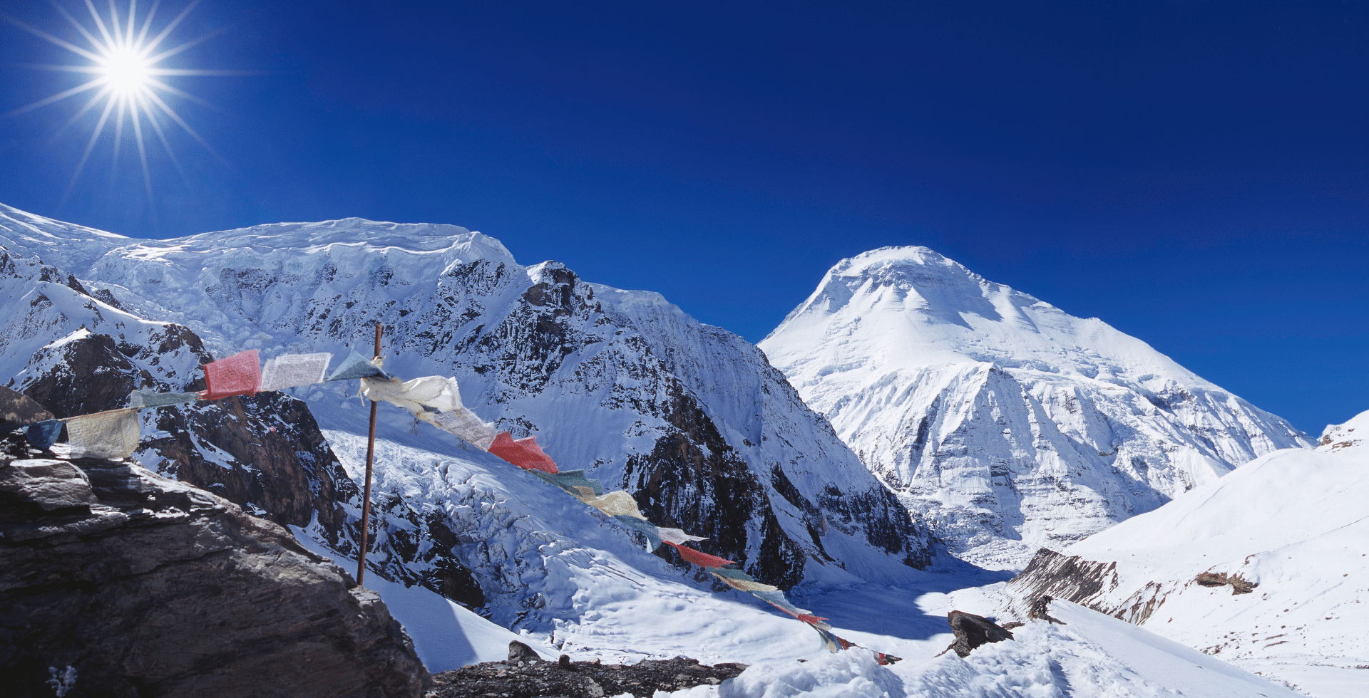
Langtang Lirung (7,234 m)
Langtang Lirung is the highest peak of the Langtang Himal and the dominant summit in Langtang Valley. It rises north of the river and west of Kyanjin Gompa. The south face hangs almost directly above the village, with icefalls and seracs clearly visible on clear days.
While it has been summited and can be summited, for most trekkers, the real joy is simply sitting in Kyanjin and watching the light on its walls change through the day.
Langtang Ri (7,205 m)
Langtang Ri stands on the Nepal-Tibet border to the northeast of Langtang Lirung. You do not see it as often from the valley floor, but it appears on the skyline from higher points like Tserko Ri and the meadows around Langshisa Kharka.
Dorje Lhakpa (6,966 m)
Dorje Lhakpa is the sharp pyramid you see from many viewpoints around Kathmandu and from ridges above Gosaikunda and Helambu. Geographically, it sits in the Jugal Himal, but it forms the southeastern skyline of Langtang National Park.
From places like Laurebina La and Panch Pokhari ridges, Dorje Lhapka aligns with other Jugal peaks such as Madiya and Phurbi Chyachu, giving a clean, jagged horizon. On very clear days, it even appears from viewpoints like Nagarkot on the eastern rim of the Kathmandu Valley.
Gangchenpo (Ganchenpo, 6,378 m)
Often nicknamed the Fluted Peak, Gangchenpo stands south of the upper Langtang ridge towards the Jugal side.
It is prominently visible once you leave the Langtang village and even up to Kyanjin Gompa. Then, from Kyanjin Ri or Tserko Ri, you see its finely ridged profile when you look southeast.
Many trekkers only notice it after their guide points it out, but once you do, it becomes a favourite for photos.
Kyanjin Ri and Tserko Ri
Kyanjin and Tserko (Tsergo) Ri are viewpoint peaks that most trekkers reach in their Langtang National Park visit. Kyanjin Ri is usually your first major viewpoint in Langtang.
About two-thirds of the distance to the Kyanjin Ri top, there is a lower summit. This summit is what you actually see from the Kyanjin Gompa and is called the Lower Kyanjin Ri.
The lower summit is situated at 4,400 m, while the main summit, i.e., Upper Kyanjin Ri, lies at an altitude of 4,700 m. The trail to both Kyajin viewpoints climbs steeply above Kyanjin Gompa, but is straightforward in clear weather.
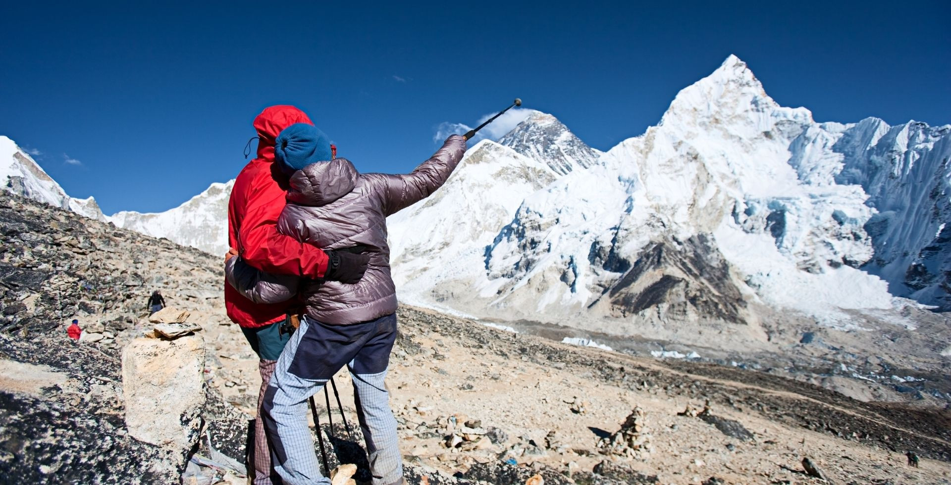
Tserko Ri is longer and higher than Kyanjin Ri, so you will need an early start and strong legs. For most trekkers, this is the single best viewpoint of the whole trip
From the top of these viewpoints, you see:
- The full curve of the upper Langtang Valley and the entire Langtang Himal panorama.
- Hanging glaciers and the Jugal and Ganesh Himal ranges.
Both sunrise and sunset are special in their own way from both of these viewpoints.
Other Peaks and Mountains
- Yala Peak (5,520 m)
- Naya Kanga / Ghanja La Chuli (5,863 m)
- Yubra / Ubra Himal (6,048 m)
- Tsangbu Ri / Kimshung (6,781 m)
- Kyunga Ri I (6,599 m)
- Langshisha Ri (6,412 m)
- More: Luri Himal (6,924 m), Pem Thang Karpo Ri (6,865 m), Shalbachum (6,707 m), Ghenye Liru / Langtang II (6,571 m).
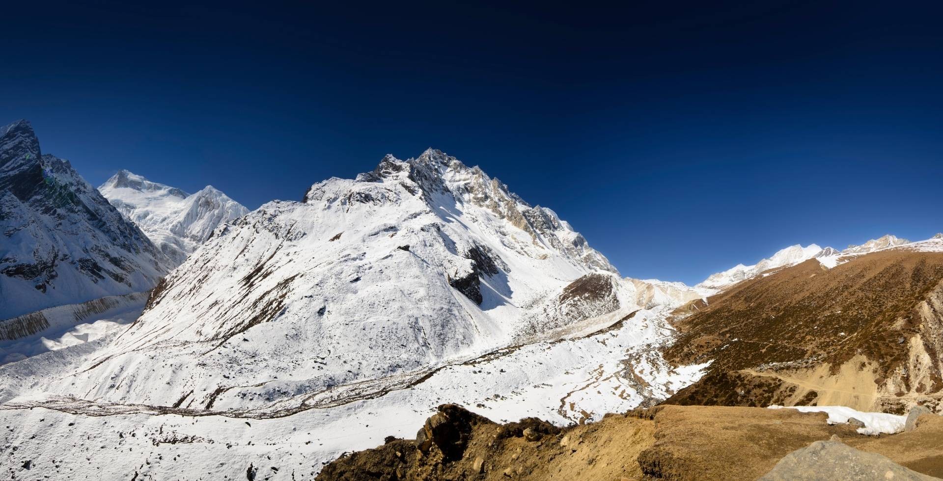
The Valley of Glaciers
Langtang Valley is often called the “Valley of Glaciers”, and it genuinely deserves the name. More than 70 glaciers of different sizes have been reported in the broader Langtang region.
You will not walk on most of them, but above Mundu and Kyanjin, you see their tongues, moraines, and meltwater streams everywhere.
Yala Glacier
Yala Glacier sits below Yala Peak, north of Kyanjin Gompa and close to the Tibetan border. If you climb Yala Peak, you normally cross parts of this glacier after trekking through yak pastures and loose moraine.
Reports from different studies show that Yala Glacier has retreated significantly since the 1970s, with a loss of more than half its mass. If current warming trends continue, it is likely to disappear within the next couple of decades.
Langtang Glacier
Langtang Glacier is the giant of the valley. It is about 18 km long and covers nearly 50 square kilometres, making it the largest glacier in the region. It gathers snow and ice from the high border crest and feeds the Tanmarche Khola and the main Langtang Khola.
You do not normally walk on this glacier on a standard trek, but from Kyanjin Gompa, Kyanjin Ri, and Tserko Ri, you can see its broad surface filling much of the upper basin.
Lirung Glacier
Directly under Langtang Lirung, the Lirung Glacier flows down towards the valley floor. From Kyanjin Ri, you can look straight into its debris‑covered tongue that feeds the Lirung Khola, which joins the Langtang Khola downstream.
Shalbachum and Langshisha Glaciers
From Langshisa Kharka, you get one of the park’s signature views: a glacier curving deep into a side valley, framed by steep rock walls and peaks like Langshisha Ri and Shalbachum.
These are the Shalbachum and Langshisha glaciers. They drain the eastern side of the upper Langtang basin and eventually send meltwater into the Langtang Khola.
The Rivers and Lakes of Langtang
The rivers and lakes of Langtang carry snow and glacier melt down to the mid‑hills and plains. They shape the valleys you walk through and, in many cases, hold deep religious importance.
Key Rivers of the Region
- Langtang Khola: It is the main river of the Langtang Valley. It starts from glacial melt above Kyanjin and runs past Langtang village, Ghoda Tabela, Lama Hotel, and down to Syabrubesi. The classic Langtang Valley trek follows it closely for most of its length.
- Lendi Khola and Chandampari Khola: They are important tributaries in the Langtang region, draining side valleys and feeding into the Bhote Koshi and Trishuli systems. You cross them on bridges or see them far below from the road and trails.
- Lirung Khola: Begins at the snout of Lirung Glacier and joins the Langtang Khola downstream. On the trail, you notice it as one of several icy streams crossing or paralleling the valley floor near and below Kyanjin.
- Tanmarche Khola: Carries melt from the Langtang Glacier into the upper Langtang basin. From higher viewpoints, you can trace it as a white line cutting through moraines before entering greener slopes.
- Trishuli River: One of central Nepal’s major rivers, forming the main road corridor to Langtang. The drive from Kathmandu to Dhunche and Syabrubesi follows the Trishuli valley for a long stretch.
- Bhote Koshi River (Rasuwa side): Flows down from Tibet near Rasuwa Gadhi and forms part of Langtang’s western boundary before meeting the Trishuli farther south. On the way to Syabrubesi, you drive alongside it, with terraced fields and Tamang villages on steep slopes above.
The Sacred Gosaikunda Lake
Gosaikunda is a high‑altitude alpine lake at about 4,380 m in the southeastern part of the park. It is sacred to both Hindus and Buddhists.
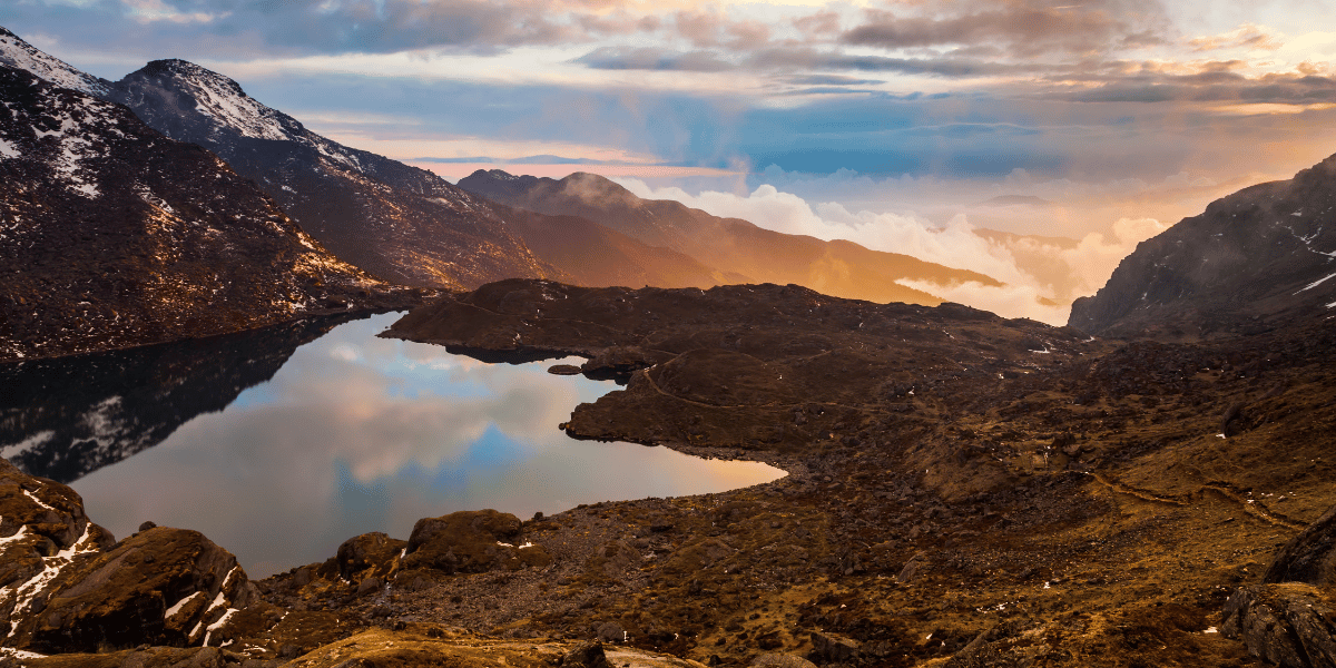
During the Janai Purnima festival in August, thousands of pilgrims make the steep climb to bathe and perform rituals in its cold waters.
Gosaikunda and its neighbouring lakes are recognised as a Ramsar site, wetlands of international importance. For trekkers, they are deep blue basins in autumn and frozen white beauties in peak winter, with a backdrop of Langtang and Jugal skyline.
The Panch Pokhari Lakes
Panch Pokhari is a group of five lakes in northeastern Sindhupalchok, at around 4,100 m. It is one of the world’s highest wetlands and a trekking route just along the eastern edge of Langtang National Park.
Like Gosaikunda, the lakes are sacred to both Hindus and Buddhists, and pilgrims visit during Janai Purnima. From ridges above and around Panch Pokhari, you see Jugal Himal, Dorje Lhapka, Langtang Lirung, and other peaks on clear days.
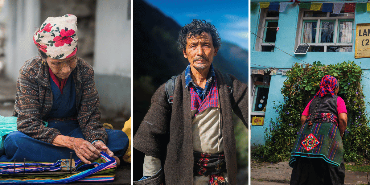
Culture and People of Langtang National Park
Like with every remote destination, Langtang is more than just the trails you walk on or the skyline you gaze upon. You walk through the Tamang, Sherpa, and Hyolmo communities, whose ancestors have lived in these valleys for centuries.
Their languages, architecture, and rituals carry strong Tibetan influence, yet they are also unmistakably shaped by Nepal’s mid-hill rhythms and the modern pull of tourism and migration.
Mountain Communities Along Different Routes
If you are paying attention, you will notice how different valleys have slightly different cultures, even though they share many beliefs and traditions.
Tamang Communities
Tamang communities dominate the Langtang Valley and the Heritage trail from Syabrubesi to Kyanjin Gompa, plus Gatlang, Tatopani, Thuman, Briddim, and Nagthali.
Their daily life revolves around a mix of farming, herding, and lodge-based tourism, but there is a deep undercurrent of Buddhist and Bon-influenced worldviews.
Hyolmo Communities
To the south and east, as the Langtang-Gosaikunda routes merge into Helambu (Tarkeghyang, Sermathang), you enter the cultural landscape of the Hyolmo (also written Yolmo) community.
Their language, dress, and rituals are also strongly influenced by Tibetan Buddhism, but the stories you hear around the fire might mention different local deities, place-spirits, and clan histories.
Sherpa Communities
Sherpa families are fewer here, but they are still an important part of Langtang. Some Sherpa households settled along the old trade routes toward Tibet, moving livestock up and down between mid-hills and high pastures.
Belief Systems, Monasteries, and Festivals
Religion is not a separate “activity” in Langtang; it’s woven into the way people live day to day. As a trekker, you start to absorb the rhythms almost without realizing it.
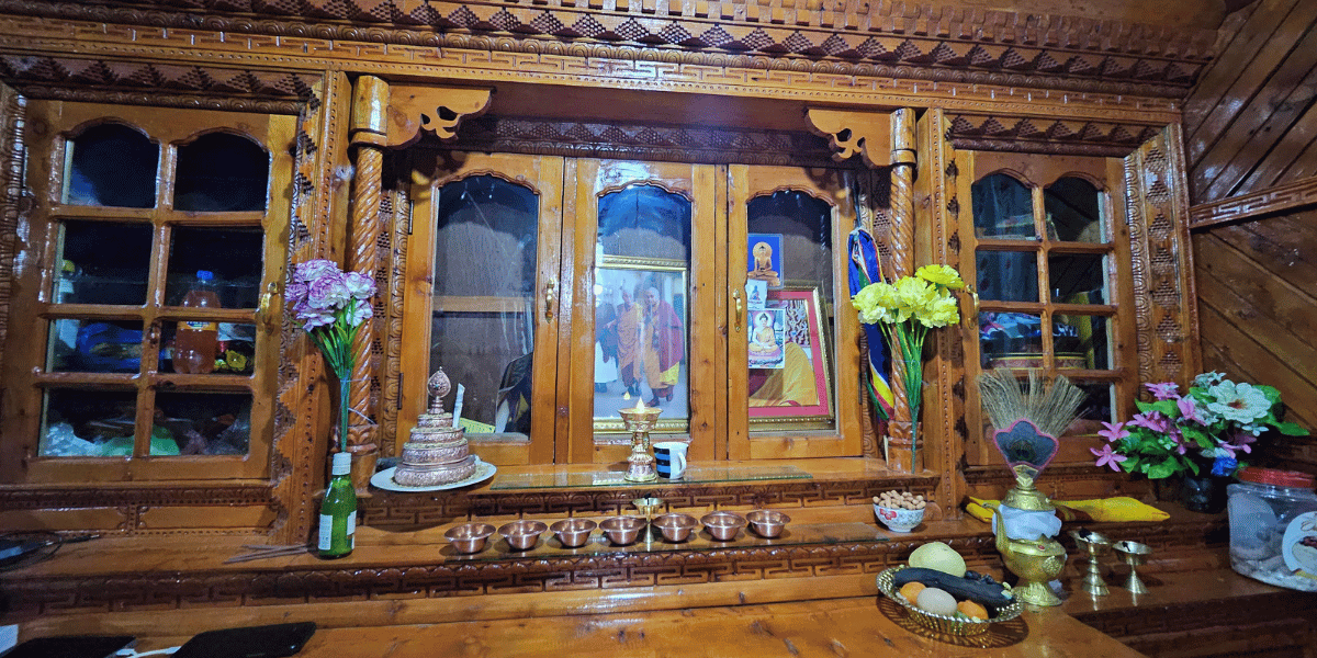
Tibetan-influenced Buddhism in daily life
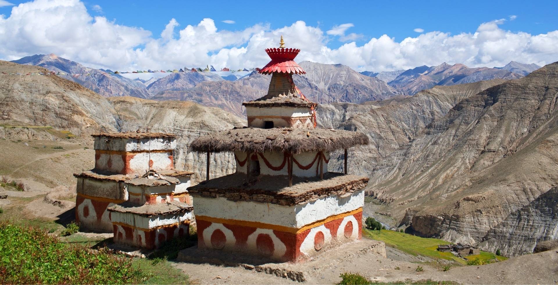
Most people in Langtang follow a form of Tibetan-influenced Buddhism, primarily the Nyingma lineage of Tibetan Buddhism, blended with local animist and shamanic traditions. You see its symbols everywhere:
- Monasteries (gompas) perched just above villages or on small ridges.
- Whitewashed chortens (stupas) at trail junctions and entrances to settlements.
- Long mani walls carved with mantras like “Om mani padme hum.”
- Strings of prayer flags fluttering from house roofs, passes, and sacred rocks.
After a few days of trekking, you will find yourself spinning prayer wheels instinctively. If you time your arrival right, you might hear young monks chanting inside the gompa (monastery) at Kyanjin Gompa, Gatlang, or Briddim.
Hindu and Buddhist Shared Pilgrimages
Although Buddhism is visually dominant, Hindu beliefs are strong in and around certain sacred sites, especially Gosaikunda and Panch Pokhari.
According to Hindu mythology, Gosaikunda was formed when Lord Shiva struck the mountain with his trident to cool his burning throat after drinking poison during the churning of the ocean (Samundra Manthan).
Panch Pokhari holds its own set of local legends and protective deities tied to Lord Shiva and Goddess Parvati.
The most relevant example of shared belief is Janai Purnima. During this festival:
- Hindu pilgrims travel to Gosaikunda or Panch Pokhari to bathe in the icy waters and change their sacred threads called Janai.
- Buddhist devotees also visit, making offerings, spinning prayer wheels, and circumambulating the lakes.
Loshar and Other Celebrations
For Tamang communities nationwide, Sonam Lhosar (Tamang New Year) is one of the most important times of the year.
However, since the Tamangs in Langtang are Tibetan-influenced, they celebrate Gyalpo Lhosar, like other Tibetan communities, instead of Sonam Lhosar.
Gyalpo Loshar (King’s New Year/Tibetan New Year) usually falls in late February or early March, depending on the lunar calendar.
In villages like Gatlang, Briddim, or even Syabrubesi, Lhosar can mean:
- Families are cleaning and repainting parts of their houses.
- Special dishes prepared with local drinks.
- People wearing traditional dresses.
- Communal dances, drumming, and visits to monasteries for blessings.
Even outside of major festivals, everyday life is punctuated by smaller rituals such as offering smoke to the mountain before a journey, hanging new prayer flags after a family event, or visiting a local lama for advice on health, journeys, or weather.
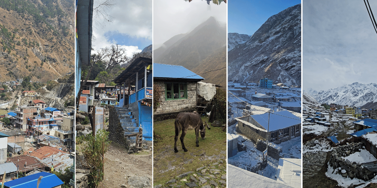
Villages of Langtang National Park
A trek to Langtang is simply just a chain of nights in different villages and deciding which side trips to add. Each settlement has a distinct atmosphere that shapes how your days and evenings feel.
Classic Langtang Valley Villages and Major Stops
On the classic Langtang Valley Trek, the standard overnight stops for accommodations are:
Syabrubesi / Syaphru Bensi (1,467 m)
Syabrubesi is the roadhead town on the Bhote Koshi/Trishuli rivers and the main starting and ending point for Langtang Valley and the Tamang Heritage Trail. Here, you will find a mix of Tamang and other ethnic groups.
You will also find plenty of lodges, restaurants, and shops selling last-minute snacks, or gear you have missed bringing from Kathmandu.
Lama Hotel (aka Changdam Village, 2,515 m)
Despite the name, Lama Hotel is not a single hotel but a cluster of lodges hidden in the deep forest. After a day of walking under tall canopies and beside the Langtang Khola, this settlement feels like an outpost in a green tunnel.
Here, lodges are strung along the trail rather than organized in a compact village. Nights are quiet, not in the literal sense but with the sushing sound of the river and wind in the trees.
Ghoda Tabela (3,008 m)
In Ghoda Tabela (literally “horse stable”), the forest begins to thin and open, the valley widens, and the views start to expand. There are a few lodges and an army/park checkpost.
This is where you get your first real sense that you are entering the upper Langtang basin, leaving the enclosed gorge behind. For many trekkers, this is where the landscape starts to feel truly Himalayan.
Langtang Village (3,455 m)
The current Langtang Village is a rebuilt and reestablished community. The old settlement was largely devastated by the 2015 earthquake and the avalanche that followed.
Since most of the village was destroyed, people rebuilt whatever remained of the village. Over time, the sections of Langtang Village where hotels were previously scarce have become the main hubs for visitors.
In Langtang Village:
- Architecture is a blend of newer construction and traditional stone‑and‑wood designs.
- Fields, yaks, and mani walls line the edges of the village.
- Families run lodges, farms, and small shops.
Spending time here is a chance to listen to stories of loss, survival, and recovery that define modern Langtang identity. And don’t forget to taste local food and drinks, like the Sea Buckthorn Juice!
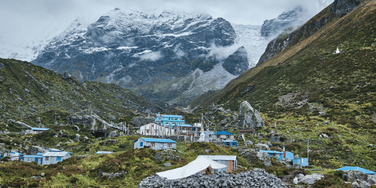
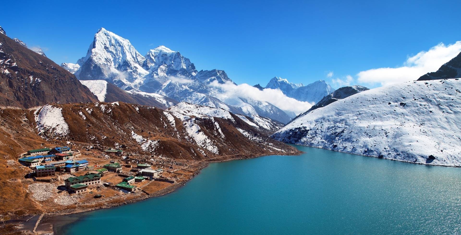
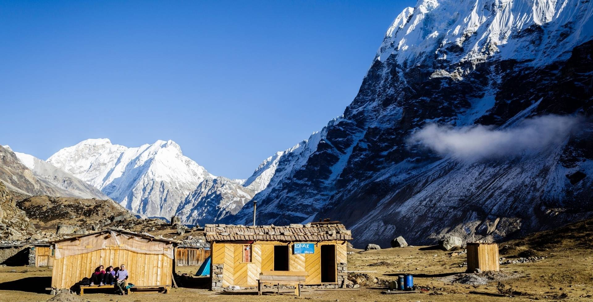
Kyanjin Gompa (3,890 m)
Above Langtang Village, the valley opens up wide and clear. Mundu offers a handful of lodges, but Kyanjin Gompa is the main hub of the upper valley.
Kyanjin Gompa is:
- A high‑altitude village with a monastery (gompa), several stupas, and prayer flags flapping against a backdrop of the Langtang and Jugal Himal ranges.
- Home to bakeries, the yak cheese factory, and some of the most scenic lodge terraces in the Himalaya.
- The base for side trips to Kyanjin Ri, Tserko Ri, Langshisa Kharka, and other viewpoints.
Gosaikunda-Helambu Side Villages
If you extend your trek towards Gosaikunda and Helambu, the villages you stop at also change. On the way to Gosaikunda, typical stops include:
- Thulo Syaphru: A larger village on a ridge, with terraced fields dropping away on both sides. Here you find a mix of lodges, traditional homes, and a strong Tamang culture.
- Shin Gompa (Sing Gompa) aka Chandanbari: A small settlement centred around a monastery, with a cheese factory nearby. It feels like a quiet spiritual stop on the way to a higher altitude.
- Lauribina: A ridge‑top cluster of lodges with big mountain views. On clear days, you can see across to Ganesh Himal and beyond.
- Gosaikunda itself: A few lodges are on the shores of the sacred lake, surrounded by barren, rocky slopes. The atmosphere can be incredibly crowded and intense during pilgrimages, but peaceful on off‑season mornings.
Beyond Gosaikunda, on the Helambu descent, you pass:
- Ghopte and Tharepati: Higher, wind‑swept settlements, often used as overnight stops between the lakes and the lower valleys.
- Kutumsang: A larger village with more farmland and a mix of ethnic groups.
- Tarkeghyang and Sermathang: They are important Hyolmo villages, with monasteries, old houses, and a more agricultural feel compared to the stark upper ridges.
- Melamchi Pul Bazaar: A road town in the valley bottom, marking the end of many Helambu treks and a return to warmer temperatures and busier roads.
Tamang Heritage Trail Villages
The Tamang Heritage Trail is designed to slow you down and bring you closer to people rather than just views. Altitude is generally lower, but cultural immersion is higher.
Key villages include:
- Gatlang: Gatlang is a hillside village with traditional stone houses, terraced fields, and a beautiful stupa. It is the first step into your Tamang cultural immersion.
- Tatopani: Famous for its hot springs, trekkers and locals alike soak tired bodies in the warm waters of Tatopani. The village has simple lodges, homestays, and terraces that overlook steep valleys.
- Thuman: Thuman has traditional houses, narrow lanes, and a strong Tamang identity. It overlooks wide panoramic views of the lower Langtang Valley and Jugal and Langtang Himal.
- Briddim: Often highlighted for community‑run homestays, Briddim gives you chances to share meals, help in the kitchen, or join in household tasks.
- Nagthali Ghyang: A settlement with big mountain panoramas and a small monastery. Up here, you feel both the exposure of the Himalayas and the warmth of a small, tight‑knit community.
Panch Pokhari Villages
Further east, the approaches to Panch Pokhari feel more remote and less touched by mainstream trekking.
This “remoteness” is part of the reason why the facilities are more basic here compared to Langtang Valley or Gosaikunda, with fewer lodges and simpler infrastructure.
Villages like Chhimti, Tuppi Danda, and Nosyampati are the staging points for treks to the five sacred lakes. You will have a more “rough-edge” experience here, with a feel for pilgrimage route and under-the-radar trekking area.
Best Time to Visit Langtang National Park
You can trek in Langtang almost year‑round, each season offering a different character. As a team, we usually recommend spring and autumn for most trekkers. Summer/monsoon and winter are best for those who understand what they are signing up for.
Spring (March-May)
- Forests explode with rhododendron blossoms, and high ridges still carry fresh snow.
- Peaks look extra sharp and clean against the blue sky.
- Mornings are often clear; clouds can build up in the afternoons.
- Temperatures are comfortable at mid‑altitudes.
Summer/Monsoon (June-August)
- Trails are much quieter in Langtang Valley side but busy in the Gosaikunda and Panch Pokhari regions.
- Forests turn almost fluorescent green with mosses and lichens covering tree trunks.
- You must be ready for heavy rain, leeches in the lower forests, and a higher risk of landslides or rockfall.
- Views come in brief, dramatic windows between clouds.
If you are flexible and like lush landscapes and solitude, this season can be beautiful with the right gear and mindset.
Autumn (September-November)
It is the classic peak trekking season.
- Skies are usually clear, the air is crisp, and you get long‑range views from Kyanjin Ri, Tserko Ri, and the Gosaikunda ridges.
- Trails and lodges can be busy, but the overall weather pattern is the most reliable.
Winter (December-February)
- Cold, especially above Langtang village and on Gosaikunda and Helambu passes.
- Some lodges close, and trails may hold snow and ice.
- When the weather is stable, the views are extremely clear.
Shorter trips to Langtang Valley without very high side trips are doable with proper winter gear and some flexibility in your plan.
Also check out: Complete Langtang Valley Trek Packing List
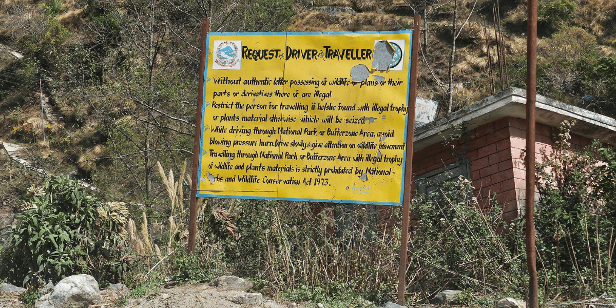
Conservation Status and Challenges in Langtang National Park
On paper, Langtang is well protected: a national park since March 26, 1976, and has had a 420 sq km buffer zone since 1998, with strong policies for community participation. In reality, conservation is always a balancing act between wildlife, forests, tourism, and local livelihoods.
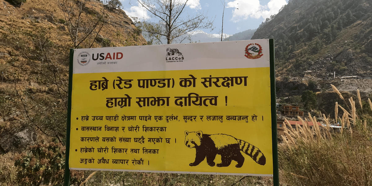
The park and its buffer zone still hold important populations of threatened species such as red panda, snow leopard, musk deer, and many high‑altitude plants. At the same time, several pressures are clear on the ground:
- Overharvesting of high‑value medicinal and aromatic plants in alpine and subalpine zones.
- Climate‑driven glacier retreat and more erratic rainfall are increasing the risk of floods, landslides, and slope instability.
- Tourism impacts such as waste, firewood demand, and trail erosion occur when visitor numbers spike without enough planning.
Research on medicinal plants in Langtang found that many threatened and endemic species are concentrated in the Langtang-Kyanjin and Cholangpati-Gosaikunda sectors, where the number of visitors is also high.
It also documented large volumes of non‑timber forest products being collected and traded from Rasuwa. The overtrading and high foot traffic have put some strain on those threatened species.
On the positive side, Nepal’s buffer‑zone policy sends 30-50 percentage of park revenue back to local communities for conservation and development.
Community forests, eco‑tourism initiatives, and awareness programs, especially around red panda and snow leopard, are all helping. The key to the future is simple but not easy:
Making sure growth in trekking and pilgrimage stays within what the landscape can actually handle.
Best Treks to Experience Langtang National Park
You can experience Langtang in many ways. Some people come for a week; others link routes for two or three weeks. Here are the main treks we recommend, depending on your time and interests.
- Typical duration: 10 days from Kathmandu and back.
- Route: Syabrubesi - Lama Hotel - Ghoda Tabela - Langtang village - Mundu - Kyanjin Gompa.
- Side trips: Kyanjin Ri, Tserko Ri
Difficulty is rated moderate, so good preparation is a must. You start at 1,467 m and reach 4,700 m at Kyanjin Ri or 4,985 m at Tserko Ri. In a short window, you see river gorges, deep forest, villages, and open alpine valleys.
If you have very limited time or cannot trek for health reasons, the Langtang Valley Helicopter Tour is the perfect option.
- Flights leave from Kathmandu, follow the hills north, and enter Langtang National Park from the air.
- Flights land near Kyanjin Gompa for a brief stop, giving you time to feel the valley and take in the peaks around you.
- Total flight time is usually 1.5-2.5 hours.
It will not replace the cultural depth of a trek, but it offers a powerful visual impression of the valley in a single day. You can choose to stay in Kyanjin in return the next day.
- Typical duration: 7-13 days.
- Route: From Dhunche or Thulo Syabru, through Shin Gompa (Chandanbari) and Laurebina to Gosaikunda.
- Highest point: Around 4,380 m at the lakes, with an optional crossing of Laurebina La (about 4,610 m) if you continue towards Helambu.
This trek combines strong cultural and religious themes with broad mountain views.
4. Langtang - Gosaikunda - Helambu Trek
If you want a fuller taste of the park in one go, you can link Langtang Valley, Gosaikunda, and Helambu into a 15-17-day loop.
Trek Outline:
- Trek to Kyanjin Gompa.
- Return towards Thulo Syabru.
- Climb to Gosaikunda.
- Cross Laurebina La.
- Continue through Helambu villages like Ghopte, Tharepati, Tarkeghyang, and Sermathang.
You experience glaciers and high peaks in Langtang, sacred lakes around Gosaikunda, and the terraced valleys and Hyolmo culture of Helambu in a single journey. You can also just do the Langtang-Gosaikunda Trek in 13 days, leaving out Helambu.
Perfect if you want more culture, moderate altitude, and homestays rather than higher passes.
- Duration: 14 days
- Route: From Syabrubesi through villages like Gatlang, Tatopani, Thuman, Briddim, and Nagthali Ghyang.
You soak in hot springs at Tatopani, stay with Tamang families, and enjoy wide views of Langtang and Ganesh Himal from ridge viewpoints.
The Panch Pokhari Trek takes you to the five sacred lakes on the flanks of the Jugal Himal, near the park’s eastern side.
- Typical duration: 6-12 days
- Route: Through mixed settlements of Sherpa, Tamang, and other groups, climbing through forest and ridges to the lakes at about 4,100 m.
This is a great choice if you want a shorter trek with a cultural immersion as well as wide Langtang views.
- Duration: 6-10 days
- Route: Sundarijal - Chisapani - Kutumsang - Tharepati - Tarkeghyang - Sermathang - Melamchi Pul Bazaar.
For any of these Langtang itineraries, we can modify the durations, stops, and add side trips based on your preference.
Responsible Trekking Practices in Langtang National Park
Langtang is stunning, but also fragile. Forests take decades to grow. Glaciers are already shrinking. Wildlife is sensitive to disturbance. A few simple habits from each trekker can make a big difference over time.
We highly encourage you to do the following things so that you have a responsible trekking experience. These are all based on park guidelines and our own experiences:
- Stay on marked trails: Yes, shortcuts look tempting, but on steep slopes, avoid them altogether! It will not only keep you safer but also reduce erosion and protect the fragile plants of those landscapes.
- Respect permit checks: You will be asked to show your permits at checkpoints in Dhunche, Syabrubesi, Ghoda Tabela, etc. Keep your Langtang National Park permit and any additional permits you may need for your trip somewhere accessible. Show them promptly whenever needed.
- Minimise waste: Avoid single‑use plastics. Refill bottles with boiled or treated water. Pack out non‑biodegradable waste and use lodge dustbins where there is a proper waste system.
- Give wildlife space: Along the trail, you will come across several wildlife species. You should, of course, admire them, click pictures, and enjoy the overall vibe. But don’t do anything that will disrupt their natural order of things. Don’t feed them, or get too close to them. If you want to get a closer look, use your camera zoom or binoculars.
- Respect local culture: Like the locals, you should also walk clockwise around stupas and mani walls. Though the villages don’t have a dress code per se, dressing modestly is highly recommended. Ask permission before photographing people or inside monasteries. Most importantly, you must not touch, disturb, or remove religious objects or prayer flags.
- Follow your guide's advice: Your guide is informed about the changing conditions in the region. So, at all times, listen to them about possible landslide zones, avalanche risk, and river crossings. Their insights determine your safety, especially in the monsoon and winter seasons when conditions change in the blink of an eye.
At Altitude Himalaya, we design our Langtang itineraries with these sustainability principles in mind. The idea is simple: you should leave the valley with memories and photos, not new scars on the landscape.
Keeping Langtang With You
Langtang National Park is one of the closest true high-mountain regions to Kathmandu. Yet, just after a day of trekking, it feels like a completely different world.
If you plan your trek thoughtfully, travel with a local team, give it enough days, and budget for your trip well, Langtang will stay with you long after you have returned home.
Yes, the final viewpoints like Kyanjin Ri, Gosaikunda, Panch Pokhari, etc are great. But often, guests return talking not just about those viewpoints but also about the forests, villages, and the people who welcomed them along the way.
More than any single viewpoint, Langtang National Park truly deserves to be remembered in its entirety.


 Karuna Bhattarai