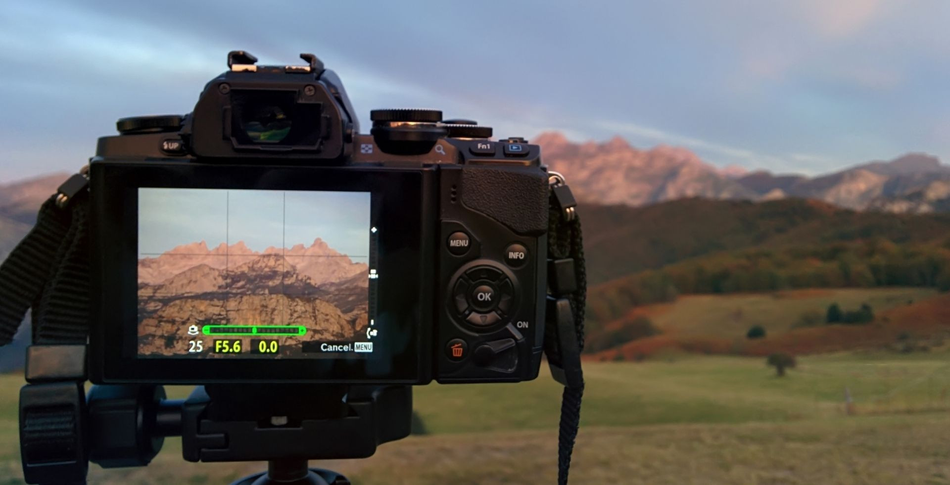
If you've been searching for a Himalayan trek that's close to Kathmandu and delivers dramatic mountain views, possible wildlife encounters, and an unfiltered alpine experience, then the Langtang Valley Trek deserves your full attention!
The Langtang Valley trail is honestly one of the most ecologically diverse and culturally rich parts of the Langtang region. But before you lace up your boots and start this beginner-friendly adventure, it’s important that you understand the route, the terrain, and daily distances.
That's exactly what this guide is all about. My aim is to walk you through the Langtang Valley Trek itinerary and route details, along with the national park map, elevation profile, every key stop along the trail, the distances between each of them, and also the best itineraries for different types of trekkers.
By the end of this article, I promise that you’ll have a clear mental picture of where to go, how far, and how long it takes to complete the Langtang Valley Trek.
Langtang Valley Trek Route Map
Before we get into the Langtang trail details and daily distances, let me orient you with the bigger picture of where you'll be trekking.
Langtang National Park Map
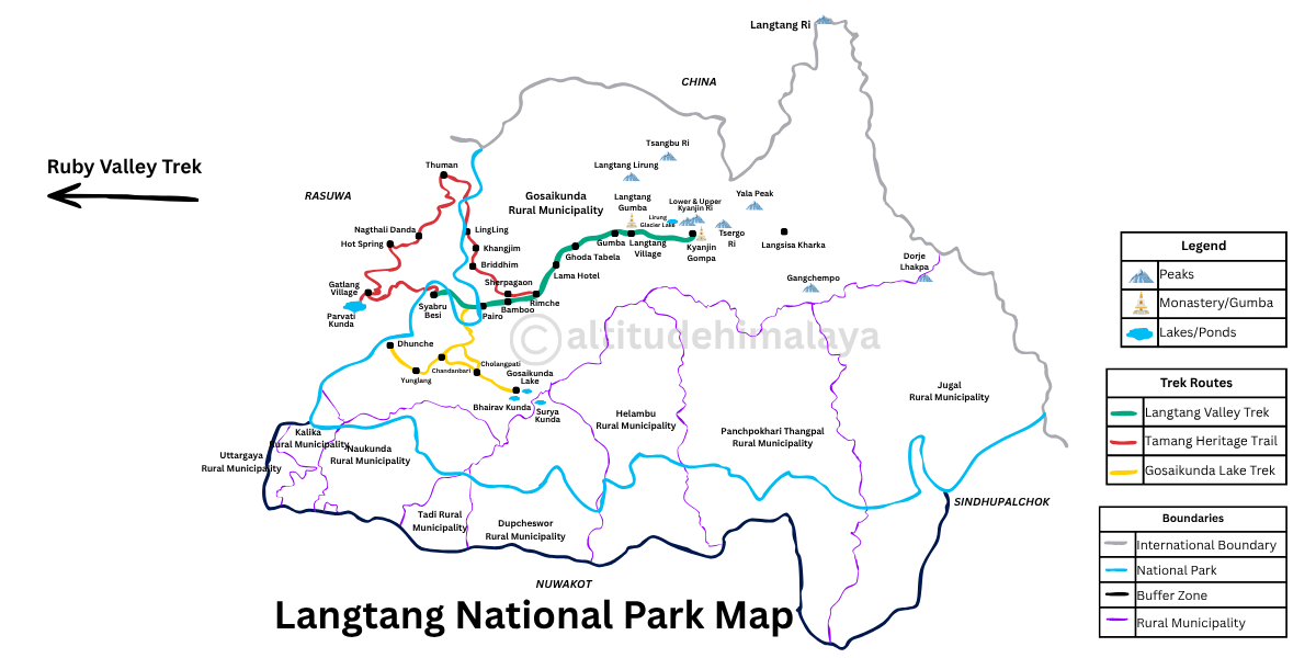
Looking at the map above, here’s what it tells us about the Langtang National Park and the Langtang Valley Trek region:
- The park covers parts of three districts: Nuwakot, Rasuwa, and Sindhupalchowk.
- It spans parts of nine rural municipalities:
- In Nuwakot: Dupcheshwar and Tadi
- In Rasuwa: Uttargaya, Kalika, Naukunda, and majorly Gosaikunda (where the Langtang Valley is located)
- In Sindhupalchowk: Helambu, Panchpokhari Thangpal, and Jugal.
- The national park borders Kyirong, Tibet (China) to the north, parts of Rasuwa to the west, Nuwakot district to the south, and parts of Sindhupalchowk to the east.
- This park also has a 420 sq. km buffer zone covering parts of Uttargaya, Kalika, Naukunda, Dupcheshwar, Helambu, Panchpokhari Thangpal, and Jugal.
- Main entry points: Dhunche, Mailung, Syaphru Bensi, Helambu
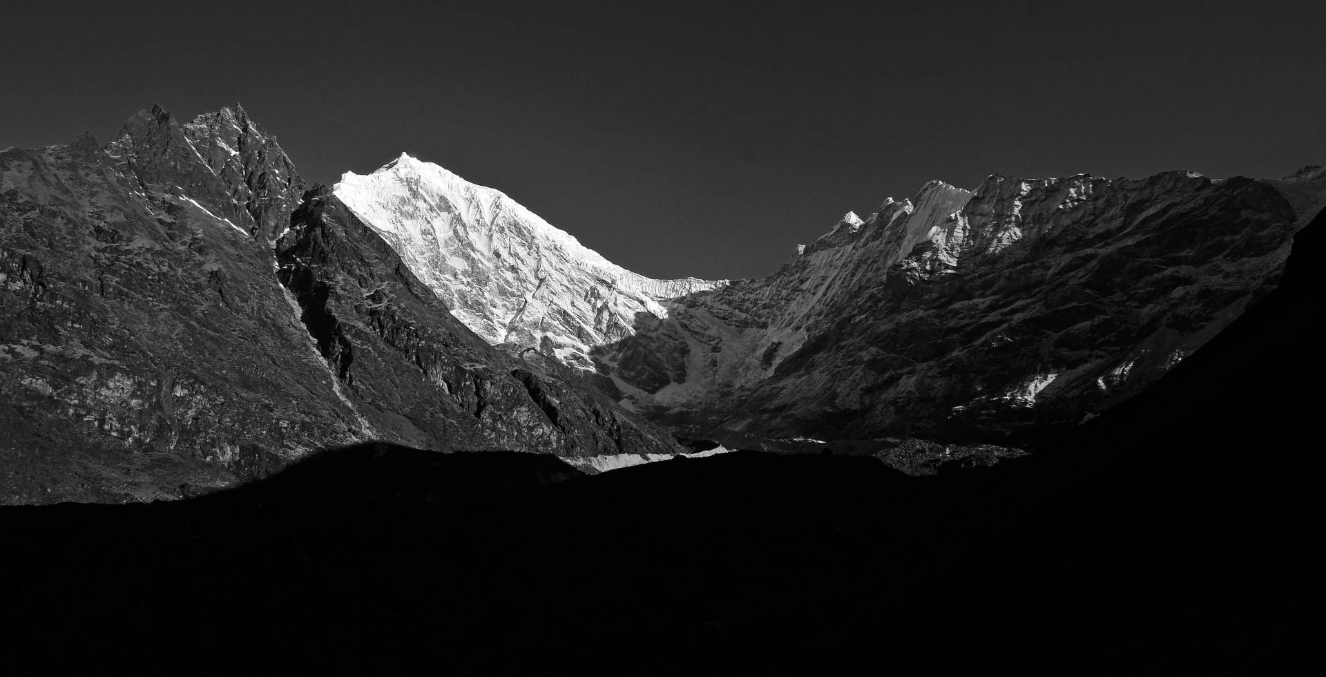
- Most prominent mountains (arranged based on height): Langtang Lirung (7,234 m), Langtang Ri (7,205 m), Leonpo Gang (6,979 m), Dorje Lyakpa (6,966 m), Gurkarpo Ri (6,891 m), Pem Thang Karpo Ri (6,865 m), Bhairab Takura (6,799 m), Kimshung / Tsangbu Ri (6,781 m), Leonpo Gang East (6,733 m), Salbachum (6,707 m), Phurbi Chyachu (6,631 m), Pangri Goldumba (6,620 m), Kyunga Ri I (6,599 m), Ghenye Liru / Langtang II (6,571 m), and Yangri / Jugal (6,535 m).
- Other popular peaks: Yubra Himal (6,048 m), Ganja La Chuli / Naya Khanga (5,863 m), Langshisha Ri (6,412 m), Ganchenpo (6,378 m), Baden Powell Scout Peak (5,857 m), Yala Peak (5,520 m)
- High-altitude passes: Ganja La Pass, Tilman Pass, and Laurebina Pass.
- Key viewpoints (exclusive to the Langtang Valley Trek): Tsergo Ri, Kyanjin Ri, and Langshisha Kharka.
- Main lakes: Gosaikunda, Bhairabkunda, Suryakunda, Langtang Hydro Glacier Lake, Panch Pokhari (five sacred ponds).
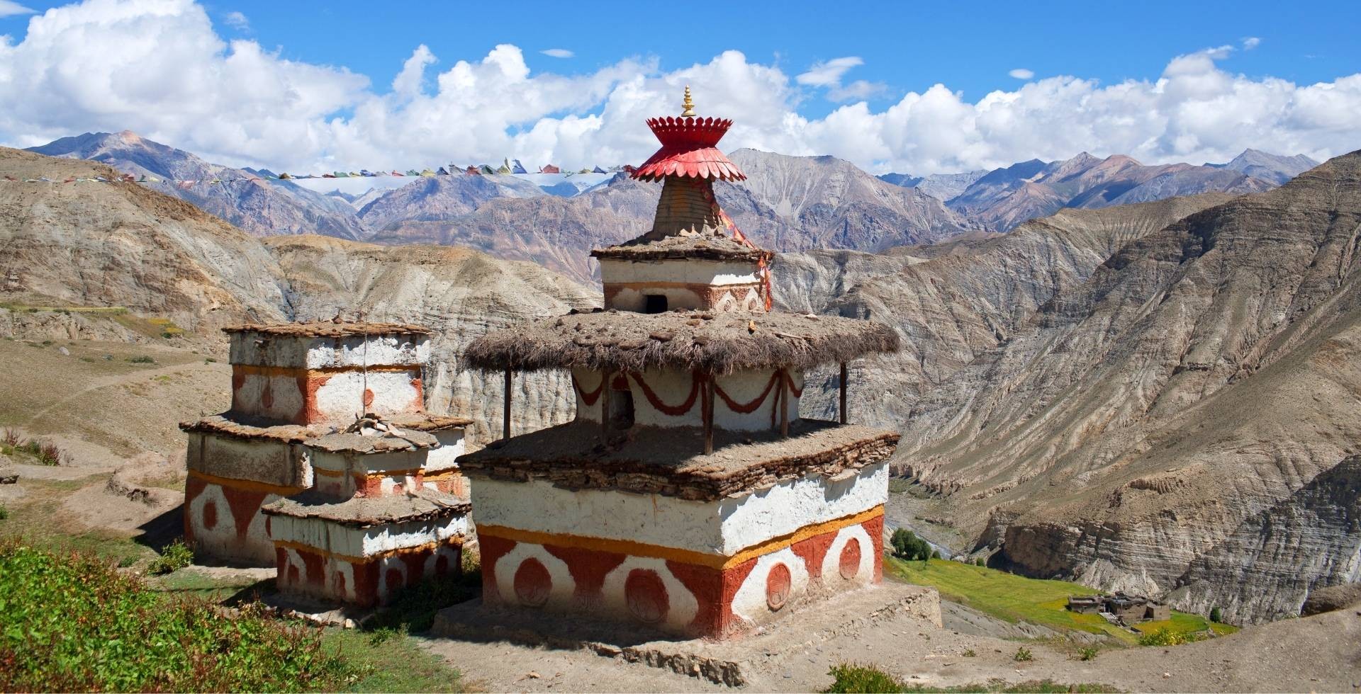
- Main monasteries: Kyanjin Gompa (in Langtang Valley) and Sing Gompa (on the Gosaikunda trek).
Langtang Valley Trek Elevation Profile
The Langtang Valley Trek starts at Syaphru Bensi (1,467 m) and climbs up to the highest point of Tsergo Ri / Tserko Ri at 4,985 m. That makes the total elevation gain roughly:
- 3,500 m if you reach Tsergo Ri
- 3,200 m if you reach (Upper) Kyanjin Ri
- 2,900 m if you reach Lower Kyanjin Ri.
Averaging this on a per-day basis, you'll gain anywhere between 300 m and 1,000 m, with an average of around 600 to 700 m depending on the itinerary and the stops you choose.
Well, this is definitely manageable for most fit trekkers, although the altitude should never be taken lightly. There are no acclimatization days built into the classic itinerary, but that doesn’t mean you should be careless.
Now, let me give you a glimpse of how the altitude profile of the Langtang Valley Trek follows the classic route from start to finish:
Syaphru Bensi (1,467 m) > Tiwari (1,530 m) > Dhomen / Domen (1,650 m) > Pairo / Landslide (1,730 m) > Bamboo (1,960 m) > Rimche / Rimiche (2,400 m) > Lama Hotel / Changdam Village (2,470 m) > Gumnachok / Riverside (2,560 m) > Chhunama (2,620 m) > Pering Kharka (2,870 m) > Ghoda Tabela (3,020 m) > Thangshyap (3,140 m) > Tsarting / Charting (3,200 m) > Chyamki (3,250 m) > Gumba (3,350 m) > Langtang Village (3,430 m) > Mundu (3,480 m) > Sindhum (3,520 m) > Kyanjin Gompa (3,870 m) > Lower Kyanjin Ri (4,350 m) > (Upper) Kyanjin Ri (4,773 m) > Tsergo Ri (4,985 m)
Langtang Valley Trek Route Overview
Now that you have the map and the altitude in your head, it's time to head for the actual Langtang Valley route details. I’ll cover everything from how you get there to the most meaningful stops along the way.
Transportation to Starting Points: Syaphru Bensi and Sherpagaun
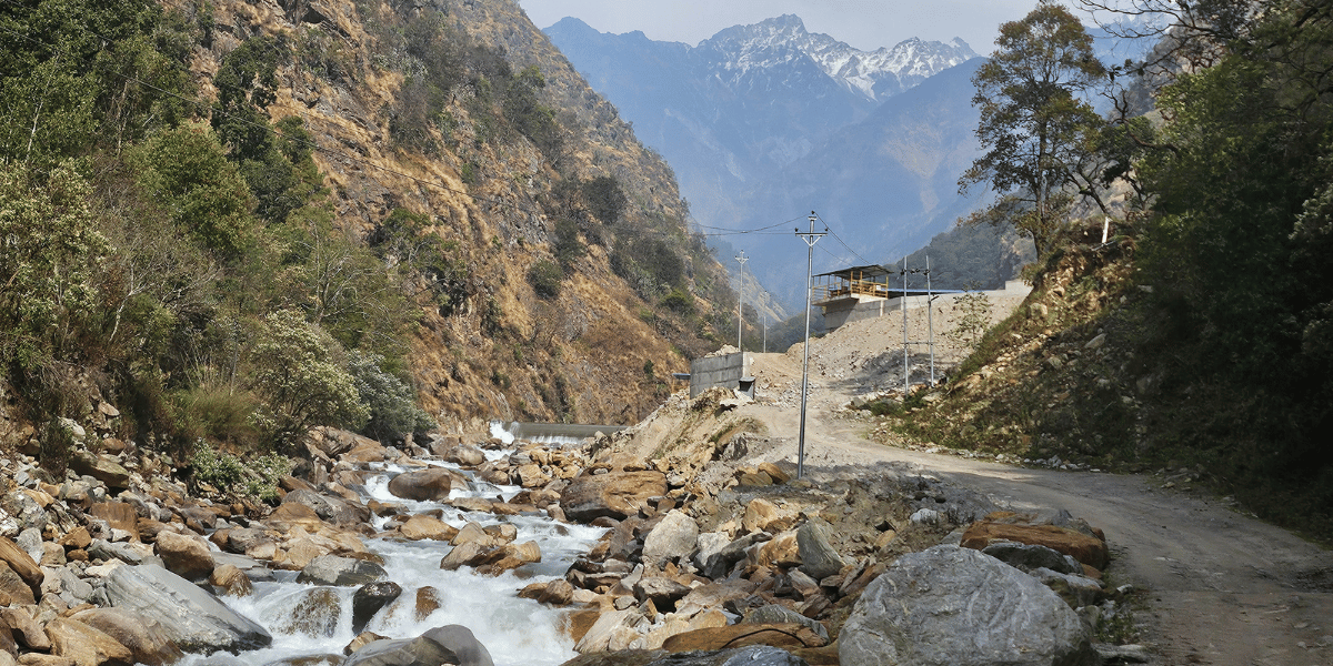
To begin the Langtang Valley Trek, you'll first drive to Syaphru Bensi via Tokha (option from Galchi, Dhading also exists), Chahare, Bidur, Betrawati, and Dhunche (Kathmandu-Nuwakot-Rasuwa).
There is an alternative road via Mailung (instead of Dhunche), too. This was one that our content team recently took during our Langtang trek in March. But it's more of an off-road route. So, the Dhunche road remains the better and more reliable choice!
Precisely speaking, you can opt for either public or private vehicles as two different modes of transportation to reach the Langtang Valley Trek's starting point.
Depending on the group size, that could be a car, jeep, van, or even a tourist bus. But do note that there are a few agencies that may choose the public option to cut down the Langtang Trek costs (so keep that in mind before booking the right travel operator).
For those traveling independently, public options like buses or electric vans are available, or you can hire a local vehicle on your own.
While the standard starting point for the Langtang Valley Trek is Syaphru Bensi, Sherpagaun (originally called Sher-Pho Gaun) has also started serving as a starting point after recent road construction.
However, the road condition in that section may not always be reliable, especially during bad weather (like monsoon and post-monsoon time). So , honestly, it's better to start from Syaphru Bensi.
But if you still choose to begin from Sher-Pho Gaun, your trekking distance reduces slightly as you reach Rimche and can push beyond Lama Hotel the same day. That’s almost 10 km of trekking saved!
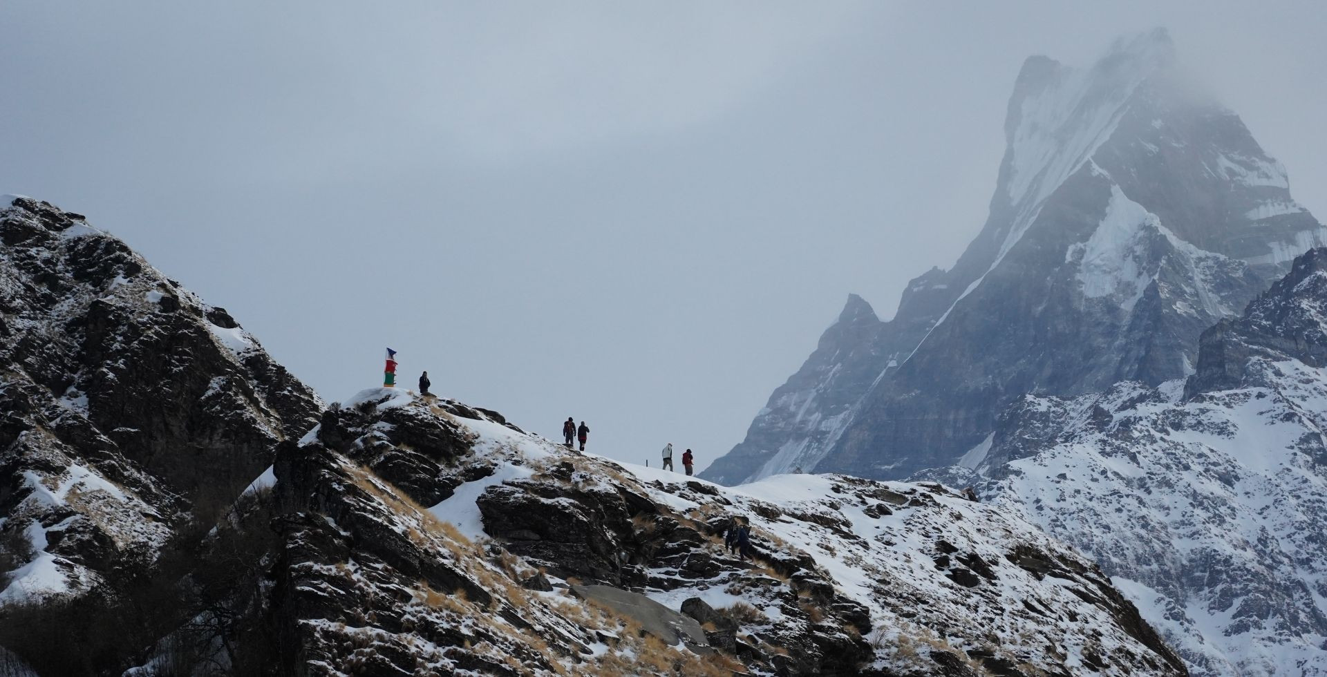
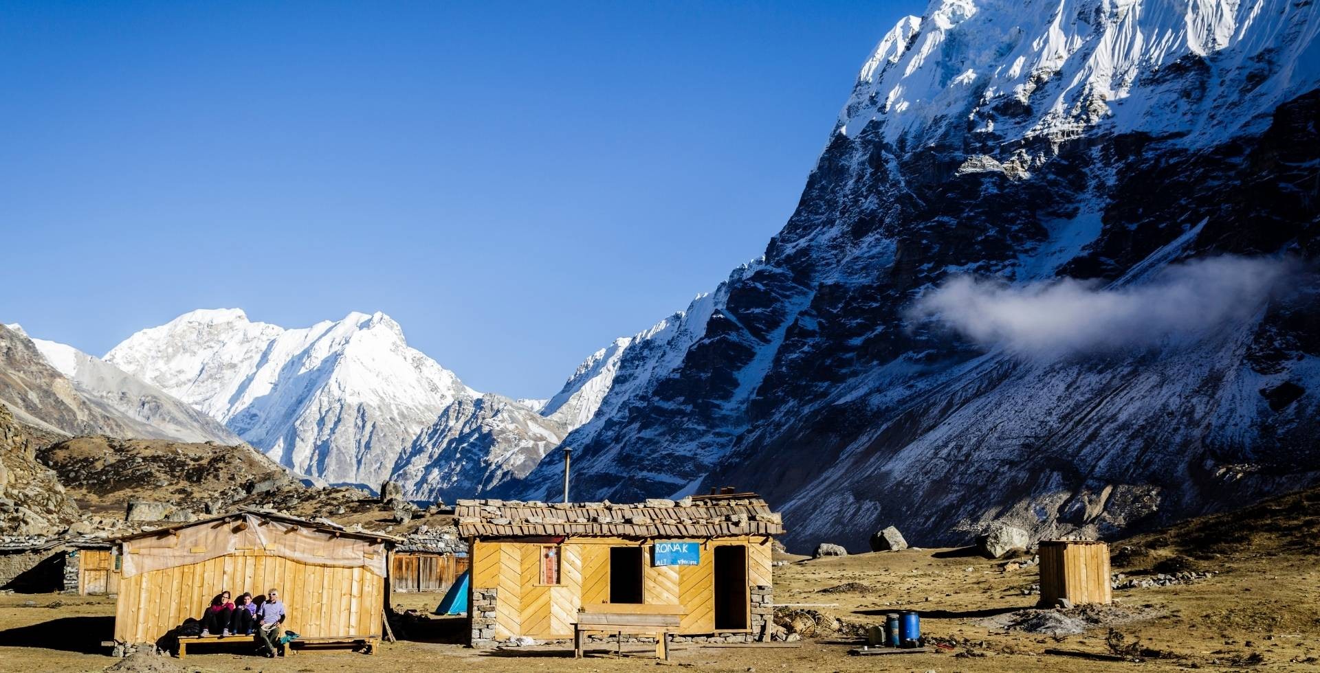
Main Stops Along the Langtang Trail
After Syaphru Bensi, the Langtang Valley trail introduces you to a series of settlements and rest points. Among them, these are the ones you’ll stop at (for accommodations or simply for tea breaks):
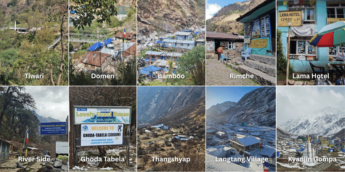
- Tiwari: Most trekkers won't notice this small settlement because they tend to follow the direct road path to Domen (Tiwari is located on the opposite side, and there’s a bridge that connects you here). But if you choose the original trail, Tiwari is where you pass through.
- Dhomen (or Domen): After crossing a bridge, you reach this small settlement with a few local teahouses. It's definitely worth stopping here for a cup of tea before pushing on.
- Pairo (or Landslide): Once upon a time, there were hot springs here. Sadly, they were swept away and buried by the landslide. Today, you’ll find a rock here labeled with ‘hot springs’, which is a reminder of what was lost. After a short uphill climb from this point, you'll reach a small section with two hotels. It’s a perfect place to pause, catch your breath, and refuel!
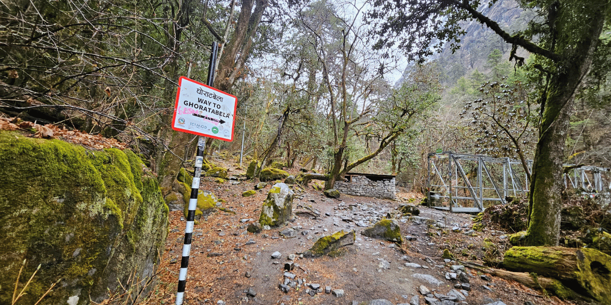
- Bamboo: True to its name, this settlement sits between the bamboo forests, right besides the Langtang Khola. It’s a beautifully relaxing vibe and serves as home to three to four teahouses here. In fact, it’s also a viable overnight stop, especially if you start your trek from Syaphru Bensi the same day.
- Rimche (or Rimiche): After crossing the Tanmarche Khola bridge and tackling the uphill from Bamboo, you arrive at this small settlement. Electricity is available from here. If you’re able to start early, I would suggest pushing up to Rimche, as Bamboo still has electricity issues.
- Lama Hotel (or Changdam Village): This place got its name after a Lama (Buddhist monk) established a teahouse here back in 1976, and the name has stuck ever since. It's the first major overnight stop for many itineraries and can get crowded during peak seasons. Note that network issues persist here, although WiFi is available in some lodges. In case you really need to use the internet, the lodges also sell prepaid cards here (but honestly, you won’t need to use your phone!) And don’t worry, I’m confident connectivity will likely improve in the future!
- Gumnachok (or Riverside): Following the rhododendron trails, you reach this relaxing spot before the next uphill push to Ghoda Tabela. There's just one teahouse here right by the Langtang Khola, which is why locals popularly call it "Riverside." It's a great place to unwind by the river, but be aware of the water level if you're trekking during the monsoon or post-monsoon season.
- Chhunama: A little further ahead, this small stop is where you first encounter sea buckthorn juice. And you will absolutely be tempted to try it (speaking from my personal experience)! There are just about one or two teahouses where you can spend the night if you’re starting the trek from Sher-Pho Gaun.
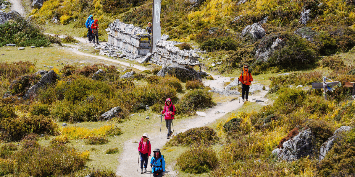
- Pering Kharka: Although there are no accommodations here yet, the open grounds make this one of the most visually striking spots on the Langtang Valley Trek. I’m especially referring to the spring season when rhododendrons bloom. And note that in winter and post-winter, the snow line often begins right around here.
- Ghoda Tabela: The name translates to "horse stable," and fittingly, you will find horses grazing in the fields from Pering Kharka onwards. Two to three teahouses here serve trekkers well, and it's a great option for beginners who need to call it a day early. There's also a Langtang Check Post here, where you'll need to show your National Park permits.
- Thangshyap: After reaching here, the mountains feel noticeably closer. This also marks the 3,000-meter elevation, so altitude sickness becomes a real consideration from this point on (especially for beginners). Talk to your guide, listen to your body, and only move forward when you're ready. If you can't push on, this is a solid overnight stop too!
- Tsarting (or Charting): Located just a short distance beyond Thangshyap, this is not a major settlement but a decent spot to rest if you're starting to feel tired.
- Chyamki: Many trekkers rush past this small settlement in the excitement of reaching Langtang Village. But do slow down here, say hello to the locals, try the sea buckthorn juice or other local Langtang food/drinks if you haven't already. There are one or two lodges here if you need to stay, and it can honestly be a budget-friendly option too.
- Gumba: This place is named after "monastery," because that’s what ‘gumba’ or ‘gompa’ means. While there are plenty of small monasteries here, this stop carries a much deeper significance.
It's a good place to pause, reflect, and offer a quiet prayer for the lives lost before approaching the site of the old Langtang Village, which was buried by the 2015 earthquake and subsequent avalanche.
There are a few accommodations here as well, and if it's already getting late, I'd strongly recommend staying here rather than pushing forward past the landslide zone in the dark.
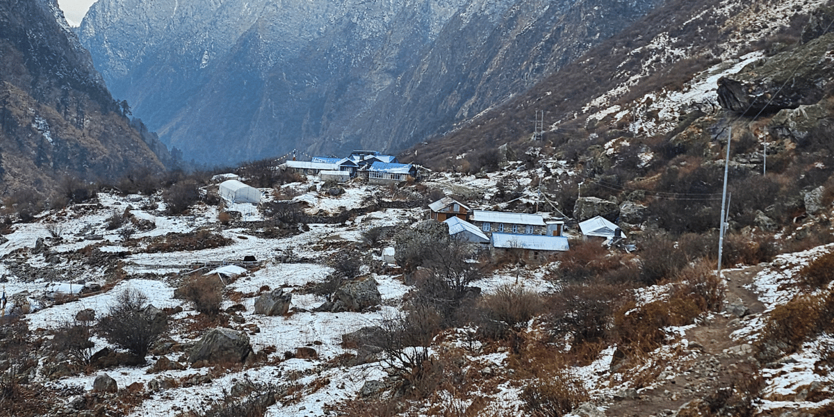
- Langtang Village: This is the emerging settlement built after the tragedy of 2015. Many trekkers stop here for their second night, and there are enough accommodations to choose from. The teahouses here have evolved into proper mountain lodges, some top-notch ones even come with attached washrooms and warm dining areas. So, it’s going to serve you as a genuine comfort even at freezing temperatures outside.
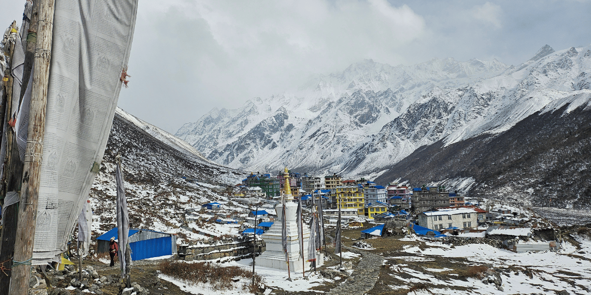
- Kyanjin Gompa: This is the final village of Langtang Valley and serves as the starting point for multiple viewpoint hikes, peak climbing, and even expeditions. The village is named after the main Kyanjin Monastery, which opens up early morning and late evening (only on certain days).
What’s important is that it feels like a town tucked right beneath the giant Langtang and Jugal mountains. And yes, don’t miss out on visiting the organic cheese production centre along with the mountain bakeries here!
Major Attractions of Langtang Valley Trek
In your Langtang Valley Trek, you won’t just be reaching Kyanjin Gompa and turning around (that would be a big mistake!).
There are some truly remarkable places worth your time and attention. Here are the most prominent ones, or what I call the major attractions of the Langtang Valley Trek (achievable within 6-to-8 days itinerary):
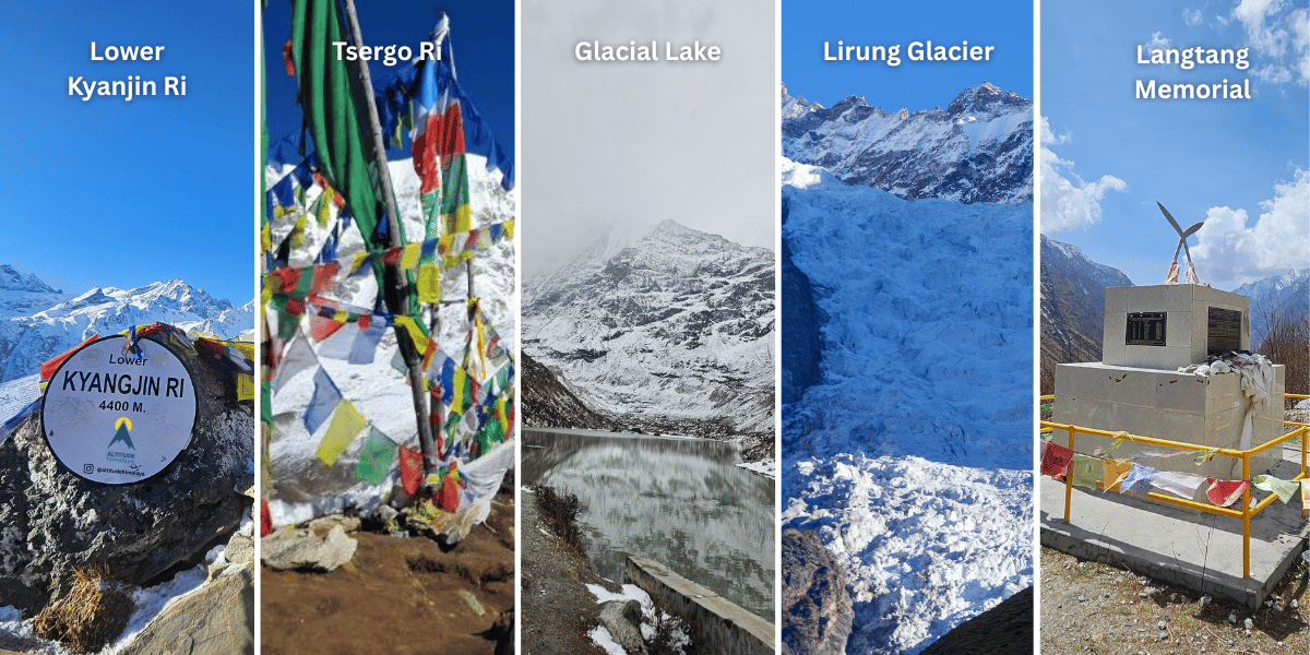
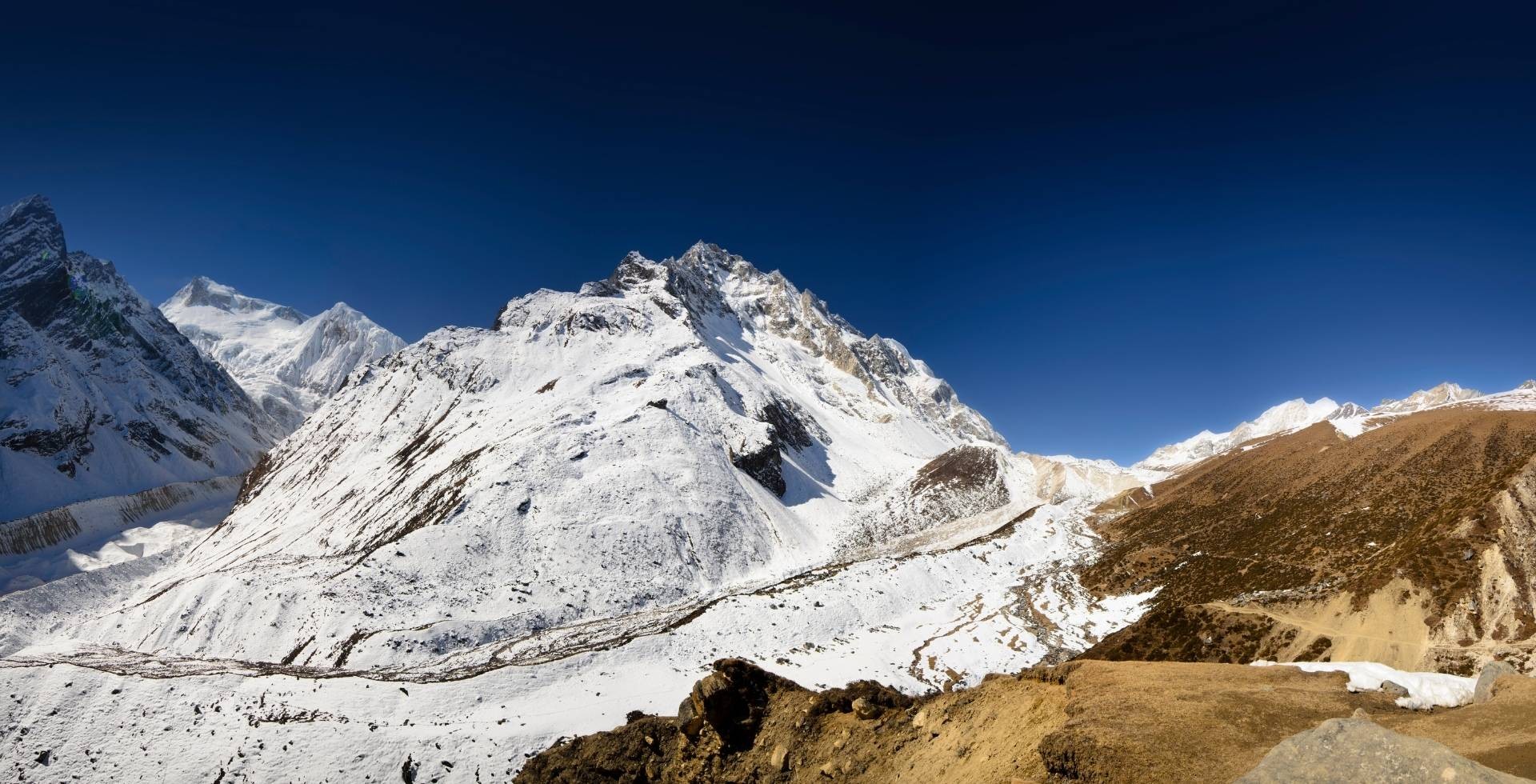
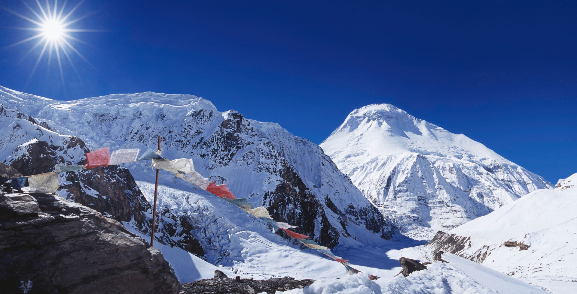
- Kyanjin Ri (Lower at 4,400 m and Upper at 4,700 m): This is the classic viewpoint hike from Kyanjin Gompa. You can choose between Lower Kyanjin Ri and the main upper one (or do both). Each offers progressively more expansive panoramas of the Langtang and Jugal range compared to the glimpses you got from below.
- Tsergo Ri (4,985 m): The highest and most dramatic viewpoint on the Langtang Valley Trek. Choosing this adventure means you’ll reach almost 5,000 m and that comes with a 360-degree view of Langtang Lirung, Kimshung, Yubra Himal, Yansa Tsenji, Shalbachum, Yala Peak, Yala Peak South, Bhemdang Ri, Bhemdang Karpo, Langshisa Ri, Ganchenpo, Naya Khanga, Kanja La Chuli, Gochenpo, Langtang II, etc.
- Lirung Glacial Lake (3,960 m): Formed by the glacier waters of Langtang Lirung and Kimshung (or Tsangbu Ri), this lake powers the micro-hydro system in Kyanjin Gompa (happens to be the first glacier hydropower of Nepal). The short hike here takes you roughly 100 m above the village and takes you very close to the two mountains.
- Langshisha Kharka (4,050 m): This is the best location for a longer day hike from Kyanjin Gompa via Numthang with an option to do camping. It has local stories connected, and people in Langtang even celebrate the ‘Langshesha Mela’ (which can be observed if you’re right at the festive period). You’ll pass yak herding grounds and sit right in front of the 6,412 m-tall Langshisa Ri.
- Langtang Lirung Base Camp (4,407 m): This has to be one of the least-known and most underrated hikes from Kyanjin Gompa. It covers roughly 10 km one-way with an elevation gain of around 537 m. The trail to the base camp passes a Buddhist shrine and gives you sweeping views of the Langtang Lirung glacier. Even glimpses of Shishapangma across the Tibetan border can be seen. You’ll reach up to the last flat grassy area, which serves as the starting point for Langtang Lirung summit expeditions. The whole round trip takes 5 to 6 hours and since very few trekkers make it this far, you'll likely have the trail entirely to yourself (better to go with a guide)!
- Lirung Glacier Viewpoint (4,161 m): This is yet another short location, which is just about a one-hour hike from Kyanjin Gompa. It gives you a close view of the Langtang Lirung glacier and the broad lateral moraines around. In case you aren’t able to get to Kyanjin Ri on the first day, you may opt for this accessible high-altitude vantage point.
- Old Langtang Village Site: During the return, we suggest stopping by the memorial site made on top of the Langtang Valley ruins. This isn’t a major natural attraction, but rather a part of the trek to mourn the death and feel sorrow for their families who are still in a grieving period.
Additional Trips From Langtang Valley
If you have more time or want to extend your adventure beyond the classic route, the Langtang region offers some compelling extensions. Here are the most popular ones:
- Gosaikunda Lake Trek: From Kyanjin Gompa, you return to Lama Hotel and continue onwards to Pairo. Then, you need to head to Thulo Syaphru and continue towards Dursagang before reaching the sacred Gosaikunda (at 4,380 m) and surrounding lakes (there are over 108 small kundas in the region).
- Tamang Heritage Trail: I call this the extended version of the Langtang Valley Trek. It takes you through the culturally immersive route through Tamang villages like Gatlang, Tatopani, Thuman, and Briddhim before connecting back into the main Langtang Valley trail.
- Yala Peak Climb: At 5,520 m, Yala Peak is one of the easiest and most accessible trekking peaks in Nepal. In fact, many have started opting for this adventure that will take you around 2-3 extra days.
- Ganja La Pass with Helambu Circuit Trek: This one's for the experienced trekkers who are willing to cross the challenging Ganja La Pass (5,122 m) from Kyanjin Gompa. This takes you into the Helambu region, and from here you can even opt for the Helambu Circuit Trek.
Langtang Valley Trek Distance [Between Different Stops]
Here's a complete summary of the distances between each stop along the Langtang Valley Trek route. I’m sure this will help you plan your daily schedule and set realistic expectations:
|
Start Point
|
Distance
|
Distance
|
Time (approx.)
|
|
Syaphru Bensi / Syabrubesi
|
Tiwari
|
2 km
|
30 - 45 minutes
|
|
Tiwari
|
Dhomen / Domen
|
1.5 km
|
30 - 45 minutes
|
|
Domen
|
Pairo / Landslide
|
1 km
|
30 - 45 minutes
|
|
Pairo
|
Bamboo
|
2 km
|
1 hour
|
|
Sherpagaun / Sher-Pho Gaun
|
Rimche / Rimiche
|
3 km
|
2 hours
|
|
Bamboo
|
Rimche
|
3 km
|
1.5 hours
|
|
Rimche
|
Lama Hotel / Changdam Village
|
1 km
|
20 - 30 minutes
|
|
Lama Hotel
|
Gumnachok / Riverside
|
2.5 km
|
2 hours
|
|
Gumnachok
|
Chhunama
|
500 meters
|
10 - 15 minutes
|
|
Chhunama
|
Pering Kharka
|
2 km
|
1 - 1.5 hours
|
|
Pering Kharka
|
Ghoda Tabela
|
700 meters
|
15 - 20 minutes
|
|
Ghoda Tabela
|
Thangshyap
|
2 km
|
1 - 1.5 hours
|
|
Thangshyap
|
Tsarting / Charting
|
700 meters
|
15 - 20 minutes
|
|
Tsarting
|
Chyamki
|
750 meters
|
15 - 20 minutes
|
|
Chyamki
|
Gumba
|
1 km
|
30 - 45 minutes
|
|
Gumba
|
Langtang Village
|
1.5 km
|
30 - 45 minutes
|
|
Langtang Village
|
Mundu
|
1.5 km
|
30 - 45 minutes
|
|
Mundu
|
Sindhum
|
650 meters
|
10 - 15 minutes
|
|
Sindhum
|
Kyanjin Gompa
|
4.5 km
|
2 hours
|
|
Kyanjin Gompa
|
Lirung Glacial Lake
|
1.5 km
|
30 - 45 minutes
|
|
Kyanjin Gompa
|
Lower Kyanjin Ri
|
1 km
|
1.5 hours
|
|
Lower Kyanjin Ri
|
(Upper) Kyanjin Ri
|
850 meters
|
1 - 1.5 hours
|
|
Kyanjin Gompa
|
(Upper) Kyanjin Ri
|
2 km
|
3 hours
|
|
Kyanjin Gompa
|
Tsergo Ri
|
4.5 km
|
5.5 - 6 hours
|
|
Kyanjin Gompa
|
Langshisa Kharka
|
12 km
|
6 - 7 hours
|
|
Syaphru Bensi to Kyanjin Gompa
|
30 km
|
16 - 18 hours (3 days)
|
|
Kyanjin Gompa to Syaphru Bensi (return)
|
9 - 10 hours (1.5 - 2 days)
|
|
Overall Trek (with Kyanjin Ri)
|
62 km
|
5 days
|
|
Overall Trek (with Lower Kyanjin Ri)
|
60 km
|
5 days
|
|
Overall Trek (with Tsergo Ri)
|
67 km
|
5 days
|
|
Overall Trek (with Kyanjin Ri and Tsergo Ri)
|
70 - 72 km
|
5 - 6 days
|
|
Overall Trek (with Lower Kyanjin Ri and Tsergo Ri)
|
68 - 70 km
|
5 - 6 days
|
The Best Langtang Valley Trek Itineraries
There's no single "correct" way to do the Langtang Valley Trek. The right itinerary depends on how much time you’re willing to allocate, your fitness level, and which side trips you want to include.
The most-preferred option is the classic itinerary, which takes 6 to 7 days. Now, if you add 2-4 more days, it’s possible to incorporate Gosaikunda, the Tamang Heritage Trail, or even the Yala Peak climb (something I’ve already explained earlier).
In March 2026, our content team went for the 6-day itinerary, and it was honestly deeply rewarding. Just one more day, and the 7-day version will give you a more comfortable experience for sure!
Our main package at Altitude Himalaya is the 10-day Langtang Valley Trek, which includes arrival, departure, and a Kathmandu sightseeing day. Whether you’d like the 6-day or 7-day Langtang Trek, you can contact us directly, and we can adjust the itinerary based on your schedule.
Not to forget that we also offer Gosaikunda and Tamang Heritage extensions (or more attractions that I explained above). Let me provide a general structure below for a clearer idea:
6-Day Langtang Valley Trek Itinerary
This is mostly popular among independent trekkers and local travellers. But if you want to cut time, this 6-day approach can definitely suit you:
- Day 01: Kathmandu to Syaphru Bensi Drive, Trek to Bamboo.
- Roadway Route: Tokha (Kathmandu) > Chahare (Nuwakot) > Bidur > Betrawati > Dhunche > Syaphru Bensi.
- Trek Route: Syaphru Bensi > Tiwari > Domen > Pairo > Bamboo
- Drive Distance: 130 km
- Approximate Drive Duration: 5 to 6 hours
- Hike Distance: 7.5 km
- Approximate Hike Duration: 3 to 4 hours
- Total Incline: 500 m
- Day 02: Bamboo to Langtang Village.
- Route: Bamboo > Rimche > Lama Hotel > Gumnachok > Chhunama > Pering Kharka > Ghoda Tabela > Thangshyap > Tsarting > Chyamki > Gumba > Langtang
- Hike Distance: 15 km
- Hike Duration: 9 to 10 hours
- Total Incline: 1500 m
- Note: If this feels too rushed, you can stay anywhere between Ghoda Tabela and Gumba. Thanghyap is a popular choice, so I would personally recommend that!
- Day 03: Langtang Village to Kyanjin Gompa, Kyanjin Ri Evening Hike.
- Route: Langtang > Mundu > Sindhum > Nepali > Kyanjin Gompa > Lower Kyanjin Ri > (Upper) Kyanjin Ri > Kyanjin Gompa
- Hike Distance: 11 km
- Total Hike Duration: 8 to 9 hours
- Total Incline (Langtang to Kyanjin Ri): 1250 m
- Total Decline (Kyanjin Ri to Kyanjin Gompa): 800 m
- Note: In case of bad weather, you can skip Kyanjin Ri this day and only opt for the nearby Lirung Glacial Lake for acclimatization hike (this is what we did).
- Day 04: Tsergo Ri Morning Hike, Kyankin Gompa Exploration.
- Route: Kyanjin Gompa > Tsergo Ri > Kyanjin Gompa.
- Hike Distance: 9.5 km
- Hike Duration: 8 to 9 hours
- Total Incline and Decline: 1,100 m
- Day 05: Kyanjin Gompa to Lama Hotel.
- Route: Same route
- Hike Distance: 18 km
- Hike Duration: 5 to 6 hours
- Total Decline: 1400 m
- Note: In case you missed out reaching hiking points earlier, you have the option to visit this day as well.
- Day 06: Lama Hotel to Syaphru Bensi, Drive Back to Kathmandu.
- Trek and Drive Route: Same as earlier
- Hike Distance: 11 km
- Hike Duration: 4 to 5 hours
- Drive Distance: 130 km
- Drive Duration: 4 to 5 hours
- Total Decline (Lama Hotel to Kathmandu): 1100 m
- Note: If you have enough time, you can hike via Sher-Pho Gaun too.
7-Day Langtang Valley Trek Itinerary
This is the most popular itinerary that I’ve been bragging about all along. It’s perfect and followed by not just us but also other reliable travel agencies. It’s altitude-friendly, best for beginners, and includes both the major viewpoints.
- Day 01: Kathmandu to Syaphru Bensi Drive.
- Drive Distance: 130 km
- Approximate Drive Duration: 5 to 6 hours
- Total Incline: 60 m approx.
- Day 02: Syaphru Bensi to Lama Hotel.
- Hike Distance: 11 km
- Hike Duration: 5 to 6 hours
- Total Incline: 1000 m
- Day 03: Lama Hotel to Langtang Village.
- Hike Distance: 12 km
- Hike Duration: 7 to 8 hours
- Total Incline: 900 m
- Day 04: Langtang Village to Kyanjin Gompa, Kyanjin Ri Evening Hike.
- Hike Distance: 11 km
- Total Hike Duration: 8 to 9 hours
- Total Incline (Langtang to Kyanjin Ri): 1250 m
- Total Decline (Kyanjin Ri to Kyanjin Gompa): 800 m
- Day 05: Tsergo Ri Morning Hike, Kyanjin Gompa Stay.
- Hike Distance: 9.5 km
- Hike Duration: 8 to 9 hours
- Total Incline and Decline: 1,100 m
- Day 06: Kyanjin Gompa to Lama Hotel.
- Hike Distance: 18 km
- Hike Duration: 5 to 6 hours
- Total Decline: 1400 m
- Day 07: Lama Hotel to Syaphru Bensi, Drive Back to Kathmandu.
- Hike Distance: 11 km
- Hike Duration: 4 to 5 hours
- Drive Distance: 130 km
- Drive Duration: 4 to 5 hours

This one is where you get the full Langtang experience, as you get to visit one of Nepal's most sacred destinations on the trip. It’s Gosaikunda Lake at 4,380 m, which is a pilgrimage site deeply tied to Hindu and Buddhist traditions.
The trail connects from a little ahead of Pairo in the main Langtang Valley and is a very rewarding extension. Eleven days gives you enough time to do both without feeling rushed.
- Day 01: Kathmandu to Syaphru Bensi Drive, Reach Bamboo.
- Day 02: Bamboo to Langtang Village.
- Day 03: Langtang Village to Kyanjin Gompa, Optional Hike to Kyanjin Ri.
- Day 04: Tsergo Ri Morning Hike, Explore Kyanjin Gompa.
- Day 05: Kyanjin Gompa to Lama Hotel.
Note: Up to Day 5 is the same as the 6-day Langtang Valley Trek itinerary.
If you have the time and want more than just the Langtang Valley, here’s another trip to consider.
The Tamang Heritage Trail adds a deeply cultural dimension to the trek, taking you through traditional Tamang villages that most trekkers completely miss. It is longer, but the added days are absolutely worth it.
Here’s what your itinerary looks like:
Note: From Day 7, it's the same as the Langtang Valley Trek route.
Other Possible Itineraries
In the ones above, I covered the most popular Langtang-focused options. But if you want to extend your trek in the Langtang region by adding a few other destinations within the national park itself, let me suggest a few options that will be totally worth it:
- Day 06: Lama Hotel to Thulo Syaphru.
- Route: Lama Hotel > Rimche > Bamboo > Pairo > Thulo Syaphru (Thulo Syabru)
- Hike Distance: 10 km
- Hike Duration: 5 hours approx.
- Total Decline: 265 m
- Day 07: Thulo Syaphru to Laurebina.
- Route: Thulo Syaphru > Dursagang > Cholangpati > Laurebina
- Hike Distance: 8 km
- Hike Duration: 6 to 7 hours
- Total Incline: 1,660 m
- Day 08: Laurebina to Gosaikunda Lake, Optional Viewpoint Hikes.
- Route: Laurebina > Buddha Mandir > Ganesh Gauda Passs > Gosaikunda
- Hike Distance: 4 km approx.
- Hike Duration: 3 hours approx.
- Total Incline: 470 m
- Gosaikunda Lake to Trishul Dhara: 700 meters, 20 minutes
- Gosaikunda Lake to nearby viewpoint: 1 km, 1 hour
- Gosaikunda Lake to Suryakunda/Laurebina Pass: 3 km, 2 hours
- Day 09: Gosaikunda Lake to Dhunche.
- Route: Gosaikunda > Chandanbari > Dhimsa > Deurali > Khendi > Ghatte Khola > Sapche > Dhunche
- Hike Distance: 16 km
- Hike Duration: 8 to 9 hours
- Total Decline: 2,400 m
- Day 10: Drive Back to Kathmandu.
- Drive Distance: 110 km
- Drive Duration: 4 to 5 hours
- Total Decline: 550 m
- Day 01: Kathmandu to Syaphru Bensi Drive.
- Drive Distance: 130 km
- Approximate Drive Duration: 5 to 6 hours
- Total Incline: 60 m approx.
- Day 02: Syaphru Bensi to Gatlang.
- Route: Syaphru Bensi > Bahun Danda > Godam > Gatlang / Gatlang Height
- Hike Distance: 17 km
- Hike Duration: 8 to 9 hours
- Total Incline: 770 m
- Note: An option for drive exists, which is about 2.5 hours drive from Syaphru Bensi. This means you can reduce a day and reach Gatlang on the first day itself and get enough time to explore Parvati Kunda the same day.
- Day 03: Gatlang to Tatopani via Thambuchet.
- Route: Gatlang > Chyamdole > Thambuchet > Chilime > Gongang > Tatopani
- Hike Distance: 11 km
- Hike Duration: 4 to 5 hours
- Total Incline: 370 m
- Day 04: Tatopani to Thuman via Nagthali.
- Route: Tatopani > Brimdang > Nagthali > Thuman
- Hike Distance: 7.5 km
- Hike Duration: 5 to 6 hours
- Total Decline: 270 m
- Day 05: Thuman to Briddhim.
- Route: Thuman > Lingling > Briddhim
- Hike Distance: 6 km
- Hike Duration: 3 to 4 hours
- Total Incline: 2,100 m
- Day 06: Briddim to Lama Hotel.
- Route: Briddhim > Khangjim > Surka > Sherpagaun > Rimche > Lama Hotel
- Hike Distance: 13 km
- Hike Duration: 8 to 9 hours
- Total Incline: 300 m
- Day 07: Lama Hotel to Langtang Village.
- Day 08: Langtang Village to Kyanjin Gompa, Optional Hike to Kyanjin Ri.
- Day 09: Morning Hike to Tsergo Ri, Kyanjin Gompa Exploration.
- Day 10: Kyanjin Gompa to Lama Hotel.
- Day 11: Lama Hotel to Syaphru Bensi, Drive Back to Kathmandu.
- Extended Langtang Valley Trek: For those who want to push further, this includes additional destinations like Langshisha Kharka and Yala Peak Trek. This can add 2 to 4 days to the standard itinerary.
- Langtang-Helambu Circuit Trek: Cross the challenging Ganja La Pass (5,180 m) from Kyanjin Gompa, descend into the Helambu region and then continue through the Hyolmo villages to reach Tarke Ghyang and Melamchi before finishing at Sundarijal. This circuit typically takes 14 to 16 days (a little longer than the standard Helambu Circuit Trek) and is recommended for experienced trekkers with solid high-altitude experience.
Langtang Valley Trail and Terrain Explained
Understanding the trail (of not just Langtang but every trek) before you walk it makes a real difference, especially when you know what to expect at each stage. And that’s exactly what I’m going to do next!
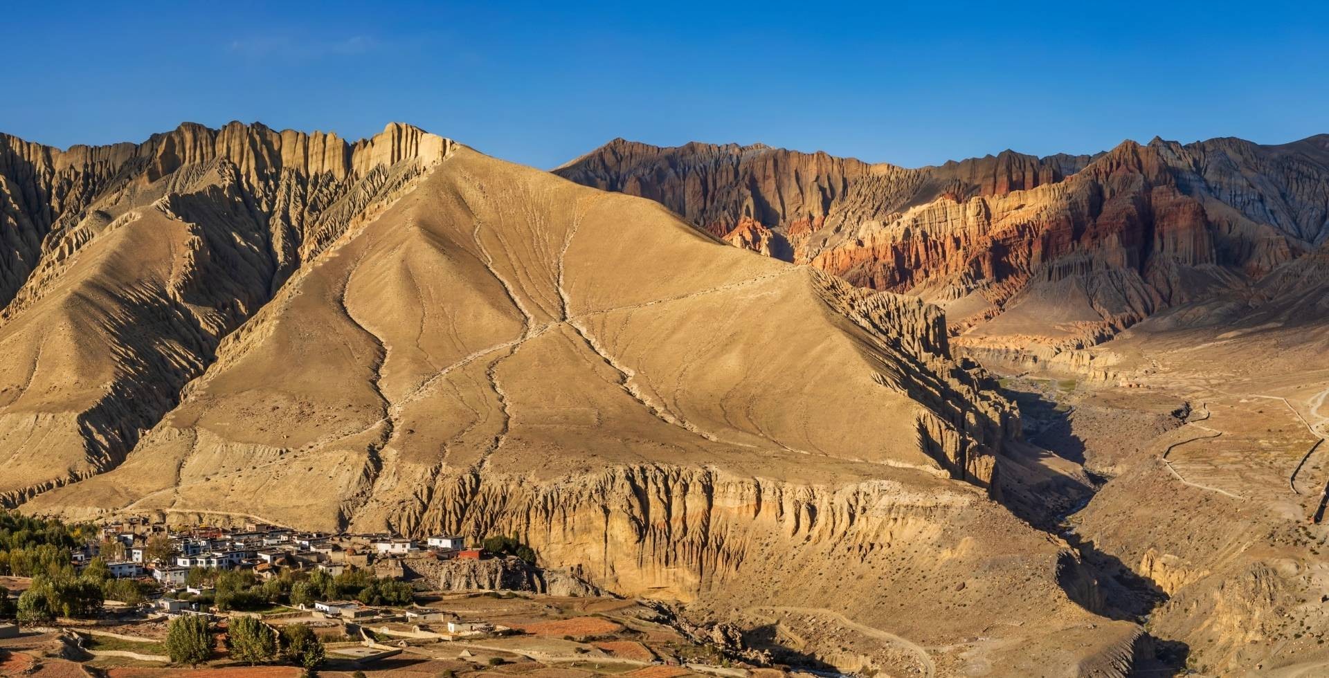
The Langtang Valley Trek passes through several terrain types as you slowly gain elevation from 1,400 m to 4,985 m. Each section has its own beauty and also comes with challenges.
Here is a breakdown of what the trail actually looks like from start to finish:
Syaphru Bensi to Domen
The Langtang Valley Trek officially begins the moment you step out of your vehicle at Syaphru Bensi. The road from here is paved up to Domen, but due to frequent construction activity along this stretch, you’ll have to start the walk from Syaphru Bensi.
You actually have two options from the start:
- One via Tiwari (the original trail with its characteristic ups and downs)
- The other is along the direct road to Domen (straighter and faster, which is why most trekkers prefer it).
The road route is simpler, but the tradeoff is the dust, especially when vehicles pass. This is why a bandana or neck gaiter is genuinely your best friend right from Day 1. Pull it out before you start walking. I’m sure you’ll come back and thank me for this tip.
Since this is the lower section of the trek, sitting in the subtropical zone below 2,000 m, warmer summer days can make the initial hike to Bamboo feel a little more sweaty than expected. So, plan your clothing layers accordingly and don't underestimate the heat in the lower valley.
The route from Syaphru Bensi to Domen also gives you your first real introduction to the Langtang Khola, the river that will accompany you almost the entire way to Kyanjin Gompa!
Domen to Ghoda Tabela
After crossing Domen, the real Langtang trail begins! You cross a few bridges and enter a forested route that takes you to the middle section of the Langtang Valley Trek.
Ecologically, you're passing through the subtropical zone (1,000–2,000 m) and climbing into the temperate zone (roughly 2,000–3,000 m) as you push towards Lama Hotel via Rimche, passing a wooden bridge over the Tanmarche Khola.
Then, you have to tackle a few steep staircases uphill leading up to Rimche. And as you head towards Ghoda Tabela via Gumnachok, you’re going to encounter the mixed temperate flora of oaks, maples, magnolias, and multiple species of rhododendrons.
Along the way, you can even stop by the Langtang Khola for a relaxing break. But do check the water level first if you're in the monsoon or post-monsoon season.
And here’s a secret that nobody tells you: this part of the trail is the prime territory for wildlife. So, it’s almost certain to spot langur monkeys swinging through the trees. Even red pandas, assam macaques also inhabit this zone, along with a wide variety of forest birds.
Locals even say that the bridges near Ghoda Tabela, in particular, are known as one of the best spots for red panda sightings! So, keep your eyes and ears wide open (and please don’t play speakers).
A word of caution: there are landslide-prone sections between Pairo and Bamboo, again between Bamboo and Rimche, and also between Lama Hotel and Ghoda Tabela. When there's rainfall, parts of the trail can become genuinely risky.
So, stay with your group; be cautious! And if you're trekking with a guide, stay close with him/her.
In October 2025, one of the sections near Ghoda Tabela saw a tragic incident as four trekkers went missing. And even today (as of writing this article), their bodies haven't been recovered. While a new bridge has since been constructed, bad weather can still make this part of the Langtang Khola unpredictable. So, kindly be very careful during adverse conditions!
Ghoda Tabela to Langtang Village
After showing your permits at the Ghoda Tabela check post, you’ve now crossed into the subalpine zone (3,000–4,000 m). This means the forest starts to thin and the mountains (particularly Langtang Lirung, Naya Khanga Peak, and Ganchenpo) begin to feel closer!
Yaks start appearing in the pastures too, which is the valley's way of confirming that you're now in the proper Himalayan region of the Langtang National Park.
The trees here are replaced by fir, hemlock, juniper, birch, and larch species. And when there's snowfall, this section looks absolutely stunning. In fact, in winter and post-winter seasons, parts of Pering Kharka, near Ghoda Tabela, are where the snow line begins.
After a slightly demanding uphill through Thangshyap, the route settles into a trail that features rugged sections, stone staircases, and also a few flatter stretches. Tsarting and Chyamki are easy to rush past, but I'd encourage you to slow down, stop for sea buckthorn juice, and enjoy the Tibetan Tamang culture.
So, expect to encounter prayer wheels, mani walls, small gompas, and stone carvings that mark the landscape from Gumba onwards.
Cultural Tip: Walk on the left side of mani walls, keeping them to your right. This is not just a random trekking tradition but rather a mark of respect for the culture you are walking through.
After Gumba, you'll pass the site of the old Langtang Village, buried under an avalanche triggered by the 2015 earthquake. The landscape here gives you a powerful moment of pause.
Memorials have been placed here, and a few sections of this stretch are still prone to risk in bad weather. So, please move through with care and intention!
Langtang Village to Kyanjin Gompa
Upon arriving in Langtang Village, you’re introduced to a completely different world (really!). More yaks, more Tibetan cultural influences, and the beginning of a truly mountain landscape!
The overall Langtang Valley Trek is of moderate difficulty. But from here onwards, during bad weather, snow can cover the trail and make reaching even Kyanjin Gompa a little hard. This is where listening to your guide or local advice becomes very important.
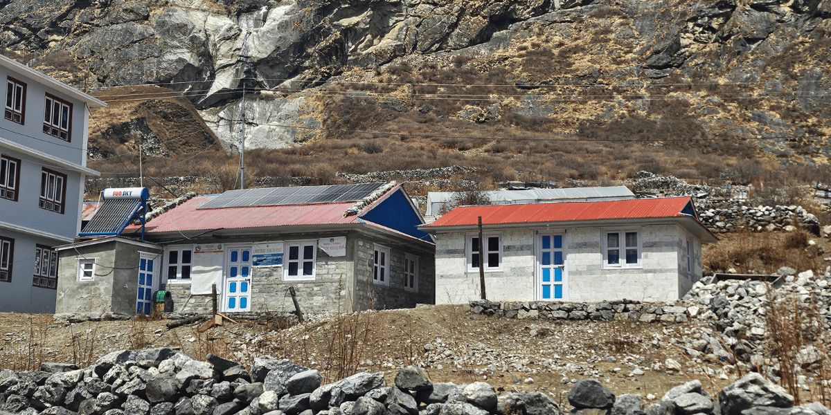
Getting past Langtang, Mundu deserves a special mention! It’s perhaps the most underrated village on the entire Langtang Valley Trek. It's home to the only Langtang Health Post, a police check post, and a school (called Sano Madad Sigi Rasp Memorial School).
In fact, it even served as the polling location for people from Langtang Village and Kyanjin Gompa in the 2026 Nepalese general election. While the village doesn’t feature many teahouses, it’s a great place to meet the core Tamang community!
Talking about the route, from Langtang Village to Kyanjin Gompa, it is relatively straight with only a few uphill sections. This is something that even complete beginners handle comfortably!
What slows you down here isn't the terrain but the amazing cultural richness of every few meters (and the mountains, of course). Prayer wheels powered by flowing water, stupas, mule and yak caravans that you must step aside for, micro-hydro stations humming along the trail, and views of Langtang and Jugal ranges on all four sides are the major highlights!
Trekking Tip: Always stay on the uphill side, not the cliff side, when giving way to yaks and mules. I’ve seen beginners get nearly pushed off by these animals, so please be careful.
Kyanjin Gompa to Kyanjin Ri
From the moment you reach Kyanjin Gompa, the real high-altitude adventure of the Langtang Valley Trek begins!
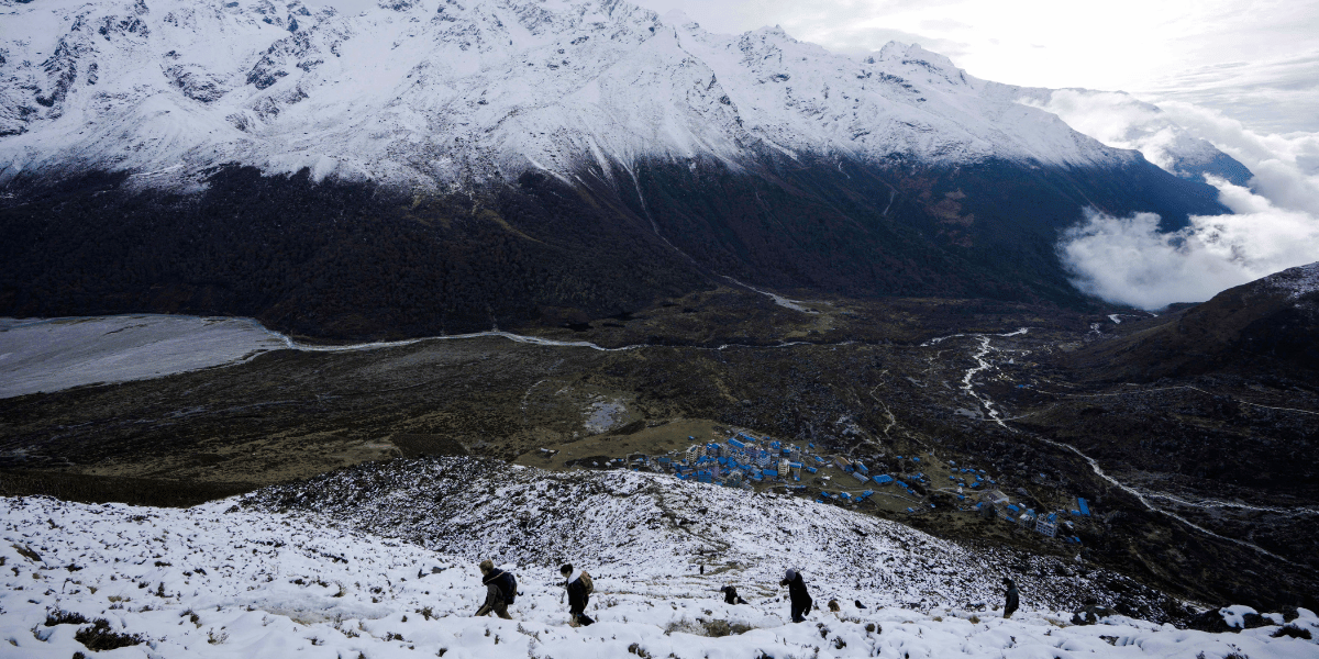
To reach Lower Kyanjin Ri, you might be looking at just 1 km, but don't let that fool you. It is the most intensely steep uphill of the entire trek. The rugged ascent makes it genuinely exhausting, even for fit trekkers.
And if you're visiting here when there’s snowfall, crampons are a must to be included in your packing list, especially during the descent, as the trail can be slippery and risky when icy.
For Upper Kyanjin Ri, the trail becomes a little more gradual compared to the lower viewpoint. But since it’s at a higher altitude, you must go slowly!
You'll be walking along the ridgelines, where bird watching opportunities are excellent. And Himalayan blue sheep (bharal), along with Himalayan Tahr, are commonly spotted at this elevation (animals that we came across during our own Langtang trek).
Kyanjin Gompa to Tsergo Ri
Tsergo Ri (or Tserko Ri), at 4,985 m, is the crown jewel of the Langtang Valley Trek! This is a peak that you get to see on your way to Kyanjin Gompa, and it pulls you towards it for sure once you hear that it’s possible to reach the top!
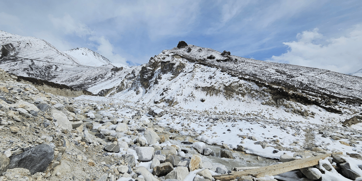
The route to Tsergo Ri involves a gradual elevation gain along a mostly rugged path. In conditions with a large snow line, the trail can be genuinely risky (something our own content team experienced firsthand in March 2026).
Even with leg gaiters and crampons, our team had to turn back before the summit due to excessive snow. That kind of decision (knowing when to turn around) is exactly what smart mountain trekking looks like. The advantage of travelling with our guides is that they are trained to read those conditions well!
That said, on clear days and in favorable conditions, the Tsergo Ri hike is one of the most rewarding experiences you'll have during your Langtang Valley visit. Reaching almost 5,000 m of altitude gives you a 360-degree panorama that stretches across the Langtang range, the Jugal Himal, and beyond that!
But at this altitude, you must constantly check your body. If you show any signs of Acute Mountain Sickness (AMS), do not push. As I always say, no summit is worth your health (please keep that in mind!).
The Return Route
The return journey of the Langtang Valley Trek follows the same trail back from Kyanjin Gompa to Syaphru Bensi. It’s going to be a complete downhill (as expected), but this return will be considerably faster.
However, you have to take care of your knees. Trekker's knee (or hiker's knee) can be an issue for some of you, so trekking poles become invaluable here!
In most of the packages (including packages from Langtang Valley), we make you reach Lama Hotel on the first return day. So, even if you’re doing the trek independently, you can comfortably complete the downhill in two days.
And in case you'd like to extend the trek towards the sacred Gosaikunda Lakes, know that the trail diverges a little ahead of Pairo. So, make this decision beforehand so you can prepare for the Langtang Trek accordingly.
Also, if you want to try a slightly different return path, you may even opt for the Sher-Pho Gaun from Rimche route.
Final Thoughts: Is Langtang Valley Trek Right For Me?
After everything I've walked you through (the route, the terrain, the altitudes, the stops, the side hikes, and the itineraries), I think the answer for most trekkers is now all clear!
Some parts can feel challenging to beginners, but still approachable enough for everyone. Even with reasonable fitness, you can complete this trek in 6 to 7 days!
The Langtang Valley trail is well-developed, the teahouses are improving every season (which is really impressive), and the cultural richness of the Tamang communities along the way makes the journey much more than just a mountain hike!
Yes, the Tsergo Ri hike can be a demanding one and challenges can come in the form of altitude, cold, and the occasional icy section. Also, the lingering weight of the 2015 tragedy can make you a little emotional. But this is exactly what makes the Langtang Valley Trek so meaningful!
Did I keep my promise? I’m sure you’ve got a visual map of the Langtang Valley Trek route now. Now, come join Altitude Himalaya for this wonderful Himalayan adventure. We’re waiting for you to book this Langtang trip!


 Bhishu Acharya