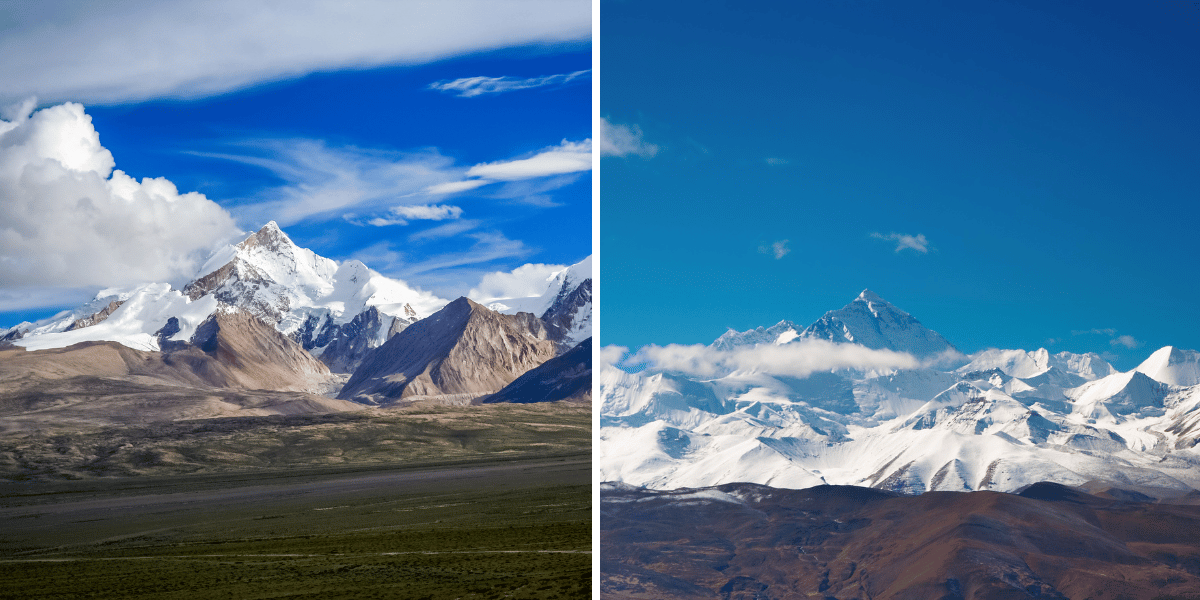
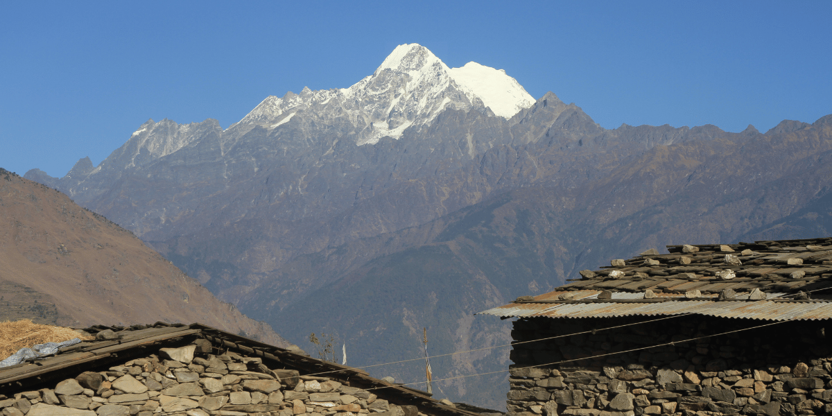
The Langtang Himal is a subrange of the Greater Himalayas that has been watching over the Langtang Valley for millions of years. It sits strikingly close to Kathmandu Valley in the Langtang National Park, yet feels stern and deeply spiritual.
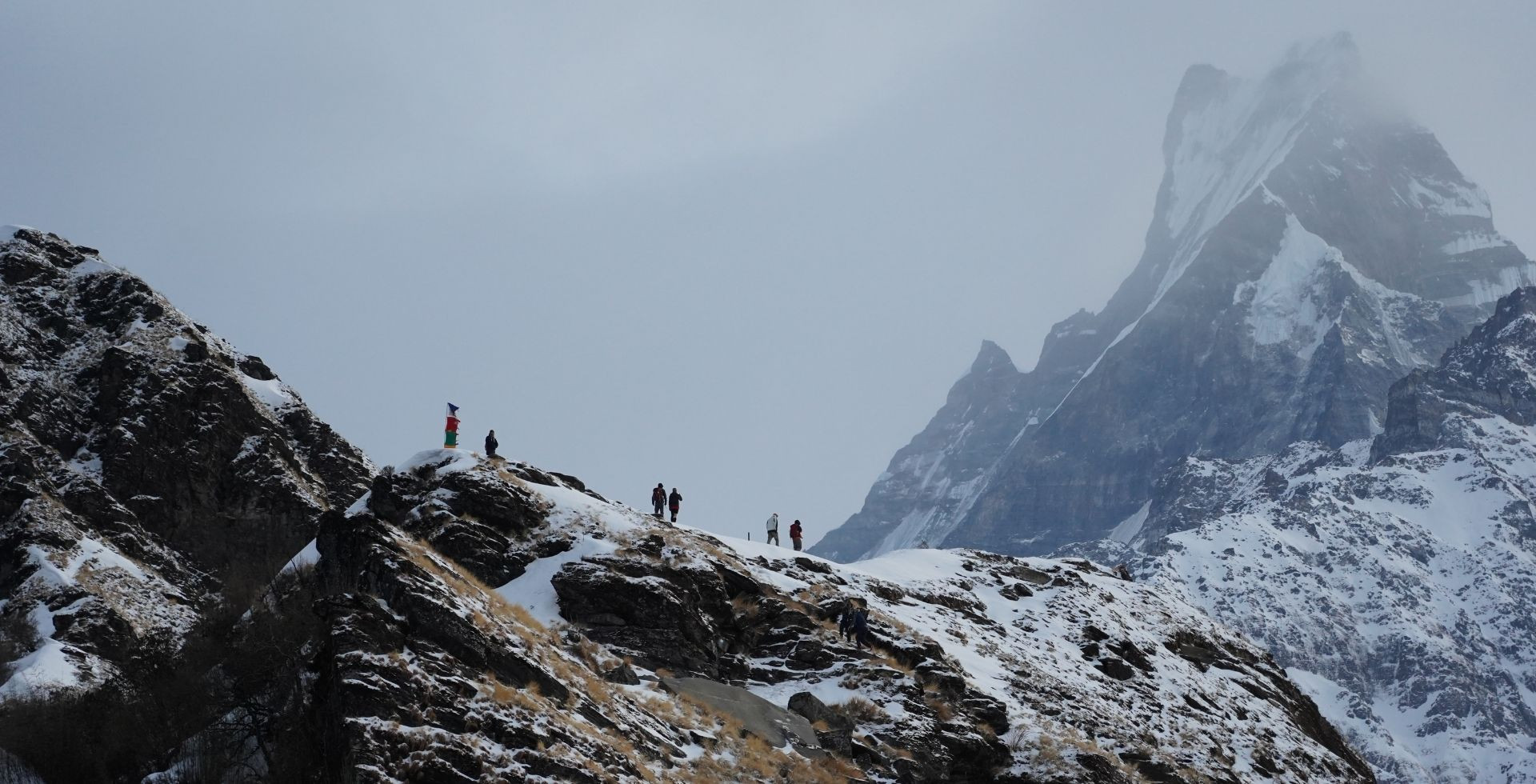
After you walk through dense forests, Tamang villages, and open pastures on the trail, the Langtang valley finally appears. From here, you will see glaciers hanging on the ridges. Prayer flags flutter in the wind.
Langtang Lirung, Langtang Ri, Yala Peak, Naya Kanga, and even the Jugal Himal range decorate the view all around you. You are still in Bagmati Province, in central Nepal, but the border with Tibet, China, is just over those high snow lines.
In this article, I will walk you through the Langtang mountains as you actually experience them on your trek: through viewpoints, villages, valleys, cultural beliefs, timings, permits, and stories that tie the whole region together.a
Quick Facts About Langtang Mountains
|
Range Name
|
Langtang Himal, a subrange of the Greater Himalaya
|
|
Highest Peak
|
Langtang Lirung (7,234 m)
|
|
Other Major Peaks
|
Langtang Ri (7,205 m), Naya Kanga (5,863 m), Yala Peak (5,520 m), Yubra Himal (6,048 m)
|
|
Location
|
Rasuwa District, Bagmati Province, Central Nepal
|
|
Protected Area
|
Langtang National Park
|
|
Neighboring Ranges
|
Ganesh Himal to the west, Jugal Himal to the east
|
|
Main Valleys
|
Langtang Valley, Helambu, Gosaikunda Basin, Bhote Koshi/Kyirong Valley
|
|
Main Rivers/Rivulets
|
Trishuli River, Bhotekoshi River
Langtang Khola, Chandampari Khola, Kyampu Khola, Chopche Khola, Chusumdo Tsangpo, Lende Khola, Lirung Khola, Tanmarche Khola
|
|
Main Glaciers
|
Langtang Glacier, Lirung Glacier, Yala Glacier, Shalbachum, and Langshisha Glaciers
|
|
Main Viewpoints
|
Kyanjin Ri, Tserko Ri, Kyanjin Gompa
|
|
Dominant Culture
|
Tamang and Tibetan Buddhism
|
The Valleys and Terrain of the Langtang Range
You can think of Langtang Himal as one small slice of the greater Himalayas. It is centered almost directly north of Kathmandu and pressed against the Tibetan Plateau.
It is small and compact compared to other ranges, but its peaks are still very high and impressive. These peaks are the main reason behind your relief as you trek towards them.
Where is the Langtang Range Located?
Langtang Himal is situated just north of Kathmandu, within the Bagmati Province in north-central Nepal. The main region of the range, including Langtang Lirung and Langtang Ri, lies inside the Rasuwa district.
Since the whole range sits between the Trishuli Gandaki valley in the west and the Sun Koshi basin in the east, it is a part of the Greater Himalaya front in central Nepal.
The northern side of the Langtang Himal forms the international boundary with Tibet, China, especially Langtang Ri and nearby summits, which literally sit on the Nepal-Tibet border.
From many viewpoints, you can look south into the Nepalese valleys and north onto the Tibetan Plateaus.
Major Valleys Around the Langtang Himal
The mountains of the Langtang region are highlighted through their valleys. The plain land of valleys especially emphasizes the towering heights of these peaks. Each valley highlights a different side of the range and offers different encounters.
Langtang Valley
Langtang Valley is basically the heart of the Langtang region and its mountains. You get here through the classic Langtang Valley trekking route.
The classic trek starts from Syaprubesi, follows the Langtang Khola through Lama Hotel, Ghoda Tabela, Langtang Village, and up to Kyanjin Gompa.
Here, you walk through subtropical forests to glacial surroundings in a matter of days. The upper Langtang valley is often called the “Valley of Glaciers” due to it being surrounded by the Langtang Glacier, the Yala Glacier, and the Lirung Glacier, to name a few.
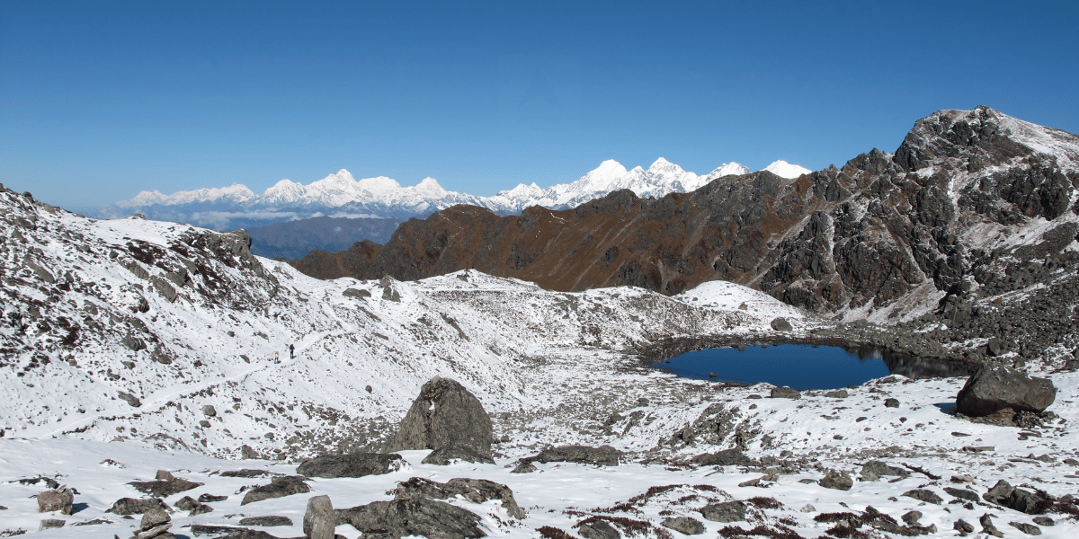
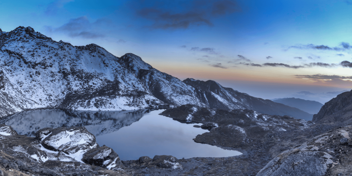
Gosaikunda Basin
This side lies to the south-east of the main Langtang Valley. The trekking trail to the Gosaikunda Region starts from Thulo Syabru or nearby villages.
It starts from the same subtropical forests like in the Langtang Valley trail, and goes towards the lakes of Gosaikunda at an elevation of above 4300 m.
From Gosaikunda, it continues over passes towards Helambu. From the ridges in the trail, you will see the Langtang Lirung to the north and the Jugal Himal skyline to the east.
Kyirong/Bhote Koshi Valley
Historically, the Bhote Koshi valley was an important trade route between Kathmandu and the Gyirong region of Tibet. This valley forms the main corridor to Tibet.
Today, roads and the border post at Rasuwa Gadhi link Nepal and China. The Bhote Koshi river itself flows in the steep slopes, slicing a deep gorge through Rasuwa’s cliffs.
You see terraced fields and Tamang homes from the roadside villages and side trails. The Ganesh Himal range lies in the west of the valley, with Langtang peaks peeking ahead in the east direction.
Helambu and Panch Pokhari Region
This region lies south of Langtang Himal and along the southwestern foothills of the Jugal Himal. You will get to experience mixed terrains of lush forests and terraced hills along with Hyolmo-Tamang villages.
One of the main viewpoints of the area is Ama Yangri, often called the “Matterhorn of Helambu”. It is situated at 3,771 m and is only a day away from Kathmandu. The hike is genuinely so rewarding, offering a panoramic view of Langtang and Ganesh Himal.
From other vantage points of this region, you get to see both Langtang Himal and Jugal Himal peaks with Dorje Lakhpa and other Jugal peaks forming the north skyline. The sacred Panch Pokhari lakes are also a part of this region.
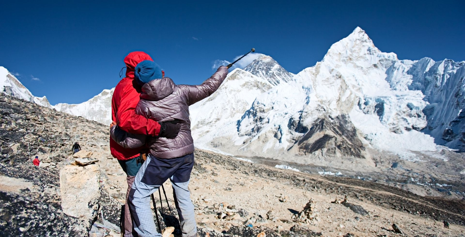
Are the Langtang Mountains Part of the Same Belt as Everest?
In short, yes. Langtang Himal is geographically on the same belt that connects all the way to the Everest region.
Geological studies done in Langtang have shown that the high peaks here belong to the Greater Himalayan Sequence. The Greater Himalayan sequence is a thick package of high-grade metamorphic rocks (gneisses, schists, migmatites) that were deposited millions of years ago.
The same Greater Himalayan Series/Sequence is noticeable in the Everest region and really anywhere along the central Himalaya. Hence, Langtang and Everest are highlighted as two major “depocenters” of this same long-lived sedimentary and metamorphic belt.
You must note that even though they are part of the Greater Himalayan sequence, they are distinct subranges. Mount Everest and three other highest mountains in the world (Lhotse, Makalu, and Cho Oyu) are a part of the Mahalangur Himal range, while the mountains within Langtang are a part of a distinct subrange.
So, when you are walking in Langtang, you are indeed walking in the same fundamental geological belt as Everest, though they are part of different subranges.
The Major Mountains and Peaks of Langtang Himal
The Langtang range is quite compact but has a very high density of tall peaks. As you walk through the trails, you will constantly see new ridges and summits as you move up the valley.
Let’s start with the most popular names of the Langtang Himal:
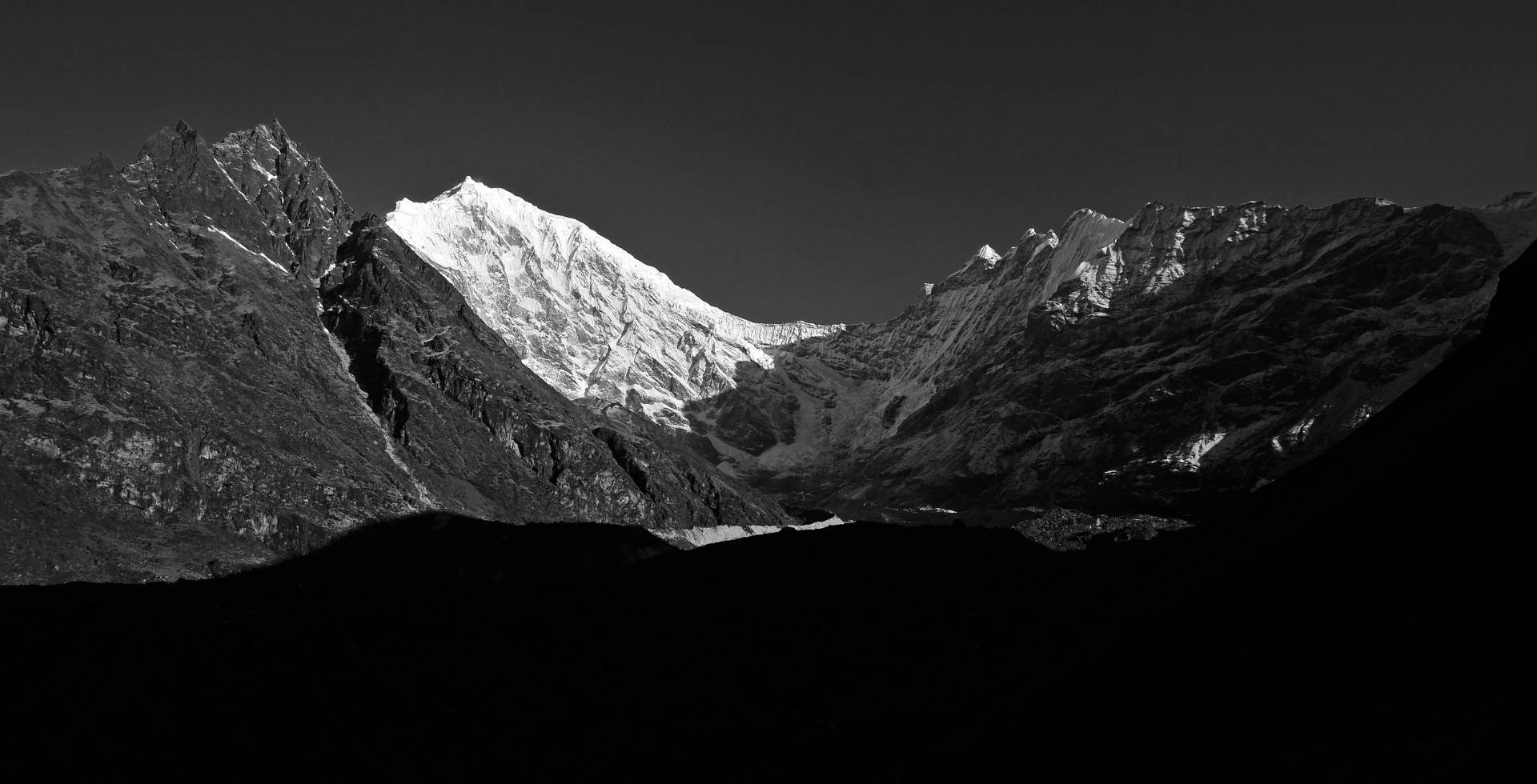
Langtang Lirung (7,234 m)
Langtang Lirung is the highest peak in the Langtang Himal, with an officially listed height of 7,234 m. It sits on the western side of the Langtang Valley, north of the Langtang Khola. From the trekking trail, you will feel it closest above Kyanjin Gompa.
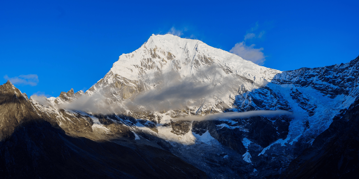
Here, the south face of Langtang Lirung looms directly overhead with glaciers and seracs hanging just above the village. You will also get to see the eastern face of the mountain from Tserko Ri. It is perfectly framed by the ridges of the Langshisa Ri.
The first successful ascent was made on 24 October 1978 via the East Ridge by Seishi Wada and Pemba Tsering Sherpa of a Japanese expedition team. Later, the south-east and south-west ridges became more popular for summit attempts.
But due to objective hazards and avalanches, there have been relatively few successful ascents compared to attempts. As an expedition peak, Langtang Lirung requires a full climbing permit from the Department of Tourism under the Ministry of Culture, Tourism, and Civil Aviation.
Langtang Ri (7,205 m)
Langtang Ri stands north-east of Langtang Lirung at 7,205 m. It marks the crest of the Nepal-Tibet border.
You do not see Langtang Ri as constantly from the main Langtang Valley as you do Langtang Lirung. The mountain is visible as you go higher up, especially from the slopes of Tserko Ri or the meadows of Langshisa Kharka.
You can also spot it on the trail between Mundu and Kyanjin Gompa, where the valley is open wide enough for the mountain to show. The hidden nature is probably one of the major charms of Langtang Ri, making it extra special when you spot it occasionally.
The first ascent was made by a Japanese-Sherpa team led by Noboru Yamada, with Soichi Nasu, Makihiro Wakao, and Ang Rinji Sherpa on 10 October, 1981. As Langtang Ri is also an expedition peak, it requires the same permits and fees as that of Langtang Lirung.
Yala Peak (5,520 m)
Yala Peak is one of the most accessible and perhaps one of the most climbed peaks of the entire region. It is a non-technical trekking peak with a summit at around 5,500 m elevation. It stands a little north of Kyanjin Gompa.
Yala Peak is often used as a first Himalayan summit for trekkers. You first trek to Kyanjin Gompa, acclimatise for a day, and then move to Yala Kharka at around 4600 m. From Yala Kharka, you make the summit push.
From the summit of Yala, you can see Shishapangma (8,027 m), Langtang Lirung, Dorje Lakpa, Ganchenpo, Langshisa Ri, Ganesh Himal range and the Tibetan plateau. You won’t need any special mountain climbing permits to summit this peak. However, you do need the Langtang National Park entry permit to enter the region.
Naya Kanga (5,863 m)
Naya Kanga, also called Ghanja La Chuli, stands south of Kyanjin Gompa and west of the Ganja La pass. It is listed at 5,863 m and is one of the classic trekking peaks of the Langtang Himal.
From the summit, you look straight across to Langtang Lirung, Langtang II, Gangchempo, Dorje Lhakpa, Shishapangma, and the Ganesh Himal in the far west.
The typical Naya Kanga expedition involves glacier travel and some 40–55‑degree snow slopes. So, it is more technical than Yala Peak and better suited to trekkers with some technical experience.
Naya Kanga is one of Nepal’s official trekking peaks. It requires a climbing permit issued through the Nepal Mountaineering Association (NMA), in addition to the Langtang National Park entry.
Other Mountains and Peaks
Besides Langtang Lirung and Langtang Ri, several other mountains and peaks decorate your views, pictures, and memories. Let’s take a look at these peaks:
- Tsangbu Ri or Kimshung (6,781 m): It rises just north of the upper Langtang Valley above the Kimshung Glacier. You see its steep ice-and-rock face from around Kyanjin and on the way towards Langshisa. Its first successful ascent was done very recently (in October 2025).
- Kyunga Ri I (6,599 m): It forms a high snow summit on the ridge behind Kyanjin. It lines up in the background, with many photos taken from Tserko Ri and the yak pastures.
- Yansa Tsenji/Dhagpache/Dragpoche (6,567 m): This peak sits on the main ridge between Langtang Lirung and Kyunga Ri. It is another peak you see from Kyanjin Ri and Tserko Ri. Its first successful ascent was recorded recently in October 2023.
- Yubra or Ubra Himal (6,048 m): This is a glaciated peak above Yala Kharka. It is one of the main trekking peaks of the region when you head out for Yala-side trips.
- Pem Thang Karpo Ri (6,865 m): Also known as Dome Blanc/Bhemdang Karpo/Kan Karmo, this is a broad, white dome near the southern edge of the range. It gives a clean, snowy block on the Helambu-facing skyline.
- Shalbachum (6,707 m): Also known as Phrul Rangtshan Ri, it is a big border peak close to the Tibet border that you spot behind Kimshung from higher viewpoints like Tserko Ri on clear days.
- Other mountains/peaks in the Langtang Range: Kyunga Ri II (6,506 m), Ghenye Liru / Langtang II (6,571 m), Luri Himal (6,924 m), Ghanna (5,995 m), Bhemdang Ri/Pemthang Ri/Moromoto (6,150 m), Risum/Fuqu Peak (7,050 m), Peri (6,174 m), Pangri Goldumba / Goldum (6,620 m), and Ramthang Karpo Ri (6,865 m).
Adjacent to Langtang: Jugal Himal Range
From most viewpoints in Langtang National Park, you get a clear glimpse of the Jugal Himal range. This consists of prominent peaks, including:
- Langshisha Ri (6,412 m): Also spelled Langshisa Ri, it sits at the head of Langshisha Kharka valley. Geographically, it lies in the Jugal Himal range but is often climbed from the Langtang side, due to which trekkers often consider it a part of the Langtang Himal. Langshisha Ri basically guides your eyes from Langtang Lirung and Ganchenpo towards Dorje Lhakpa.
- Ganchenpo/Fluted Peak (6,378 m): Ganchenpo is one of the most beautiful peaks above the upper Langtang Valley. Also called the fluted peak, it is visible when you look southeast from Kyanjin Ri and Tserko Ri. It stands just south of the main Langtang ridge near the Tilman’s Pass route. Ganchenpo lines up beautifully with Langshisha Ri, often appearing in the same frame as Langtang Lirung, Yala Peak, and Naya Kanga.
- Dorje Lakhpa (6,966 m): Dorje Lakpa (Dorje Lakhpa or Dorje Lyakpa) is the sharp, pyramid-shaped mountain that you often see from the Helambu and Gosaikunda side. It is actually visible even from Kathmandu’s eastern horizon. At 6,966 m, Dorje Lakpa is geographically a part of the Jugal Himal range. But it forms the southeastern skyline of Langtang National Park, sitting north-east of Lantang Valley and above the Helambu/Balephi Khola.
- Madiya Peak (6,799 m): Madiya, also known as Bhairav Takura, forms part of the central Jugal chain to the east of Dorje Lakhpa. From high ridges and lakes of Panch Pokhari, it sits in the same skyline as Dorje Lakhpa and Phurbi Chyachu. It adds a solid white block to the far horizon you glimpse from the Langtang-Gosaikunda side.
- Phurbi Chyachu (6,631 m): Phurbi Chyachu is located on the Nepal-Tibet border above Sindhupalchok and the Panch Pokhari area. In clear days, when you look southeast from Gosaikunda and the higher Langtang region, Dorje Lakpa, Madiya, and Phurbi Chyachu close the skyline in the distance.
- Other Notable Jugal Mountains and Peaks: Yangri or Jugal Peak (6,535 m), Urkenmang / Urkimang (6,150 m), Gyalzen Peak (6,151 m), Leonpo Gang (6,979 m), Gurkarpo Ri (6,891 m), Leonpo Gang East (6,733 m), Baden Powell Scout Peak (5,857 m), etc.
Can You Summit Any Langtang Himal?
You are not limited to simply looking at the Langtang Himal from below. Several peaks are officially open for climbing, from easy trekking summits to serious expeditions.
Viewpoint Peaks
These are peaks that you can reach on long day hikes from Kyanjin Gompa or nearby. You don’t need any special climbing permit to trek these summits.
- Kyanjin Ri: A steep but straightforward half-day hike above Kyanjin Gompa. You will need trekking poles and, in winter, microspikes, but not technical gear.
- Tserko Ri (Tsergo Ri): It is a longer, higher ascent that gives you a much wider view of the mountains. Again, no technical gears are needed. You just need to manage stamina, acclimatize well, and plan ahead.
These viewpoints are more about long, steady uphill walking than mountaineering. However, stay alert for symptoms of altitude sickness and also be wary of weather changes.
Trekking Peaks: Semi-Technical Summits
These peaks require some basic technical knowledge, but nothing overboard. Depending on the season you are climbing, you will need crampons, an ice axe, and sometimes rope teams.
Some trekking peaks now require no separate climbing permit, while some still do. It depends on their elevations and technical difficulty.
- Yala Peak: Yala does not require a special climbing permit, meaning it is now royalty-free. You will need some basic mountaineering gear like microspikes and crampons.
- Naya Kanga: Also called Ghanja La Chuli, Naya Kanga requires a special climbing permit along with your regular national park permit. It is more technical than Yala, but it is still doable by beginner climbers.
- Yubra Himal: It is listed as an NMA Group A trekking peak, so you need a full NMA climbing permit plus the usual trekking and park permits. It is a step up in altitude as well as technicality compared to Yala and Naya Kanga.
These peaks are kind of your entryway into mountaineering, as long as you are willing to train seriously for your attempt. Treating them as simple add-ons to your trek may cause you more harm than good due to a lack of preparation.
Expedition Peaks
For serious mountaineering, you can climb the giants of Langtang Himal, listed under expedition peaks. These require full expeditions with multiple high camps, base camps, and strong technical skills.
The key expedition peaks of Langtang are:
- Langtang Lirung (7,234 m)
- Langtang Ri (7,205 m)
These expeditions may take anywhere from 4 to 7 weeks, depending on which peak you are attempting. These figures already include the approach, acclimatization, and contingency days.
For expedition peaks, besides government royalties, you must also budget for:
- National park permits
- Liaison officer and administrative costs
- Climbing fee and permits from the Department of Tourism under the Ministry of Culture, Tourism, and Civil Aviation
- Travel Insurance
- Expedition logistics (guides, Sherpa staff, food, equipment, transport, etc.)
- Garbage Collection fee (USD 500 to 1000)
|
Peak Type
|
Peak Names
|
Permit Issuer
|
Climbing Fee (per person)
|
|
Expedition
|
Langtang Ri and Langtang Lirung
|
Department of Tourism (DoT)
|
Spring: USD 800
Autumn: USD 400
Winter/Summer: USD 200
|
|
NMA Group A
|
Yubra Himal
|
Nepal Mountaineering Association (NMA)
|
Spring: USD 350
Autumn: USD 175
Winter/Summer: USD 175
|
|
NMA Group B
|
Naya Kanga
|
|
Non-NMA Peaks (below 6,500 m)
|
Bhemdang Ri, Peri
|
Department of Tourism (DoT)
|
|
Non-NMA Peaks (above 6,500 m)
|
Kyunga Ri I, Kyunga Ri II, Ghenye Liru, Pem Thang Karpo Ri, Shalbachum, Kyunga Ri II, Pangri Goldumba
|
Department of Tourism (DoT)
|
Spring: USD 500
Autumn: USD 250
Winter/Summer: USD 200
|
|
Peaks below 6,000 m
|
Yala Peak
|
-
|
Not required
|
Note: Besides the climbing fees, every peak mentioned above requires the Langtang National Park entrance fee and TIMS Card (optional).
The Glaciers of Langtang Himal
In Langtang, you can see some hanging glaciers on almost every tall peak surrounding you. They feed the rivers along the trail and shape the entire landscapes you move through.
The Langtang Glacier dominates your view from Mundu village onwards. Lirung Glacier lies under Langtang Lirung; Yala glacier is small and tucked to the north; the long Shalbachum and Langshisha reach back towards Tibet, China.
Langtang Glacier
Langtang Glacier is around 18 km long and covers an area of nearly 50 sq km. It is the biggest glacier of the region. Because of its sheer size and volume, it controls much of the waterflow of the valley.
It collects snow and ice from the border crest and feeds the Tanmarche Khola and Langtang Khola itself down below.
You do not walk the Langtang glacier on a normal trek, but from Kyanjin Gompa, Tserko Ri, and other high points, you can see its broad surface filling a huge part of the upper valley.
Scientists use this glacier as a reference to understand how Himalayan glaciers are responding to global warming. Studies actually show heterogeneous thinning of the glacier over the last 40 years.
The thinning rate has doubled from 0.24 meters per year to 0.45 meters per year in the upper parts of the glacier. This is caused by debris cover, melt ponds, and rising temperature.
An ICIMOD-linked research project shows that the complete loss of this glacier will cut off the basin runoff by 32%. But for trekkers, it is what keeps the Langtang Khola running long after the last snowflake has melted off the trail.
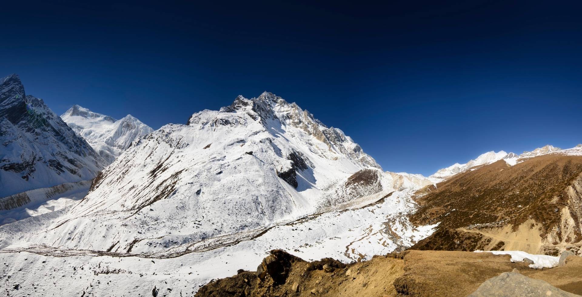
Lirung/Langtang Lirung Glacier
The Lirung glacier is the ice river directly under Langtang Lirung. From Kyanjin Ri, you can look straight down into the glacier and onto its debris-covered tongue.
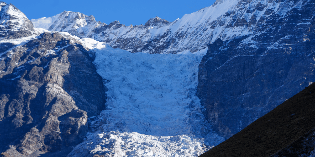
At the snout of this glacier, you will find a glacial pond and the origin of the Lirung Khola. The lower part is almost completely buried under rocks and boulders, carried down by centuries of rockfall and avalanches.
You will also notice how chaotic the surface is. There are small blue ponds in its hollows, and steep ice cliffs appear suddenly where the debris mantle is thin.
Yala Glacier (Is It Actually Dead?)
Yala glacier sits just below Yala Peak, north of Kyanjin Gompa, and quite close to the Tibetan border. If you are climbing the Yala peak, you cross this glacier after you move up through yak pastures and loose moraine.
Compared to Langtang or Lirung, Yala is small and at a higher elevation. Due to climate change, it is only getting smaller.
Guides, monks, and locals actually organized a funeral for the Yala glacier on May 12, 2025. Since the 1970s, the glacier has retreated by over 60% and is expected to completely disappear by 2040.
This funeral was a tribute to the studies and life Yala supported over the years and a reminder of the real effects of global warming.
Shalbachum and Langshisha Glaciers
From the yak pastures at Langshisha Kharka, you see one glacier curving deep into a side valley, framed by rock walls. This is the “Langshisha view” many photographers come for.
Together with nearby Shalbachum Glacier, it drains on the eastern side of the Langtang basin. Further downstream, they feed the main Langtang Khola.
You probably will not step into these glaciers on your normal treks. But they are a major part of the view you get from Tserko Ri in the eastern and north-eastern skyline.
Debris, Ponds, and Changing Ice
In Langtang, debris-covered glaciers are common. Rockfall from steep valley walls and avalanche deposits build up a thick layer on the ice, especially near the snouts.
Once you know what you are looking at, the surface of these glaciers becomes even more interesting. On top of the debris skin, uneven melting creates small superglacial ponds and steep ice cliffs on the glaciers themselves.
Studies over the last 4-5 decades clearly show that Langtang’s glaciers are thinning and retreating. Average thinning has roughly doubled since the late 20th century.
When you see higher glacier snouts, more bare moraine, and larger melt ponds, you are seeing the long-term climate change effects in real time.
Best Viewpoints to Enjoy the Langtang Mountains
Of course, climbing peaks brings you the closest to the Langtang Himal. But that is not the only way you can do so. You just need to choose the right place and the right time of the day.
Kyanjin Ri
Kyanjin Ri is often your first major viewpoint of the trek. You start the trek to Kyanjin Ri directly from Kyanjin Gompa, following a path along a rocky ridge. The ascent is steep, but with enough rest and snacks, you’ll reach the top in no time.
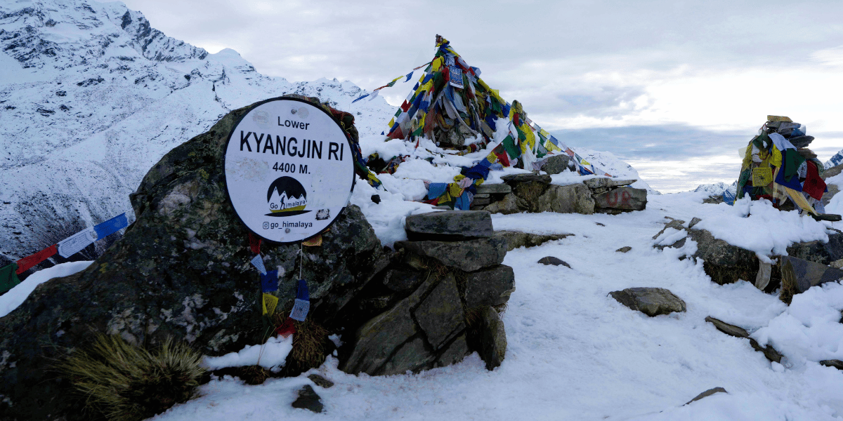
From the top of Kyanjin Ri, at 4,773 m, you get a view of the full curve of the upper Langtang Valley. You will also see Langtang Lirung and its hanging glaciers, Ganchenpo, and the Jugal side peaks, along with the long glacial valley below the south face of Langtang Lirung.
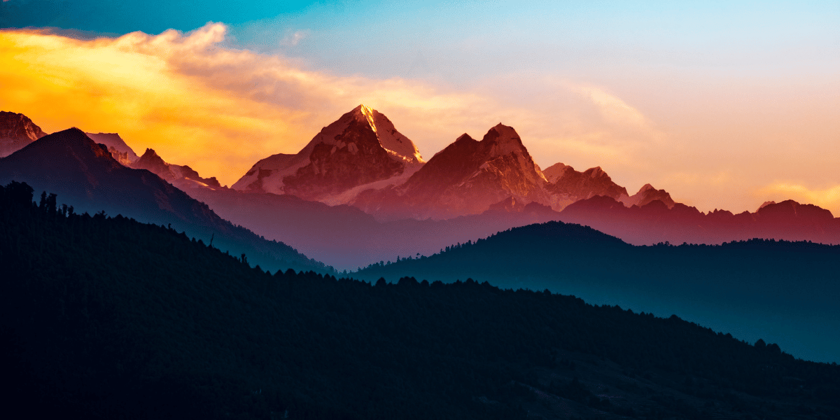
You can choose to do either a sunset hike or a sunrise hike, or even both, if your legs allow it. During sunset, the panorama of peaks is shrouded in shades of orange, while the valley is bathed in blue shadows.
At sunrise, you get to watch the pink light slide down from the summits to the valleys. Honestly, both views are worth every bit of effort.
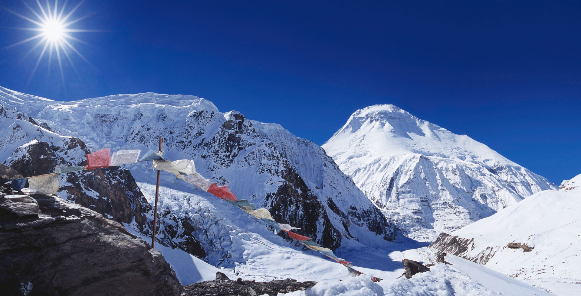
Tserko Ri (Tsergo Ri)
Tserko Ri is a little longer hike than Kyanjin Ri, sitting at 4,984 m. As a result of that longer hike, you get a wider horizon, i.e., bigger, better views of the mountains and valleys around you.
Similar to Kyanjin Ri, you start the hike from Kyanjin Gompa and walk east along the valley floor, and then climb a steep, long, rocky slope. I won’t lie, the never-ending uphill will test your patience and, more so, your strength.
But if you push through and reach the top, Langtang Ri, Langtang Lirung, Helambu ridges, and further ranges of the central Himalaya will leave you in awe.
On a clear morning, the entirety of the Langtang Himal stands all around you, almost wrapping you in its embrace.
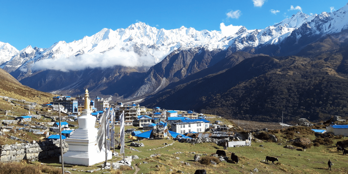
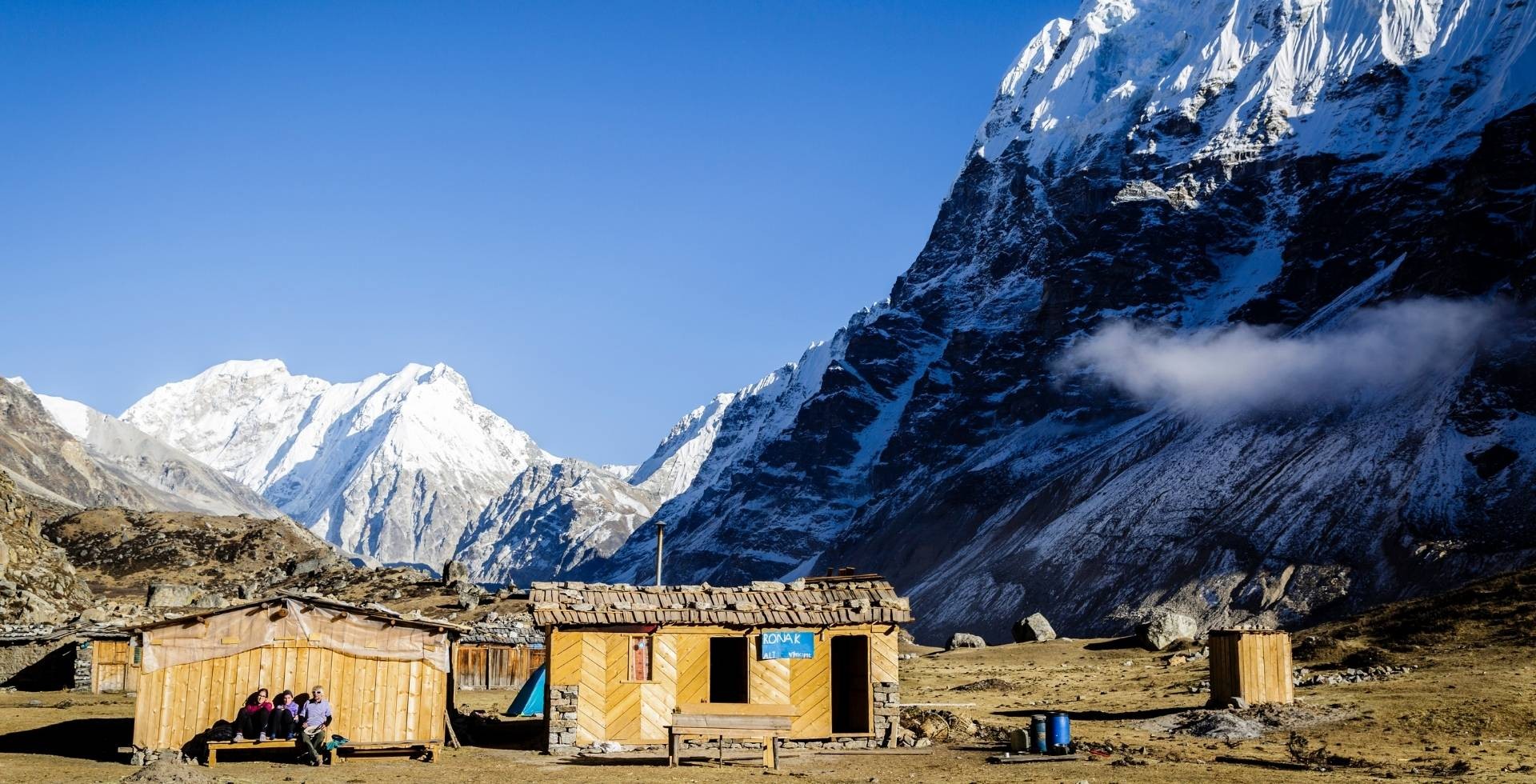
Kyanjin Gompa and Yak Pastures
Kyanjin Gompa itself is actually a viewpoint village. It sits in an opening in the upper valley at 3,870 m. You are surrounded by Langtang Lirung to the west, Ganchempo and Langshisha Ri to the east, and Yala Peak to the north.
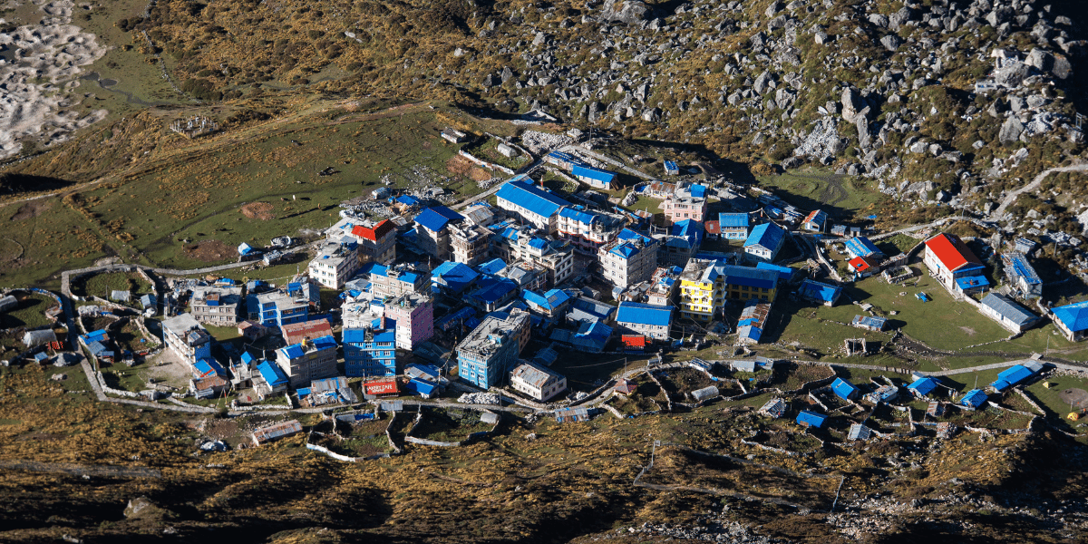
You can sit by a teahouse window and enjoy the view of the mountains around you. You can also take a leisurely short hike to the Kyanjin Gumba or try some delicacies from the Swiss bakery.
Laurebina La and Gosaikunda Ridge
Laurebina La and the ridgeline above Gosaikunda give you one of the widest views of this part of the Himalaya.
From the trail above the Gosaikunda Lakes and at the pass itself, you get a picture-perfect view of Langtang Lirung and Ganesh Himal and out to Mount Manaslu, Gauri Shankar, and even the distant Annapurna range on very clear days.
If you stay near Lauribina or Cholangpati, you can walk up to the ridge to watch sunrise with a full wall of peaks turning pink and gold. It is one of the best viewpoints along the Langtang-Gosaikunda-Helambu link.
Chisapani: Closest From Kathmandu
Chisapani is just a day hike away from Kathmandu that gives you a teaser of the Langtang mountains. You can visit it over the weekend and wake up to a sweep of Langtang, Ganesh Himal, Dorje Lakpa, Jugal Himal, and much more around the horizon.
Because it is only a day’s walk from Sundarijal, Chisapani is ideal if you want a taste of the Langtang skyline without committing to a full multi-day trek. It's actually accessible via a dirt road if you want to ride instead of hike.
Recommended tour: Chisapani-Nagarkot Trek
Nagthali Ghyang
Nagthali Ghyang, above the Tamang villages of Thuman and Timure, is one of the easiest high viewpoints to reach in the region. Sitting at around 3,165 m, it gives peaceful open views of Langtang Lirung, Langtang Ri, and Ganesh Himal up across the northern horizon.
You usually hike 2–3 hours up from the villages through oak and rhododendron forests. At the top, a small monastery, grass meadows, and long ridges make it a place where you can sit for hours just watching the light change on the Langtang range.
Beyond these villages, yak pastures such as Langshisa Kharka and Yala Kharka give you open views of the Lantang glacier, seracs, and surrounding peaks. Oftentimes, these places are used for acclimatization by travellers on longer Langtang itineraries.
When the Langtang Mountains Look Their Best
If you are prepared enough, you can visit the Langtang region all year round. But the mountains do not look the same every month. Light clouds, snow, and greenery all change, and with them your view of Langtang Ri, Langtang Lirung, and their neighbours.
Here is a breakdown of Langtang in different seasons of Nepal:
March - May (Spring)
In spring, fresh snow still rests on the high ridges and shoulders of the peaks, so the skyline looks clean and bright. The forest below is full of rhododendron blossoms, which makes the white summits stand out even more.
On most mornings, you get clear, crisp views of the entire Langtang range before any haze or clouds drift in.
This is one of the most popular times and, of course, one of the prettiest times to visit the Langtang region. But due to its popularity, you might have a hard time finding lodges, so prebook whenever possible.
June - September (Summer/Monsoon)
Mountains are covered by clouds a lot of the time, but when they lift occasionally, you get one of the best views of the Langtang Himal. The crowd is significantly lower during this period.
But personally, it is my favorite time to visit Langtang. You will have to deal with persistent showers, especially in the afternoon and evening. The monsoon forest is almost fluorescent green with mosses and lichens swallowing entire tree trunks.
The trail is slippery, leeches will torment you in the lower forest, and there is an increased risk of landslides and rockfall in steeper sections. Despite it all, if you have proper gear and are prepared enough, it is one of the most enchanting times to be in Langtang.
October - November (Autumn)
Autumn is the classic trekking season for Langtang, right after the monsoon. This time of the year offers the clearest skies and sharpest views of the mountains.
The trails might be washed away in some parts due to rain and landslides. In lower villages, fields are golden and ready to be harvested. The weather is crisp and perfect for trekking.
If you want those crystal-clear panoramas from Kyanjin Ri or Tserko Ri, autumn gives you your best odds.
December - February (Winter)
Winter trekking in Langtang is usually quiet and very beautiful. You get regular snowfall above Langtang village, and sometimes in lower villages as well.
The views are very clear when it is not snowing. But due to extreme cold and difficulty in transporting goods, some lodges and teahouses close during the winter season.
You can trek to Langtang and Kyanjin with good gear and flexibility, but high-altitude trips to Tserko Ri and Kyanjin Ri can be difficult and even unsafe.
How Shifting Seasons are Affecting the Langtang Himal
The clearest signs of shifting seasons in the Langtang Himal are seen on the faces of the peaks themselves. The ridges that used to hold clean, white lines of snow well into spring are now showing more bare rocks, more often.
Up close, the glaciers tell the same story as well. Yala glacier has lost two-thirds of its mass and is now officially declared a “dead” glacier. As these glaciers waste away, they release meltwater faster and earlier in the year.
A warmer, wetter high country is, by nature, a more unstable one. Thinning ice, wetter snow, and heavier downpours all add a bit more tension to steep couloirs and cliff bands, raising the chances of floods, avalanches, rockfall, and landslides along the valley sides.
There is also a large shift in precipitation and runoff patterns as the average temperature rises. Rainfall is extending beyond the “normal” monsoon window. Visitors and residents report late and patchy snowfall, odd storms, heavy rain, and snow in supposedly dry months.
These changes affect the trail conditions, visibility, and how you plan. On recent Langtang trips, many teams have already had to add unplanned rest days in Langtang village or Kyanjin Gompa because of heavy rain or snow. To adapt, you are now better off to:
- Build at least one or two buffer days into your plan.
- Monitor forecasts from Kathmandu and local operators closely in the week before and during your trek.
- Come ready for a wider range of conditions, rather than packing only for a textbook “best season”.
If you do that, you still get everything Langtang offers. You just give yourself enough flexibility and pack your bags accordingly to meet the Langtang Himal on its own changing terms.
Getting to the Langtang Range
You can reach the Langtang trailhead in just a day from Kathmandu. Buses and jeeps leave Kathmandu and follow the Trishuli River north to Dhunche and Syabrubesi.
From these two towns, you can start your trek into the Langtang Valley, the Tamang Heritage area, and the Gosaikunda-Helambu routes. I have curated some of the best itineraries to enjoy the Langtang region.
Langtang Valley Trek
The classic Langtang Valley Trek is usually 7 - 10 days long. It takes you from Syabrubesi through Lama Hotel, Ghoda Tabela, Langtang village, and Mundu to Kyanjin Gompa. You can choose to do a day hike to Kyanjin Ri and Tserko Ri.
This trek is considered moderate in difficulty. You start your trek at about 1,500 m and reach 4,773 m at Kyanjin Ri or nearly 5,000 m at Tserko Ri. You get the full experience of forests, river gorges, villages, and high alpine valleys in this trek.
Langtang Valley Helicopter Tour
If you have limited time or cannot trek for health reasons, you can still see the Langtang Himal on a Langtang Valley Helicopter Tour.
Several operators (including Altitude Himalaya) run Langtang helicopter flights from Kathmandu. A typical trip flies north over the hills into Langtang National Park and lands at Kyanjin Gompa.
From Kyanjin Gompa, you can choose to spend the day there or return after briefly enjoying the views of Langtang Lirung, Dorje Lhakpa, Ganesh Himal, and sometimes Gosaikunda from the air.
The total flight time is usually around 1.5 to 2.5 hours. This option does not replace a trek culturally, but it does let you experience the scale of the range from above in a very short window.
Langtang Valley and Gosaikunda Lake Trek
Langtang Gosaikunda Trek combines Langtang Valley with the sacred Gosaikunda Lake. It usually runs 12 - 16 days, depending on side trips you take.
Firstly, you trek up to Kyanjin Gompa, then return towards Thulo Syabru and climb southeast through Shin Gompa and Lauri Binayak to Gosaikunda. From there, you can cross passes and finish near Helambu and Sundarijal or loop back to Dhunche.
Gosaikunda is a sacred lake for both Hindus and Buddhists. During the Janai Purnima festival, thousands of pilgrims visit the lakes, and the whole area feels very alive.
Langtang Tamang Heritage Tour
If you are someone who wants to focus more on culture, you can take the Tamang Heritage Trail in the lower Langtang region.
This route runs through Tamang villages such as Gatlang, Tatopani, Thuman, Briddim, and others north of the Trishuli and below the main Langtang Valley.
You generally start from Syabrubesi and spend 6 to 10 days walking between villages. You get to soak in hot springs at Tatopani and visit monasteries and viewpoints with broad views of the Langtang Himal.
Panch Pokhari Trek
Panch Pokhari Trek takes you to a cluster of five sacred lakes in Langtang National Park, east of the main valley. It usually runs about a week, with longer itineraries lasting for up to 10-12 days from either the Chautara or Melamchi side.
You pass Tamang and Sherpa villages like Tuppi Danda and Nosyampaati, climbing to about 4,100 m at the lakes.
Side hikes reach ridges and viewpoints, where you see Jugal Himal, Dorje Lakpa, Langtang Lirung, Ganesh Himal, Gauri Shankar, and smaller peaks on clear days.
Panch Pokhari holds deep religious meaning for Hindus and Buddhists, with frozen lakes in winter and vibrant pilgrim crowds in the monsoon.
Helambu Circuit Trek
Helambu Circuit Trek circles the Helambu valleys southeast of Langtang, offering framed views of the range. It typically lasts 6 - 8 days starting from Sundarijal near Kathmandu.
The trail goes through Chisopani, Kutumsang, Tharepati, Tarkeghyang, Sermathang, and Melamchi Pul Bazaar. High points like Tharepati and nearby ridges give wide views of Langtang Lirung, Dorje Lakpa, Ganesh Himal, Gauri Shankar, Jugal Himal, and even Rolwaling on very clear days.
Hyolmo culture shines here, with monasteries, apple orchards, and Buddhist sites along the way – perfect for a shorter taste of Langtang-area mountains without the full valley commitment.
What You Will Experience Around the Langtang Range
It goes without saying that Langtang is more than just its mountains. Here you are visiting a world where people, forests, rivers, mountains, and beliefs are all woven together.
Wildlife and Forests of Langtang
Before you reach the highlands and the upper valleys, you walk through rich forest and wildlife zones that lie directly under the shadow of Langtang Himal.
Langtang National Park has great geographical and wildlife diversity, all contained within a relatively small slice of the Himalayas.
In the lower regions of the trail, you will find subtropical forests with broadleaf trees fed by the rivers that tumble down from the glaciers. Between Syabrubesi and Lama Hotel, the trail passes through oak, rhododendron, bamboo, and dense riverine forest.
Then, as you climb towards Ghoda Tabela and Langtang Village, it's mostly just fir, hemlock, birch trees, and Nepal’s only native larch species. Beyond Langtang village, the tall trees are replaced by shrubs and alpine meadows beneath the snow line.
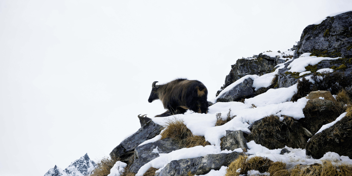
This gradient of vegetation is home to red pandas, Himalayan black bears, musk deer, Himalayan tahr, grey langur monkeys, and many species of pheasants, including the Himalayan monal and tragopan.
On my trip, I actually got to see a herd of musk deer drinking water on the shore of Langtang Khola just above Lama Hotel. I also got to see a group of langurs while resting in Ghoda Tabela on our way up to Langtang village.
The stretch between Lama Hotel and Ghoda Tabela feels genuinely ethereal in monsoon months. Mosses, ferns, and lichens coat large tree trunks, and there is almost a continuous green canopy overhead.
This same corridor is a prime habitat for red pandas because of its thick, moist forest and bamboo cover. The view of the mountains and the walk from Lama Hotel to Ghoda Tabela are by far my most favorite memories from Langtang.
The Reborn Langtang Valley
On 25 April 2015, a 7.8 magnitude earthquake triggered a large rock-ice avalanche on the southern slopes above the old Langtang village.
A huge volume of rock and ice fell into the valley and produced an air blast strong enough to flatten the village and nearby forest in seconds.
More than 300 people, including residents, trekkers, and soldiers, died or went missing. Many bodies were never recovered.
For locals, it changed every part of their daily life. Since the disaster, many villagers have returned, rebuilt homes and lodges, and reopened the trekking route. The trail reopened to trekkers in 2017, and visitor numbers have slowly increased.
In the present Langtang village, you see newly built houses and memorials to those who died. The paths you walk are cleared and maintained by families who lost relatives and property here. So, your presence is a part of the local economy that helps the valley continue.
Local Beliefs Around the Langtang Himal
In Buddhist tradition, Langtang is listed as one of the five Beyul Dagam Namgo, i.e., a hidden valley blessed by Guru Rinpoche (Padmasambhava) as a spiritual refuge.
The local legends say an ox led the first settlers into the valley and chose Langtang as a sacred place. People still point to rock marks in the Langshisa area that they connect to this story.
The Kyanjin Monastery is considered the spiritual center of upper Langtang. Inside the gompa, peaceful statues of Guru Rinpoche, Green Tara, and other deities contrast with the stark cliffs and white slopes outside.
From birth rites to funerals, Lamas and shamans perform rituals that often look towards glaciers and ridges believed to hold protective spirits. The Tibeto-Burman roots and Buddhist practices of locals are simply a part of highland life beneath the Langtang mountains.
During the Tarna festival, which honors Guru Rinpoche’s meditation in caves above the Lirung Glacier, the sound of Dhampu drums is carried towards the rock and ice of the same mountains.
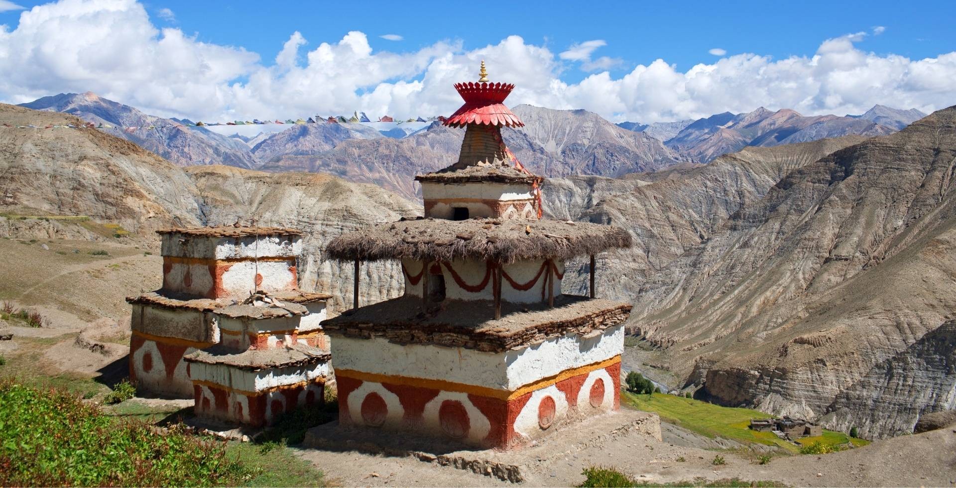
Prayer flags, khatas, mani walls, prayer wheels, and chortens are spread everywhere along the valley. As a visitor, it is your responsibility to be mindful and respectful of the local customs and beliefs.
How to Enjoy the Mountains to Their Fullest
You really don’t need to summit a peak to feel the best of the Langtang Himal. Just make sure you are present, unhurried, and a little intentional about how you travel through the valley.
Here are a few small things you can do to make your time under the Langtang Himal feel richer:
- Early mornings have the best view! So take a cuppa tea and stand outside your lodge and enjoy the quiet moments with the mountains.
- Near Kyanjin and Langshisa Kharka, you will find big open meadows. Take off your bag and lie down on the grass, simply watching the clouds skim over the summits.
- Walk slowly between the villages. Leave a bit earlier and stop often to watch a herder move yaks, to listen to the river, to appreciate the place you are in.
- At the end of the day, write at least something you noticed throughout the day. Journal seems tiresome after a long day of hiking, but you will relive the valley more clearly when you look back.
Final Words: Walk with the Langtang Himal
When you walk into Langtang, you are walking into a tight knot of stories. Geological formation, cultural richness, ecological diversity, and, of course, the mountains!
If you approach the Langtang Himal with enough curiosity and patience, they will give you more than just photographs. They will show you how everything can fit within a narrow valley and still hold together as a whole.
And once you feel that, you will understand why people keep coming back to Langtang. You will understand just how this mere week-long adventure takes a permanent place in your memories.


 Karuna Bhattarai